How to Use Drone LiDAR for Construction Site Development
Feb 23, 2023
Construction site development is a complex process that requires precise planning and execution. Every detail must be accounted for to ensure the construction is safe, efficient, and successful. One of the most important aspects of construction site development is accurate and efficient data collection. Traditionally, this has been done through surveying and mapping, which can be time-consuming, costly, and potentially dangerous.
However, with the development of more accurate and efficient drone LiDAR technology, construction site surveying has become much simpler, faster, and safer. In this article, we'll discuss how to use drone-equipped LiDAR for construction site development, including its benefits, applications, and best practices.
What is Drone LiDAR?
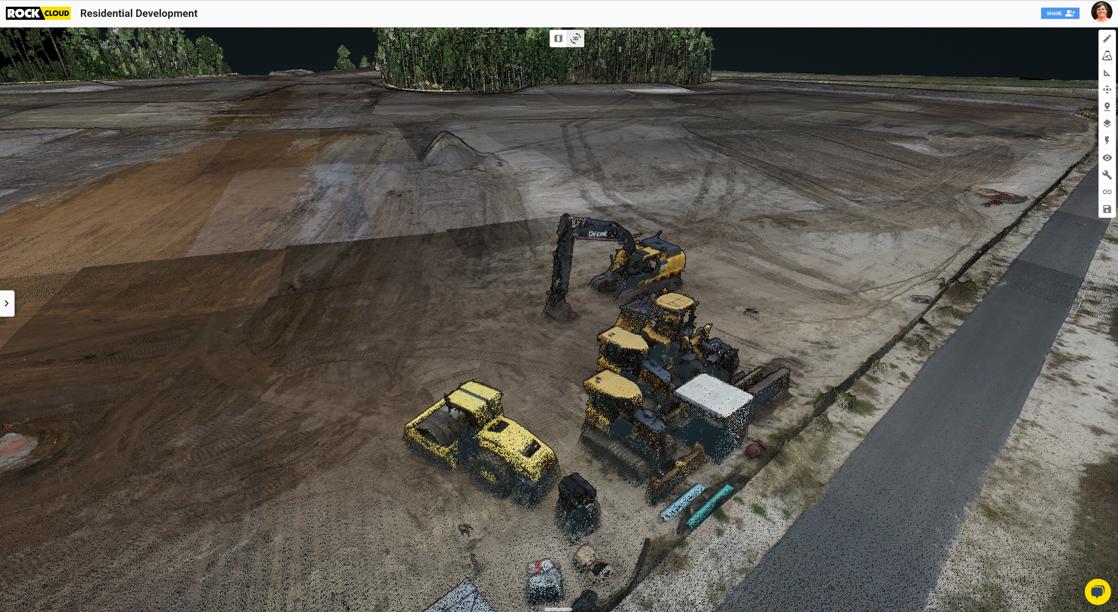
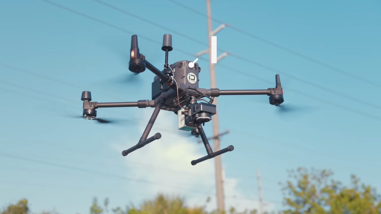
LiDAR is a remote sensing technology that uses laser pulses to measure distances and create 3D maps of objects and environments. Drone LiDAR is a variation of this technology that uses drones as the platform for data collection. Equipping a drone with a LiDAR sensor makes it possible to collect a high-resolution, accurate, and detailed 3D point cloud of a construction site from the air.
Benefits of Using Drone LiDAR for Construction Site Development
There are several benefits to using a drone LiDAR system for construction site development, including:
- Accuracy: LiDAR sensors can collect data with a high degree of accuracy, which is essential for construction site development. The data collected can be used to create precise 3D models of the site, which can be used for planning, design, and construction.
- Efficiency: Drone LiDAR can collect 3D point cloud data much faster than traditional surveying methods. This means construction projects can be completed more quickly and with less downtime.
- **Safety: **LiDAR eliminates the need for surveyors to work in potentially hazardous environments, such as near heavy machinery or uneven terrain. This reduces the risk of accidents and injuries.
- **Cost Savings: **Drone LiDAR can be more cost-effective than traditional surveying methods, requiring less personnel and equipment. ROCK Cloud post-processing software allows you to skip most of the time-consuming data processing, sending you the deliverables you need for your project. ROCK Cloud offers photogrammetry support, delivers construction site planimetrics, and delivers highly accurate contour maps.
Applications of Drone LiDAR in Construction Site Development
LiDAR can be used for a variety of applications in construction site development. Here are some of the most common uses:
- Site Surveying: Drone LiDAR can quickly and accurately survey a construction site, generating detailed 3D maps of the site. This can help construction managers identify potential hazards, plan construction activities, and ensure that the site meets the necessary regulatory requirements.
- Volume Calculations: LiDAR can be used to calculate the volume of materials on a construction site, such as stockpiles of gravel, sand, or soil. This can help construction managers estimate the amount of materials needed for a project and avoid delays due to material shortages.
- Topographical Mapping: LiDAR sensors can create high-resolution topo maps of a construction site, which can help construction managers identify the best locations for building foundations, roads, and other infrastructure.
- **Quality Control: **You can use drone LiDAR to monitor the quality of construction work. By comparing point clouds collected at different stages of the construction process, construction managers can identify deviations from the planned design and take corrective action.
- Safety Inspections: Drone LiDAR can be used to inspect construction sites for potential safety hazards, such as unstable slopes, erosion, or areas prone to flooding. This can help construction managers identify and mitigate potential risks before they cause accidents or delays.
Best Practices for Using Drone LiDAR in Construction Site Development
To ensure the best results when using UAV LiDAR in construction site development, it is essential to follow some best practices, including:
- Choose the right drone and LiDAR sensor for the job. The ROCK R360 LiDAR sensor creates the highest accuracy 3D point clouds and outpaces any other LiDAR systems you can find.
- Plan the flight path carefully, considering the terrain and any potential obstacles.
- Calibrate the LiDAR sensor and adjust the settings for optimal performance.
- Ensure that the drone and LiDAR are properly maintained and serviced.
- Process the data carefully, using specialized software like ROCK Cloud to create accurate and detailed 3D models.
Should construction companies be using LiDAR? Absolutely. Here's just one example of a company that has saved $300,000 in just seven projects by measuring contours.
**It's not a bandwagon if it's the best option. If you're a construction project manager and your company isn't using drone LiDAR yet, it's time to get on board. **
**Visit rockrobotic.com **to learn more about our survey-grade hardware and processing software.