Case Study: Creating Planimetrics from an Orthomosaic Map Using ROCK Cloud
Nov 29, 2022
PROJECT SNAPSHOT
- ROCK's Client: SmartDrone
- **SmartDrone's Client: **Commercial Real Estate Broker in Tyler, TX
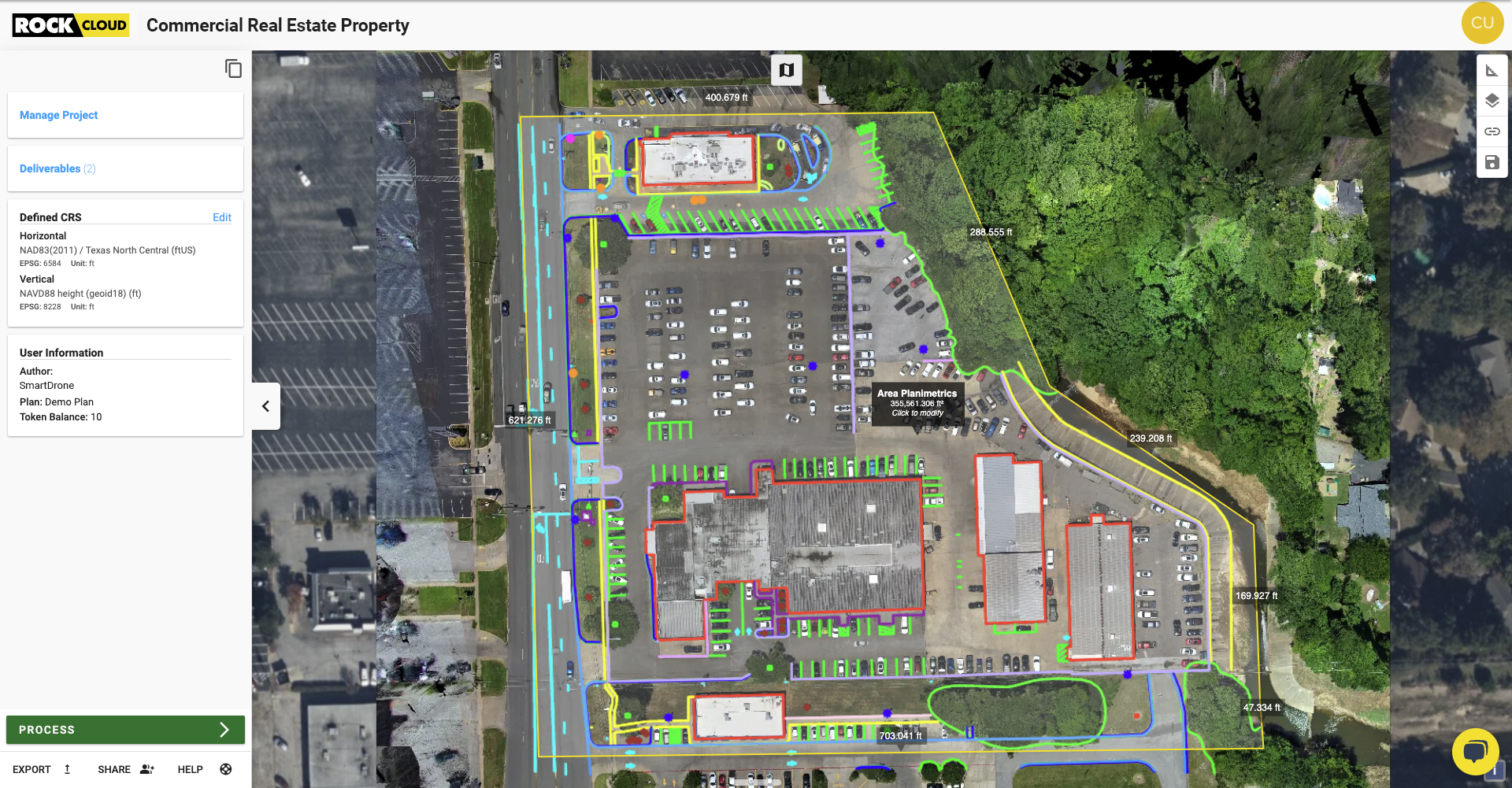
- **Assignment: **The client needed a planimetric map (linework) from an orthophoto of a 4.58-acre commercial property without using LiDAR data.
- **Result: **After the drone flight, the SmartDrone team created an orthophoto and ordered linework through ROCK Cloud. The resulting deliverable was delivered in three business days.
CLIENT: SMARTDRONE
SmartDrone is a leader in drone surveying innovation and technology for accurate land surveying, utilizing U.S.-manufactured drone hardware to collect feasible aerial LiDAR data, combined with streamlined processing software.
EQUIPMENT USED
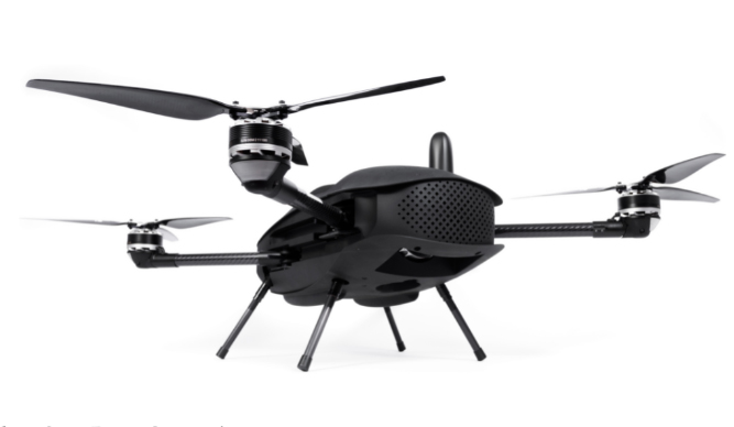
The SmartDrone team used its Discovery 2 mapping drone which utilizes a 12.3-megapixel RGB camera to capture images for orthomosaic generation alongside a LiDAR sensor for topographic mapping. Alongside the hardware, they used ROCK Cloud Processing Software to generate a planimetric/linework map from stitched-together orthophotos.
BACKGROUND
The SmartDrone team wanted to demonstrate how they use drone capabilities to aid commercial real estate listings, as SmartDrone has had potential clients show interest in generating linework deliverables. The real estate firm had purchased the property from a current car dealership that is relocating.
"Using the ROCK Cloud was an easy experience, turnaround met the suggested timeline, and the results they said they would deliver were delivered. Not to mention their team reached out quickly to share questions and had great communication!"
–Al Thead, Vice President Operations, SmartDrone
SOLUTION
The SmartDrone team captured aerial images with their Discovery 2, created an orthomosaic file in Pix4DMapper and uploaded the resulting files into ROCK Cloud in their desired projection. After selecting the pertinent site area, SmartDrone ordered ROCK Planimetrics in ROCK Cloud. The ROCK Team delivered the quality-checked linework three business days later (see the final project deliverables in the ROCK Cloud).
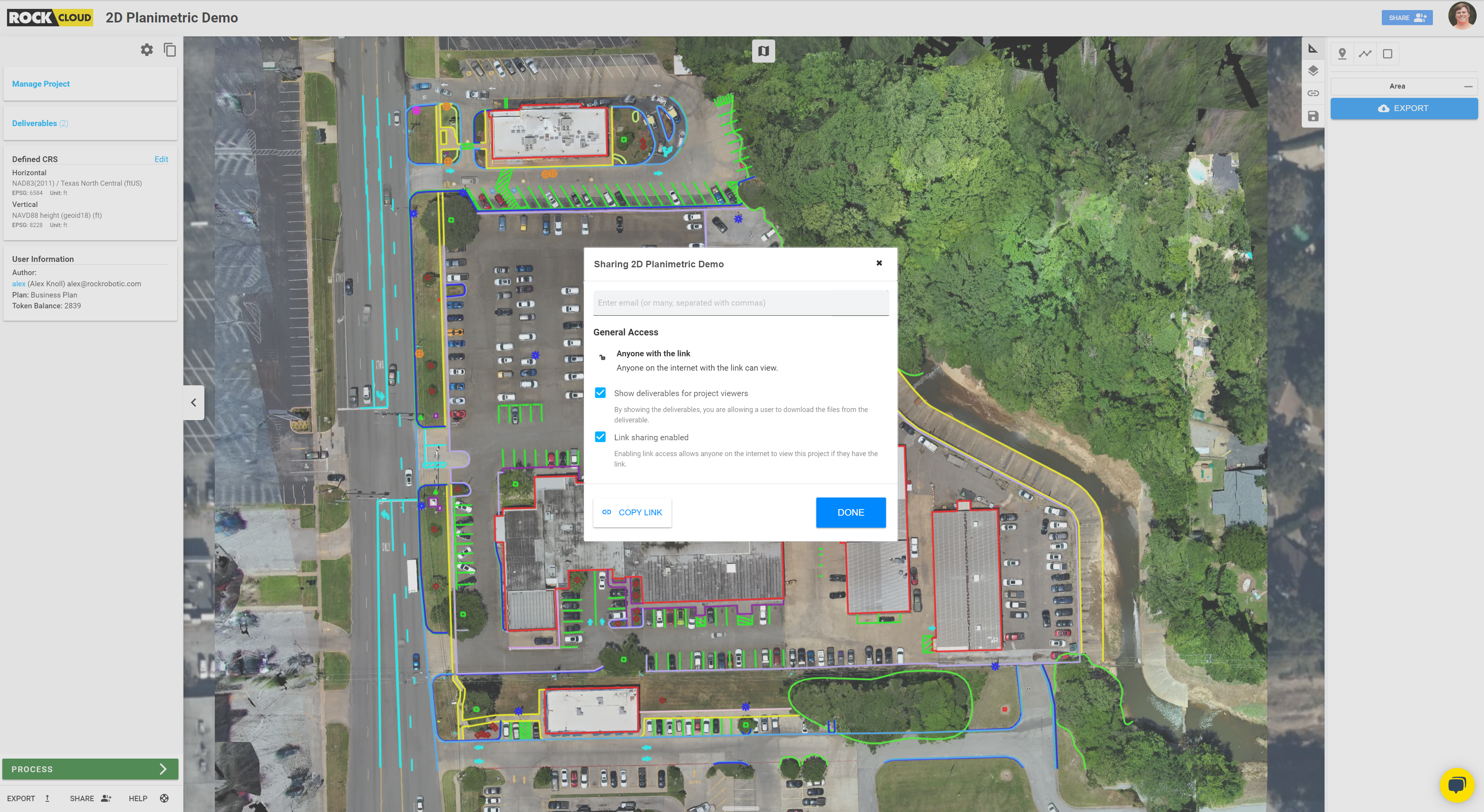
The data from ROCK Planimetrics can easily be added to GIS or CAD software, or just viewed in ROCK Cloud with a simple share link!
*Related: *Reasons ROCK Cloud is the Best LiDAR Data Processing Software
ROCK Cloud enables users of both LiDAR and Photogrammetry drones to reduce the burden of collecting data in the field efficiently. ROCK Planimetrics allows SmartDrone and other companies to offload significant labor time and cost and focus on what they do best: producing awesome drone solutions for clients!
As not every aerial surveying project gets flown with LiDAR, many DSPs (drone service providers) have drones that can be used with photogrammetry without capturing 3D point clouds.
*Tutorial: *How to order ROCK Planimetrics from Orthomosaic Maps
CONCLUSION
ROCK Cloud enables users to obtain planimetric data with either LiDAR point clouds or orthomosaic maps, as the SmartDrone team did in this project. The survey-grade deliverable map features were color-coded and easy to distinguish from each other. By using ROCK Planimetrics, both SmartDrone and its client were able to quickly and easily make better business decisions than with traditional methods.
When time is of the essence, ROCK Planimetrics helps ease the stress of data collection and due diligence. SmartDrone's client, a Commercial Real Estate Broker, can use the map and data to provide a window into the full level of assets of the property to potential buyers. Bottom Line: Everyone wins using the ROCK Cloud!