Mastering Drone LiDAR Scanning with ROCK R3 Pro & DJI M300
Explore the process of flying the R3 Pro LiDAR scanner to map buildings using the DJI M300 drone.

Mastering Drone LiDAR Scanning with ROCK R3 Pro & DJI M300


Planimetric Linework Surveying Deliverables with ROCK Pro Services


ROCK Pro Services: Get Professional & Accurate Surveying Deliverables


ROCK SLAM LiDAR with the R3 Pro: A Comprehensive Guide


Case Study: Drone Services Provider Navigates a 2,500-Acre Gold Mine Site in Fiji with ROCK LiDAR


GCP Best Practices for Aerial Surveying Projects


Case Study: Construction Company Saves $300k by Updating Contours with ROCK Cloud


Case Study: 25 Acres of LiDAR Data Captured (and Delivered) in Under 48 Hours


3 Types of Contours — Which Option is Best for your Surveying Project?


Case Study: Creating Planimetrics from an Orthomosaic Map Using ROCK Cloud


Here's a Better Alternative for Processing DJI Zenmuse L1 LiDAR Data


Top 10 LiDAR Support Questions: Answered by the ROCK Support Team

10 Reasons Why ROCK Cloud is the Best LiDAR Data Processing Software

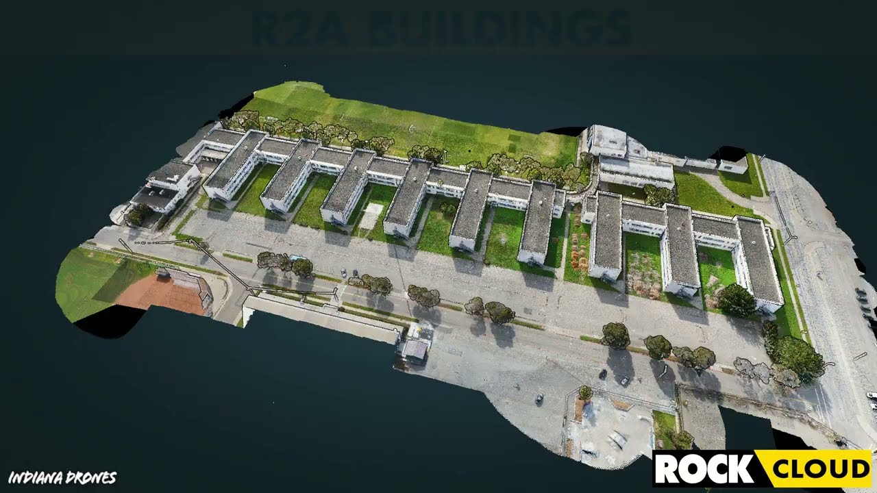
Featured Use Case: Surveying 750 Acres in Under 12 Hours with ROCK R2A LiDAR


IRS Section 179 Changes Coming: Why You Should Invest in LiDAR Equipment by the End of 2022


How-To Improve DJI Zenmuse L1 Accuracy w/ Strip Alignment in ROCK Cloud LiDAR Processing Software


Get 1.65 cm Accuracy Results with the ROCK R2A Drone LiDAR & ROCK Cloud 3D Data Processing Software


Capturing Aerial Drone LiDAR & Photogrammetry in a Single Flight (Earthworks Demo)


Improving Accuracy of DJI Zenmuse L1 with ROCK Cloud 3D LiDAR Data Processing Software
Turn your LiDAR data into stunning animations using the ROCK Cloud.