top of page


How to Use Drone LiDAR for Construction Site Development
Construction site development is a complex process that requires precise planning and execution. Every detail must be accounted for...
3 min read
2,159


What is LiDAR?
LiDAR, or Light Detection and Ranging, is a technology that uses laser pulses to measure distance and create high-resolution 3D models...
2 min read
288


10 Reasons Why ROCK Cloud is the Best LiDAR Data Processing Software
We're living in very exciting times! LiDAR data is growing in popularity with the advent of handheld SLAM systems. Notably, the Leica...
7 min read
901
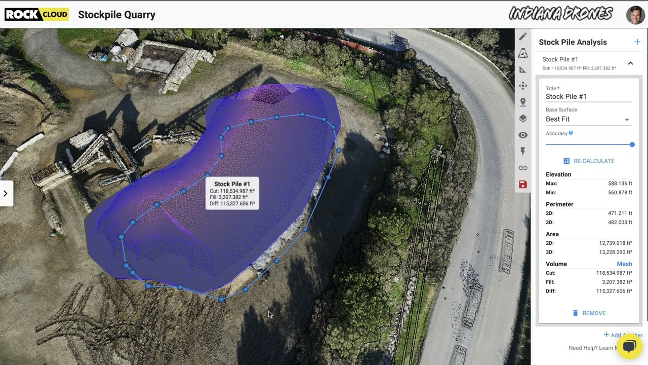
Easily calculate Volumetrics with the ROCK Cloud Stockpile Tool.
Good news... we have added a new feature to the ROCK Cloud! Now, you can quickly draw a polygon around an object to calculate the "Cut &...
1 min read
347


Four Crews? Four Weeks? Forget that! ROCK can help get the job done in one day.
We received amazing feedback from one of our ROCK Cloud users. He had nothing but great things to say about our LiDAR processing software.
1 min read
267
bottom of page