Mastering Drone LiDAR Scanning with ROCK R3 Pro & DJI M300
Dec 19, 2023
Today, we're going to take you on an exciting journey as we explore the process of flying the R3 Pro LiDAR scanner to map buildings using the DJI M300 drone. From mission planning to data processing, we'll cover it all and equip you with the knowledge to capture stunning and accurate 3D point clouds. So, let's dive in!
1. Preparing for the Flight
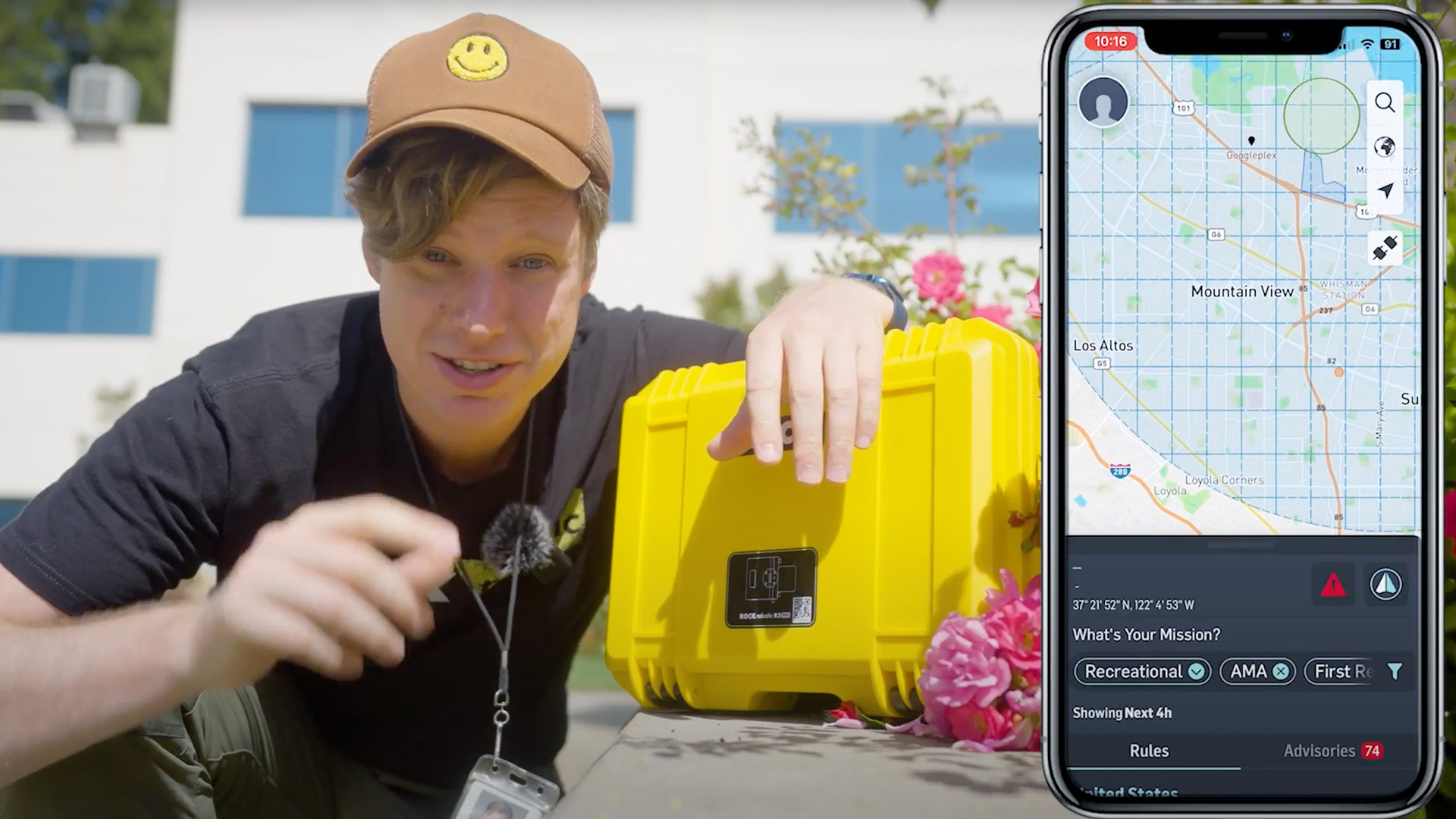
Before heading out to the job site, meticulous mission planning is crucial. We recommend using AirMap or similar platforms to check the airspace and ensure safe drone operations. Familiarize yourself with the terrain to optimize your flight path.
For scanning a building, remember to adjust your mission plan to capture not only the top but also the walls. Position the drone outside the walls so the lidar can effectively scan and capture all relevant data.
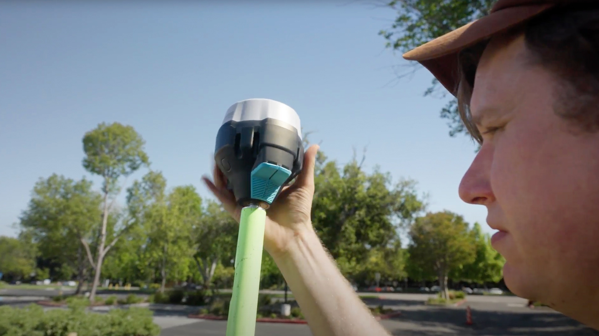
2. Setting Up the Base Station
Once on-site, start by setting up the base station. Choose a location with an unobstructed view of the sky and, if possible, place it on a known survey monument for better post-processing accuracy.
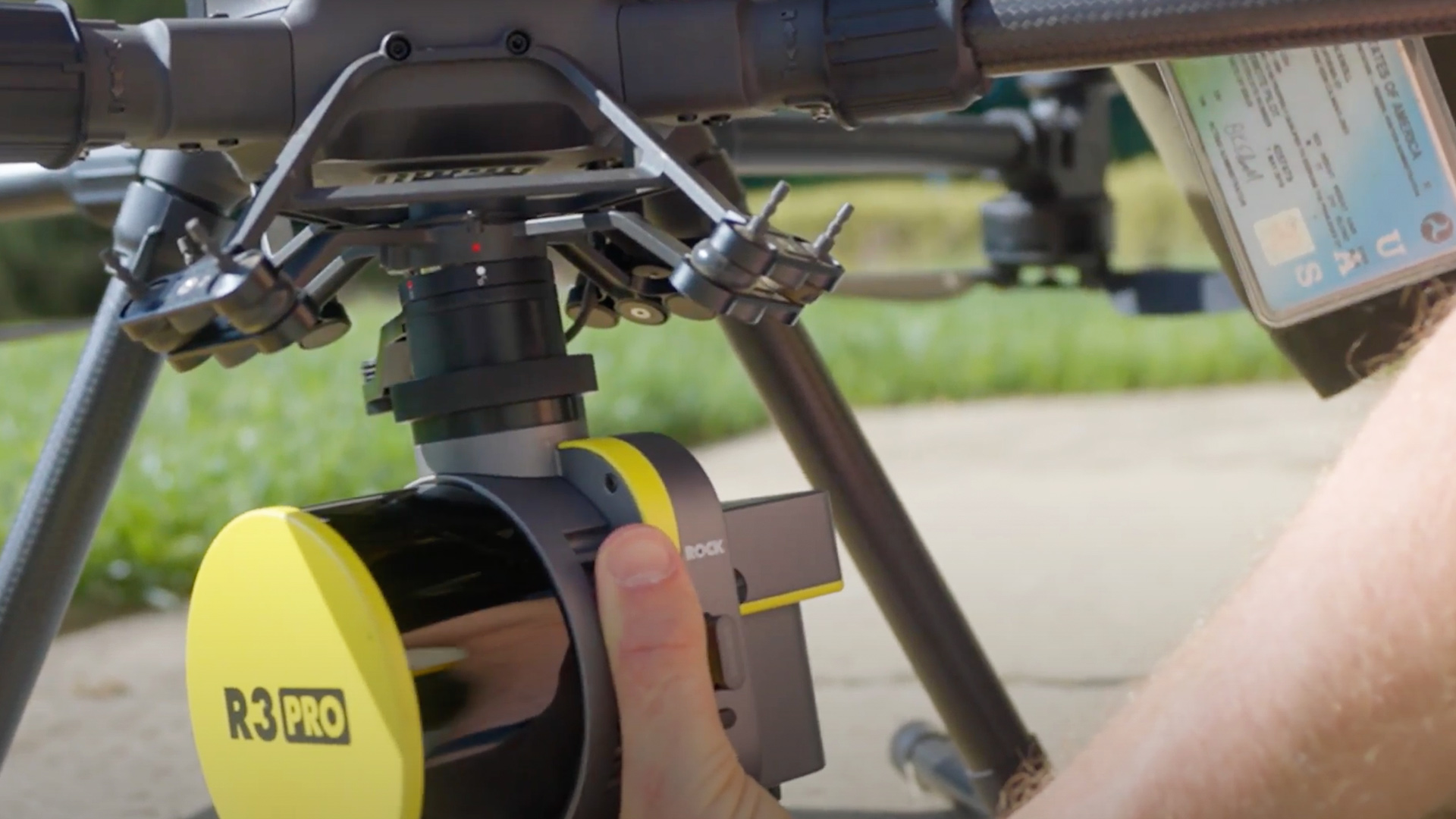
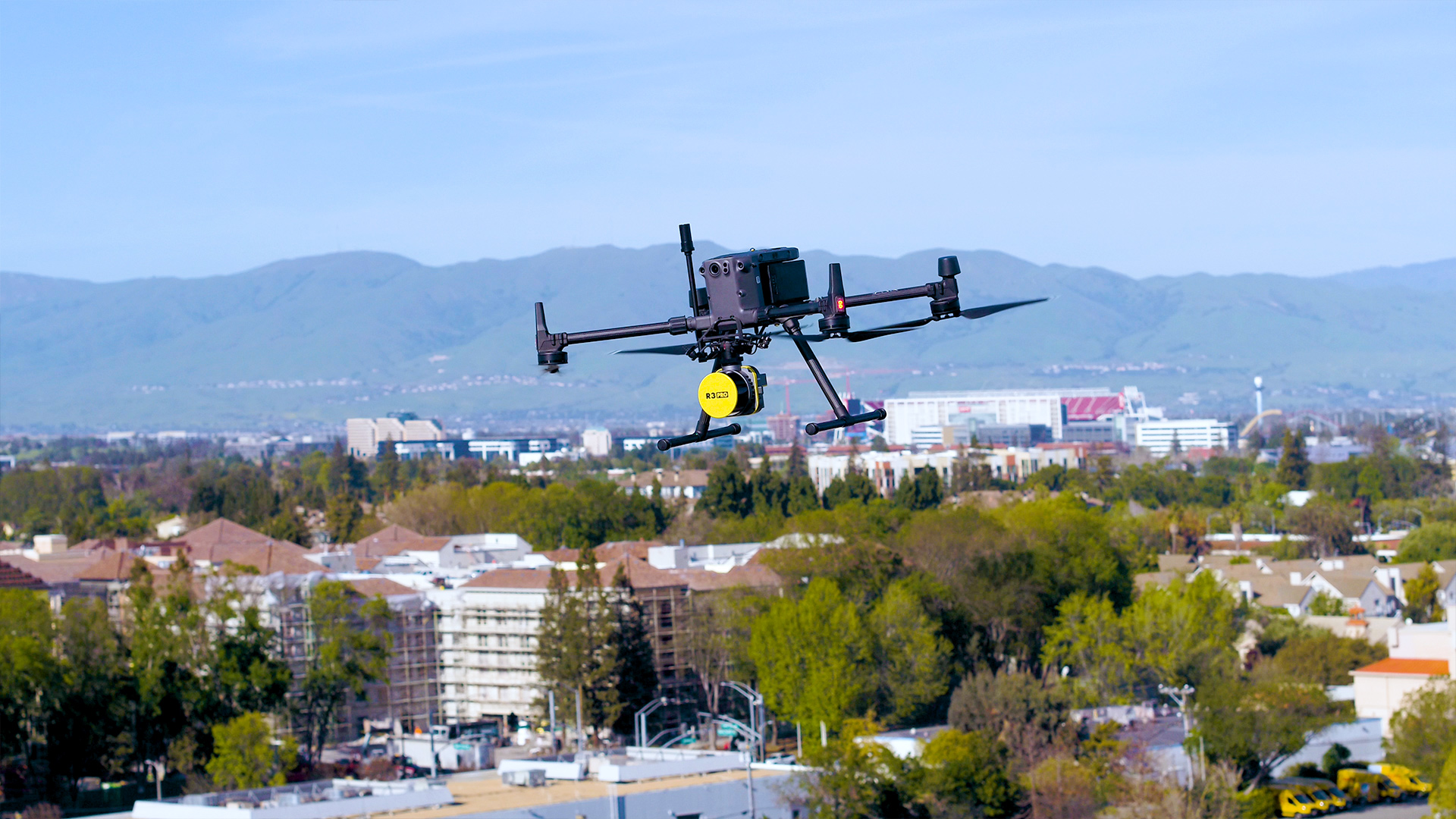
3. Installing R3 Pro LiDAR on DJI M300 Drone
Next, prepare the DJI M300 for the flight. Check the drone for any damages and make sure everything is securely fastened. Then, install the R3 Pro LiDAR on the drone. Follow the easy steps for attaching the GPS antenna and lever arm attachment, and you're ready to go.
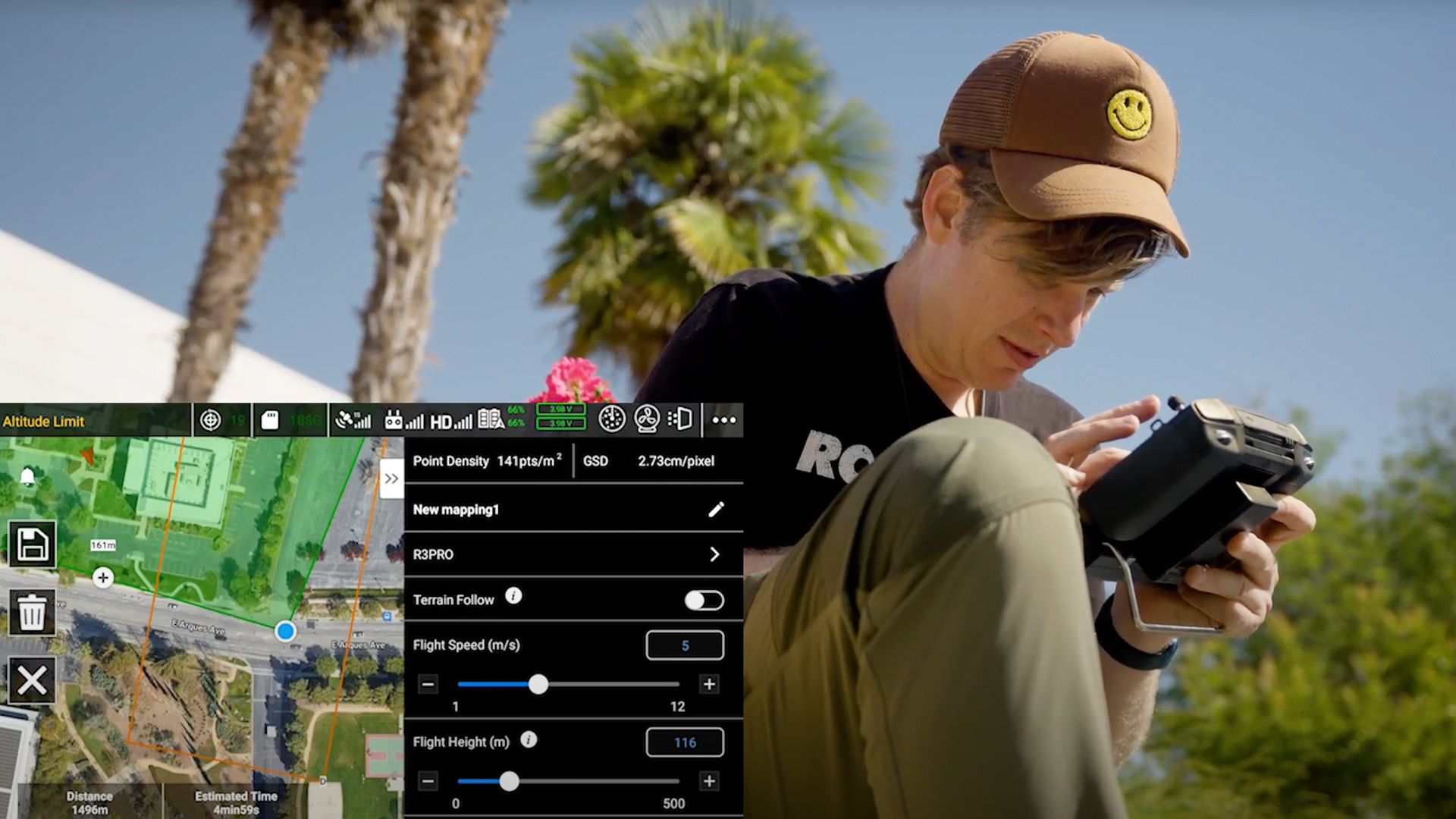
4. Mission Planning with ROCK Pilot App
For mission planning, you can use various apps like ROCK Pilot, DJI Pilot 2, or others compatible with your DJI drone. We recommend ROCK Pilot for its simplicity and real-time data visualization.
Draw a polygon covering the area of interest and set the desired AGL height, overlap, and speed. Lower AGL height and slower speed may be ideal for smaller areas like buildings, as you can maximize battery usage.
5. Flying the Mission & Capturing the Data
Now comes the exciting part – flying the mission. Take off the base station and start logging data. With ROCK Pilot, the app handles most of the on-ground processes, including calibration flight, making it a breeze.
Fly the mission and capture the data using the R3 Pro LiDAR scanner. Keep an eye on the battery level and adjust your flight path if needed. Upon completing the flight, land the drone and stop logging data.
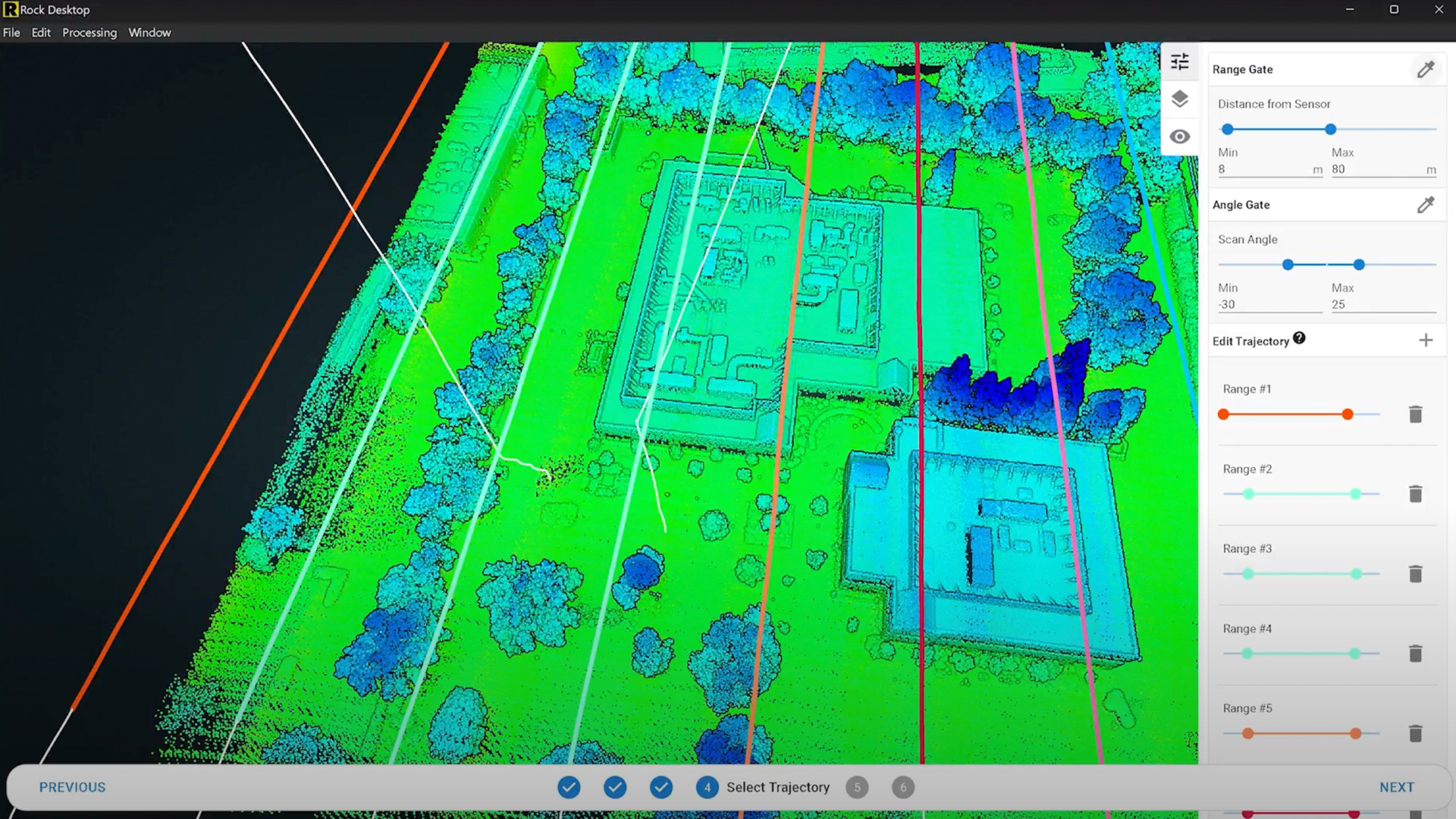
6. Data Processing with ROCK Desktop
With all the data collected, it's time to process it using ROCK Desktop. Copy the data onto your local machine and open ROCK Desktop. Process the data, select the flight lines, angle, and range gate, and click "Start Processing."
ROCK Desktop will generate a colorized and optimized point cloud, providing a visual representation of the scanned area.
7. Uploading to ROCK Cloud & Generating Deliverables
After processing, upload the data to ROCK Cloud. This step is ten times faster when using ROCK Desktop. Now you have access to a range of functionalities like adding ground control points, reprojection, and ordering deliverables such as surveyor planimetrics and powerline data.
See the processed point cloud deliverables in the ROCK Cloud:
Conclusion
And there you have it! Mastering LiDAR Scanning with the ROCK R3 Pro and DJI M300 Drone opens up a world of possibilities for 3D point cloud data collection. From construction and surveying to environmental monitoring and asset inspection, the applications are vast.
We hope this comprehensive guide has given you a clear understanding of the process, from planning to delivering results. So, what are you waiting for? Get out there and start capturing stunning 3D data with your R3 Pro and M300 setup.