Planimetric Linework Surveying Deliverables with ROCK Pro Services
Dec 12, 2023

Why wait around for what you need? ROCK Pro Services will process professional deliverables for you, and we'll make sure they're perfect. Every project is quality checked by our team of experts to ensure you get the most out of your data. Need a large-scale custom order? Not a problem, we do it all. Contact us today to get learn more and get started!
Expanding Survey Capabilities with the ROCK Robotic
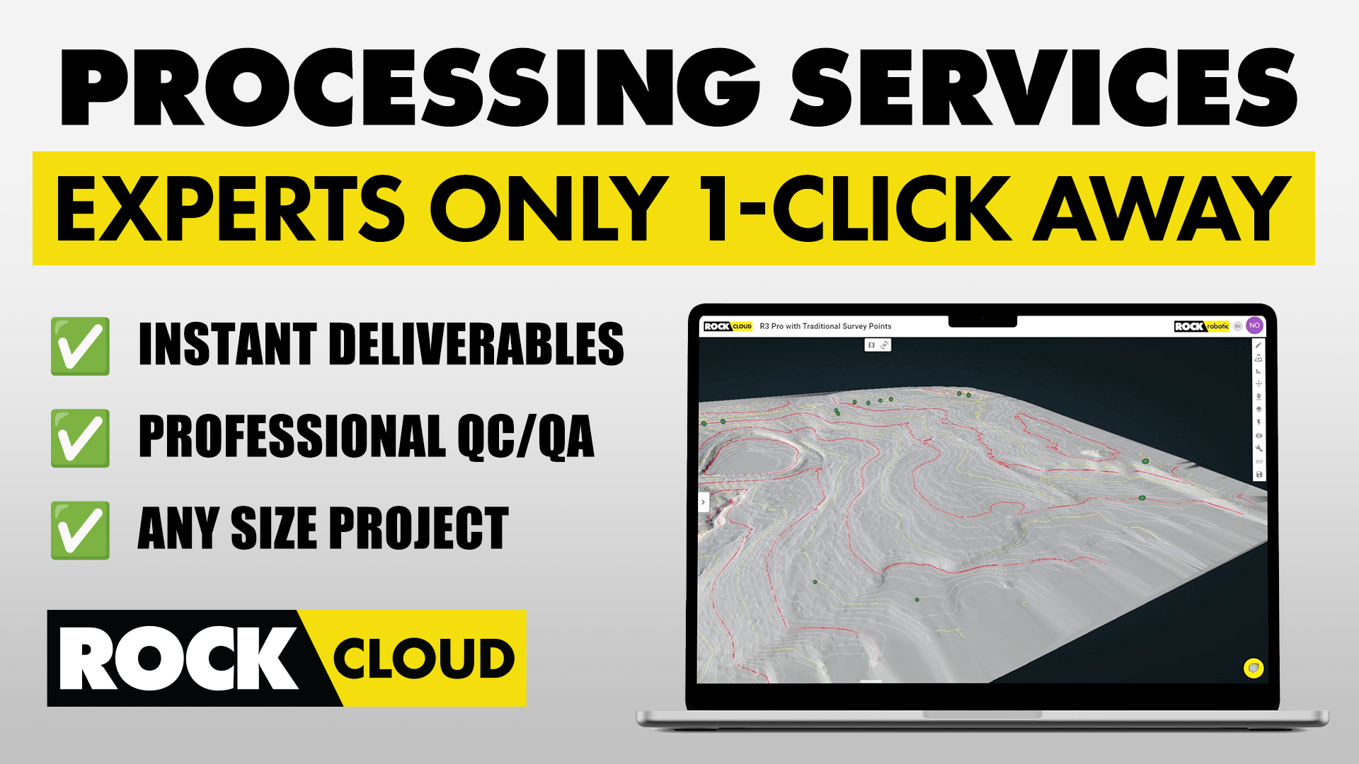
The true potential of the ROCK 50 Plan is realized when surveyors choose to expand their deliverables. Through ROCK Pro Services, the ROCK 50 Plan seamlessly grows with your project's demands, offering advanced planimetric mapping services that elevate the detail and utility of your surveys.
Understanding Planimetric Mapping
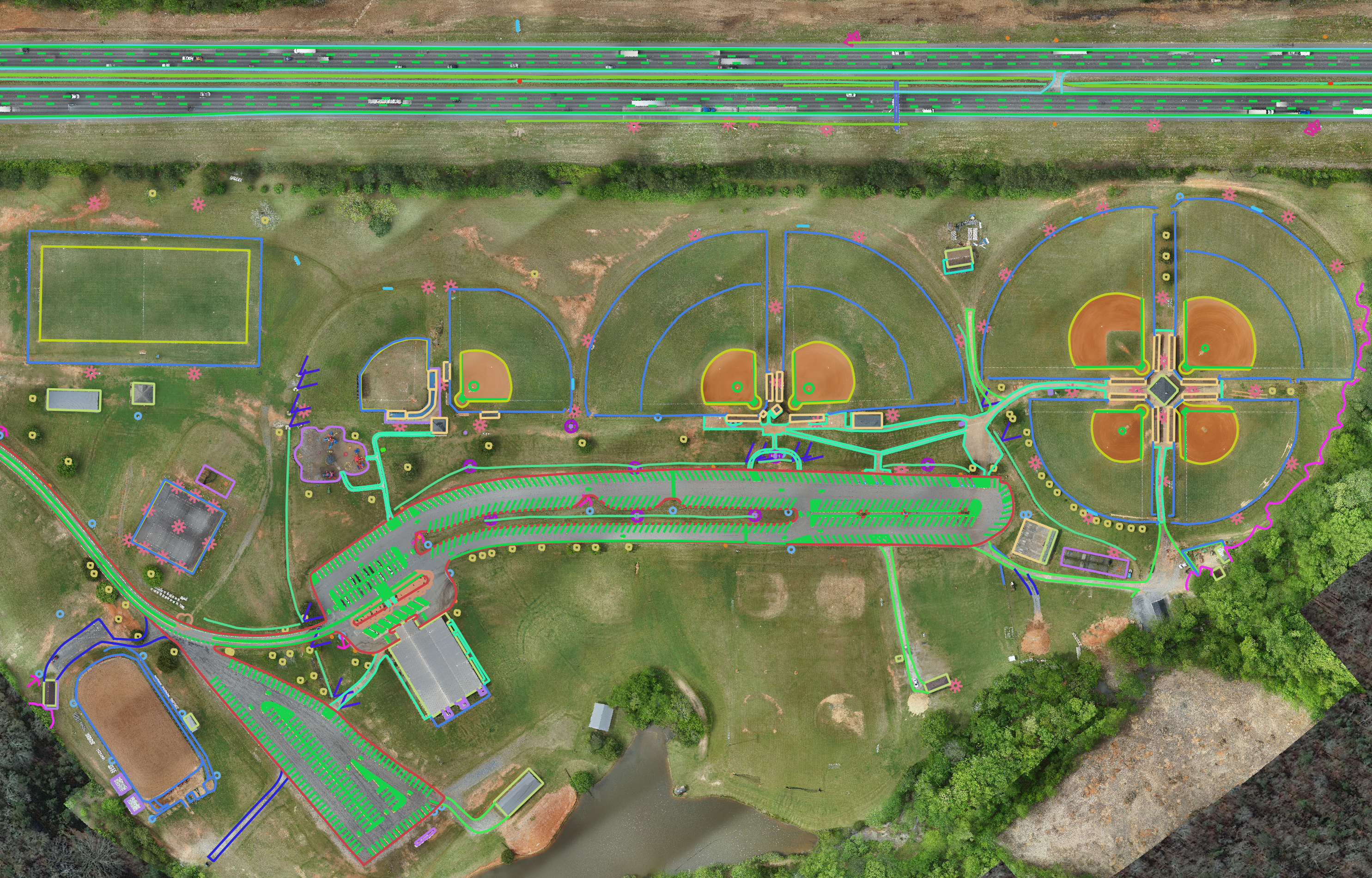
Planimetric mapping is the art of rendering a detailed, 2-dimensional picture of an area's layout, capturing the precise horizontal positions of natural and man-made features. This technique is integral to a variety of applications, from urban planning and construction to environmental conservation, providing a clear view of an area's infrastructure and landscape without the complexity of elevation data.
The Power of Planimetrics in ROCK Cloud
With the ROCK 50 Plan as your foundation, you can harness the power of ROCK Pro Services to order detailed planimetric deliverables. These services translate your raw data into meticulously crafted planimetric maps. This not only spares you the laborious task of manual map creation but also ensures that your deliverables are of the highest quality and precision, thanks to ROCK's superior AI and machine learning algorithms backed by human expertise (QC/QA).
Streamlined Planimetric Ordering
Ordering planimetric deliverables is a breeze. Simply upload your LiDAR or orthomosaic data to ROCK Cloud, define your area with a bounding box, and ROCK Pro Services will calculate the cost based on the selected acreage. This system ensures you're only billed for the area you need, optimizing your project's budget.
Enhancing Efficiency & Accuracy
The integration of planimetric services with ROCK Pro Services is not just about expanding capabilities; it's about enhancing efficiency and accuracy in surveying practices. By utilizing these professional planimetric services, surveyors can quickly identify and delineate intricate details of any site, such as utility lines, pavement markings, and vegetation boundaries.
Here's a list of the key benefits:
-
Efficiency & Accuracy Enhancement: Planimetric ROCK Pro Services within the ROCK Cloud boost surveying efficiency and accuracy.
-
Detailed Site Analysis: Enables surveyors to identify and delineate intricate site details such as utility lines, pavement markings, and vegetation boundaries.
-
Crucial for Meticulous Planning: Ideal for projects that demand high precision, like roadway designs and property development.
-
Centimeter-Level Accuracy: Ensures planning and decision-making are based on highly reliable data, crucial for urban environments and ecological zones.
-
Ease of Use & Workflow Integration: Simplifies the integration of advanced planimetric services into existing surveying workflows.
-
In-Depth Insights & Comprehensive Data: Allows surveyors to provide more detailed information to clients, stakeholders, and project teams.
-
Innovation & Excellence in Surveying: Demonstrates ROCK Pro Services commitment to advancing surveying technology and practices.
Diving Deeper with 2D and 3D Planimetrics
Whether your project requires a basic 2D planimetric map or a more comprehensive 3D rendering, ROCK Cloud has you covered. 2D planimetrics provide a flat representation of surface features, while 3D planimetrics bring an additional layer of depth, offering a more immersive view of the landscape with elevation details for each feature, which can be invaluable for complex designs and analyses.
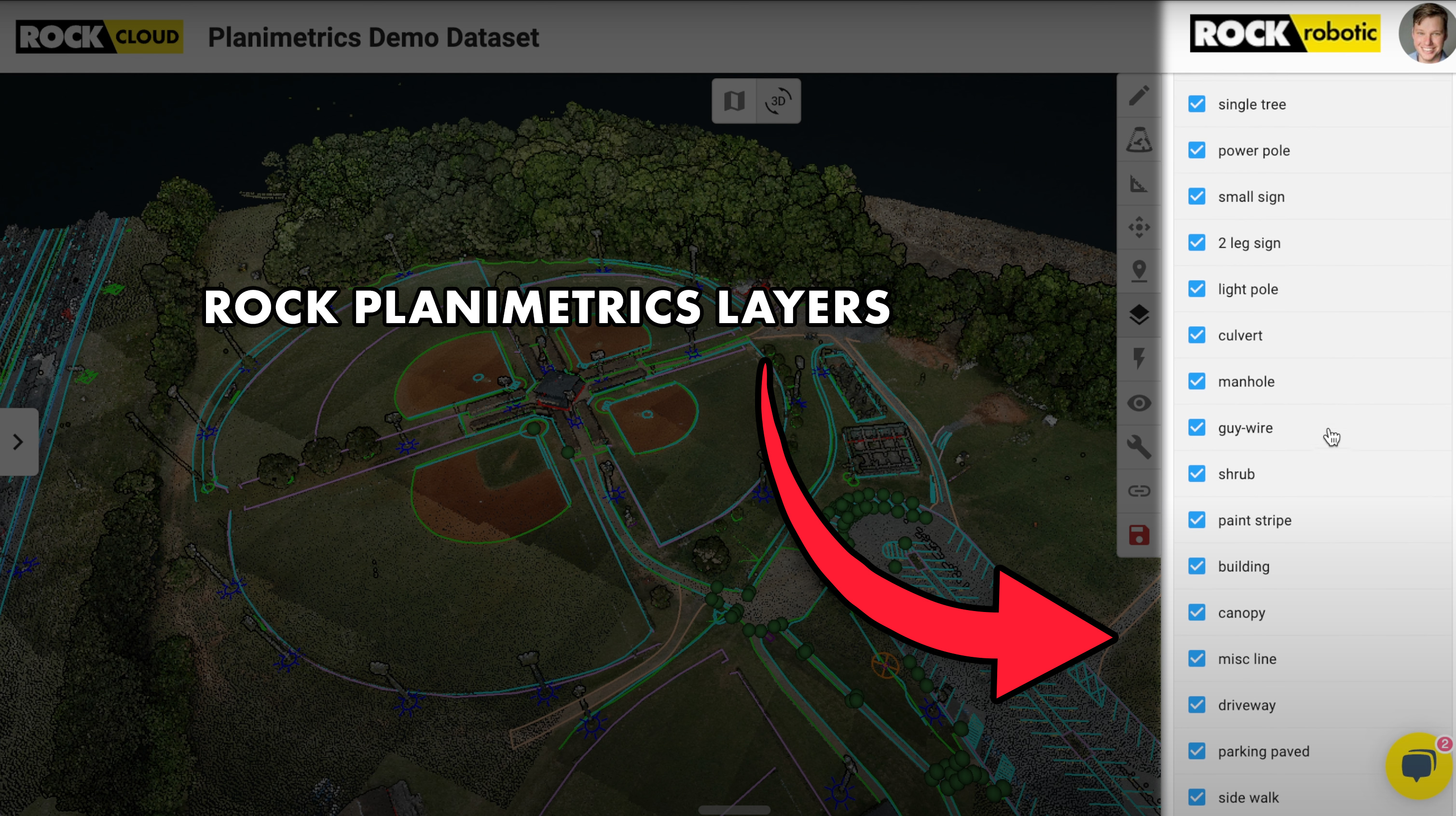
Feature Layers in ROCK Planimetrics
The precision of ROCK's Planimetric mapping is evident in the extensive list of feature layers available, ranging from basic infrastructure like roads and buildings to nuanced elements like treelines and drainage systems. This diversity in feature layers means that no detail is too small to be captured and represented on your planimetric map.
Customization & Support
ROCK Pro Services understands the unique needs of different projects, which is why
they offer custom feature codes to align with your internal CAD software. Moreover, if any issues arise or revisions are necessary, the responsive ROCK Support Team is always ready to assist and discuss your project's specifics.
Conclusion
By starting with the ROCK 50 Plan and leveraging the expansive capabilities of ROCK Pro Services for planimetric mapping, surveyors can significantly enhance the scope and detail of their deliverables. This powerful combination ensures that no matter the size or complexity of the project, you have the tools and support to deliver outstanding results.