Capturing Aerial Drone LiDAR & Photogrammetry in a Single Flight (Earthworks Demo)
May 12, 2022
It doesn't get much better than this: Photogrammetry and LiDAR in a single flight with ROCK Robotic! Now, with the ROCK R2A and ROCK Cloud, we've got you covered from points to orthos. In this article, we are showcasing a recent demo job that the ROCK Support Team helped deliver.
The Backstory
ROCK Robotic was called to provide a demo of the ROCK R2A LiDAR + Photogrammetry hardware combo, along with the ROCK Cloud data processing solution. The client wanted to compare the workflow to their existing Phantom 4 RTK + Propellor workflow. ROCK’s job was to provide an accurate 3D topographic surface to calculate cut / fill on a large earthworks project and a high-resolution orthomosaic to track the construction progress.
This article will focus on the results from the R2A LiDAR + Photogrammetry solution, alongside the output deliverables from the ROCK Cloud. We will discuss and compare the results from the two separate workflows in an upcoming article.
The Job
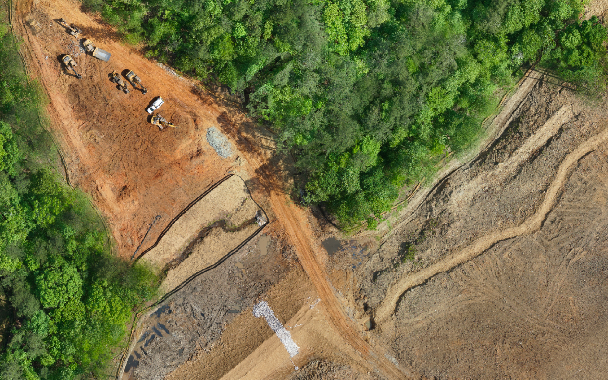
The location was a 90 acre job site, with roughly 25 acres recently cleared and large earth moving underway. The remainder of the project area was still covered in dense vegetation. The job site posed no unusual risks or challenges — a fairly straightforward mission.
The Flight
The ROCK R2A was flown on the DJI M300 drone at an AGL of 200 ft, with a 50% side overlap and a camera interval of 2 seconds in order to capture both LiDAR 3D data and photogrammetry. The R2A is a precision LiDAR instrument with industry-leading high precision hardware. The LiDAR collects up to 720,000 points per second, with a 70 degree field of view. The max range is over 1400 ft — although our recommended flight height is between 200 and 400 ft. The system also comes with a co-aligned 24MP camera for both colorization and ortho photo acquisition. When flying the R2A for a dual-purpose LiDAR + photogrammetry mission, it is recommended to fly at 50% or higher overlap for accurate photogrammetric reconstruction. For LiDAR-only missions, an overlap of 30% is sufficient.
The 90-acre site was flown with 1 battery set and completed in under 25 minutes.
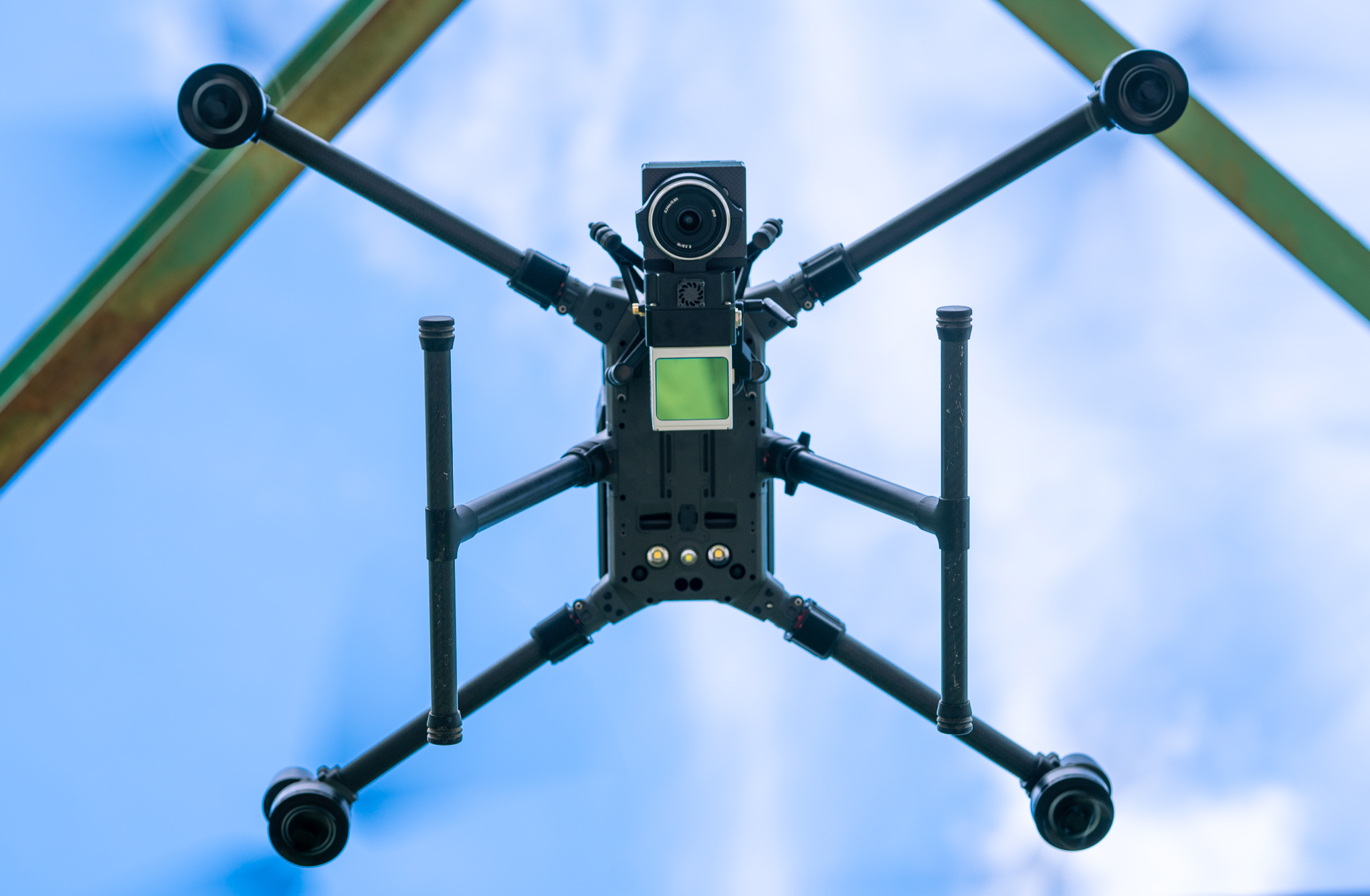
ROCK R2A LiDAR x DJI M300
Data Processing
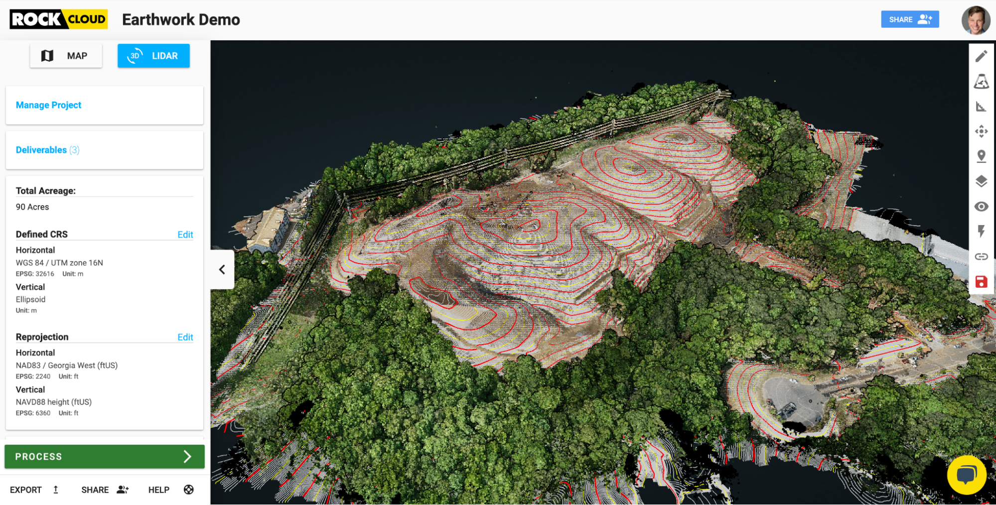
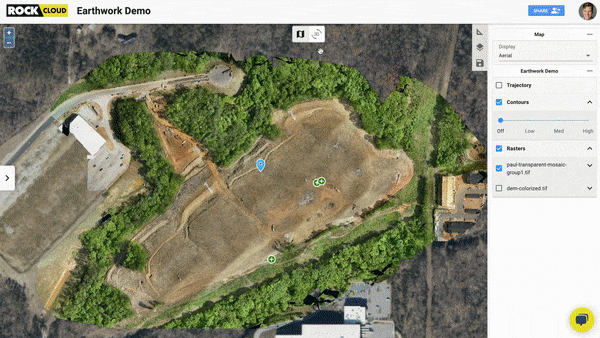
Once the flight was complete, a high-resolution point cloud (LAS) was generated using the ROCK Desktop pre-processing software (PCMaster) and uploaded to the ROCK Cloud for post-processing. The ROCK Cloud is a complete post-processing solution that delivers full 3D data results in a user-friendly and efficient interface. With the ROCK Cloud, you can quickly produce survey-grade surface models from raw point cloud data. Additionally, the ROCK Cloud is your hub for 3D data and now it includes orthomosaic data. The ROCK Cloud makes it simple to store, visualize, analyze, and share your data. Once the LiDAR data was uploaded to the ROCK Cloud, the data was reprojected into the local coordinate system and contours and a surface model were generated using the ROCK Surveyor deliverable. The deliverables beat the, “1-2 business day” estimated turnaround time and were complete in only 11 minutes! While the ROCK Cloud computed the surface deliverable, the orthophotos from the ROCK R2A were loaded into Pix4D to produce an orthomosaic. Once completed the ortho was uploaded to the ROCK Cloud and then the results were visible with the contours generated from the 3D LiDAR data. In addition to the visualization of the ortho, you can now order 2D Planimetrics on all ortho data. ROCK will soon be adding even many more features to further unlock the insights in your captured data.
The Results
The R2A LiDAR + Photogrammetry along with the ROCK Cloud produced an accurate surface model that was free of the defects typically found when photogrammetry data is used alone. A clean surface was generated that removed all unwanted surface features including trees, trucks, bushes and all other non-ground features. The data was delivered to the client the next day so they could continue the cut / fill process.
Check out the video and data examples below to see how awesome this is!
ROCK Cloud - Earthworks Demo - Map to LiDAR
ROCK Cloud - Earthworks Demo - Data Examples
Visit www.rockrobotic.com to learn more
about our products and services.