Vegetation Penetration: The #1 Reason for Drone LiDAR
Oct 09, 2023
The #1 Reason** **for Drone LiDAR is Vegetation Penetration. In this article I will show you how the ROCK Ecosystem™ from the ROCK R3 Pro, ROCK Desktop, and ROCK Cloud work seamlessly together to enable surveyors to work faster, safer, and more accurately.
Laying the Groundwork
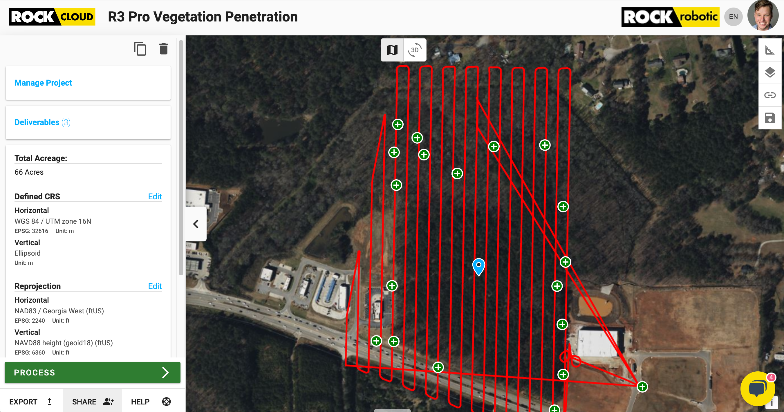
For our study, we zeroed in on a 66-acre woodland terrain south of Atlanta, GA in the full summer of 2023. The vegetation here is very dense! To walk this site it would take a 2 man crew approximately 2 weeks to survey and build a Topo. It was above 90 degrees with full humidity. No one wants to walk this entire site and get poison ivy all over while risking dehydration.
GCP Prep: Total Station Traverse
To establish a baseline of accuracy we had control points captured using a total station, performing a traverse around the perimeter of the survey area. These points, set within the thick vegetation, aimed to provide an accurate benchmark against which the LiDAR's capabilities will be assessed.
Taking to the Skies
With the preparatory work complete, the ROCK R3 Pro took center stage. Mounted on the DJI M300 drone, it ascended above the dense canopy. What would typically demand weeks of on-foot surveying was seamlessly completed in just an hour.
The captured data was reviewed onsite with ROCK Desktop to ensure a successful capture. Then back in the office we uploaded to a new project on the ROCK Cloud for processing. In quick time, a comprehensive surface model, detailed with precise contours, was generated.
The Proof is in the Precision
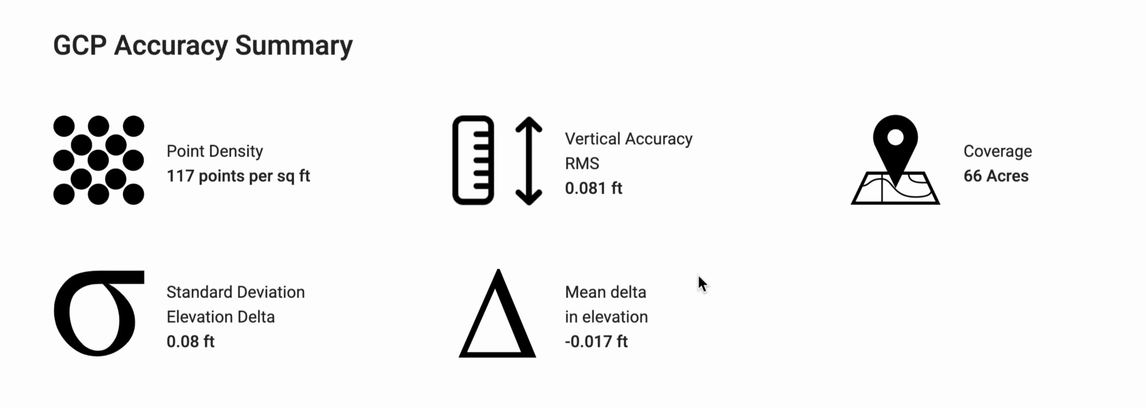
Upon analyzing the processed data against the control points, the results were AMAZING. The ROCK R3 Pro demonstrated a remarkable accuracy of 0.081 FT – inside the dense vegetation! This is a testament to its unmatched vegetation penetration capabilities and accuracy.
But the system's prowess wasn't solely in its accuracy. The density of the captured data brought to light terrain features often missed by traditional methods. One such revelation was the intricate terracing patterns, masked for years beneath the forest's thick canopy. Look at the video below and you will see on the surface model, clear terracing. You would have walked right over this feature with a RTK GPS or Total Station!
See the Data in the Cloud
The ROCK Cloud is like the superhero of LiDAR data handling. Picture it as your trusty sidekick, helping you master and play with LiDAR data like a pro. Imagine a toolkit filled with gadgets for visualizing, analyzing, and storytelling—making data exciting and understandable. In the world of industries like mining, construction, and forestry, ROCK Cloud swoops in, providing accurate spatial insights at lightning speed, making projects a thrilling adventure with better outcomes!
🔎 See the Data in the Cloud: https://cloud.rockrobotic.com/share/d1e62a17-cceb-4093-b427-eb89c51999f8
Weighing Tradition Against Technology
The ROCK R3 Pro is the new best tool in the surveyor toolkit. The technology is here today, and with ROCK Robotic you can perform your Topos: faster, safer, and more accurate. ROCK Robotic offers a complete end-to-end solution and seamless workflow. We get you the best hardware, software, training, and support on the market. In the ROCK Ecosystem™, you are in good hands.