3 Surveyors and Another Guy: An Incomplete History of Famous U.S. Surveyors
Feb 08, 2023
Mount Rushmore is known for its giant presidential faces carved into the Black Hills, but did you know that three of the four presidents were actually former surveyors?
That's right, George Washington, Thomas Jefferson, and Abraham Lincoln all got their start as land surveyors before becoming presidents. So, when people joke about Mount Rushmore being "Three surveyors and another guy," they're not too far off. The only non-surveyor president on the sculpture is Theodore Roosevelt. Come on, Teddy!
George Washington
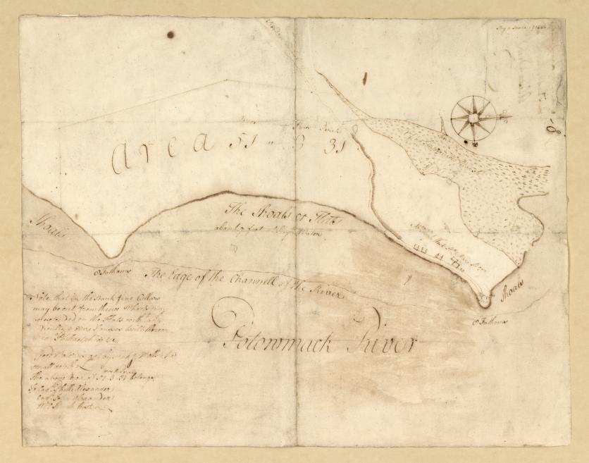
We mentioned George Washington, as his image is etched in Mt. Rushmore. At just 17 years old, he was appointed as Surveyor General for Virginia and helped to survey the land and pave the way for westward expansion. Washington’s intimate knowledge of the Virginia backcountry gained from surveying the commonwealth helped him devise successful strategies as a lieutenant colonel in the French and Indian War.
Thomas Jefferson
How about Thomas Jefferson, the third president of the United States? He worked as the Albermarle County surveyor in Virginia in 1773 and later sent Merriweather Lewis and William Clark on their famous expedition to explore the land gained through the Louisiana Purchase. We’ll get to them in a second. And if you keep reading, you'll pick up on the theme that Jefferson was perhaps the single-most influential surveyor in U.S. history, both prior to the Louisiana Purchase and after it.
Abraham Lincoln
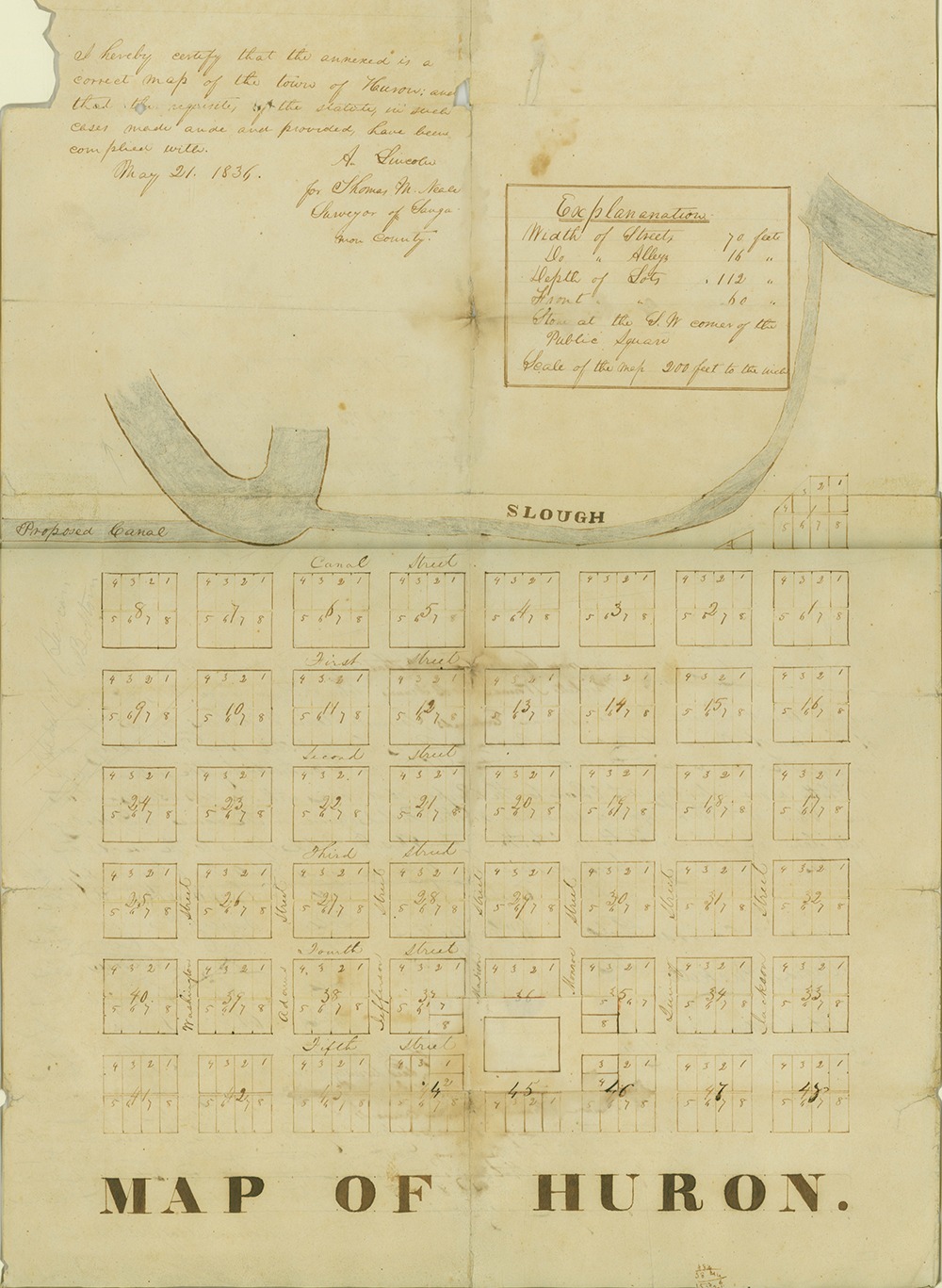
To round out our list of primary presidential land surveyors, there’s Honest Abe. Before becoming the 16th president of the United States, Lincoln was a self-educated man from Kentucky who worked as a storekeeper, postmaster, and land surveyor, all while studying law. He was a man of many talents and skills!
Daniel Boone
Let’s explore some other notable surveyors in U.S. history, starting with Daniel Boone. As an American pioneer and explorer, Boone helped settle land claims and was known for his travels across the American frontier. Although he never went to school, he became an expert tracker in his teenage years and eventually took up surveying. Boone performed over 160 surveys during his career, mostly in the state of Kentucky. However, he did receive quite a bit of flack from his clients, as his surveys weren’t very accurate. Boone really could have used a ROCK R360 LiDAR scanner. Just saying.
Henry David Thoreau
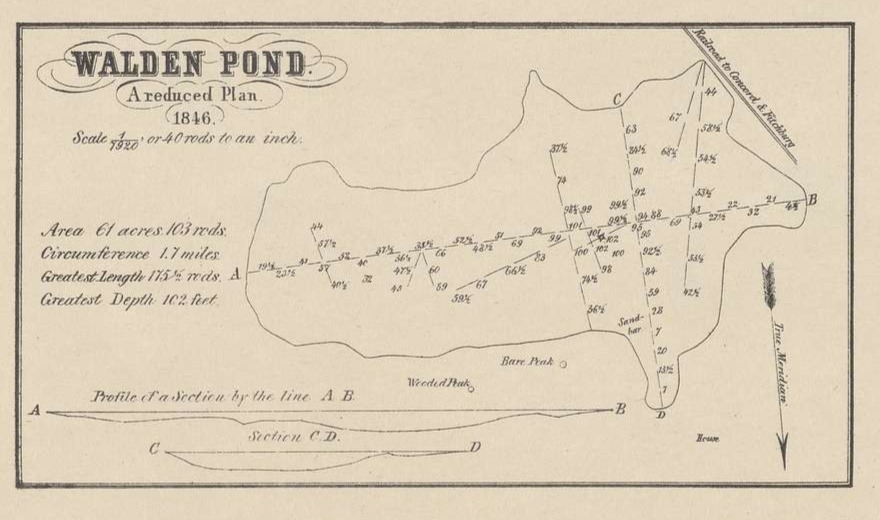
American writer and Transcendentalist Henry David Thoreau held jobs as a teacher and as a worker in his dad’s pencil factory, but his longest-held job tenure was as a land surveyor. Thoreau is probably best known for his 1854 book* Walden*, which explores his values of simple living in nature. While his buddy Ralph Waldo Emerson owned the Walden Pond property, Thoreau actually surveyed the land in 1846.
Benjamin Banneker
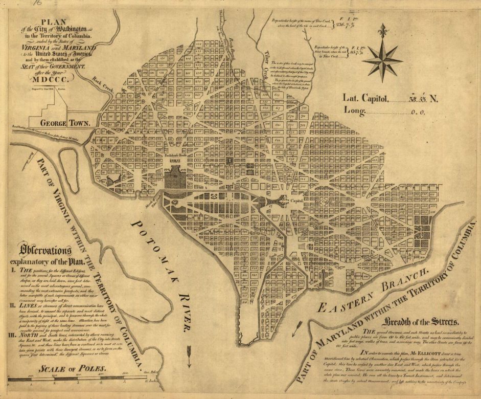
Benjamin Banneker was a mathematician, almanac author, scientist and land surveyor. In 1789, then Secretary of State Thomas Jefferson hired Banneker to survey the borders of Washington, D.C. You can still find some of his original boundary stones today. Notably, Benjamin Banneker made a name for himself as the first high-profile African-American surveyor in the U.S., gaining the admiration of Jefferson and his contemporaries.
Lewis and Clark
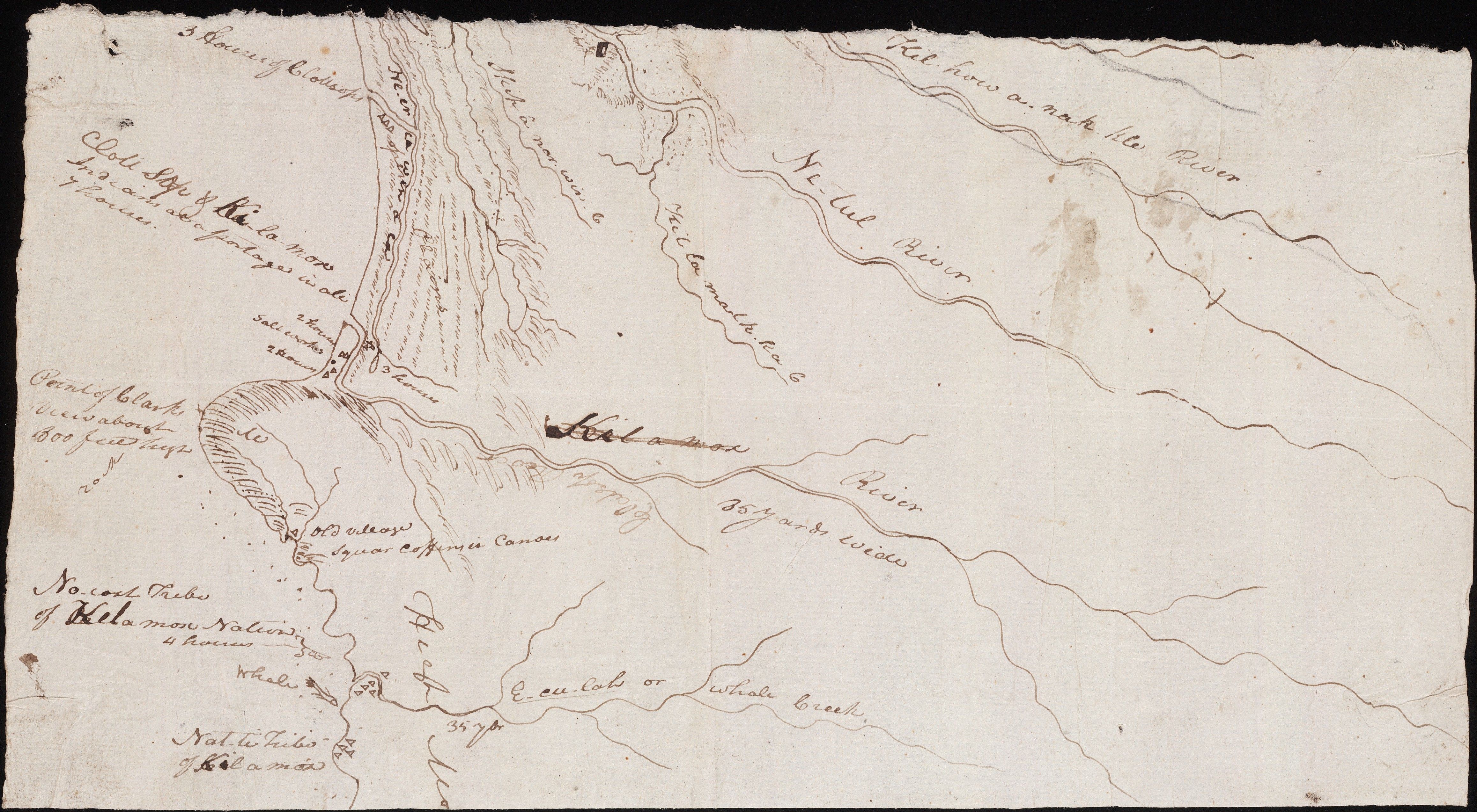
We can’t talk about significant U.S. surveying contributions without mentioning Lewis and Clark. The famous duo set out with their crew of forty to survey the Louisiana Purchase all the way to Oregon. As America’s most famous surveyors, Lewis and Clark created about 140 maps of the vast area (all without GPS, by the way).
America’s rich heritage of surveyors makes standing out in a field seem worth it! These historical figures left a legacy of a noble, important profession that ROCK Robotic helps continue today. As we stand on the shoulders of these impressive surveying giants, let’s keep moving forward in exploring the land.
**Ready to make your contribution to surveying history? Visit rockrobotic.com **to learn more about our survey-grade hardware and processing software.