簡単にキャプチャ、表示、 SLAMデータを処理する
合理化されたワークフローによりシンプルになります
.png)

Upload Data
Securely upload your data into the ROCK Cloud to view, modify and analyze your 3D point cloud.

Process Data
Quickly process your SLAM data by ordering deliverables with 1 click in the ROCK Cloud Marketplace.

Get Deliverables
Download your highly accurate results in just a few minutes. Final is delivered in LAZ file format.


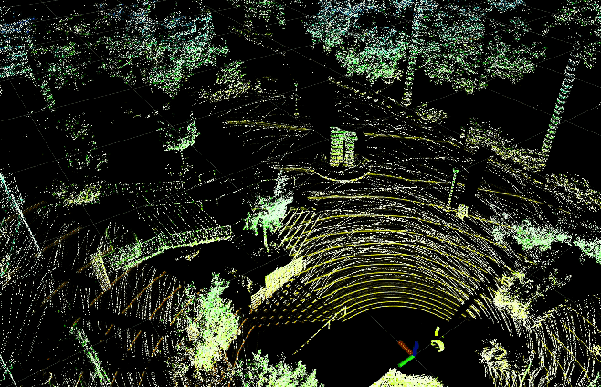
データを表示して、結果を見てください

「ROCK Robotic の R360 の SLAM 機能には非常に感銘を受けています。システムを簡単に導入し、信じられないほど正確なデータを収集し、すべてを数時間で処理できます。」
ロックスラムの試合を観戦
最終的な SLAM 成果物を表示するここ ←


14-Days
$2,000 USD
-
Unlimited SLAM data processing (30 minute maximum per SLAM collection)
-
ROCK Support via chat or email to assist with SLAM capture and processing
-
ROCK Cloud tools to align and project SLAM data for the time period specified.
1-Year
$12,000 USD
-
Unlimited SLAM data processing (30 minute maximum per SLAM collection)
-
ROCK Support via chat or email to assist with SLAM capture and processing
-
ROCK Cloud tools to align and project SLAM data for the time period specified.
ROCK SLAMサービスに登録する
お客様のニーズに合わせたコスト効率の高いオプション
さらに詳しい情報が必要ですか?
にアクセスしてください。ロック知識ベース ROCK Surveyor の使用方法の詳細については、「ROCK Surveyor」を参照してください。または、ご質問、コメント、懸念事項がございましたら、お気軽にお問い合わせください。
必要な成果物を入手する
ワンクリックで SLAM データを処理します。