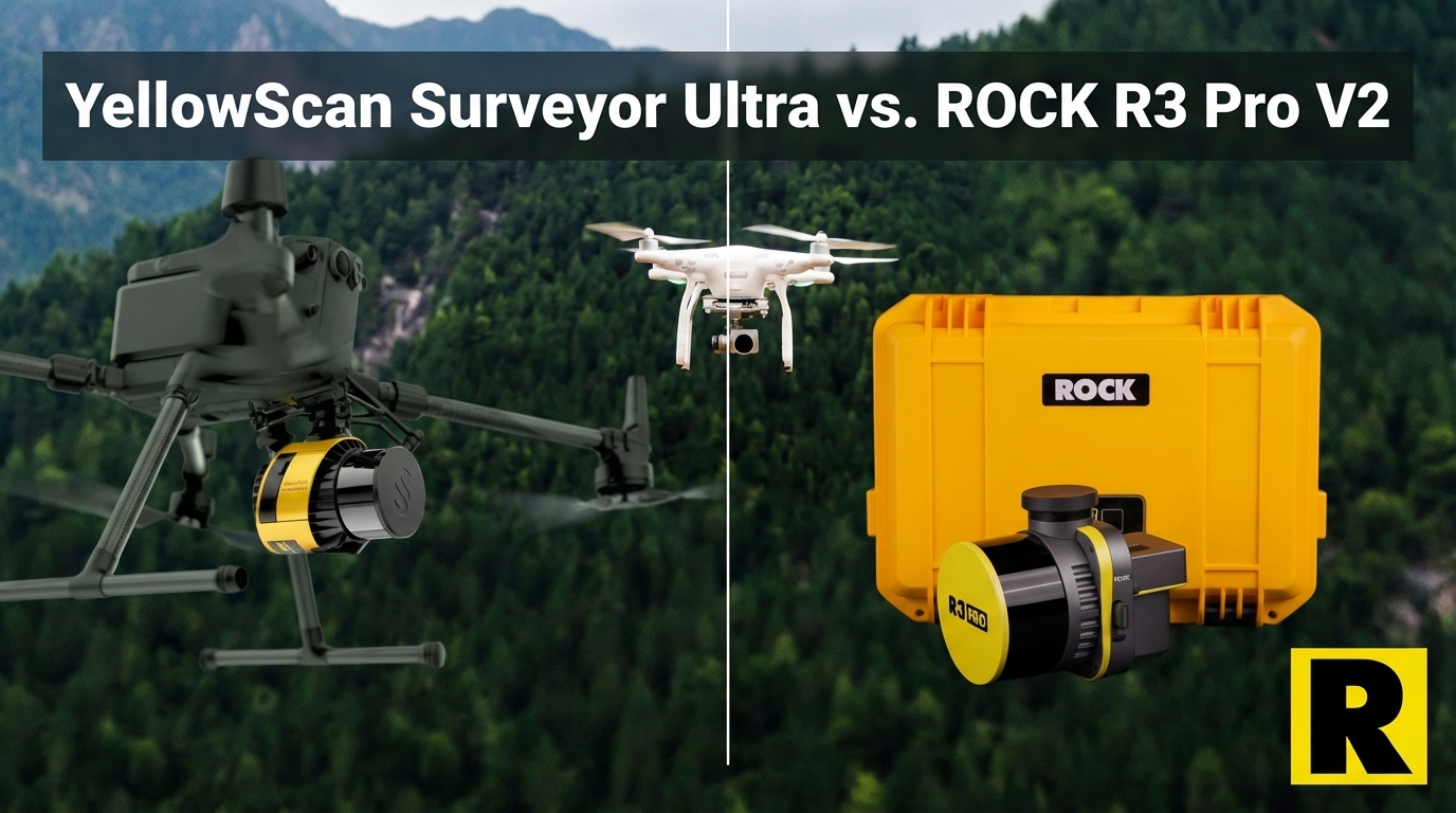
YellowScan Surveyor Ultra vs. ROCK R3 Pro V2: Premium Price, Partial Capability
Apr 01, 2026
If you want the lightest mid-range UAV LiDAR sensor on the market, the YellowScan Surveyor Ultra is it. At 0.98 kg before battery and camera, it's an engineering achievement — lighter than anything else in its scan performance tier.
YellowScan has been doing this for over a decade and they make excellent hardware. The Surveyor Ultra is a premium product with real strengths.
It's also priced at an estimated $40,000–$60,000 for a drone-only sensor with an 8 MP embedded camera, no handheld SLAM capability, and no cloud processing ecosystem comparable to ROCK Cloud.
For survey firms evaluating which mid-range system to build their business around, that math deserves a close look.
What YellowScan Got Right
The Surveyor Ultra earns honest credit for several things:
Weight. 0.98 kg (without battery and camera) is genuinely the lightest in class. This is important for operators running tight payload budgets, flying smaller drones, or maximizing flight endurance. The weight advantage is real.
Triple-Return Capability. Up to 1.92M points per second in triple-return mode using the Hesai XT32M2X — slightly ahead of ROCK's dual-return rate on the same scanner family.
Applanix APX-15 IMU. One of the most respected inertial navigation systems in the survey industry, giving the Surveyor Ultra an IMU pedigree that commands confidence on demanding projects.
CloudStation Software. YellowScan's CloudStation handles mission planning and post-processing competently. It's hardware-centric but solid.
YellowScan Brand. Over a decade of European precision engineering. Respected in the survey industry, particularly in European and Australian markets.
Now for the practical comparison.
1. The Price Reality
YellowScan doesn't publish pricing on the Surveyor Ultra, but industry estimates consistently place it in the $40,000–$60,000 range for the sensor with the 61 MP camera kit.
The ROCK R3 Pro V2 comes in at a significantly lower price point with:
- 26 MP integrated camera (vs. 8 MP embedded on the Surveyor Ultra)
- ROCK Desktop license included
- ROCK Cloud access included
- Multi-platform capability (drone + vehicle + handheld SLAM)
At roughly the same aerial scan performance level (both use Hesai XT32 variants), the price difference is substantial. For a regional survey firm building their first LiDAR capability or adding a second sensor, the cost delta buys real business expansion — not just a lighter sensor.
2. The Camera Gap
This is a significant practical issue that gets underplayed in spec discussions.
The YellowScan Surveyor Ultra uses an 8 MP global shutter camera embedded in the sensor. That's the standard configuration.
The ROCK R3 Pro V2 uses a 26 MP integrated camera.
For colorized point clouds — which are expected on most modern survey deliverables — camera quality directly affects data quality. An 8 MP image on a high-density point cloud produces noticeably lower colorization quality than a 26 MP image.
YellowScan does offer camera upgrade options, but those add cost and complexity. The R3 Pro V2 includes a 26 MP camera as part of the standard system.
3. The SLAM Gap
The Surveyor Ultra is a drone-mounted sensor with a Fly & Drive vehicle pod option. It can fly and do mobile mapping — that's meaningful versatility.
But it has no handheld SLAM capability. No GPS-denied environments. No building interiors. No parking structures. No utility tunnels.
The ROCK R3 Pro V2 with ROCK SLAM Dock V2 covers all of those:
- Drone survey
- Vehicle mobile mapping (ROCK Mobile Mount)
- Handheld SLAM for GPS-denied environments
YellowScan's Fly & Drive gives you two modes. ROCK gives you three. For survey firms serving clients who need all of the above — and increasingly they do — that third mode opens project types that the Surveyor Ultra simply cannot address.
4. The Ecosystem Gap
CloudStation handles YellowScan data processing. It's competent but desktop-first, hardware-centric, and without automated deliverable services.
ROCK Cloud offers:
- Automated strip alignment
- One-click ground classification
- Automated contour extraction
- Browser-based collaborative data review
- ROCK Pro Services — licensed surveyors produce CAD-ready planimetrics with 3-5 day turnaround
YellowScan has no equivalent to ROCK Pro Services. When a Surveyor Ultra customer needs to deliver planimetrics or CAD-ready output, they handle it in-house or find a third-party processor.
For small and growing survey firms, the ability to outsource the hardest part of the LiDAR workflow — feature extraction, classification review, CAD drafting — often determines which system they choose.
5. Support Timezone and Market Focus
YellowScan is a French company. For US-based customers, their support operations are on European time. On a tight project deadline with a processing problem, that time zone difference is a real operational consideration.
ROCK's support team is US-based, practitioner-staffed, and available during US business hours. The Indiana Drones YouTube channel (150K+ subscribers) provides a level of accessible, practical guidance that no European manufacturer currently matches for the US survey market.
Head-to-Head: ROCK R3 Pro V2 vs. YellowScan Surveyor Ultra
| ROCK R3 Pro V2 | YellowScan Surveyor Ultra | |
|---|---|---|
| Laser | Hesai XT32 | Hesai XT32M2X |
| Point Rate | 1.28M (dual) | 1.92M (triple) |
| Weight | 1.26 kg | 0.98 kg |
| Camera | 26 MP integrated | 8 MP (embedded) |
| IMU | Tactical grade | Applanix APX-15 |
| Multi-Platform | Drone + Vehicle + SLAM | Drone + Vehicle (Fly & Drive) |
| SLAM Capability | Yes (SLAM Dock V2) | No |
| Cloud Workflow | ROCK Cloud + Pro Services | CloudStation |
| Automated Deliverables | Yes (Pro Services) | No equivalent |
| Estimated Sensor Price | Lower | $40K–$60K+ |
| Support Timezone | US-based | Europe (French company) |
Where Surveyor Ultra wins: Weight (0.98 kg), IMU quality (Applanix APX-15), triple-return point rate.
Where R3 Pro V2 wins: Camera quality (26 MP vs. 8 MP), handheld SLAM, total system cost, complete cloud ecosystem with Pro Services, US support.
The Bottom Line
The YellowScan Surveyor Ultra is beautifully engineered and genuinely the lightest sensor in its class. If weight is your primary constraint and you're doing purely aerial and vehicle mapping with a premium budget, it's a capable tool.
For survey firms evaluating this purchase on business terms — cost, versatility, camera quality, workflow automation, and the ability to address every project type a client might need — the ROCK R3 Pro V2 wins the comparison at a lower price with a more complete capability set.
Lighter isn't always better. More capable usually is.