The Advantages of Drone Surveying vs. Traditional Methods
Aug 29, 2025
The land surveying industry is built on a foundation of precision and trust. For decades, the total station and GPS receiver have been the gold standards for capturing the data that shapes our world. These traditional methods are reliable and accurate, but they face a fundamental challenge in the modern era: the demand for more data, captured faster, and over larger areas.
Enter drone-based LiDAR (Light Detection and Ranging). This technology represents not just an evolution, but a revolution in how we create digital representations of reality. By mounting advanced laser scanners on unmanned aerial vehicles (UAVs), surveyors can now capture millions of data points in minutes, creating a comprehensive 3D "digital twin" of a site with unprecedented detail and speed.
But what does this shift mean in practical terms? This article moves beyond the hype to provide a detailed, head-to-head comparison between drone LiDAR and traditional surveying, focusing on the two most critical factors for any business: time and cost.
A Quick Refresher: Traditional Surveying
Traditional surveying is a "boots-on-the-ground" discipline. It involves a team of skilled surveyors physically walking a site, using instruments like total stations or network GPS rovers to manually collect individual data points. Each point—whether it's the top of a curb, the base of a tree, or a spot elevation in a field—is painstakingly measured one by one.
Limitations of Traditional Methods:
- Time-Consuming: Large or complex sites can require a survey crew to be on-site for days or even weeks.
- Labor-Intensive: Typically requires a two-person crew, representing a significant operational cost.
- Hazardous: Puts surveyors in potentially dangerous situations, such as on steep slopes, in high-traffic corridors, or on active construction sites.
- Data Gaps: The final dataset is an interpolation between the points that were physically captured. Features between these points are estimated, not directly measured.
The Modern Approach: Drone LiDAR Surveying
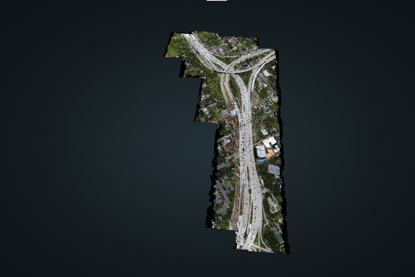
Drone LiDAR surveying transforms data collection from a manual, point-by-point process into an automated, area-based one. A drone, like a DJI M350 equipped with a system like the ROCK Ultra, autonomously flies a pre-programmed grid pattern over the project site. The LiDAR sensor emits hundreds of thousands of laser pulses per second, which bounce off the terrain and return to the sensor.
An integrated tactical-grade IMU and GNSS receiver tracks the precise position and orientation of the drone, allowing every laser return to be georeferenced with centimeter-level accuracy. The result is a dense, comprehensive 3D point cloud containing millions of data points that blanket the entire site.
Head-to-Head: A 100-Acre Topographic Survey
To illustrate the dramatic differences, let's analyze a common scenario: performing a 1-foot topographic survey on a 100-acre site with mixed open terrain and moderately dense tree cover.
The Traditional Method:
A 2-person survey crew is tasked with the project.
- Field Time: The crew spends 5 to 7 full days on-site. This includes daily travel, instrument setup, data collection, and managing potential weather delays. They must physically walk the entire site, navigating through wooded areas and around obstacles.
- Labor Cost: Assuming an average loaded rate of $75/hour per surveyor, the cost is significant.
- 2 surveyors * 8 hours/day * 6 days * $75/hour = $7,200
- Data Completeness: The crew captures key breaklines and spot elevations, but the density of shots in the wooded areas is low due to physical access constraints.
The Drone LiDAR Method (with ROCK Ultra):
A single FAA Part 107 certified pilot is tasked with the project.
- Field Time: The pilot arrives on-site, sets up a base station, and performs pre-flight checks. The actual flight time to cover 100 acres is about 25 minutes. The total time on-site, from arrival to departure, is roughly 3 to 4 hours. The ROCK Ultra's long-range capability allows the pilot to fly at 400ft AGL, simplifying mission planning and avoiding most obstacles.
- Labor Cost:
- 1 pilot * 4 hours * $75/hour = $300
- Data Completeness: The LiDAR sensor captures millions of points across the entire 100 acres, including the areas under tree canopy. Its 7-return laser capability reliably measures the ground through vegetation, resulting in a true, high-fidelity Digital Terrain Model (DTM).
The Results: A Quantifiable ROI
| Metric | Traditional Survey | Drone LiDAR Survey (ROCK Ultra) | Advantage |
|---|---|---|---|
| Field Time | 5–7 Days | 3–4 Hours | ~95% Reduction |
| Field Labor Cost | ~$7,200 | ~$300 | ~95% Reduction |
| Personnel | 2-Person Crew | 1 Pilot | 50% Staff Reduction |
| Safety Risk | High (terrain, traffic) | Minimal | Greatly Improved |
| Data Density | Sparse (hundreds of points) | Extreme (millions of points) | Massively Superior |
This comparison reveals a staggering return on investment. The drone LiDAR workflow reduces field labor costs and time by over 90%, freeing up the survey crew to manage multiple projects simultaneously. A firm can move from completing one 100-acre project a week to completing several per day.
Beyond the Numbers: The Data Quality Advantage
While the time and cost savings are compelling, the biggest long-term advantage of drone LiDAR is the quality and completeness of the data.
The clean curbs at 120 m AGL were a game changer.
— ROCK Pro Services Manager
-
Seeing Through Trees: Traditional surveyors can't see through vegetation. LiDAR can. With multiple laser returns, systems like the ROCK Ultra can capture the top of the canopy, multiple layers within the foliage, and, most importantly, the true ground beneath it. This capability is revolutionary for surveying in wooded or overgrown areas.
-
A Complete Digital Record: The resulting point cloud is a complete, high-resolution digital record of the site at a specific moment in time. This "digital twin" can be revisited for years to come to extract new features or perform analysis without ever returning to the field, saving immense time and money on future remobilization.
Solving the Final Piece of the Puzzle: From Data to Deliverable
One of the historical barriers to adopting LiDAR has been the perceived complexity of processing the massive datasets. A 30-minute flight can generate hundreds of gigabytes of raw data, which requires powerful computers and specialized software to turn into a final deliverable.
This is where the ROCK Robotic ecosystem provides the "easy button."
- In-Field QC: Land your drone and immediately use ROCK Desktop on a laptop to pre-process the data and ensure you have full coverage before ever leaving the site.
- Cloud Processing: Upload the verified data to the ROCK Cloud, a powerful platform for viewing, analyzing, and securely storing your point clouds.
- One-Click Deliverables: This is the game-changer. Instead of spending days in the office drafting linework, use ROCK Pro Services. With a single click, you can order survey-grade deliverables like:
- Bare-Earth DTMs
- 1-foot Contours
- Full 3D Planimetrics (buildings, curbs, paint stripes, utilities)
Our team of GIS experts, powered by advanced AI, transforms your point cloud into a clean, layered CAD file, ready for your clients. This solves the processing bottleneck and makes LiDAR accessible to any firm, regardless of its in-house drafting capacity.
Conclusion: The Future is Now
Drone LiDAR is no longer an experimental technology; it is a proven, reliable, and profoundly more efficient method for topographic surveying. By drastically reducing time in the field, lowering operational costs, enhancing crew safety, and delivering a far superior dataset, it offers an undeniable return on investment.
For land surveyors and civil engineers ready to scale their business, take on more projects, and deliver higher quality products to their clients, the choice is clear. Adopting an end-to-end drone LiDAR workflow is the most impactful investment you can make in the future of your company.