GreenValley LiAir X3C-H vs. ROCK R3 Pro V2: The Specs Match — The Ecosystem Doesn't
Apr 01, 2026
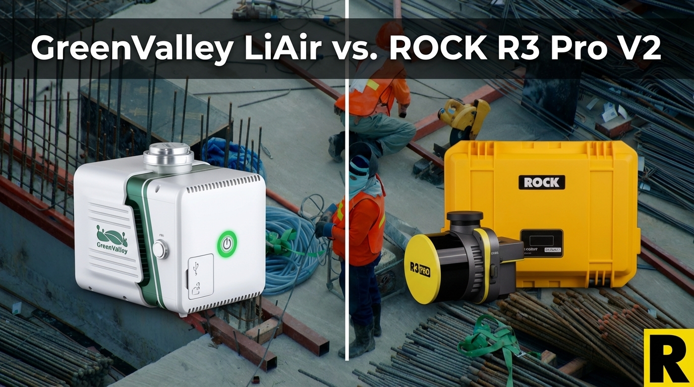
GreenValley International has built meaningful market share in the UAV LiDAR space — particularly in Asia-Pacific and among US firms looking for capable systems at competitive prices. Their LiAir X3C-H is their most comparable product to the ROCK R3 Pro V2: a compact 32-channel system built on the Hesai XT32, SLAM-capable, and designed for both aerial and handheld deployment.
On paper, the specs are close. Both use the same core scanner. Both weigh around 1.1–1.3 kg. Both offer SLAM capability.
The comparison is nearly neck-and-neck on hardware. It diverges sharply everywhere else.
What GreenValley Does Well
GreenValley is a legitimate company with real product capability. The LiAir X3C-H earns some honest credit:
Hesai XT32 Core. Same 32-channel scanner trusted by ROCK, GeoCue, and YellowScan. The raw scan performance is comparable at the hardware level — 640K single return, 1.28M dual, up to 1.92M triple return.
Lightweight. The X3C-H comes in at approximately 1.12 kg — slightly lighter than the R3 Pro V2's 1.26 kg. For operators pushing payload margins on every flight, this matters at the margin.
SLAM-Capable Handheld. GreenValley offers a handheld SLAM kit for the X3C-H, enabling GPS-denied indoor and urban capture. This multi-platform capability is a genuine differentiator versus drone-only competitors.
LiDAR360 Software. GreenValley's LiDAR360 is a respected desktop processing suite, particularly in forestry, utilities, and powerline analytics. LiPowerline (a module for powerline corridor analysis) is considered strong by utility market operators.
Competitive Pricing. GreenValley typically prices below ROCK and GeoCue, particularly in markets where they sell direct.
So where does ROCK R3 Pro V2 pull ahead?
1. Accuracy: The Gap Is Real
This is the most consequential difference.
GreenValley's published accuracy spec for the LiAir X3C-H is ±5 cm vertical.
ROCK R3 Pro V2 delivers 2–3 cm vertical accuracy on real survey projects — verified by customer deployments including airports, highway interchanges, and construction sites where deliverables are compared against ground control.
For many survey use cases — topographic mapping, ALTA surveys, corridor surveys where the data needs to meet client accuracy requirements — the difference between ±5 cm and ±2-3 cm is the difference between delivering a passing result and needing a re-flight.
PilotByte (Dylan Gorman) mapped a 133-acre highway interchange to survey-grade accuracy with the R3 Pro V2 in 30 minutes. That data went to a client who measured it against ground truth. A ±5 cm system on the same project would likely not meet contract specifications.
2. NDAA Compliance: The Disqualifier
GreenValley International is a Chinese manufacturer. The LiAir X3C-H is non-NDAA compliant.
This is a binary issue for US government, DOT, utility, and infrastructure contracts. If you're a survey firm pursuing these markets — or wanting the option — the LiAir X3C-H eliminates those opportunities.
The ROCK R3 Pro V2 on Freefly Astro or Inspired Flight IF800 achieves full NDAA compliance. You can bid government contracts today. That option doesn't exist with GreenValley hardware.
3. The Software Ecosystem
LiDAR360 is good desktop software. It has real depth for forestry, vegetation analysis, and powerline applications.
But desktop-first is not the same as automated.
ROCK Cloud doesn't require a skilled LiDAR processing specialist to produce survey deliverables. It's designed to be operated by the drone pilot who collected the data — automated strip alignment, one-click ground classification, automated contour extraction. ROCK Pro Services takes it further: submit your data, get back CAD-ready planimetrics within 3-5 business days, reviewed by licensed surveyors.
GreenValley has no equivalent to ROCK Pro Services. When a GreenValley customer needs planimetrics, feature extraction, or CAD deliverables, they're either doing it in-house with LiDAR360 expertise or hiring a third-party processing shop.
For survey firms scaling up drone LiDAR without hiring a full-time LiDAR specialist, the ability to send data to ROCK Pro Services is often the deciding factor in the entire purchase.
Additionally: GreenValley's software suite (LiDAR360 and LiPowerline) involves additional purchase costs on top of the hardware. ROCK Desktop comes bundled with the hardware, and ROCK Cloud access is included. You're not paying extra for separate modules to do basic survey work.
4. Western Market Support
GreenValley's global support is centered in China. Their US distribution relies on third-party resellers — DSLRPros, Dronefly, Candrone — who can help with initial setup but typically lack deep technical support for complex processing questions.
When you're standing in a field having a PPK issue that's affecting your strip alignment, or you're troubleshooting an unexpected point cloud artifact on a $75,000 survey job, the support experience matters.
ROCK's support team are practitioners. They have flown the R3 Pro V2. They know what causes the problem you're describing and how to fix it. Phone support is real. The community around ROCK — the Indiana Drones YouTube channel, the user forums — is active and practitioner-driven.
5. Platform Versatility
Both the LiAir X3C-H and the R3 Pro V2 offer drone + handheld SLAM capability. This is a genuine tie at the hardware level.
The R3 Pro V2 adds one capability GreenValley doesn't match: the ROCK Mobile Mount for vehicle-based corridor mapping. Aerial, vehicle, and handheld SLAM — three revenue streams from a single sensor.
The X3C-H is drone + handheld. The R3 Pro V2 is drone + vehicle + handheld.
Head-to-Head: ROCK R3 Pro V2 vs. GreenValley LiAir X3C-H
| ROCK R3 Pro V2 | GreenValley X3C-H | |
|---|---|---|
| Laser | Hesai XT32 | Hesai XT32 |
| Point Rate | 1.28M (dual) | 1.28M (dual) / 1.92M (triple) |
| Accuracy | 2–3 cm | ±5 cm |
| Weight | 1.26 kg | 1.12 kg |
| Multi-Platform | Drone + Vehicle + SLAM | Drone + SLAM only |
| NDAA OK? | Yes (on Astro/IF800) | No |
| Cloud Workflow | ROCK Cloud + Pro Services | LiDAR360 (desktop-first) |
| Automated Deliverables | Yes (Pro Services) | No equivalent |
| Software Included | ROCK Desktop bundled | LiDAR360 additional cost |
| Support | US-based practitioners | Asia-Pacific primary |
Where X3C-H wins: Slightly lighter, triple-return point rate, competitive pricing.
Where R3 Pro V2 wins: Accuracy (2-3 cm vs. ±5 cm), NDAA compliance, vehicle platform capability, cloud automation with Pro Services, included software, US support.
The Bottom Line
If you're primarily evaluating raw scan performance on a tight budget and don't need government contracts, the LiAir X3C-H is competitive hardware at a lower price point.
If you need survey-grade accuracy consistently verified against ground control, if you want government contract access, or if you want a complete field-to-finish workflow without building a separate processing operation in-house — the ROCK R3 Pro V2 is the stronger professional tool.
The sensors share a heart. The systems don't share a standard.