Case Study: Drone LiDAR and Wildfire Recovery – The Palisades Fire
Sep 22, 2025
In January 2025, the Palisades Fire swept through the hills of California, leaving hundreds of acres of charred terrain and damaged infrastructure in its path. For residents and local communities, the devastation was more than a headline—it was personal. Rebuilding after an event of this scale requires not only resilience but also accurate, timely information about the land itself.
This is where drone-based aerial LiDAR proves its value. By providing high-resolution elevation data and precise topographic mapping, LiDAR surveys give communities, engineers, and decision-makers a clear picture of what has been lost and what must be rebuilt.
Why aerial LiDAR matters in wildfire recovery
After a wildfire, the challenges extend beyond burned structures. Erosion risks, unstable slopes, damaged utilities, and altered drainage patterns complicate the path forward. Traditional ground surveys in these environments are often dangerous, time-consuming, and limited in scope.
Drone-mounted LiDAR systems can safely capture detailed 3D data from above, even in rugged or hazardous areas. These datasets help:
- Assess damage quickly – mapping burn scars, destroyed vegetation, and structural loss.
- Plan safe rebuilding – identifying slope stability, powerline corridors, and potential hazards.
- Guide mitigation efforts – supporting soil erosion control, drainage planning, and reforestation.
- Document conditions – creating accurate records for insurance, municipal planning, and environmental agencies.
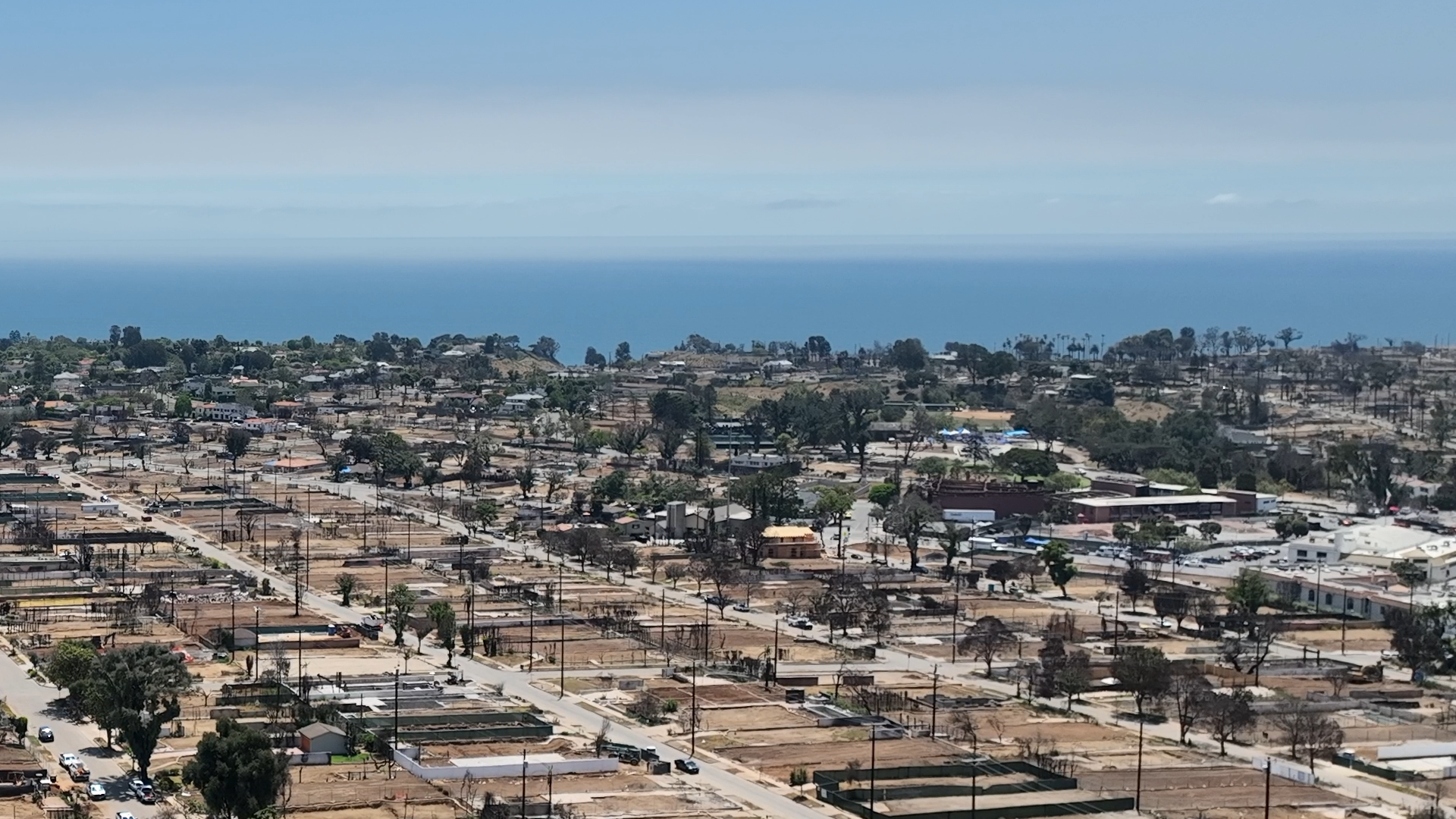
The Palisades Fire dataset
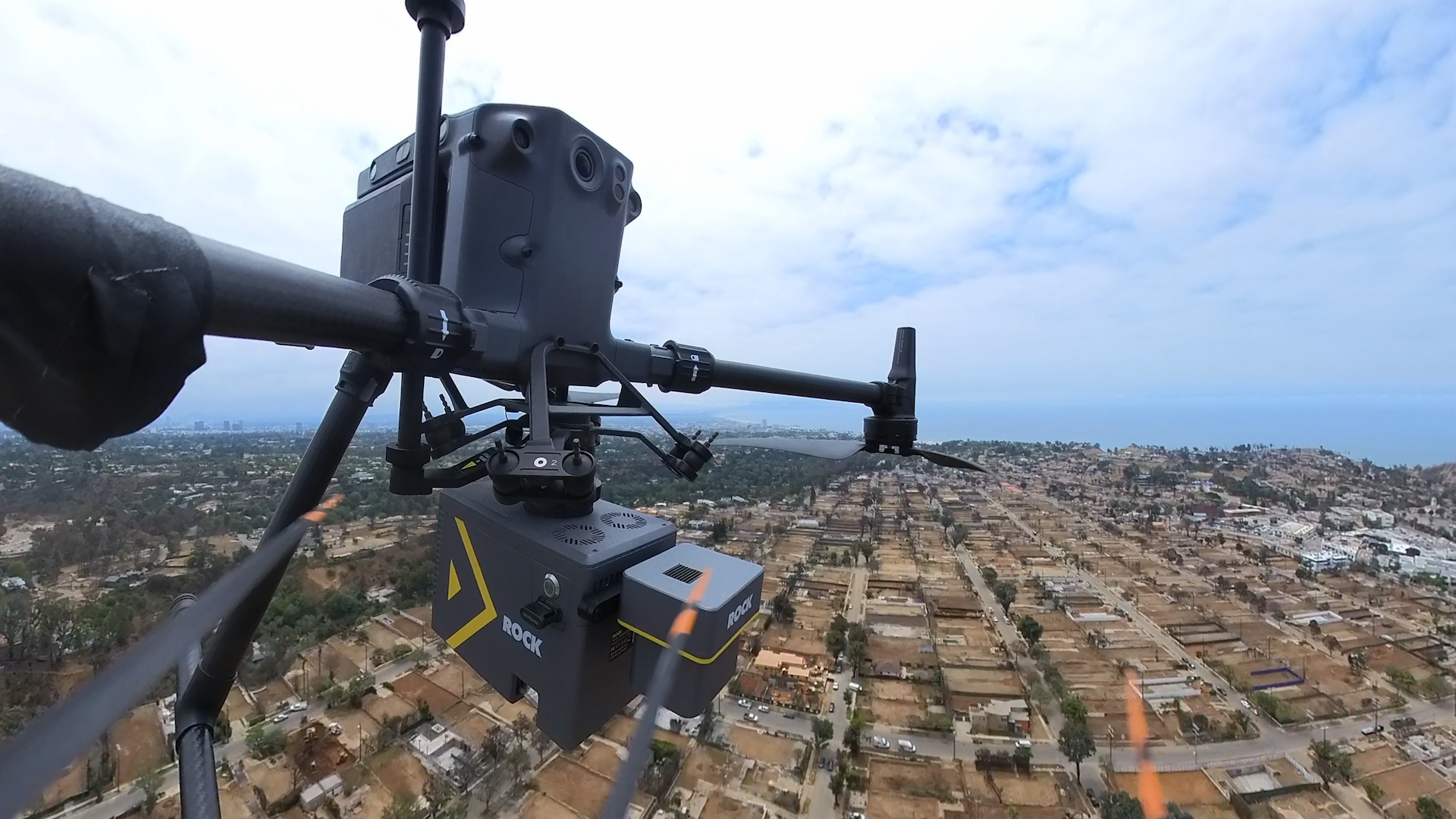
As part of ROCK Robotic’s ongoing efforts to demonstrate the role of LiDAR in critical applications, a ROCK Ultra system was flown over the burn area of the Palisades Fire. Two flights were merged to cover approximately 362 acres at 120 meters altitude while maintaining a speed of 15 meters per second—fast enough to minimize disturbance while still delivering high-resolution survey results.
The resulting dataset reveals striking detail. Powerline wires were clearly captured, along with elevation changes across both hillside and residential terrain. Switching between elevation and RGB modes highlights the extent of destruction, as well as the landscape that will need to be stabilized and rebuilt.
You can really see the extent of rebuilding that is going to need to take place in this area. It is quite sobering, but it is an honor to use this data for applications like remediation and understanding what can be done with an area after something devastating like this.
— Jamie Lackner, ROCK Pro Services Manager, reflecting on the dataset
Data visuals
Below is a slider of still images captured from the Palisades Fire dataset. These visuals illustrate how the ROCK Ultra maps both the burned terrain and surviving infrastructure.
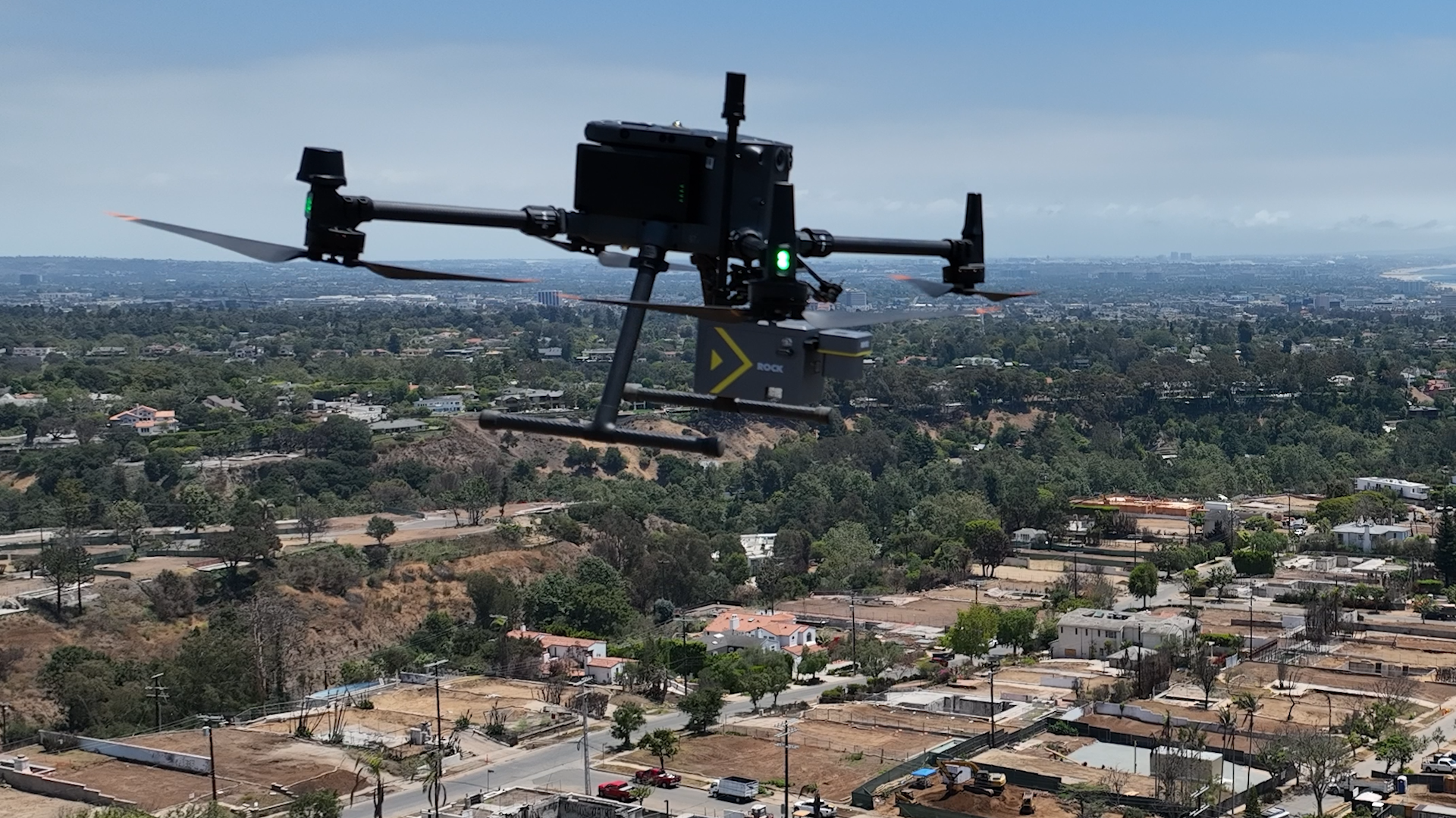
ROCK Ultra in the field
The ROCK Ultra was engineered for missions where both coverage and detail are critical. Key features—such as high-altitude flight capabilities, wire detection, and dense point cloud generation—make it well-suited for wildfire response and recovery.
Several capabilities stand out in the context of wildfire recovery:
- High-altitude efficiency – capture hundreds of acres in fewer passes, reducing survey time in sensitive or hazardous environments.
- Precision detail – dense data enables the detection of utility lines, structures, and subtle terrain changes that influence rebuilding efforts.
- Versatile deployment – adaptable to varying terrain, from steep hillsides to residential corridors impacted by fire.
These strengths allowed the Palisades Fire survey to deliver data that was both broad in scope and fine in detail—an essential combination for understanding damage and planning reconstruction.
Building toward new beginnings
Wildfires leave behind more than scorched earth—they leave questions about safety, sustainability, and how best to begin again. Drone LiDAR helps answer those questions by offering a precise blueprint of the terrain as it exists today.
In the case of the Palisades Fire, the ROCK Ultra’s dataset not only documents the scale of damage but also provides a foundation for planning what comes next. From restoring infrastructure to guiding residential rebuilding, aerial LiDAR ensures recovery efforts begin on a solid, informed footing.