True-Position Orthomosaics.
LiDAR Accuracy. Minutes to Process.
ROCK Photogrammetry eliminates the trade-offs of traditional drone mapping. By leveraging LiDAR trajectory and surface models, we create perfect orthomosaics with zero distortion, no leaning buildings, and survey-grade accuracy—all in the time it took to fly.
What Makes ROCK Photogrammetry Revolutionary
We don't guess where photos belong—we know. By using LiDAR to create a perfect 3D model first, every photo pixel is placed with mathematical precision.
Lightning Fast
Process in minutes, not hours. Our 1:1 processing ratio means a 30-minute flight processes in 30 minutes.
Perfect Accuracy
Every pixel inherits LiDAR's survey-grade precision. Buildings stand straight, measurements are exact.
Unified Data
Point cloud and orthomosaic are one dataset. Toggle between views instantly with perfect alignment.
The Game-Changing Difference
Traditional photogrammetry uses photos to guess the 3D world, leading to distortions and misalignments. ROCK Photogrammetry flips the script:
- 1Capture LiDAR and photos simultaneously with ROCK Ultra
- 2Build a perfect 3D surface model from LiDAR
- 3Project photos onto the LiDAR model with zero distortion
Why Traditional Photogrammetry Falls Short
See the problems that disappear when you switch to LiDAR-driven orthorectification
Traditional SfM Problems
- Hours of Processing
Complex calculations take forever
- Leaning Buildings
Vertical features appear distorted
- Can't See Ground
Vegetation blocks terrain
- Data Misalignment
Point clouds don't match orthos
ROCK Photogrammetry Solutions
- Minutes to Process
1:1 ratio - fly 30 min, process 30 min
- Perfect Geometry
True positioning from LiDAR model
- See Everything
LiDAR penetrates vegetation
- Perfect Alignment
One unified dataset
LiDAR-Driven Orthorectification
Instead of using photos to guess the 3D world, we use the 3D world to perfectly position the photos.
Survey-Grade Trajectory
ROCK Ultra's tactical-grade IMU and GNSS with PPK processing provides exact 3D position and orientation for every photo captured.
LiDAR Surface Model
Dense, accurate point cloud creates a perfect Digital Surface Model (DSM) representing the true 3D geometry of your site.
Direct Projection
Photos are mathematically "draped" onto the LiDAR DSM, correcting all distortions with the precision of the LiDAR system itself.
The Result: True-Position Orthomosaic
Perfect Geometry
Vertical features appear in their true horizontal position. The top of a curb is directly above its base, buildings stand straight.
Inherent Accuracy
Born with the same survey-grade accuracy as the LiDAR dataset—even before applying Ground Control Points.
Two Views. One Truth.
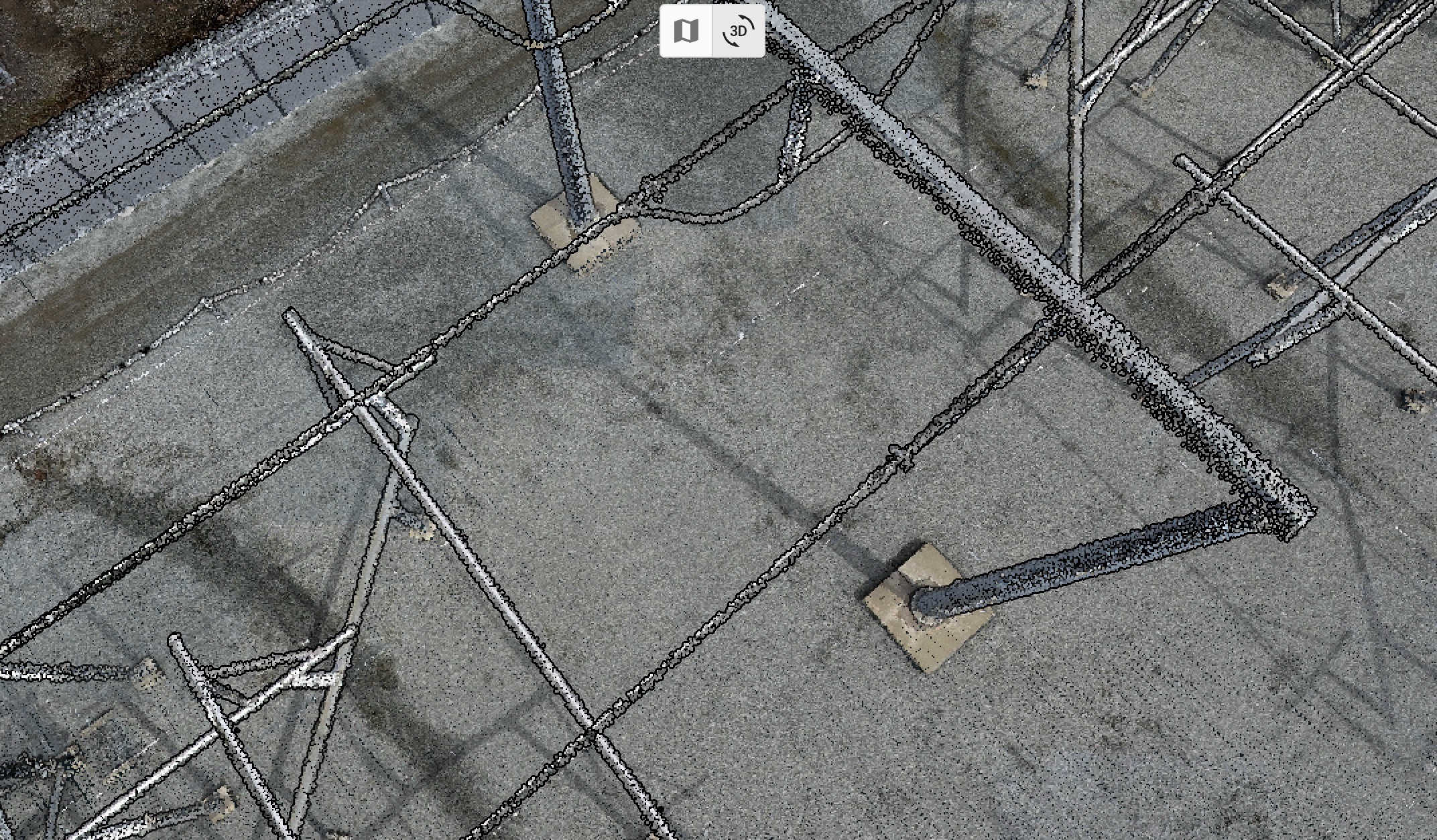
Traditional photogrammetry struggles with vertical infrastructure. ROCK Photogrammetry captures it perfectly—slide to see how LiDAR-driven orthorectification preserves true positioning of power lines, poles, and towers.
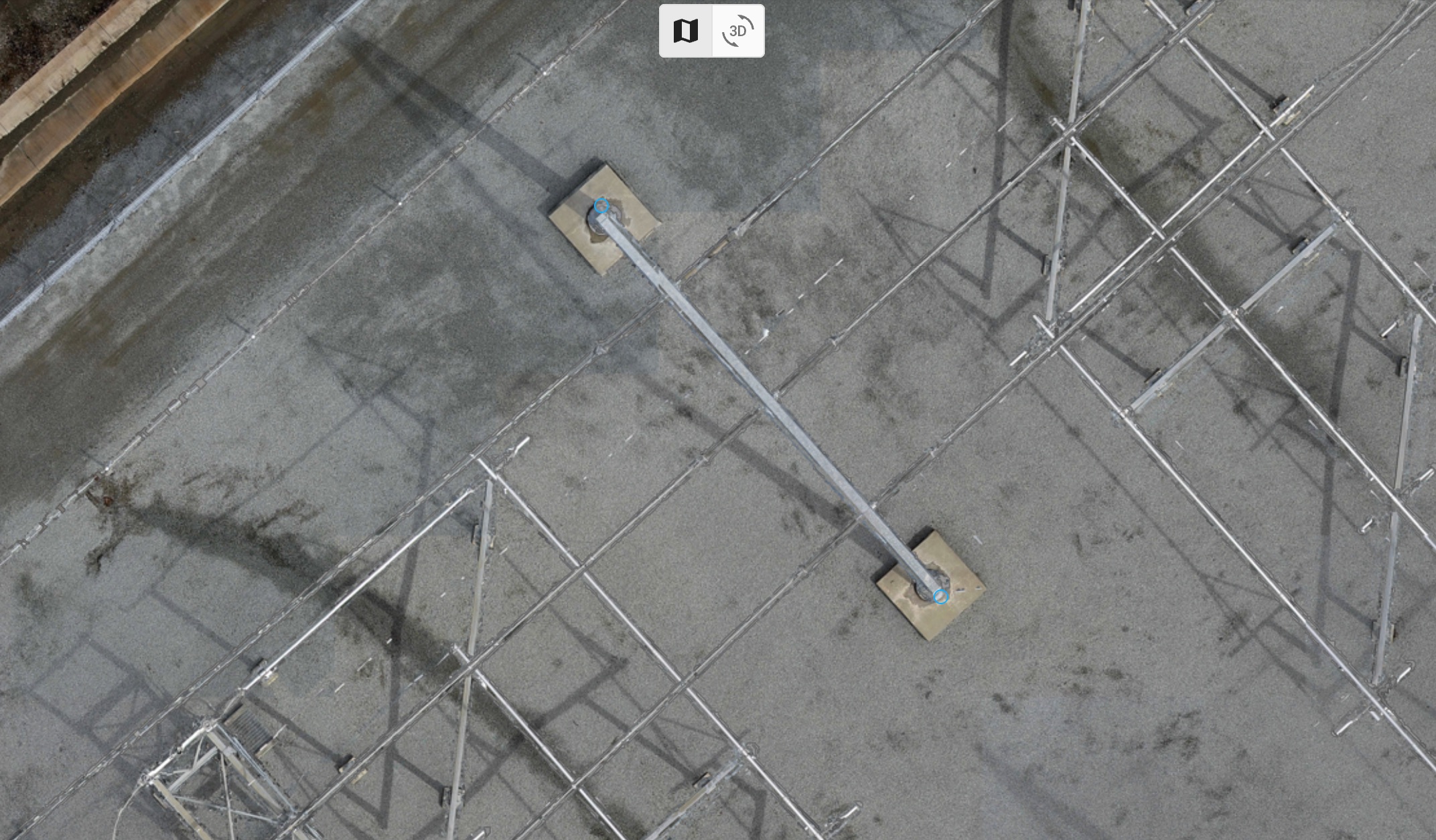
True-Position Orthomosaic
- •Perfect nadir view with zero lean or distortion
- •Accurate horizontal measurements of all features
- •Survey-grade positioning for CAD and GIS
3D Perspective View
- •Shows true height and dimension of structures
- •Ideal for visualization and inspection
- •Reveals clearances and spatial relationships
Notice the difference: Power lines and poles that appear tilted in traditional orthomosaics are positioned perfectly vertical in ROCK Photogrammetry—because we use the actual 3D LiDAR model to place every pixel.
The ROCK Photogrammetry Advantage
Revolutionary benefits that transform how you deliver mapping projects
1:1 Processing Speed
Generate orthomosaics in minutes—processing time equals flight time
True Position Accuracy
Every pixel placed with LiDAR precision, no distortion or leaning
Perfect Data Fusion
Point cloud and orthomosaic are one unified dataset
Survey-Grade Results
Meets ALTA/NSPS standards without compromise
One Dataset. Two Views. Zero Discrepancy.
ROCK Cloud treats LiDAR and orthomosaic as a single, unified data structure—not separate files.
Example: Digitizing Curb Lines
- 1.Open 3D point cloud view, zoom to curb
- 2.Digitize precise 3D polylines using point-snapping
- 3.Toggle to 2D orthomosaic—lines appear instantly
- 4.Perfect overlay, no manual alignment needed
See The Complete Workflow In Action
From LiDAR capture to unified visualization—watch how ROCK Photogrammetry transforms complex infrastructure mapping
LiDAR Capture
High-density point cloud captures every wire, insulator, and structural component with centimeter accuracy
True-Position Ortho
LiDAR-driven orthomosaic provides perfect positioning—measure clearances directly from the imagery
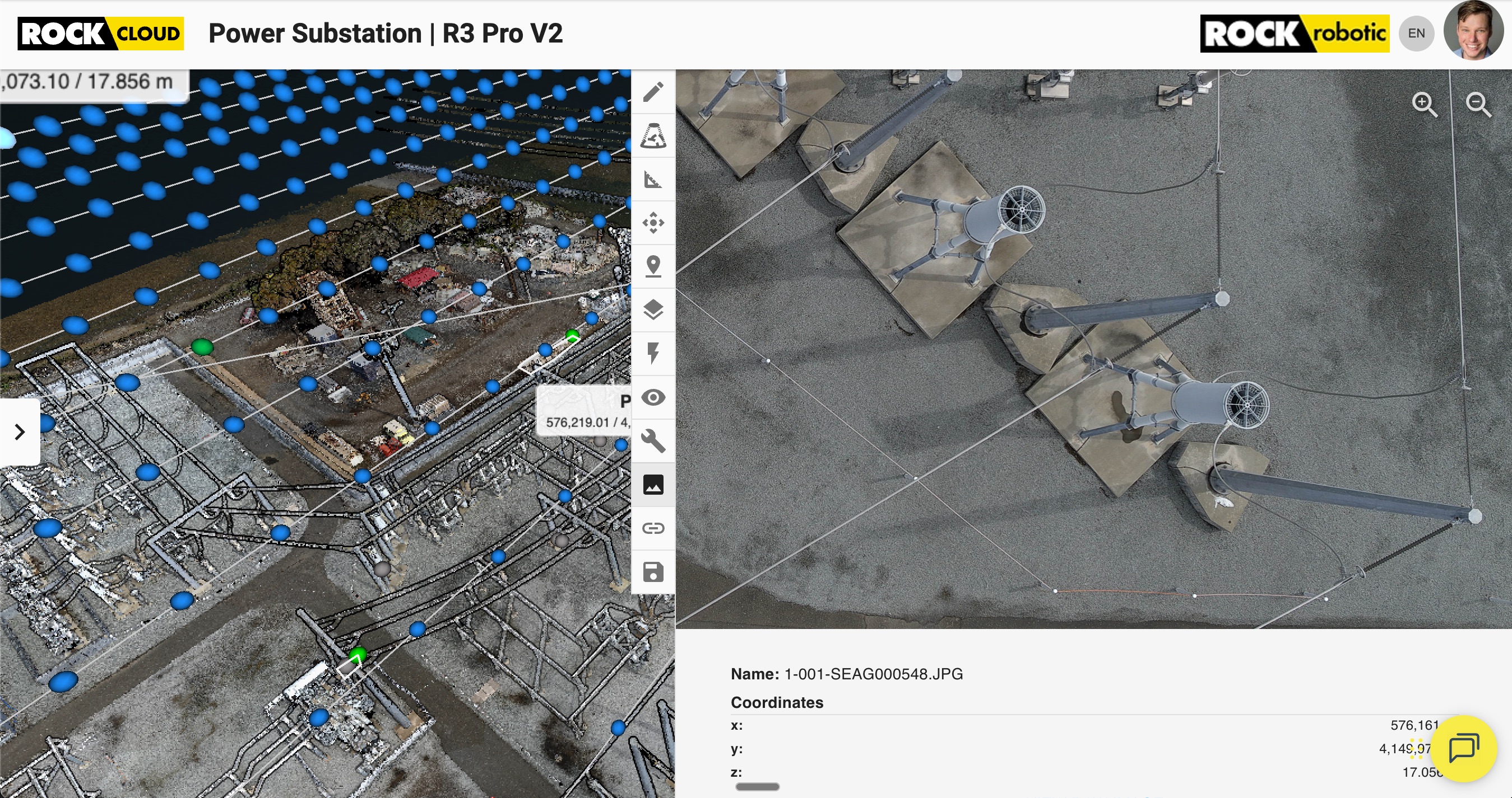
Unified Analysis
Toggle seamlessly between 3D point cloud and 2D orthomosaic in ROCK Inspect for complete documentation
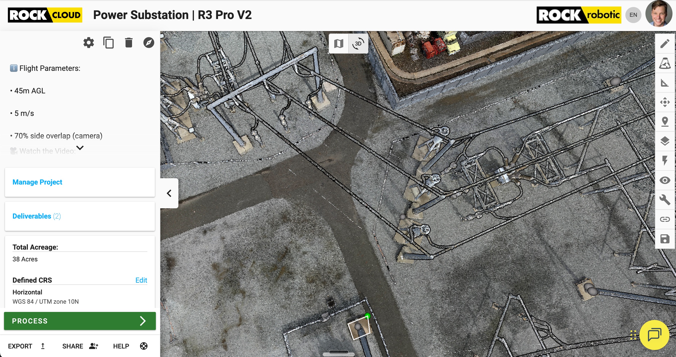
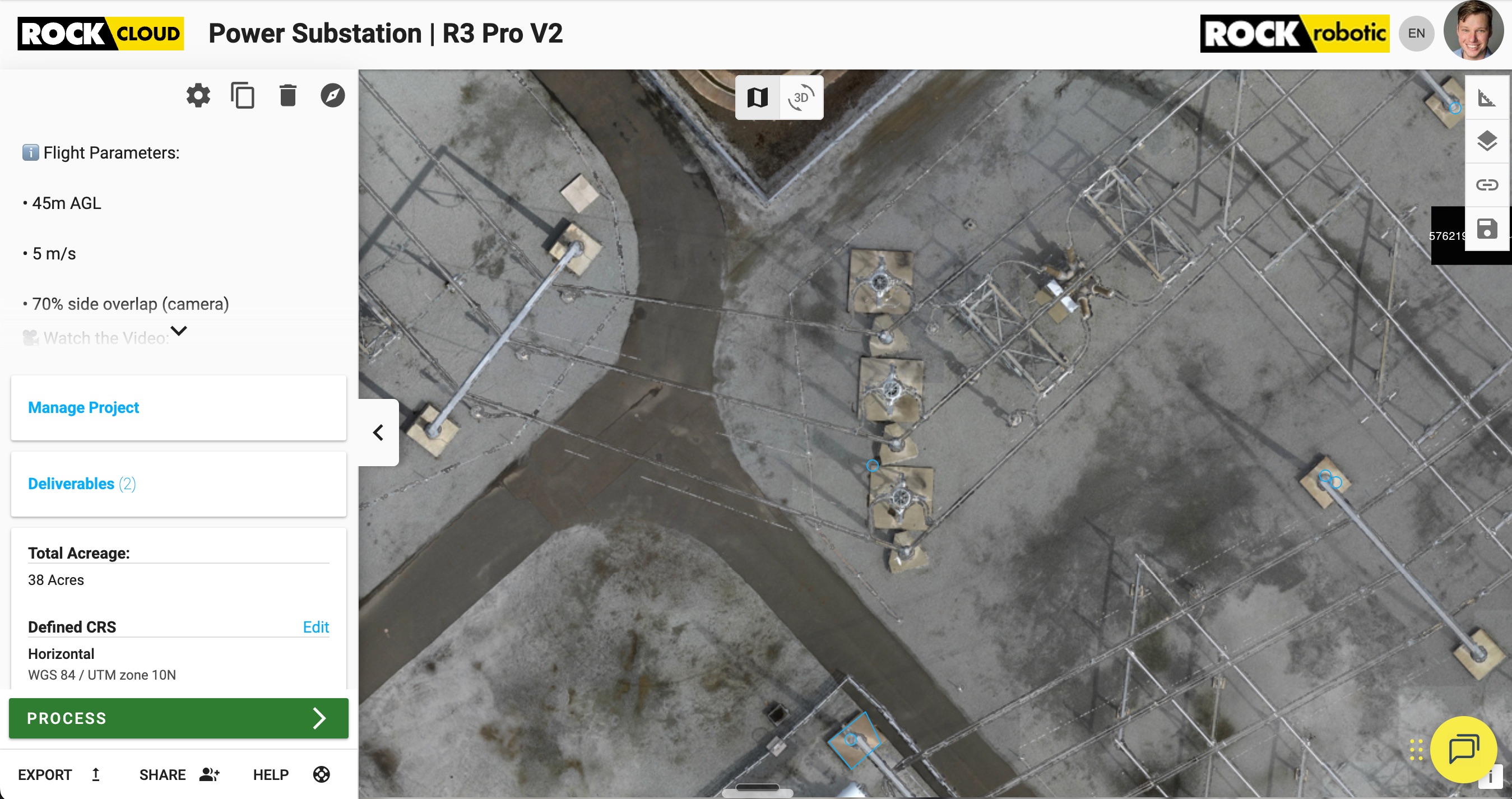
One Flight. Complete Documentation.
This entire substation was captured in a single 20-minute flight. Processing completed in under an hour. Every measurement, every clearance, every asset—documented with survey-grade accuracy.
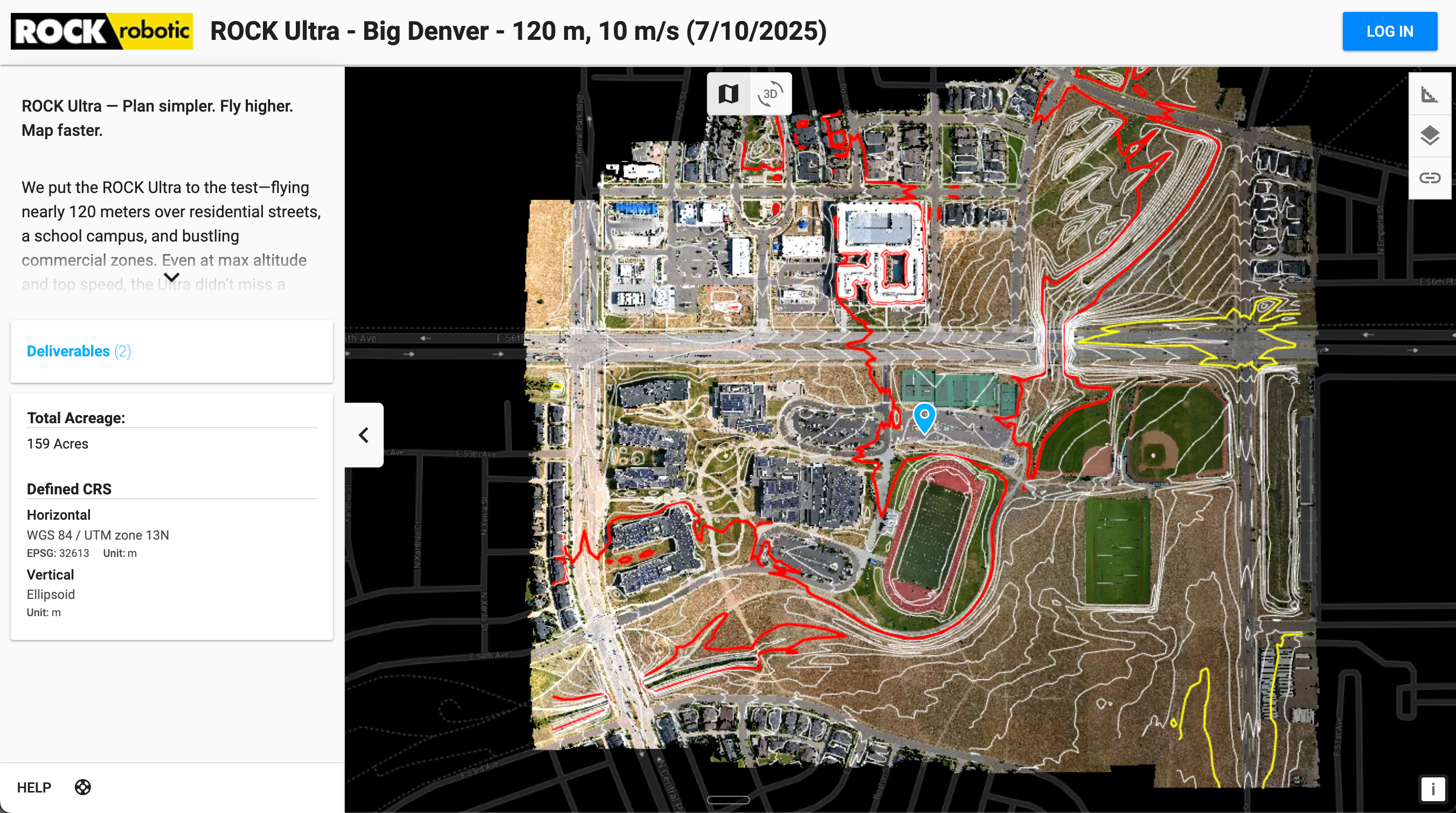
159-Acre ALTA Survey in Denver
See actual deliverables from a complex urban site—breaklines, contours, and orthomosaics extracted with survey-grade precision
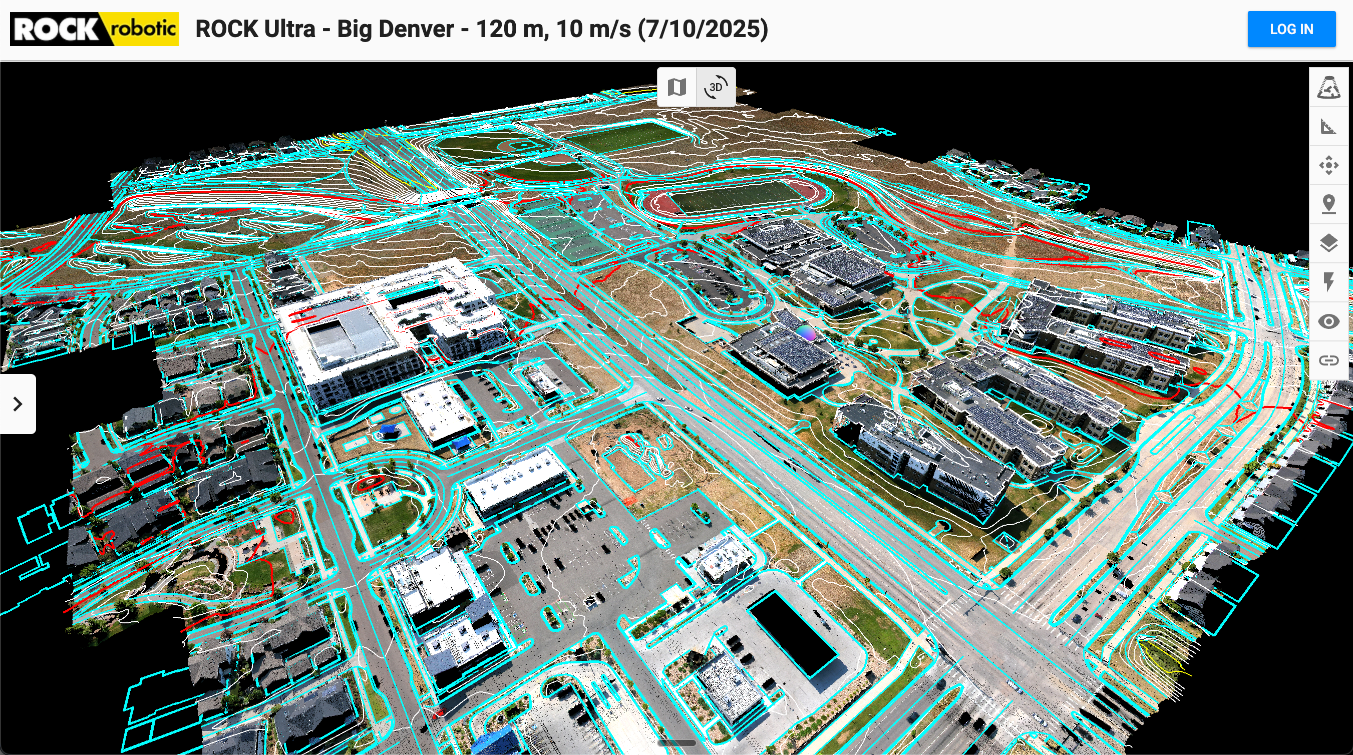
Breaklines & Features
Clean, accurate breaklines extracted from LiDAR—curbs, road crowns, building footprints, and utilities all mapped with centimeter precision
Contours & Orthomosaic
True-position orthomosaic with 1-foot contours generated directly from LiDAR surface model—perfect alignment, zero distortion
Complete ALTA Survey in 3-5 Days
What traditionally took weeks is now completed in days with survey-grade accuracy
Capture
30 minutesFly once with ROCK Ultra at 400ft, capturing LiDAR and photos simultaneously
Field QC
15 minutesVerify coverage and data quality in ROCK Desktop at the truck
Process
1 hourUpload to ROCK Cloud for automatic True-Position Orthomosaic generation
Deliverables
3-5 daysROCK Pro Services extracts survey-grade CAD with AI + human QC
Traditional vs. ROCK Photogrammetry
Traditional SfM Photogrammetry
- Hours to days of processing time
- Leaning buildings and distorted features
- Cannot see through vegetation
- Point cloud and ortho often misaligned
- Requires high-end desktop workstation
- Limited by photo overlap and angles
ROCK Photogrammetry
- 1:1 processing ratio (minutes)
- Perfect vertical feature positioning
- LiDAR penetrates to ground
- Unified dataset, perfect alignment
- Desktop Processed --> Cloud Integrated
- LiDAR accuracy drives everything
Part of the Complete ROCK Ecosystem
ROCK Photogrammetry works seamlessly with our hardware and software suite
Perfect For Professional Applications
ALTA/NSPS Surveys
Meet the highest standards with true horizontal positioning of all features
Commercial Development
Accurate site plans with perfect building footprints and infrastructure
Topographic Mapping
Combine terrain models with photorealistic imagery for complete maps
Vegetation Analysis
See through canopy with LiDAR while capturing tree health with imagery
Infrastructure Inspection
Document assets with both geometric accuracy and visual context
Client Deliverables
Share interactive web views combining point clouds and orthomosaics
Stop Wrestling with Data. Start Delivering Results.
ROCK Photogrammetry is the new benchmark for professional mapping. Experience the speed, accuracy, and efficiency that only LiDAR-driven orthomosaics can deliver.
Available exclusively with ROCK Ultra and ROCK Cloud Business