Press Guide & Media AssetsBrand usage guidelines and downloadable assets
Everything you need to accurately represent ROCK Robotic in your publications, presentations, and marketing materials.
Welcome to the ROCK Robotic Press Center
This comprehensive guide provides journalists, partners, and media professionals with the resources needed to accurately represent ROCK Robotic and our products.
Please review our brand guidelines before using any assets to ensure consistent and proper representation of our brand across all media.
Company Bio
ROCK Robotic is a Denver, Colorado–based technology company revolutionizing the way professionals capture, process, and deliver high-precision spatial data. Specializing in advanced LiDAR (Light Detection and Ranging) systems and integrated software platforms, Rock Robotic serves industries including land surveying, construction, utilities, forestry, mining, and transportation.
The company’s comprehensive ecosystem includes cutting-edge aerial drone LiDAR hardware, handheld and mobile mapping devices, a powerful cloud-based processing platform (ROCK Cloud), and professional-grade deliverables through ROCK Pro Services. By combining robust hardware with seamless software workflows, Rock Robotic enables centimeter-level accuracy, even in challenging environments with dense vegetation or complex terrain.
ROCK Robotic’s solutions drastically reduce traditional surveying timelines—from weeks to hours—while enhancing safety by minimizing time spent in hazardous field conditions. The company’s flagship offerings, such as the ROCK R3 Pro V2 and ROCK Ultra, deliver unmatched efficiency, precision, and versatility. Paired with tools like ROCK Desktop for field QC, ROCK RTK Network for global corrections, and the ROCK Academy for training, customers gain an end-to-end LiDAR workflow that is both accessible and scalable.
Driven by a mission to simplify complex geospatial technology, Rock Robotic empowers mapping professionals worldwide with reliable, innovative tools and responsive customer support. Whether capturing 3D data from the sky or the ground, Rock Robotic delivers the accuracy, speed, and confidence needed to transform raw data into actionable insights—helping clients master their LiDAR workflow and unlock the full potential of 3D reality capture.
Learn more at rockrobotic.com.
Brand Guidelines
Company Name Usage
Correct Usage
ROCK RoboticROCK
Incorrect Usage
Rock RoboticRockRoboticRockROCK ROBOTIC
Note: Always use "ROCK" in all capital letters. When using the full company name, capitalize only the R in "Robotic".
Product Name Guidelines
Hardware Products
Correct Usage
ROCK UltraROCK R3 Pro V2ROCK R3
Incorrect Usage
Rock UltraR3 ProR3Pro
Note: Always include "ROCK" before product names. Use proper spacing and capitalization.
Software Products
Correct Usage
ROCK CloudROCK DesktopROCK PilotSplat Labs
Incorrect Usage
Rock CloudRockCloudROCK cloudSplatLabsSplat labs
Note: Software names should follow the same capitalization rules as hardware. "Splat Labs" is two words with proper capitalization.
Technical Terminology
Correct Usage
LiDARGNSSPPKIMUUAV
Incorrect Usage
LidarLIDARlidarGPS (when referring to GNSS)drone (when referring to UAV in technical contexts)
Note: Use industry-standard acronym capitalization.
Downloadable Media Assets
Company Logos
ROCK Robotic Logo
Primary company logo with tagline
ROCK Big R Logo
Simplified "R" icon logo
ROCK Pro Services Logo
Logo for professional services division
Splat Labs Logo
Gaussian Splat cloud platform logo
Product Images
ROCK Ultra LiDAR System
Next-generation long-range LiDAR system
ROCK R3 Pro V2
Versatile 3-in-1 LiDAR mapping system
ROCK R3
Entry-level professional LiDAR system
ROCK Base
Professional RTK base station
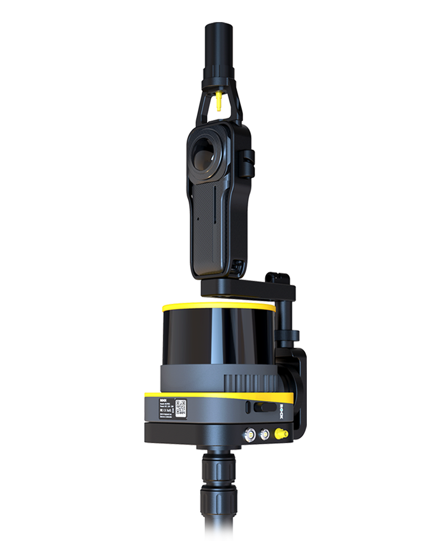
ROCK SLAM Dock V2
SLAM and 360° photo integration module
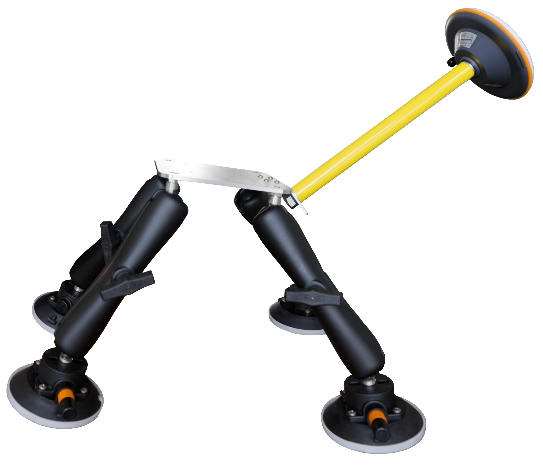
ROCK Mobile Mount
Universal vehicle mounting solution
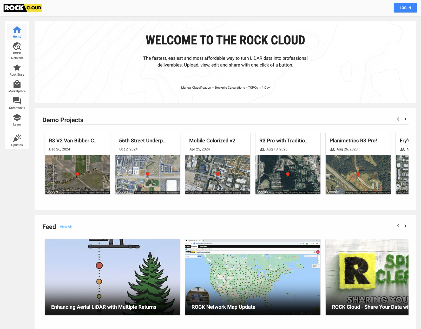
ROCK Cloud
Web platform for hosting and analyzing LiDAR data
Marketing Materials
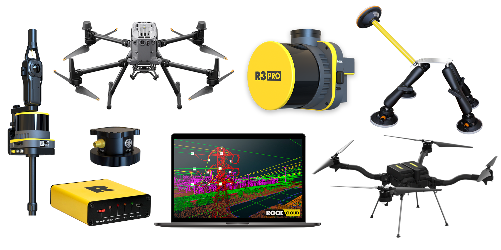
Product Family
Complete ROCK Robotic product lineup
Usage Guidelines
Key Messaging
- ROCK Robotic is the industry leader in user-friendly LiDAR hardware and software solutions
- Our 'Easy Button' philosophy makes professional-grade mapping accessible to all skill levels
- We provide complete field-to-finish workflows, not just sensors
Visual Guidelines
- Always use high-resolution images when available
- Maintain proper aspect ratios - do not stretch or distort logos
- Ensure adequate white space around logos for clarity
Press Boilerplate & Approved Descriptions
ROCK Robotic builds professional LiDAR hardware, software, and services that make survey‑grade mapping simple. Our integrated ecosystem—from ROCK Ultra and R3 Pro V2 to ROCK Cloud and Pro Services—delivers a true field‑to‑finish workflow used by surveyors, engineers, utilities, and mapping professionals worldwide.
Approved One‑Sentence Descriptions
- ROCK Ultra: A long‑range 1550 nm airborne LiDAR with up to 7 returns and a 90° FOV for dense, survey‑grade point clouds at high altitude.
- ROCK R3 Pro V2: A versatile 3‑in‑1 LiDAR system for drone, vehicle, and handheld mapping with a tactical‑grade IMU and 26 MP imagery.
- ROCK R3: A compact, efficient airborne LiDAR ideal for everyday survey missions and topographic mapping.
- ROCK Cloud: A web platform to host, analyze, and share LiDAR data, order AI‑assisted deliverables, and collaborate in 3D.
- ROCK Pro Services: On‑demand CAD/GIS deliverables—Surveyor, Planimetrics, and PLS‑CADD—produced with AI + expert human QC.
- Splat Labs: A professional cloud platform for hosting, sharing, and collaborating on Gaussian Splat models with AI-powered features.
Need Something Else?
If you need additional assets, custom imagery, or have questions about brand usage, please contact our marketing team.
Social Media Bio (100 words)
ROCK Robotic is a Denver-based leader in LiDAR mapping technology, delivering cutting-edge hardware, software, and professional services for surveying, construction, utilities, forestry, mining, and more. Its ecosystem includes drone and handheld LiDAR systems, ROCK Cloud data processing, ROCK RTK Network, and expert deliverables through ROCK Pro Services.
With centimeter-level accuracy, rapid turnaround, and deep vegetation penetration, ROCK Robotic helps professionals capture and process 3D spatial data with unmatched speed and safety. From field to finish, our mission is simple—make high-precision LiDAR accessible, efficient, and reliable for mapping professionals worldwide.
Learn more at rockrobotic.com.