Road & Railway
From Mile One to Mile Done
Capture continuous corridors efficiently and deliver CAD‑ready results for planning, construction, and asset management.
From DOT projects to freight rail, ROCK LiDAR solutions streamline high‑accuracy corridor mapping, clearance checks, and vegetation management — all in one integrated workflow.
Three ways transportation teams use ROCK
As‑built & design surfaces
Map roadways, rail beds, and adjacent structures with repeatable precision. Generate DTMs, breaklines, and planimetrics for design, inspection, and documentation.
Clearances & encroachment
Perform rapid clearance measurements for bridges, tunnels, and railways. Detect encroachments along rights‑of‑way and validate compliance.
Vegetation management
Identify, classify, and track vegetation encroachment at scale. Support proactive maintenance to meet safety standards and avoid service interruptions.
Recommended workflow
Plan corridor capture via aerial LiDAR or mobile mapping along alignment.
Field‑check in ROCK Desktop to confirm coverage and alignment quality.
Process in ROCK Cloud for classification, alignment, and QA.
Export CAD deliverables—surfaces, breaklines, encroachment reports, vegetation maps—for design, maintenance, or compliance.
Why road & rail operators choose ROCK
Corridor efficiency: capture hundreds of miles with high‑altitude LiDAR (ROCK Ultra) or vehicle‑mounted mapping (Mobile Mount).
Regulatory‑grade accuracy: meet DOT, FRA, and transport authority specs with centimeter‑level positioning.
Specialized deliverables: PLS‑CADD outputs, clearance envelopes, vegetation encroachment layers, and asset mapping.
Any environment: overhead wire, dense canopy, bridges, tunnels—LiDAR + imagery handle complex environments.
Workflow integration: deliverables formatted for Civil 3D, MicroStation, ArcGIS, and PLS‑CADD.
Typical deliverables
- Ground‑classified point cloud (LAS/LAZ)
- Corridor DTM/DEM with breaklines
- Clearance envelope diagrams for bridges/tunnels
- Encroachment maps with flagged coordinates
- Vegetation management layers (height, proximity to asset)
- Planimetric linework for pavement edges, curbs, tracks, utilities, signals
- Orthomosaic & colorized LiDAR for visual inspection
- File formats: DWG/DXF, LandXML, SHP/GPKG, GeoTIFF, CSV.
Capture solutions for any corridor
Aerial LiDAR (UAV)
- ROCK Ultra – fly higher, cover more, and penetrate canopy for wide rights‑of‑way.
- R3 Pro V2 – detailed mapping for high‑resolution surfaces and dense assets.
Mobile mapping
- ROCK Mobile Mount – collect from vehicles or hi‑rail for continuous asset corridors.
- Mountable on trucks, rail maintenance vehicles, or boats (for bridges over water).
Positioning & control
- ROCK Base + RTK Network – triple‑band GNSS with NTRIP corrections and PPK data for high‑accuracy control.
Use cases
FAQs
How do you handle mixed environments?
LiDAR captures both open and vegetated areas, while SLAM/mobile covers GNSS‑denied tunnels.
Can you meet DOT/FRA accuracy standards?
Yes—ROCK workflows are designed to meet or exceed these specs with proper control.
Do you offer PLS-CADD deliverables?
Yes—export structures, conductors, terrain, and sag/tension details for integration.
Can you map without shutting down traffic?
Often yes—vehicle-based mapping or high-altitude UAV minimizes impact on operations.
What vegetation standards do you follow?
We align classification to utility and transport authority guidelines, customizable per client.
Knowledge for Road & Railway

The Advantages of Drone Surveying vs. Traditional Methods
A detailed breakdown of how modern drone LiDAR workflows generate massive ROI by drastically cutting field time, reducing operational costs, and improving data quality compared to traditional methods.
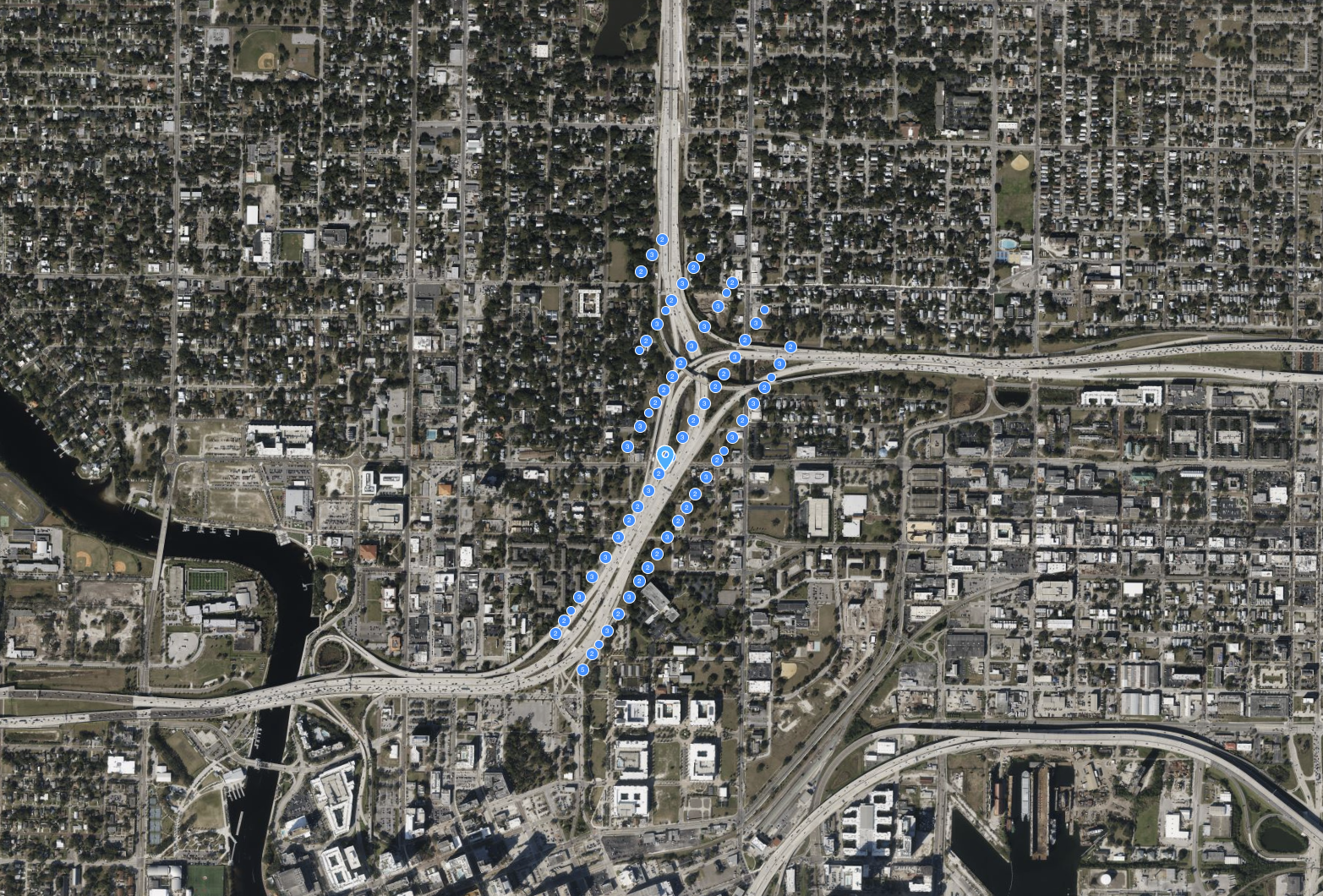
30 Minutes On-Site: A ROCK Ultra Drone LiDAR Case Study with Dylan Gorman
Aerial Intelligence Expert Dylan Gorman from PilotByte.com demonstrates how the ROCK Ultra LiDAR system captured a complex 133-acre highway intersection in just 30 minutes on-site.
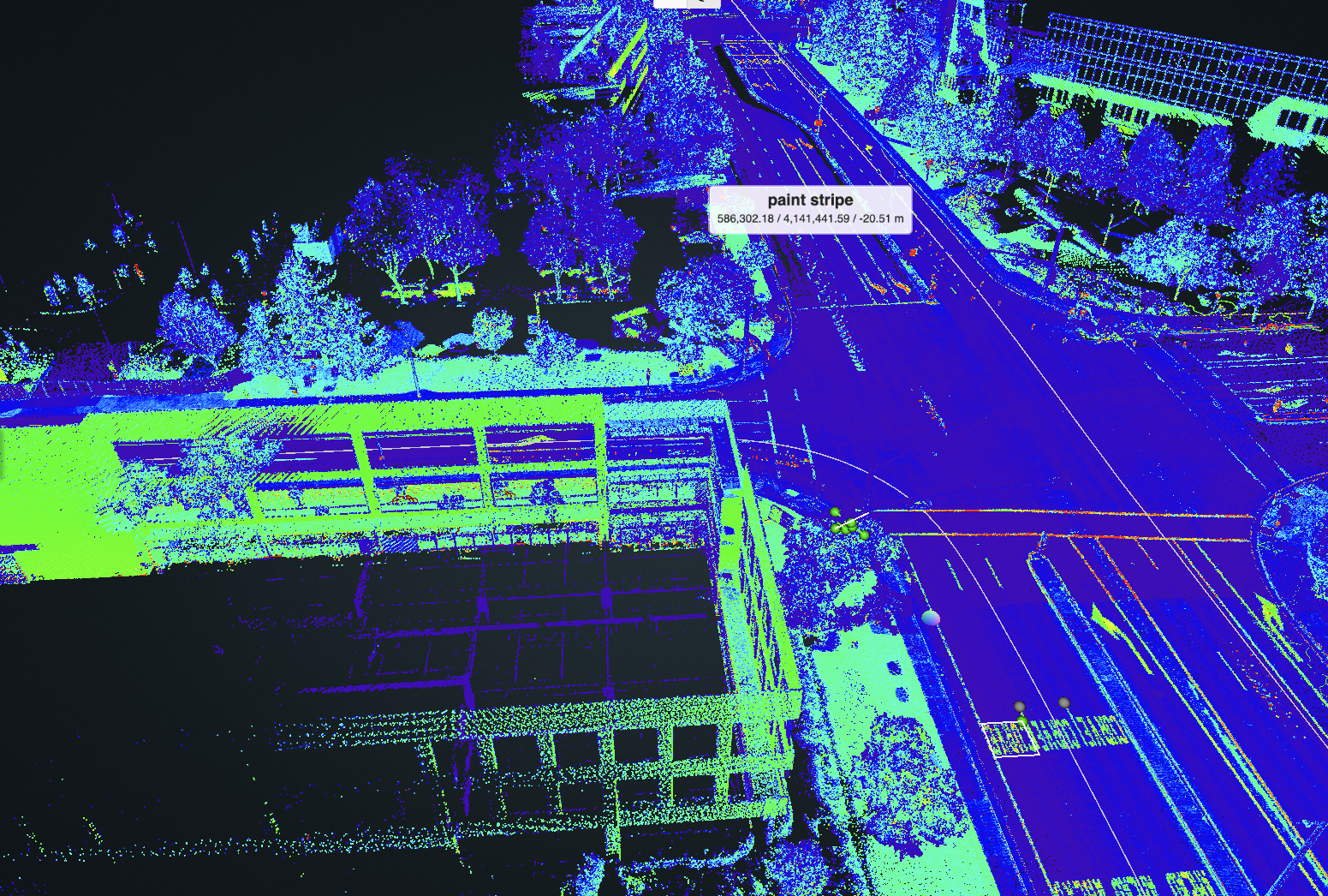
ROCK Ultra – Intersection Flyover
Experience the ROCK Ultra mapping a 133-acre highway interchange from 115 m at 7.5 m/s, capturing every detail of the busy I-275 & I-4 merge in Tampa Bay.
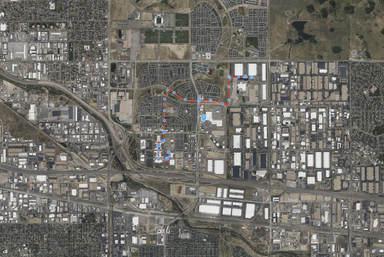
ROCK R3 Pro V2 – Mobile Mapping of an Urban Corridor
This ROCK R3 Pro V2 dataset showcases a 125-acre mobile mapping mission of an urban corridor, captured from a vehicle traveling at 19 mph.
Try ROCK Robotic now
Your 3D scanning journey starts here. Download ROCK Desktop or process in ROCK Cloud.