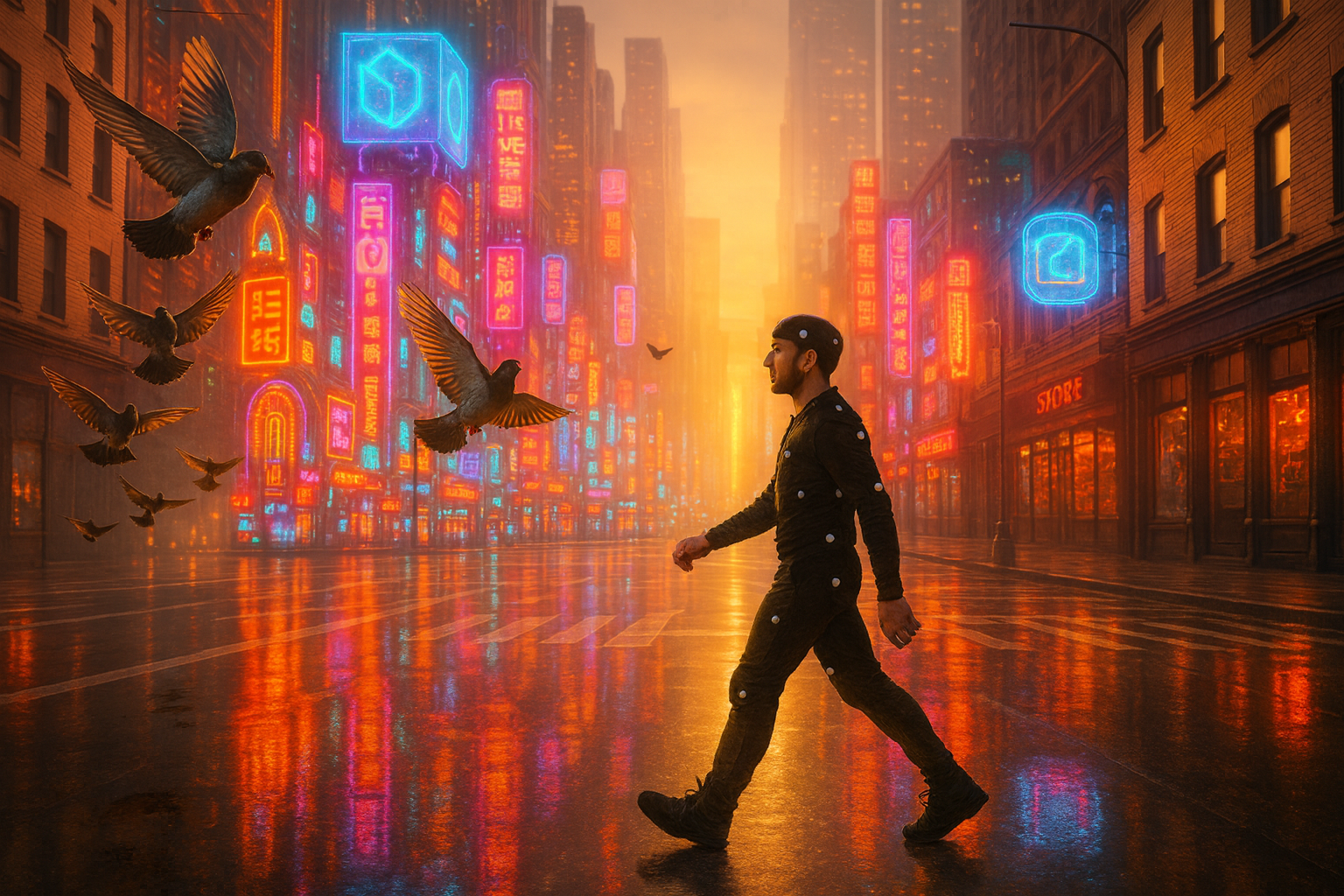
Media & Entertainment
From Location to Pixel—
Film-Accurate 3D, Fast.
Turn real-world locations into production-ready digital assets
With ROCK LiDAR and imagery you’ll capture sets, props, and environments at true scale, then process to meshes, textures, and surfaces in ROCK Cloud—ready for VFX, virtual production, and interactive experiences.
What you can build with ROCK
Studios need clean geometry, consistent scale, and quick turnarounds. Our field-to-finish stack—ROCK Ultra or R3 Pro V2 for capture, ROCK Desktop for on-set QC, and ROCK Cloud for processing—standardizes scanning so your assets drop straight into DCC apps and game engines.
Digital Twins
Survey-grade capture of sets and locations for seamless CG integration and set extension.
Virtual Production
Scan stages, sets, and plates for LED volumes and pre-viz with consistent world scale and alignment.
Games & VR
Generate optimized geometry, clean UVs, and PBR textures from LiDAR + imagery for real-time.
Set/Location Scanning
Rapidly digitize complex environments for layout and blocking.
Asset Capture
Props, vehicles, costumes, and miniatures converted into production-ready meshes.
Before/After Continuity
Measure change across reshoots; lock scale and camera alignment.
Reality Capture for News/Docs
Authentic reconstructions with verifiable geometry.
Recommended workflow
Capture LiDAR + imagery on location (R3 Pro V2 or Ultra) and run a quick on-set QC in ROCK Desktop.
Process in ROCK Cloud for alignment, ground/asset classification, decimation, texture baking, and QA.
Export meshes/orthos/point clouds to your DCC (Maya, Houdini, Blender) or engine (Unreal, Unity).
Typical deliverables
- Point clouds & surfaces: LAS/LAZ, tiled meshes, watertight proxies, collision meshes.
- Textured assets: OBJ/FBX/Alembic/GLB; UDIM UVs; PBR maps (albedo, normal, roughness, AO, displacement) in 16-bit/32-bit EXR/PNG.
- Environment products: HDRI domes (32-bit EXR), orthos, and parallax-correct geometry for LED volumes.
- Scale & alignment: World-true units, control reports, camera paths/poses on request.
- Delivery formats: USD/USDA/USDC, FBX, ABC, OBJ/MTL, GLB/GLTF, GeoTIFF, LandXML, DWG/DXF.
Why studios choose ROCK
Film-accurate scale with survey-grade positioning (RTK/PPK) and documented control.
Clean geometry—decimation, hole fill, and UVs configured for real-time or high-end offline.
Fast turnarounds with on-set QC and cloud processing.
Proven under mixed lighting & cluttered sets where photogrammetry alone struggles.
A single pipeline for VFX, VP, and interactive teams.
Use cases
What to expect
- Absolute accuracy (post-processed): ~1–3 cm horizontal, ~2–3 cm vertical (control & site dependent)
- Turnarounds: Same-day on-set QC; production assets in 24–72 hours depending on scope
FAQs
How do you guarantee true scale for VP and VFX?
We use survey control (RTK/PPK), scale bars/targets, and provide control & alignment reports with deliveries.
Which apps and engines are supported?
Unreal, Unity, Maya, Houdini, Blender—and interchange via USD, FBX, Alembic, GLB/GLTF.
Can you deliver optimized real-time assets?
Yes—LOD meshes, UV/UDIM packs, and PBR texture sets ready for engines.
What about reflective or low-texture surfaces?
LiDAR geometry combined with calibrated imagery yields stable results where photogrammetry alone fails.
Do you support LED volume calibration assets and HDRIs?
Yes—32-bit HDRI domes, parallax-correct geometry, and alignment helpers.
Knowledge for Media & Entertainment
ROCK Robotic Launches Splat Labs: The Professional Gaussian Splat Cloud Platform
Introducing Splat Labs—a cloud platform for hosting, sharing, and collaborating on Gaussian Splat models, plus the new PortalCam spatial camera for capturing photorealistic 3D scenes.
Mark Rober Uses ROCK LiDAR to Reveal Space Mountain's Secrets
In a viral video comparing autonomous vehicle sensors, YouTube creator Mark Rober used a ROCK R3 Pro LiDAR scanner to create the first-ever public 3D map of Disneyland's iconic Space Mountain.
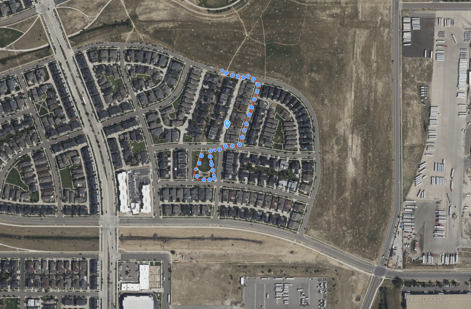
ROCK R3 Pro V2 & SLAM Dock – 10-Acre Handheld Neighborhood Scan
Experience a 10-acre ground-level digital twin captured with the ROCK R3 Pro V2 and SLAM Dock. This dataset showcases a handheld walking scan of a residential neighborhood and park.
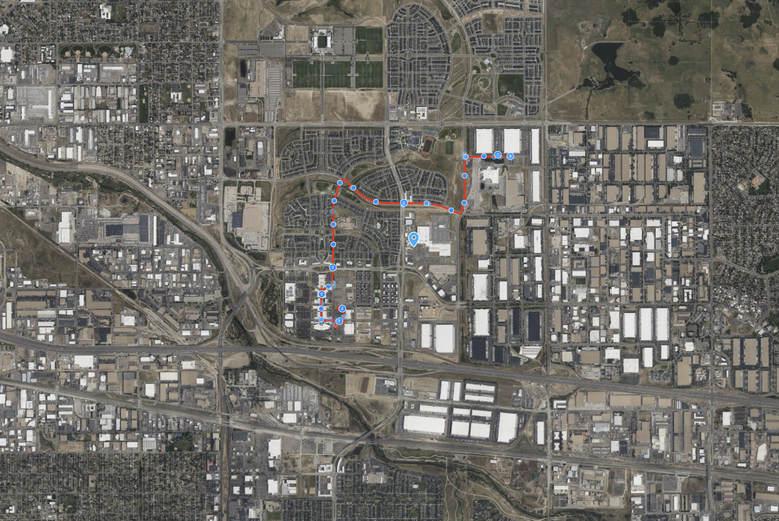
ROCK R3 Pro V2 – Mobile Mapping of an Urban Corridor
This ROCK R3 Pro V2 dataset showcases a 125-acre mobile mapping mission of an urban corridor, captured from a vehicle traveling at 19 mph.
Try ROCK Robotic now
Your 3D scanning journey starts here. Download ROCK Desktop or process in ROCK Cloud.