Energy & Utilities
Capture, process, and deliver corridor analytics at scale
Capture, process, and deliver corridor analytics at scale—with repeatable accuracy and industry compliance.
Three ways utilities use ROCK
Vegetation management
Automate the detection of vegetation encroachment along transmission and distribution corridors. Classify growth zones by proximity to conductors, prioritize trimming, and track changes over time.
Clearances & sag
Measure conductor‑to‑ground, conductor‑to‑structure, and mid‑span clearances with repeatable precision. Monitor thermal sag under varying load and temperature conditions.
PLS‑CADD Deliverables
Export ready‑to‑load terrain, structure, and conductor models for engineering design, maintenance planning, and compliance reporting.
Recommended workflow
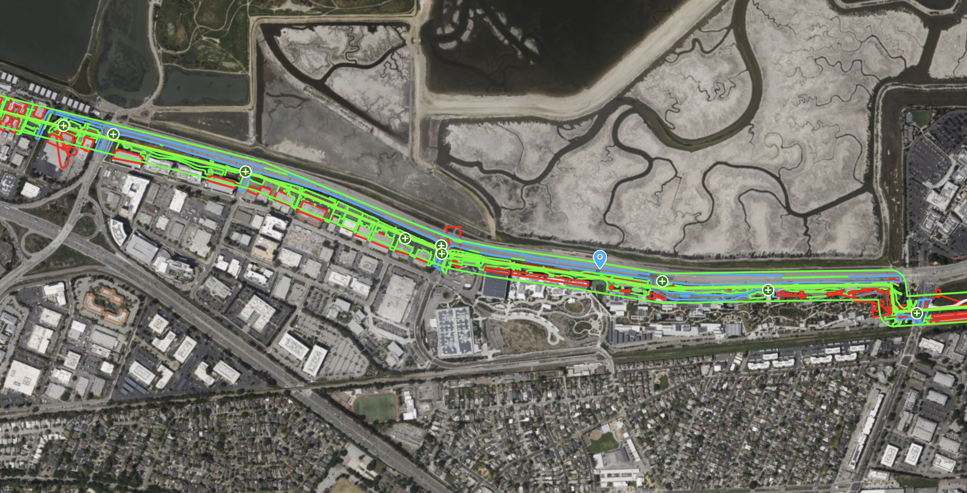
Capture corridor LiDAR with UAV (ROCK Ultra or R3 Pro V2) or mobile mapping along alignment.
Field‑check in ROCK Desktop to confirm coverage and alignment quality.
Process in ROCK Cloud — align to control, classify assets and vegetation, and compute clearances.
Export PLS‑CADD deliverables and generate compliance/maintenance reports.
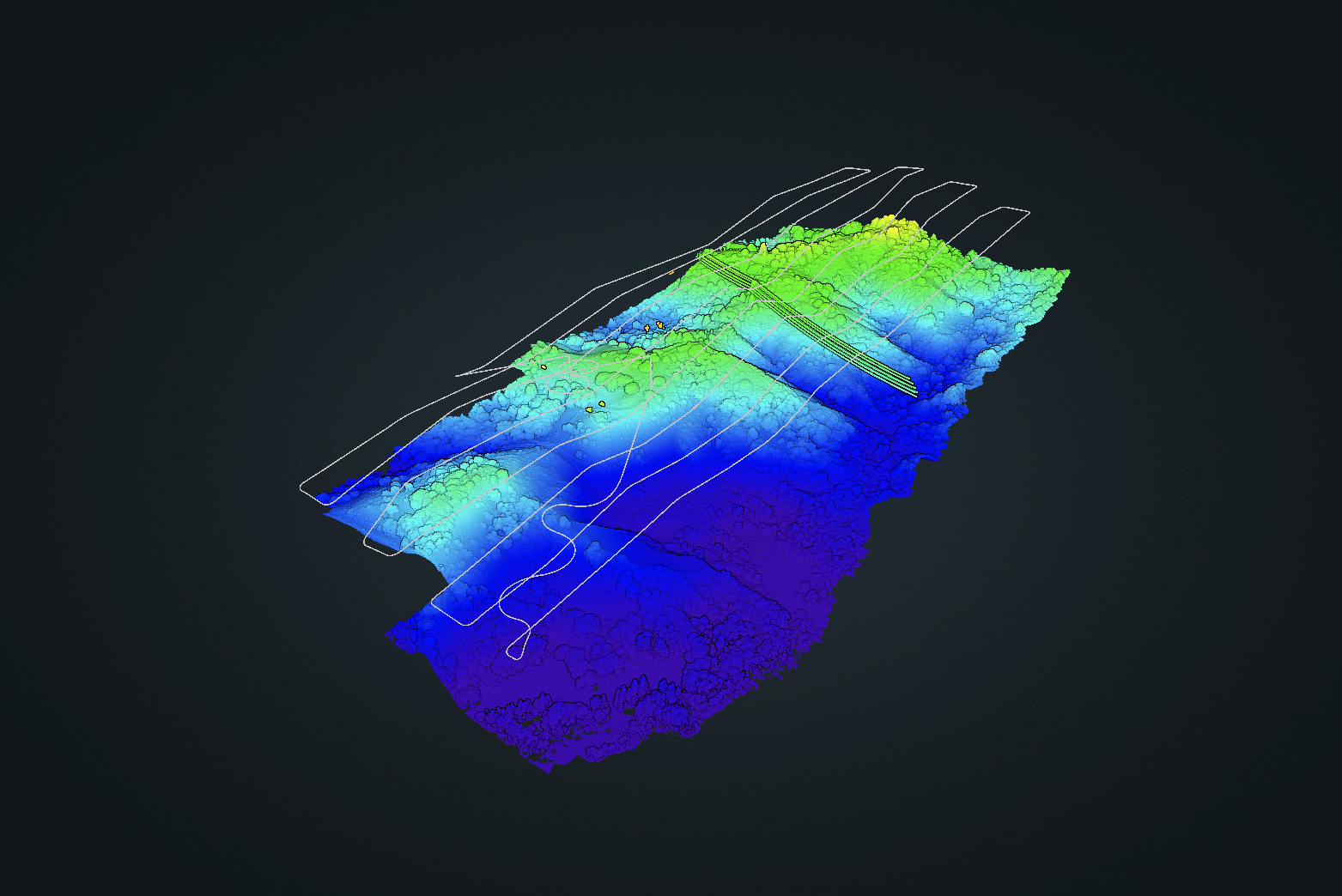
Typical deliverables
- Ground‑classified point cloud (LAS/LAZ)
- DTM/DEM & breaklines
- Structure models with attachment points
- Conductor geometry with sag/tension details
- Clearance envelope analysis (to ground, structure, vegetation)
- Vegetation encroachment maps with height and proximity classifications
- Planimetric linework for roads, fences, waterways, access paths
- Orthomosaic & colorized LiDAR for visual inspection
- File formats: PLS‑CADD XML, DWG/DXF, LandXML, SHP/GPKG, GeoTIFF, CSV.
Capture solutions for utilities
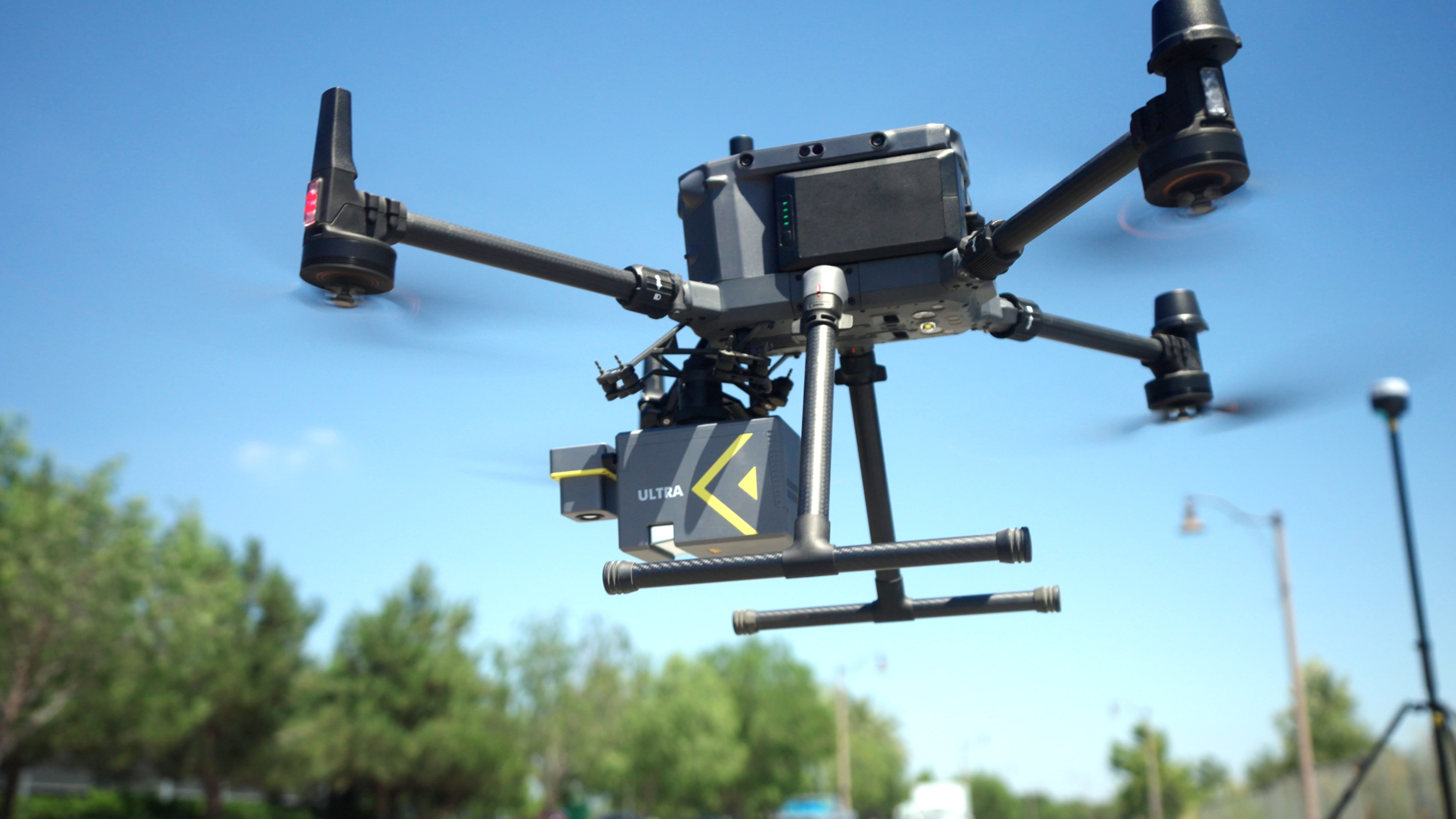
Aerial LiDAR (UAV)
- ROCK Ultra – fly higher and capture longer spans, even in dense canopy.
- R3 Pro V2 – detailed capture for high‑resolution structure and terrain mapping.
Mobile mapping
- ROCK Mobile Mount – vehicle or hi‑rail‑based collection for distribution networks and substations.
Positioning & control
- ROCK Base + RTK Network – triple‑band GNSS, NTRIP corrections, and RINEX for PPK processing.
Why utilities choose ROCK
Survey‑grade accuracy: meets utility engineering tolerances for structure placement, sag, and clearance.
High‑speed acquisition: map miles of corridor per day from UAV or vehicle platforms.
Turnkey deliverables: directly usable in PLS‑CADD, GIS, and CAD without rework.
Vegetation intelligence: AI/ML classification for encroachment detection and growth forecasting.
Reduced crew exposure: minimize time in energized or difficult‑to‑access zones.
Use cases
FAQs
Can you match our PLS-CADD template?
Yes—deliverables can be formatted to your company’s specifications.
What vegetation classification standards do you follow?
We align with NERC FAC-003 and can customize to regional utility requirements.
Can you work under energized lines?
Yes—UAV and vehicle mapping allow capture from safe distances without line shutdowns.
How do you prove accuracy?
We supply PPK/RTK stats, alignment checks, and independent check-shot residuals.
Do you offer change detection over time?
Yes—ROCK Cloud can compare datasets and highlight growth, encroachment, and clearance changes.
Knowledge for Energy & Utilities

Save Money on LiDAR in 2025: How Section 179 Cuts Your Costs
Land surveyors and geospatial professionals can leverage Section 179 to write off qualifying LiDAR equipment in 2025—making this the ideal time to upgrade to the latest ROCK Robotic systems.
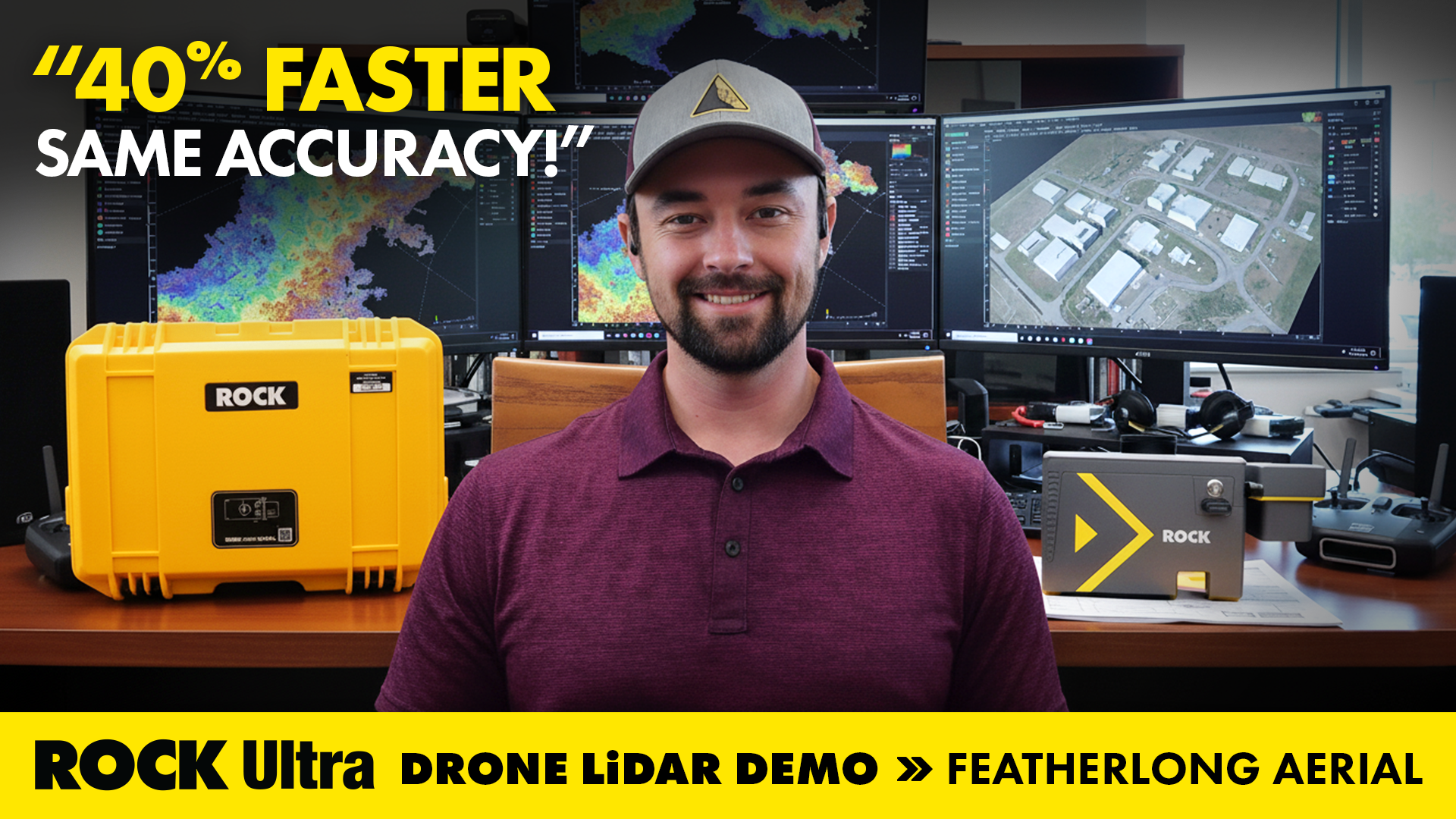
Drone LiDAR in Action: Mapping Avalanche Paths with ROCK Ultra in Colorado
How ROCK Ultra drone LiDAR supported land surveying and aerial 3D mapping during the Demo Tour with Featherlong Aerial — including a full video, dataset gallery, and practical takeaways for field workflows.

ROCK Robotic is Powering Up for the 2026 Energy Drone & Robotics Summit!
Join ROCK Robotic in Houston for the 10th Annual Energy Drone & Robotics Summit. Discover how our LiDAR solutions are transforming asset inspection and management in the energy sector.
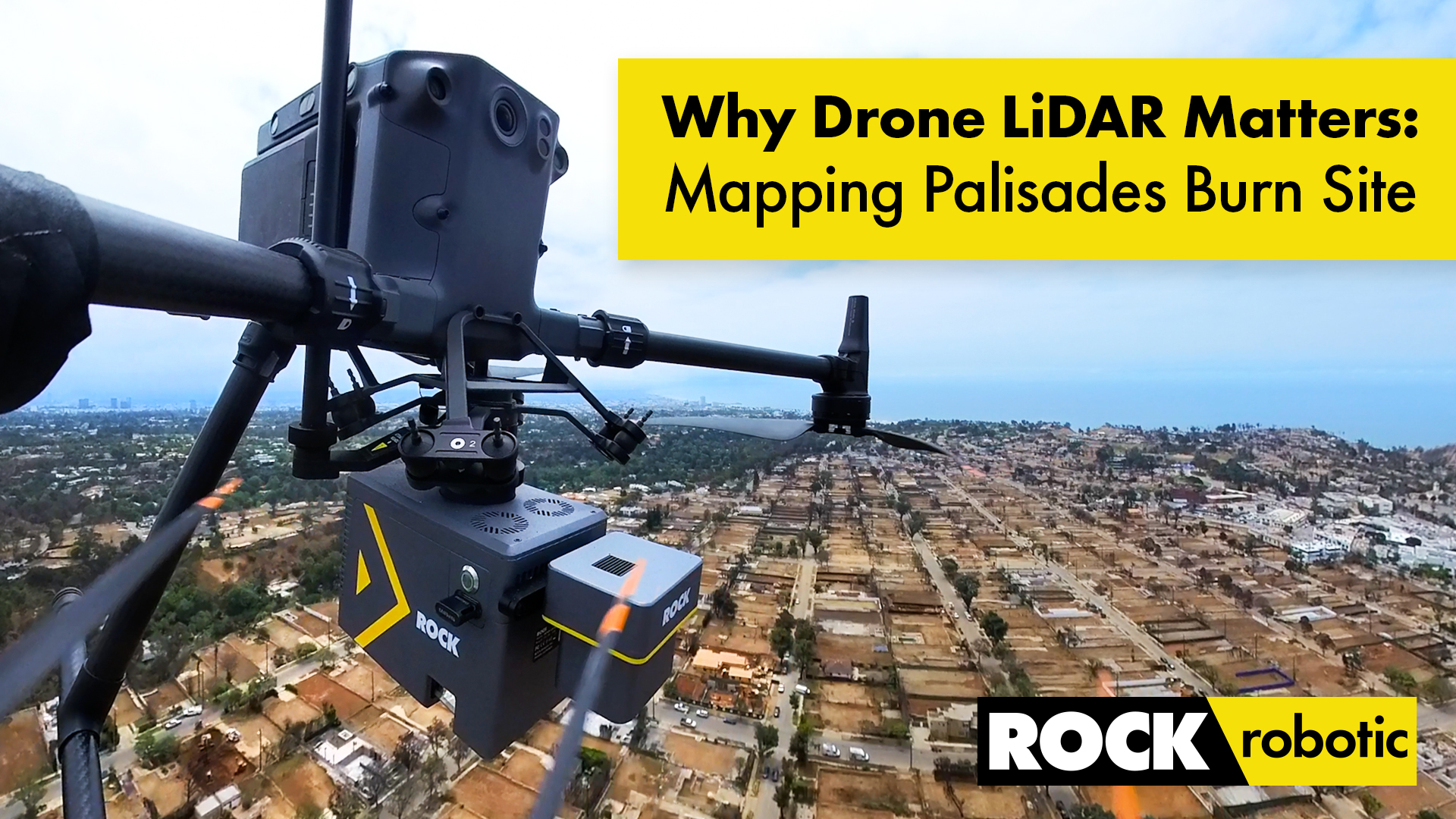
Case Study: Drone LiDAR and Wildfire Recovery – The Palisades Fire
How ROCK Ultra LiDAR helped capture critical data of the Palisades Fire burn area, providing a foundation for rebuilding and wildfire recovery efforts in California.
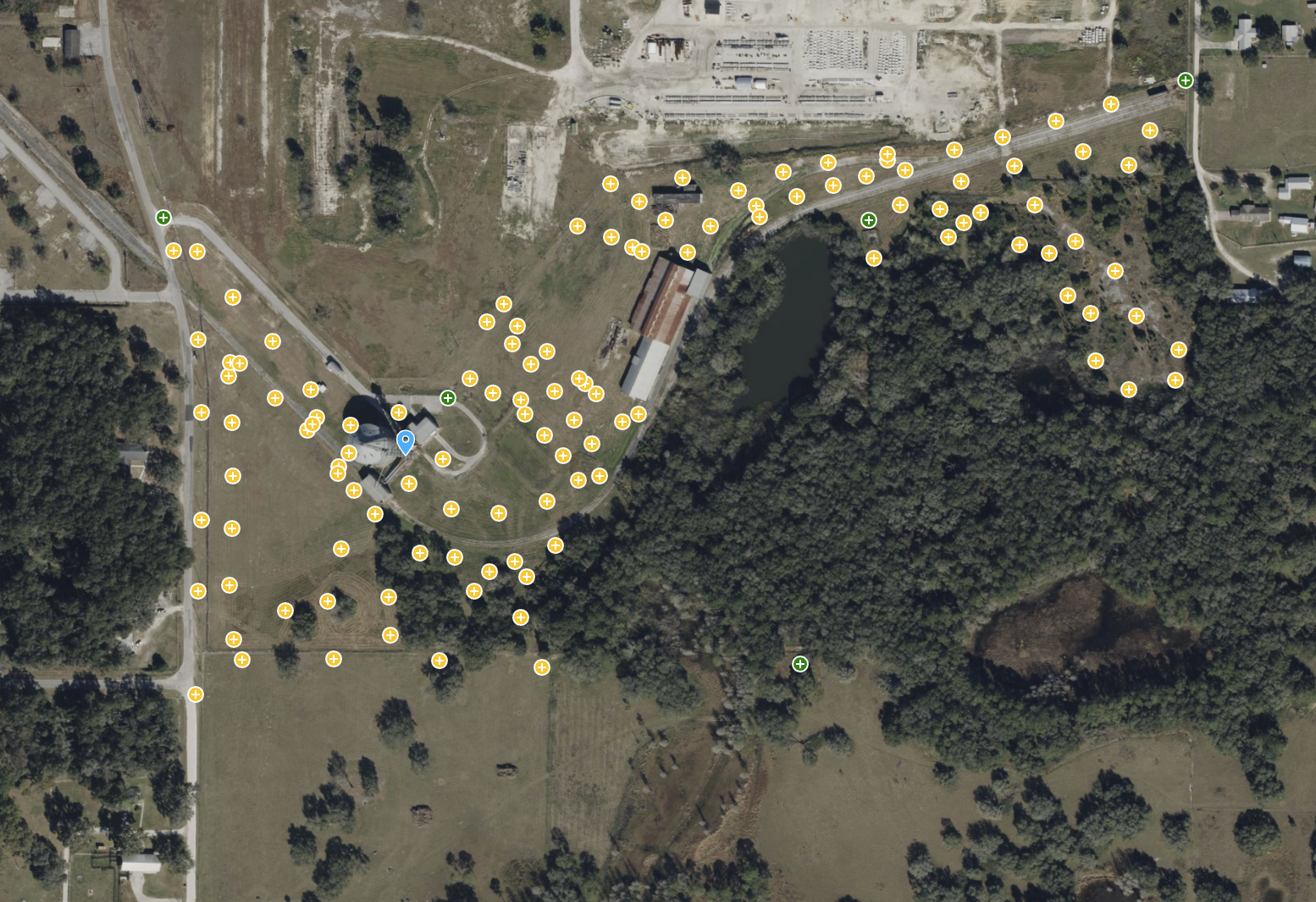
ROCK Ultra – Bower Road Survey
This 188-acre dataset, captured in just 17 minutes, showcases the ROCK Ultra's unparalleled ability to penetrate dense Florida vegetation and map rugged terrain with creek beds and steep slopes.
ROCK Robotic Unveils ROCK Ultra LiDAR, Enabling Surveyors to Map 2-3x More Area Per Flight
The new ROCK Ultra LiDAR system revolutionizes large-scale aerial surveying with a powerful long-range sensor and an "Easy Button" workflow, allowing professionals to fly higher and faster without sacrificing data quality.
Above the Wires: How the ROCK Ultra’s High-Altitude LiDAR Makes Hazardous Surveys Safe
This case study explores a 178-acre canyon survey where high-voltage power lines posed a critical threat. See how the ROCK Ultra's ability to fly at 120m AGL turned a high-risk mission into a safe and efficient operation.
ROCK Ultra – Van Bibber Creek (120m, 5 m/s)
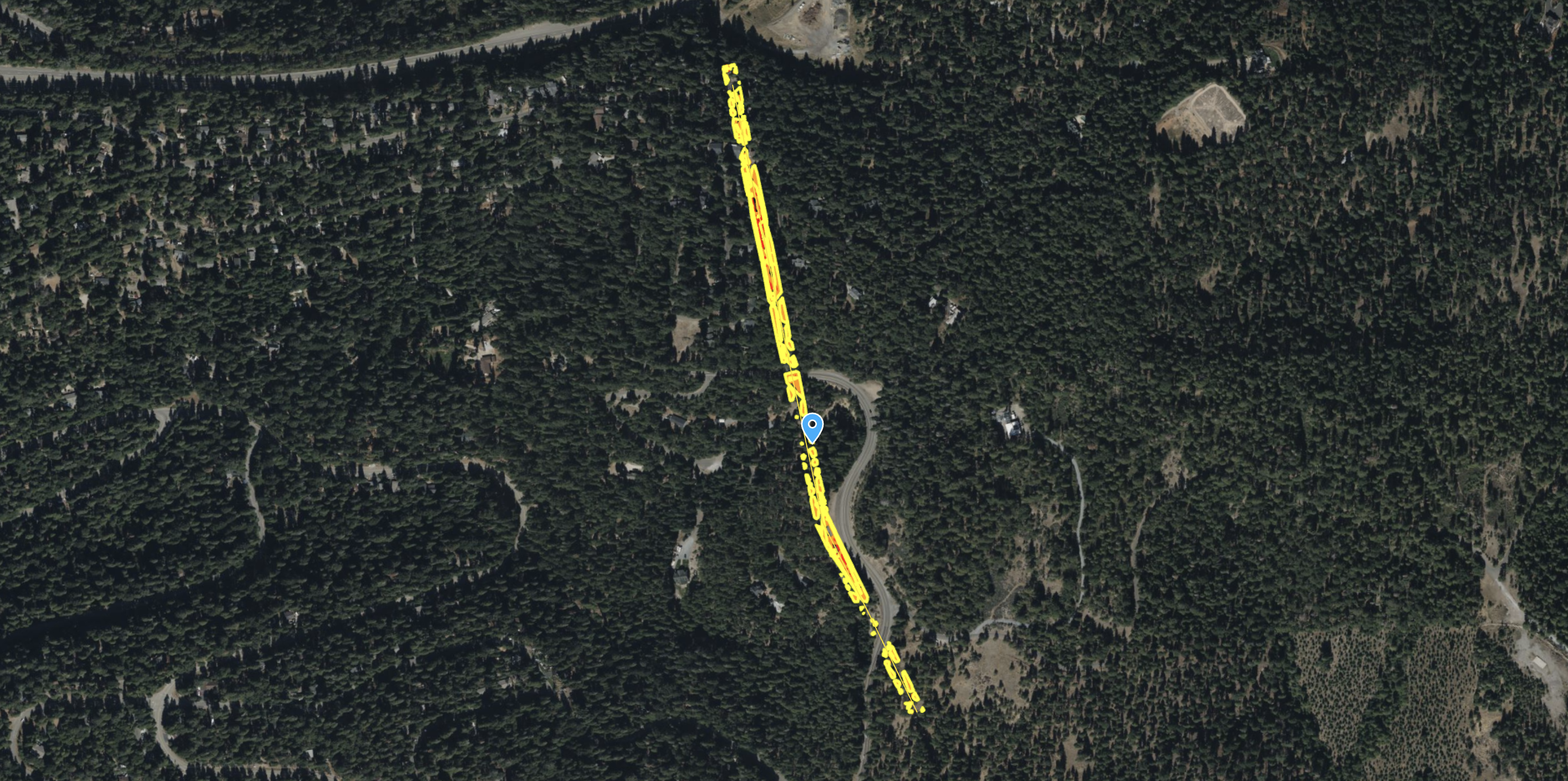
Testing the ROCK Ultra’s canopy penetration and ground detail capture at Van Bibber Creek.

R3 V2 Van Bibber Creek
Showing off the R3 Vegetation Penetration.
ROCK R3 Pro – High-Density Transmission Corridor Survey for PLS-CADD
See the ROCK R3 Pro capture a 111-acre transmission corridor at an incredible density, delivering 4.3 cm RMS accuracy for demanding PLS-CADD engineering workflows.
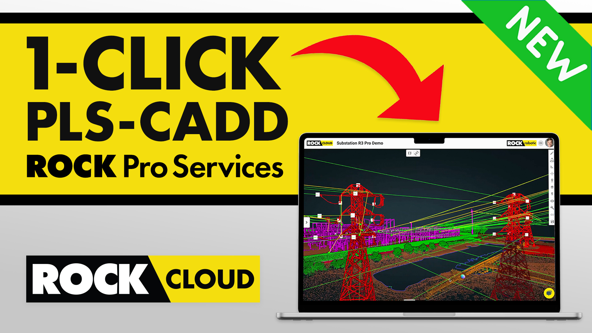
Power Line Surveying & Management Made Effortless with ROCK Pro Services for PLS-CADD
Power Line Surveying and Management Made Effortless with ROCK Processing Services for PLS-CADD.
ROCK R3 Pro V2 – High-Accuracy LiDAR Survey in Dense Georgia Vegetation
Discover how the ROCK R3 Pro V2 achieved survey-grade accuracy of 0.089 ft RMS on a 37-acre site with dense vegetation, validated by a registered survey firm.
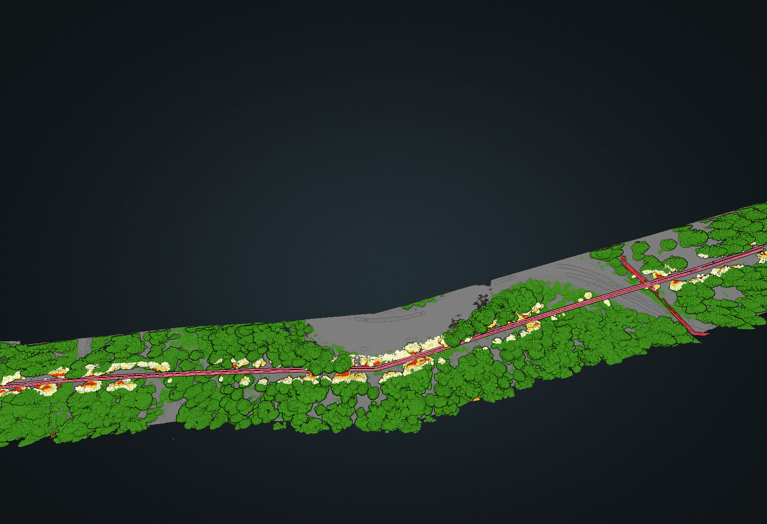
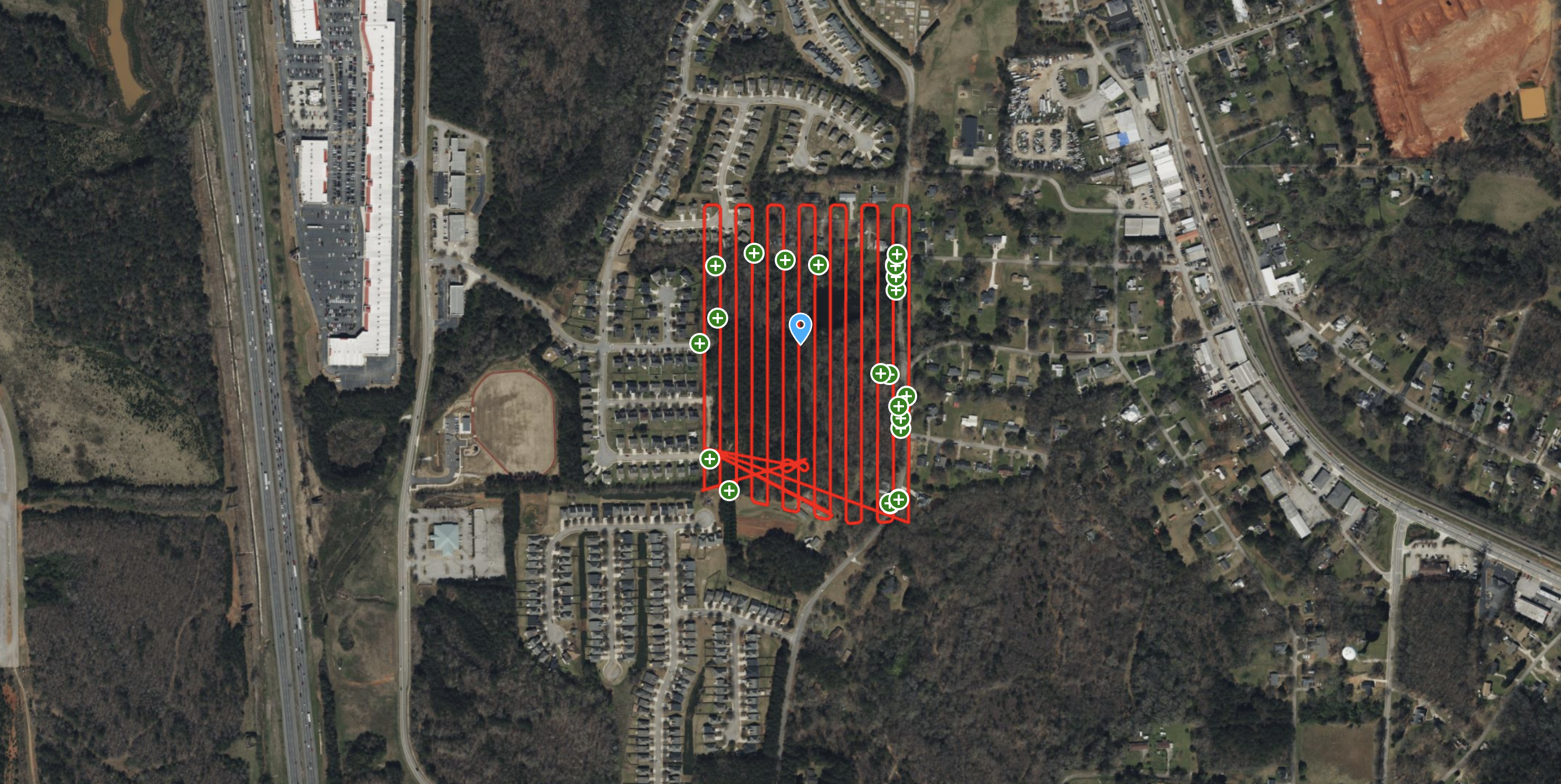
ROCK R3 Pro – Powerline Corridor & Vegetation Management
See how the ROCK R3 Pro and ROCK Vegetation Management service identified 712 vegetation encroachments along a 23-acre powerline corridor, providing actionable data for utility companies.
Try ROCK Robotic now
Your 3D scanning journey starts here. Download ROCK Desktop or process in ROCK Cloud.