Construction & Engineering
Build with Certainty.
Survey with Speed.
High‑frequency site scanning to keep your construction and engineering projects on schedule and on budget—with precise, CAD‑ready outputs.
From Groundbreaking to Handover, Digitize Your Entire Workflow
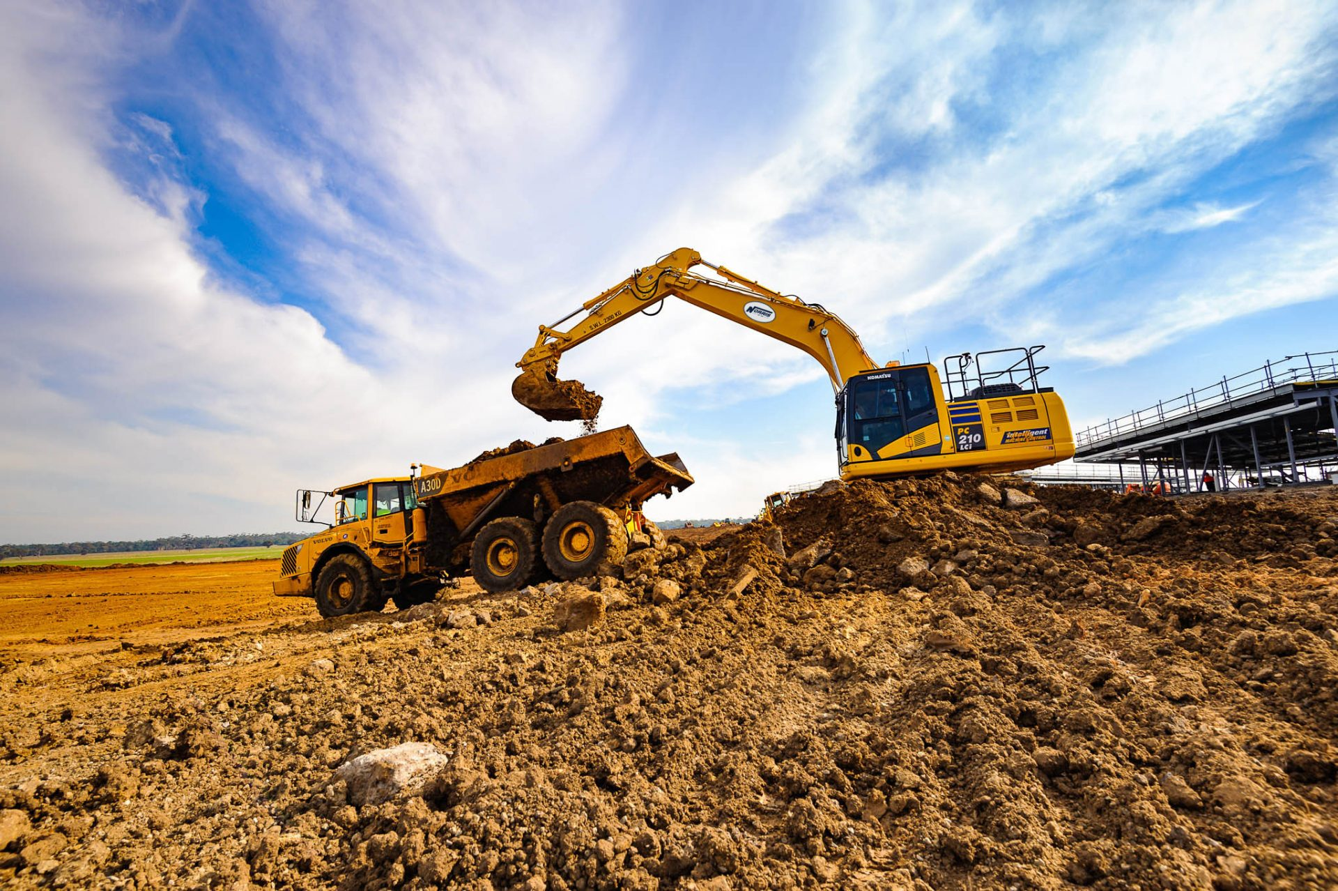
In construction and engineering, every decision is critical, and every delay costs money. Traditional surveying methods are slow, often unsafe, and can fail to capture the complete picture — leading to costly rework and project overruns.
ROCK Robotic provides an end‑to‑end LiDAR and photogrammetry ecosystem that empowers you to capture a complete, centimeter‑accurate 3D digital twin of your site in hours, not weeks. Make confident decisions, streamline communication with stakeholders, and ensure your project is built exactly to plan.
How ROCK Robotic Transforms Construction & Engineering
Accurate Earthwork & Volumetrics
Eliminate guesswork in your cut/fill analysis. Capture high‑density DTMs, calculate stockpiles, track earthmoving, and verify quantities so you only pay for the work performed.
High‑Frequency Progress Tracking
Conduct weekly or daily drone surveys to build a 4D record of your site. Overlay point clouds against BIM/CAD in ROCK Cloud to spot deviations and communicate clearly.
Rapid As‑Built Surveys & Verification
Use the handheld ROCK SLAM Dock V2 for interior capture and the aerial ROCK R3 Pro for full‑site coverage. Verify milestones before concrete is poured or walls close.
CAD‑Ready Site Plans & Linework
Order professional planimetric linework from ROCK Cloud. Our GIS experts, powered by AI, deliver utilities, breaklines, and building footprints in CAD‑ready formats.
Enhanced Site Safety & Logistics
Reduce time on active job sites. Drone‑based mapping minimizes exposure to hazards and provides detailed models to plan logistics and virtual site walk‑throughs.
Detailed Structural & Façade Inspection
Combine imagery with LiDAR to inspect buildings, bridges, and infrastructure. Measure and document conditions without scaffolding inside ROCK Cloud.
Recommended workflow (field‑tested)
Scan on a cadence aligned to milestones
Weekly or bi‑weekly capture aligned to project milestones.
Field‑check in minutes with ROCK Desktop
Confirm coverage before leaving the site.
Upload to ROCK Cloud
Generate DTM, contours, and linework with ROCK Surveyor / Planimetrics.
Compare to design & share
Run cut/fill and compliance checks; share a web viewer link with the GC/owner.
Knowledge for Construction & Engineering
ROCK Robotic Launches Splat Labs: The Professional Gaussian Splat Cloud Platform
Introducing Splat Labs—a cloud platform for hosting, sharing, and collaborating on Gaussian Splat models, plus the new PortalCam spatial camera for capturing photorealistic 3D scenes.
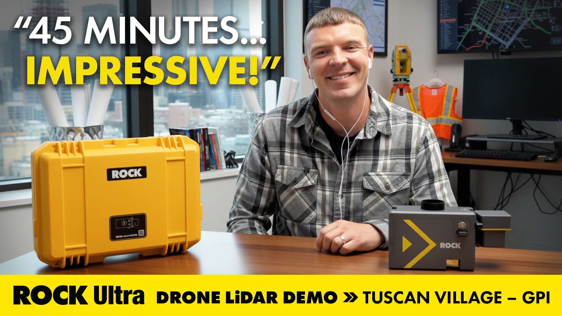
Mapping 360 Acres of Complex Urban Breaklines in 45 Minutes: Inside the ROCK Ultra Tuscan Village Demo
How GPI used the ROCK Ultra LiDAR to scan a 360-acre urban redevelopment in just 45 minutes—and how ROCK Pro Services delivered engineering-ready breaklines through the holiday week.

Save Money on LiDAR in 2025: How Section 179 Cuts Your Costs
Land surveyors and geospatial professionals can leverage Section 179 to write off qualifying LiDAR equipment in 2025—making this the ideal time to upgrade to the latest ROCK Robotic systems.
Flying Solo: How a Single Surveyor Used ROCK Ultra Drone LiDAR to Map a Mountain Ski Resort
A single surveyor from British Columbia proves the power of the ROCK Ultra Drone LiDAR system — flying solo at 400 feet to map a Canadian mountain ski resort with precision, speed, and confidence.
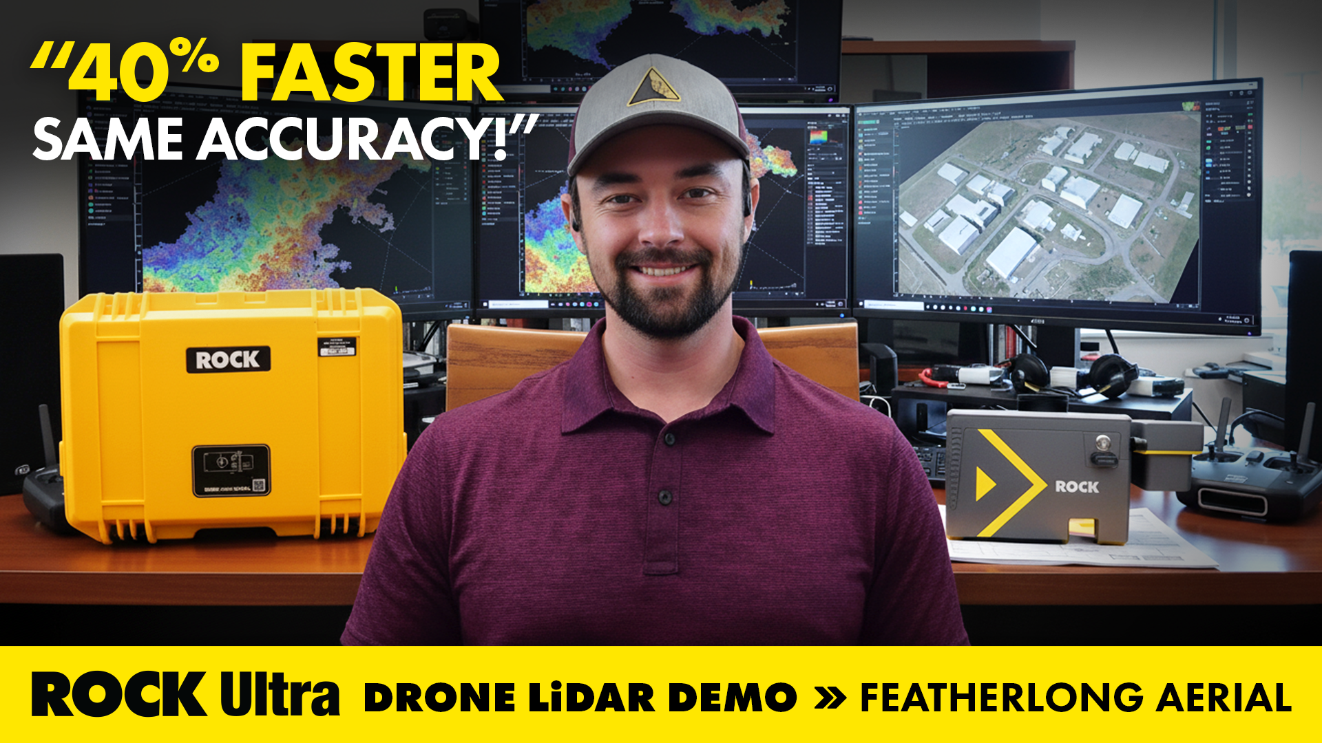
Drone LiDAR in Action: Mapping Avalanche Paths with ROCK Ultra in Colorado
How ROCK Ultra drone LiDAR supported land surveying and aerial 3D mapping during the Demo Tour with Featherlong Aerial — including a full video, dataset gallery, and practical takeaways for field workflows.
ROCK Robotic is Heading to Geo Week 2026 in Denver!
Join ROCK Robotic at Geo Week in Denver! Discover the latest in LiDAR technology, see our industry-leading hardware and software in action, and connect with our team.
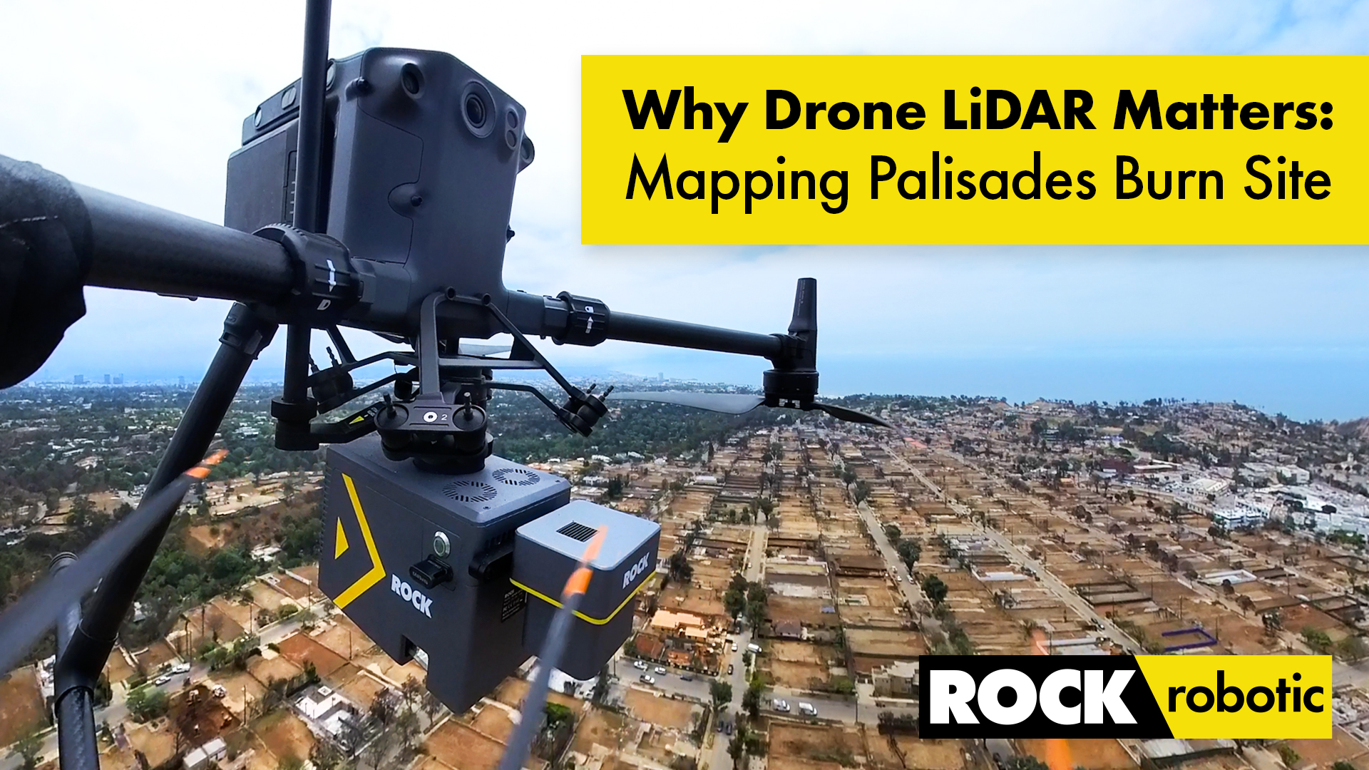
Case Study: Drone LiDAR and Wildfire Recovery – The Palisades Fire
How ROCK Ultra LiDAR helped capture critical data of the Palisades Fire burn area, providing a foundation for rebuilding and wildfire recovery efforts in California.
Elevate Your Job Site: Why Drone LiDAR from ROCK Robotic is the Best Solution for Construction Project Management
Discover how drone LiDAR from ROCK Robotic is revolutionizing construction project management, offering unparalleled precision, safety, and efficiency.
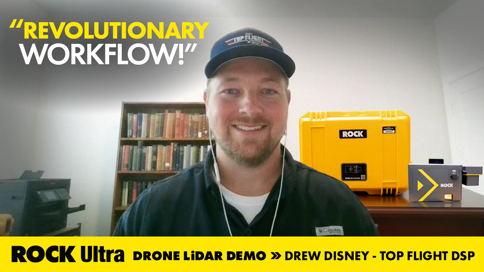
Drone Service Provider Achieves Unprecedented Efficiency with ROCK Ultra LiDAR on 300-Acre Rail Depot Project
Top Flight DSP's Drew Disney utilized the ROCK Ultra LiDAR system to quickly and accurately map a vast rail depot in Beaumont, TX, demonstrating superior efficiency and data quality.

The Advantages of Drone Surveying vs. Traditional Methods
A detailed breakdown of how modern drone LiDAR workflows generate massive ROI by drastically cutting field time, reducing operational costs, and improving data quality compared to traditional methods.
ROCK Ultra LiDAR: 188 Acres Surveyed in 17 Minutes – A Game Changer for D.C. Johnson & Associates
Discover how D.C. Johnson & Associates leveraged the ROCK Ultra LiDAR drone system to survey 188 acres in just 17 minutes, replacing days of manual work and delivering unparalleled accuracy in challenging Florida environments.
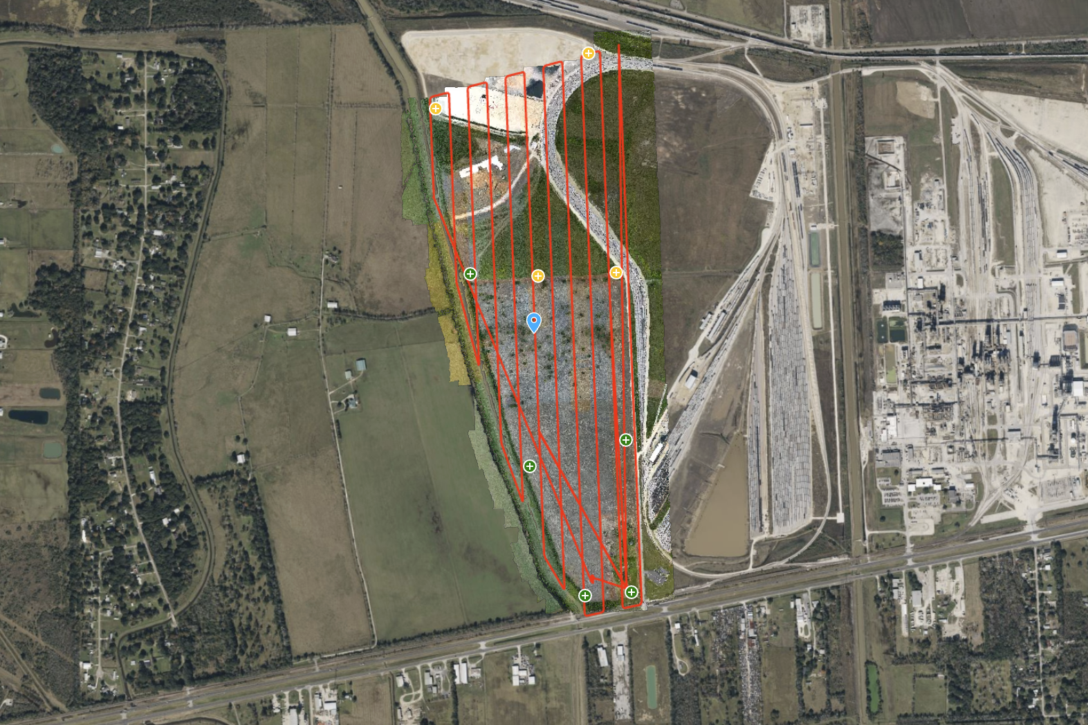
ROCK Ultra – Texas Farmland for Rail Depot Expansion
Explore a 300-acre Texas farmland site, captured for a rail depot expansion project. The ROCK Ultra LiDAR, flying at 120 meters and 5 m/s, delivered a dense, ground-classified point cloud with exceptional efficiency.
Fly Higher, Finish Faster: How Florida Design Consultants Mapped 500+ Acres in One Flight with ROCK Ultra
Discover how Florida Design Consultants, Inc. used the ROCK Ultra to survey a complex 500+ acre residential site in a single 70-minute flight, saving days of fieldwork and revolutionizing their workflow.

ROCK Robotic at Commercial UAV EXPO: See the All-New ROCK Ultra!
Join ROCK Robotic at the Commercial UAV EXPO in Las Vegas to see the groundbreaking ROCK Ultra in person and receive exclusive offers!
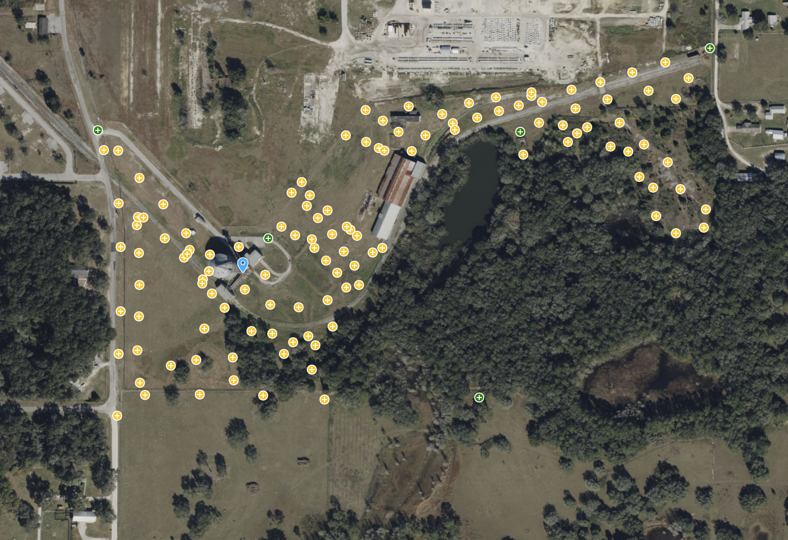
ROCK Ultra – Bower Road Survey
This 188-acre dataset, captured in just 17 minutes, showcases the ROCK Ultra's unparalleled ability to penetrate dense Florida vegetation and map rugged terrain with creek beds and steep slopes.
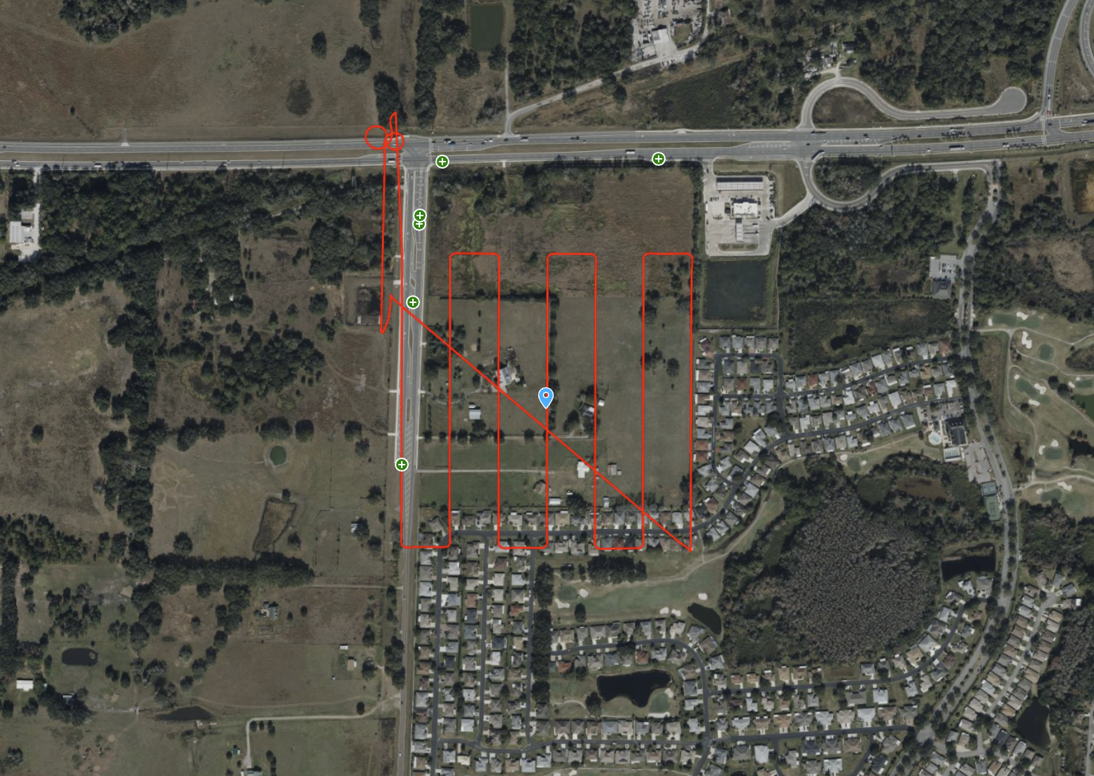
ROCK Ultra – Stillwell Construction Site
Experience the ROCK Ultra's power in capturing a 77-acre construction site with tall industrial structures from over 120m. This dataset highlights safe, high-speed data acquisition over complex environments.
ROCK Robotic Unveils ROCK Ultra LiDAR, Enabling Surveyors to Map 2-3x More Area Per Flight
The new ROCK Ultra LiDAR system revolutionizes large-scale aerial surveying with a powerful long-range sensor and an "Easy Button" workflow, allowing professionals to fly higher and faster without sacrificing data quality.
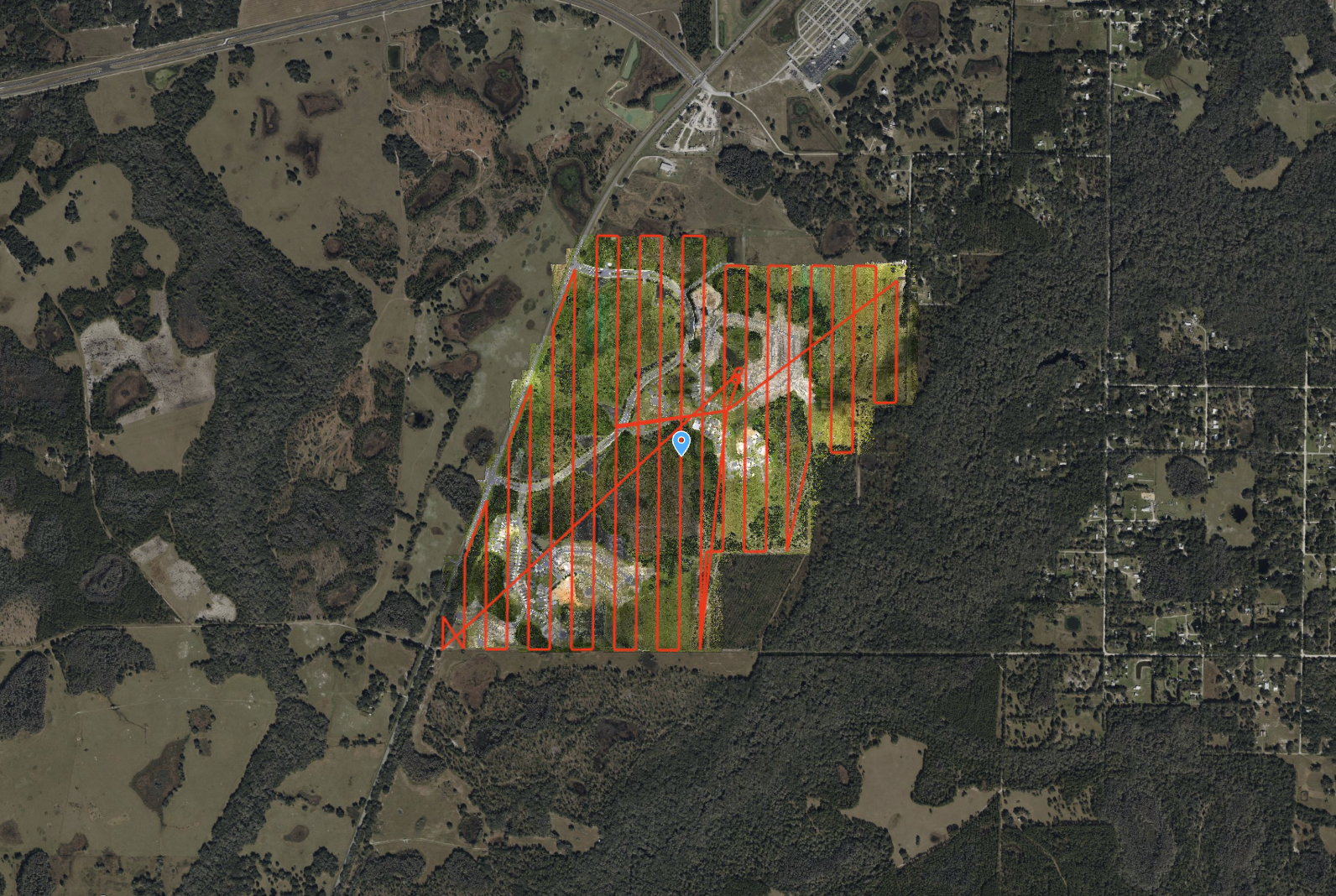
ROCK Ultra – Zephyrhills Residential Development
Flying at 120 m and 8 m/s, the ROCK Ultra mapped a massive 546-acre multi-phase development in Zephyrhills, FL, capturing wetlands, dense vegetation, and construction zones with precision.
Try ROCK Robotic now
Your 3D scanning journey starts here. Download ROCK Desktop or process in ROCK Cloud.