The Modern Surveyor's Workflow
Cut ALTA survey field time by 55%
See exactly how drone LiDAR transforms your workflow, reduces crew hours, and delivers survey-grade accuracy—with real project comparisons and pricing.
From Field Control to Final CAD in Days, Not Weeks
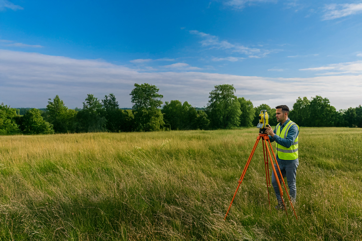
Traditional survey methods are reliable but don't scale. When projects demand 500-acre topographic surveys or dense vegetation penetration, field crews face weeks of dangerous, labor-intensive work.
ROCK Robotic provides the complete ecosystem—hardware, software, and services—to capture survey-grade data in hours, process billions of points without crashes, and deliver CAD-ready files your clients can use immediately.
The Complete ALTA Survey Solution
ROCK Robotic enables licensed surveyors to deliver ALTA/NSPS Land Title Surveys faster and more profitably by pairing high-accuracy drone LiDAR (ROCK Ultra) with ROCK Pro Services for topographic and planimetric extraction.
Cost Reduction
Day Delivery
Survey Accuracy
You Still Control:
- Boundary decisions and legal certification
- Utilities coordination and Table A requirements
- Total station pickup for critical features
- PLS seal and final deliverable quality
Understanding ALTA/NSPS Surveys (2021 Standard)
Complete boundary, title, and improvement surveys to national standards
Core Requirements
- →Records research (title commitment Schedule B, prior plats/deeds)
- →Field measurement and monument recovery
- →Boundary analysis and PLS certification
- →Table A optional items as requested
Common Table A Items
- Item 5:Vertical relief with contours (1-ft or 2-ft typical)
- Item 9:Parking counts and striping (urban/commercial)
- Item 11a:Utilities from observed evidence and records
- Item 11b:Private utility designating when requested
A-to-Z Workflow Comparison
See exactly where ROCK Ultra saves time and money
Traditional Method
Kickoff & Records
4-6 hrs office
811 Ticket & Locates
Schedule marking
Control & Boundary
4-8 hrs field
Data Capture
8-16 hrs RTK/TS detail
QC & Processing
4-6 hrs office
Extraction/Drafting
12-20 hrs CAD work
Boundary & Certification
PLS review & seal
ROCK Ultra Method
Kickoff & Records
4-6 hrs office
811 Ticket & Locates
Schedule marking
Control & Boundary
2-4 hrs field
Data Capture
30-45 min flight + spot TS
QC & Processing
1-2 hrs with ROCK Desktop
Extraction/Drafting
1-3 days Pro Services
Boundary & Certification
PLS review & seal
The Complete ROCK Ecosystem
1. Capture with Survey-Grade Hardware
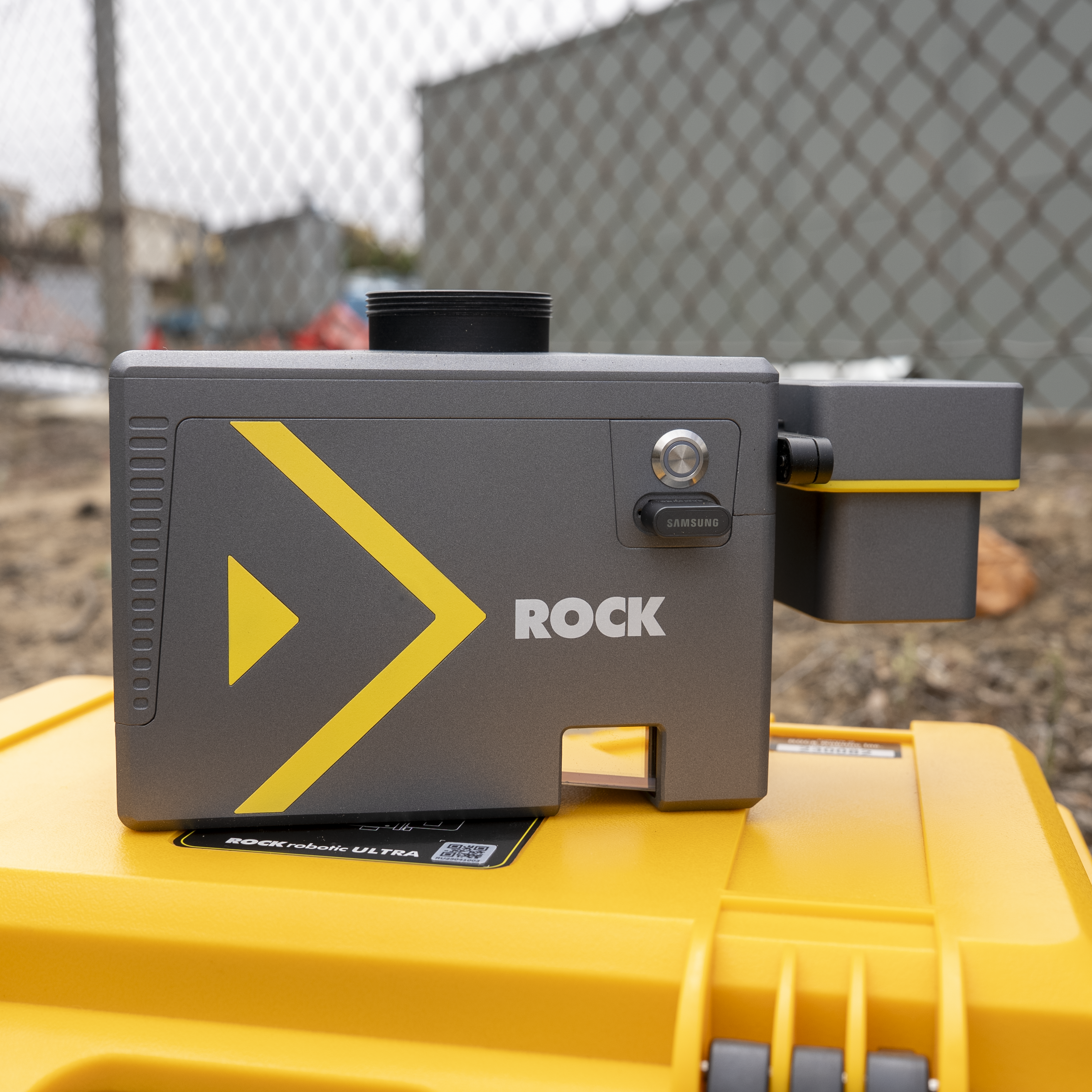
ROCK Ultra
RECOMMENDEDThe surveyor's choice for large sites and dense vegetation. 1000m range lets you fly at 400ft AGL for maximum efficiency and safety.
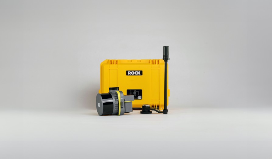
ROCK R3 Pro V2
The versatile 3-in-1 system for aerial, mobile, and handheld SLAM scanning. Perfect for corridors and mixed indoor/outdoor projects.
2. Process with Professional Software
ROCK Desktop
Field processing and QC before you leave the site. PPK trajectory processing, coverage verification, and rapid visualization in minutes.
- Immediate data verification
- PPK/RTK processing
- No costly re-flights
ROCK Cloud
Process massive datasets that would crash your workstation. Ground classification, reprojection, and alignment to control—all in the cloud.
- Handle 100GB+ datasets
- Web-based visualization
- Share via simple links
3. Deliver with Pro Services
ROCK Pro Services
Your on-demand drafting team. Order deliverables with one click from ROCK Cloud and receive professional CAD files in 48 hours. AI-powered extraction with human QC ensures survey-grade quality.
Pro Services Pricing (per acre)
Use Area of Interest tool to only process what you need
Real ALTA Survey Project Comparison
Based on actual project data and industry-standard billing rates
Traditional Method
COST BREAKDOWN
TIMELINE
ROCK Ultra Method
COST BREAKDOWN
TIMELINE
Summary: All Three Scenarios
| Scenario | Traditional Cost | ROCK + Plan | Savings | ROCK + Topo | Savings |
|---|---|---|---|---|---|
Urban Strip Mall 1 acre | $6,788 | $4,628 | $2,160 (32%) | $4,378 | $2,410 (36%) |
Greenfield 5 acres, dense vegetation | $6,942 | $3,880 | $3,062 (44%) | $3,630 | $3,312 (48%) |
Mixed-Use 3 acres | $7,171 | $4,822 | $2,349 (33%) | $4,572 | $2,599 (36%) |
Less Field Time
Cost Reduction
Faster Delivery
Projects to ROI
What ROCK Pro Services Delivers
Professional extraction services that integrate seamlessly with your workflow
What Pro Services Does
- Classify point clouds - Generate bare earth DTM and accurate contours at any interval (Item 5)
- Extract planimetric linework - Curbs, ramps, striping, signs, fences, walls, building footprints
- Package deliverables - DWG/DXF/LandXML/SHP with your layering standards
- Provide QA artifacts - Control report, check-shot residuals, notes on data gaps
- Fast turnaround - 1 day for topo, 2-3 days for full planimetrics
You Retain Control Over
- •Boundary adjudication - Legal opinions and boundary decisions remain your responsibility
- •PLS responsibilities - ALTA certificate and seal authority stays with you
- •Subsurface utilities - Item 11 caveats apply; 11b designating remains separate
- •Monument setting - Construction staking and monumentation by your field crew
- •Client relationships - Direct communication and project management
Pro Services Pricing Guide
Transparent per-acre pricing with minimum orders. Use Area of Interest tool to process only what you need.
ROCK Surveyor
per acre
Basic DTM & contours
Rural Planimetrics
per acre
Low density features
Suburban Planimetrics
per acre
Moderate complexity
Urban Planimetrics
per acre
High detail density
Note: Minimum orders typically $500 (topo) or $750 (planimetrics). Contact for volume pricing.
Industry Standard Billing Rates
Use these rates for accurate project estimation and ROI calculations
Office Roles
Field Crews & Equipment
Note: Rates shown are industry averages for the US market. Adjust based on your region and market conditions.
Control, Targets, and Accuracy Standards
Achieve survey-grade accuracy that meets ALTA/NSPS certification requirements
Control Setup Best Practices
Primary Control
- ►Establish 2-3 primary control points tied to project datum
- ►Add traverse legs where GNSS is occluded
- ►Capture with GNSS RTK/PPK and total station as needed
Aerial Targets
- ►Place 6-12 targets based on acreage and geometry
- ►Include independent check points not used in adjustment
- ►Validate with check shots and report RMSE/95% stats
Small Sites (1-3 acres)
- Aerial targets6-8
- Check points2-3
- Control points2-3
- Setup time1.5-3 hrs
Medium Sites (3-10 acres)
- Aerial targets8-12
- Check points3-5
- Control points3-4
- Setup time2-4 hrs
Accuracy Achieved
- 1-2cm vertical accuracy
- 2-3cm horizontal accuracy
- RTK/PPK trajectory processing
- ALTA 2021 compliant
- 95% confidence reporting
Protect Your Team & Your Business
ROCK Ultra dramatically reduces field exposure and operational risks
Traditional Survey Risks
ROCK Ultra Safety Advantages
Why This Matters for Your Survey Business
Lower Insurance Costs
Reduced field exposure means fewer claims, lower premiums, and better safety ratings
Better Employee Retention
Keep skilled surveyors happy with safer working conditions and modern technology
Win More Contracts
Deliver faster with fewer weather delays; take on dangerous sites competitors avoid
The Bottom Line: ROCK Ultra isn't just about efficiency—it's about protecting your most valuable asset: your people. When crews spend 55% less time in the field, they face 55% less exposure to hazards. That's fewer injuries, lower insurance costs, and a competitive advantage in hiring and retention.
We Ensure Your Success
Comprehensive training and support from Day 1
ROCK Academy
48+ modules covering ALTA workflows, control setup, and CAD integration
Start Learning →1-on-1 Onboarding
Personal setup sessions focused on your typical projects and workflows
Learn More →Expert Support
US-based geospatial professionals for mission planning and troubleshooting
Get Support →Resources for Land Surveyors
Case studies, workflows, and insights from surveyors using ROCK Robotic
Transform Your Survey Business
Join 500+ survey firms already using ROCK Robotic to win more bids and increase profits