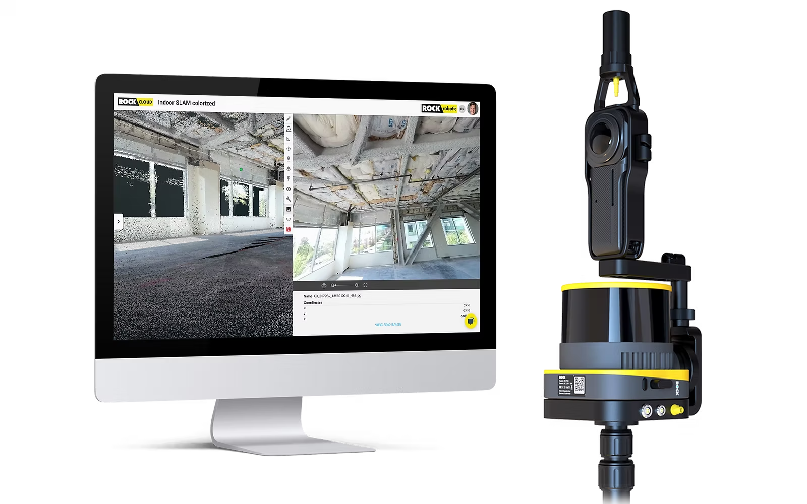
The Future of Colorized SLAM 3D Mapping
Pushing the boundaries of precision and versatility in LiDAR SLAM technology. Capture accurate SLAM with vivid, colorized point clouds and integrated 360° photo spheres.
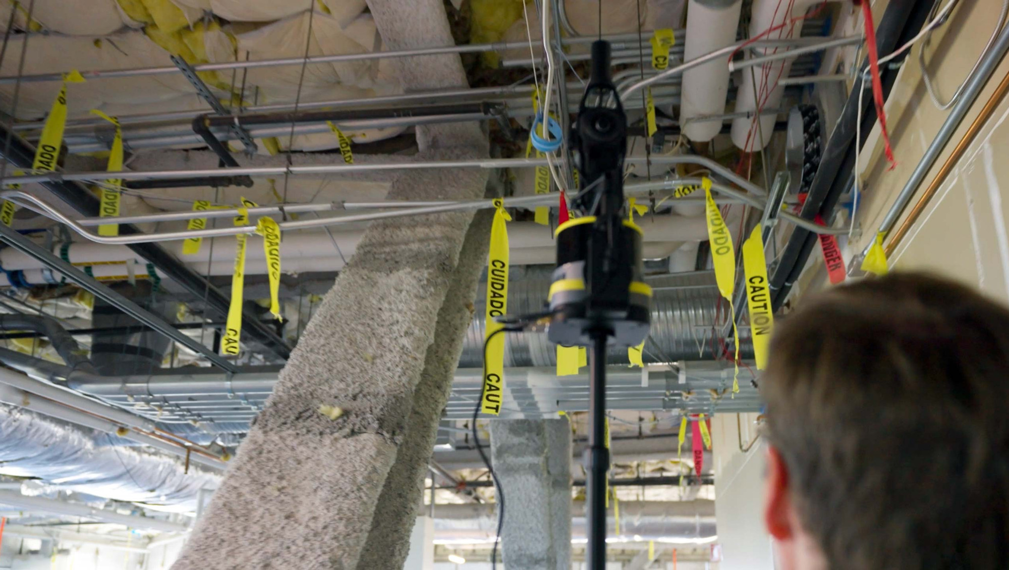
ROCK SLAM DOCK V2
Versatile Mapping
Integrated 360° camera and GNSS deliver accurate and efficient SLAM capture. Paired with the ROCK R3 Pro V2, enable Colorized ROCK SLAM for vibrant, detailed point clouds.
ROCK R3 PRO V2
Compatible LiDAR
Seamlessly integrates with SLAM Dock V2. High‑resolution imaging and robust performance for complex indoor/outdoor surveys.
ROCK COLORIZED SLAM
Beautiful Colorization
Merge 360 imagery with precise laser measurements to produce vivid, detailed 3D models that elevate visualization and decision‑making.
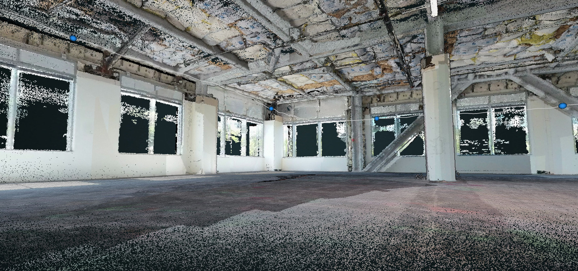
Enhanced Features, Better Data
View DatasetEnhanced Corner Accuracy
Advanced IMU algorithms improve sharp‑corner capture without manual fixes.
Improved Colorization
Crisper wall‑to‑ground transitions and cleaner visual detail.
Repeatability & Overlap
Highly repeatable tracks and accurate overlaps between passes.
Better Data Quality
Improved alignment and accuracy—even at speed and height.
Specifications
- Camera: Insta360 ONE RS (21MP 360°), 1" sensor
- Battery life: 4 hours (single)
- Accuracy: Relative 2 cm / Absolute 5 cm
- GNSS: Integrated antenna
- Power: USB‑C, 25,700 mAh, 95 Wh
- Dimensions: 136 × 149 × 108 mm (L×W×D)
- Mounting: M5 (x4) or 3/8" center
- Scanning modes: GNSS‑denied / GPS‑enabled SLAM
ROCK Inspect: 360° Photo Spheres
Integrate synchronized 360° photo spheres for inspection and documentation, enabling a virtual on‑site experience in ROCK Cloud.
Learn MoreGPS‑SLAM Hybrid Workflows
Seamlessly transition indoor/outdoor. Maintain accuracy through GNSS dropouts with advanced SLAM and a tactical‑grade IMU.
FAQs
What is the ROCK SLAM Dock V2?
A handheld/mobile SLAM companion for ROCK R3 Pro V2 enabling colorized SLAM and 360° photo spheres.
What are the main improvements with the V2?
Enhanced precision in 3D SLAM modeling, support for Colorized ROCK SLAM, integrated 360° photo spheres for inspection (ROCK Inspect), and improved hardware durability for field use.
What are the benefits of the Insta360 integration?
The Insta360 ONE RS provides high‑resolution 360° imagery that synchronizes with the point cloud, improving visual detail and the color accuracy of SLAM models.
Can it be used indoors and outdoors?
Yes. It is designed for GNSS‑denied environments and GPS‑enabled outdoor mapping.
What industries benefit from using the SLAM Dock V2?
Construction, architecture, engineering, real estate, facilities, mining, utilities, and urban planning teams use it to create detailed 3D models for planning, analysis, and documentation.
How is the data processed?
Data is pre‑processed in ROCK Desktop and then uploaded to ROCK Cloud for visualization, analysis, and professional deliverables.
Capture Accurate Colorized SLAM Data
Enhance your mapping capabilities today with the ROCK SLAM Dock V2.
Talk to Sales