Das ultimative vielseitige LiDAR‑Arbeitstier.
Doppelte Dichte. Doppelte Kanäle. Gleichbleibend einzigartige Vielseitigkeit. Der R3 Pro V2 liefert Ergebnisse in Profi‑Qualität – in der Luft, im Fahrzeug oder zu Fuß – mit 1,28 Mio. Punkten pro Sekunde.
Erleben Sie den ROCK R3 Pro V2 in 3D
Entdecken Sie das Design in Profi‑Qualität mit doppelter Anzahl an Laserkanälen
32 Kanäle
Hesai XT32
2× Dichte
vs. R3 Standard
SLAM‑bereit
GPS‑freie Umgebungen tauglich
2-3 cm
Genauigkeit (post‑processed)
1.28M
Punkte/s
360°
Sichtfeld
1.26 kg
Gewicht (mit Kamera)
32
Laserkanäle
5 mm
Entfernungspräzision
Fliegen: Maximale Dichte für Luft‑Mapping.
Mit 32 Laserkanälen und 1,28 Mio. Punkten/s erfasst der R3 Pro V2 außergewöhnliche Details selbst bei 60 m AGL. Die verdoppelte Punktdichte bedeutet bessere Vegetationsdurchdringung, sauberere Geländemodelle und präzisere Objektextraktion – ideal für anspruchsvolle Vermessungen, dichte Stadtgebiete und detaillierte Infrastruktur‑Inspektionen.
Fahren: Professionelles Mobile Mapping.
Machen Sie Ihr Fahrzeug zum Mobile‑Mapping‑Kraftpaket. 32 Kanäle bieten überlegene Abdeckung bei Autobahngeschwindigkeit und erfassen scharfe Details von Fahrbahnen, Beschilderung und Infrastruktur. Die hohe Punktdichte gewährleistet vollständige Abdeckung selbst unter Brücken, durch Tunnel und entlang komplexer Korridore – ideal für DOT‑Projekte und Asset‑Management.
Gehen: SLAM‑Exzellenz überall.
Mit dem SLAM DOCK V2 glänzt der R3 Pro V2 im Handheld‑Modus. Die hohe Punktdichte liefert außergewöhnliche Details für Innenraum‑Mapping, As‑Built‑Dokumentation und Vermessungen in engen Räumen. GPS‑SLAM‑Hybridtrajektorien verbinden nahtlos Außen‑ und Innenaufnahmen. Erfassen Sie Gebäudinnenräume, Minen, Tunnel und Wälder – alles mit demselben Sensor in Profi‑Qualität.
Ihr Professional‑Paket
Alles für LiDAR‑Mapping in Profi‑Qualität – mit doppelter Leistungsfähigkeit.
LiDAR‑Einheit
32 Kanäle, 1,28 Mio. Pkt./s
Pro‑Montageset
Pro‑Montage
Robustes 3‑in‑1‑Kit
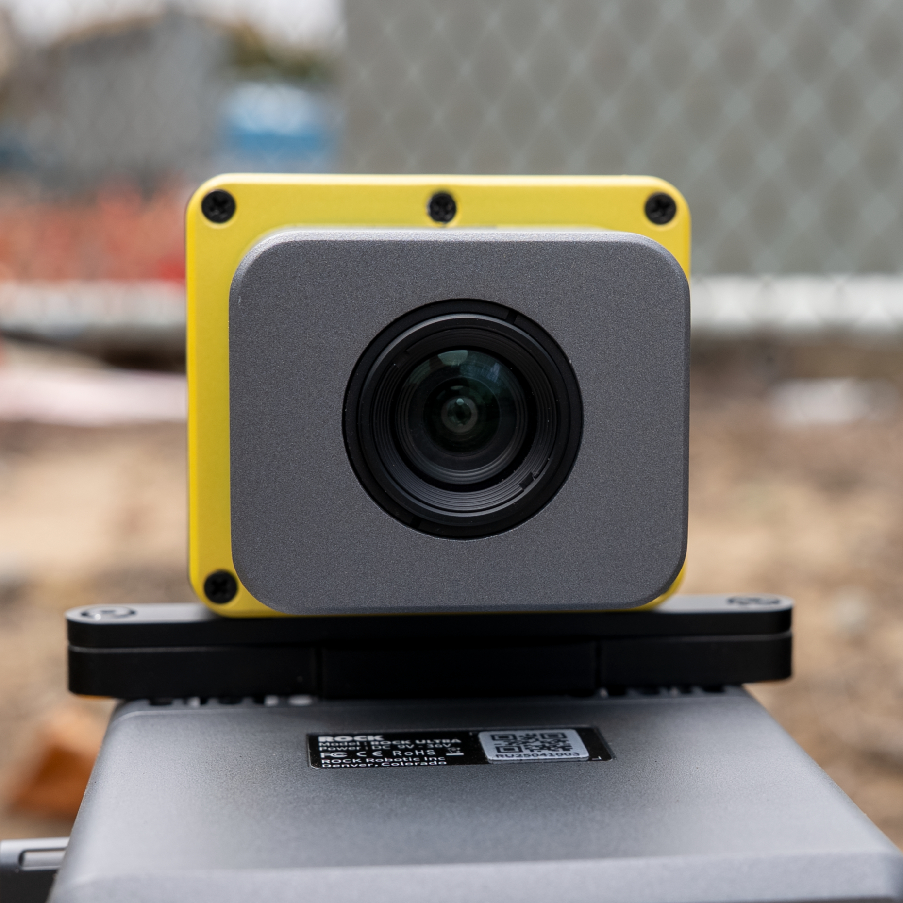
RGB‑Kamera
Pro‑Farbgebung
SLAM V2
SLAM DOCK V2
GPS‑SLAM‑Hybrid
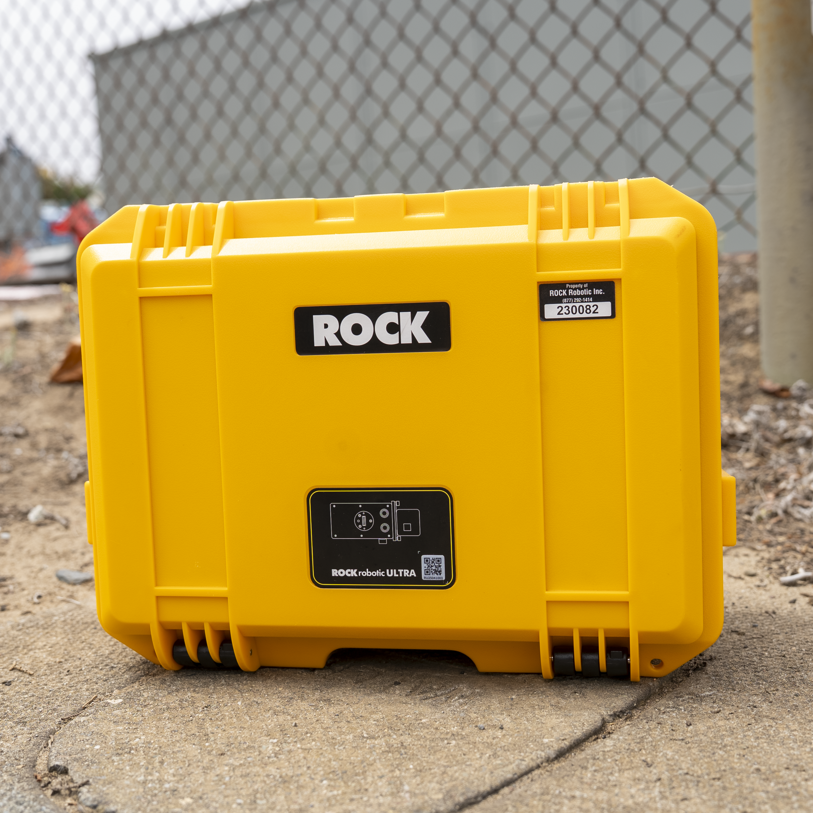
Pro‑Koffer
Zusätzlicher Schutz
Professionelles Ökosystem
ROCK Cloud Business Pro
Priorisierte Verarbeitung, 1 TB Speicher, erweiterte Tools
ROCK Desktop Pro Lizenz
Aerial + Mobile + SLAM Verarbeitung
Priorisierter Support
Direkter Zugang zu Senior‑LiDAR‑Ingenieuren
Fortgeschrittenen‑Training
Pro‑Module + 1‑zu‑1‑Onboarding
Pro‑Kalibrierung
Verbesserte Boresight‑Kalibrierung mit Zertifikat
Verlängerte Garantie
2 Jahre Abdeckung mit Vorab‑Austausch
Get the Complete Technical Specifications
Laden Sie unseren umfassenden Spezifikationsleitfaden mit detaillierten technischen Informationen, Leistungskennzahlen und Vergleichstabellen herunter.
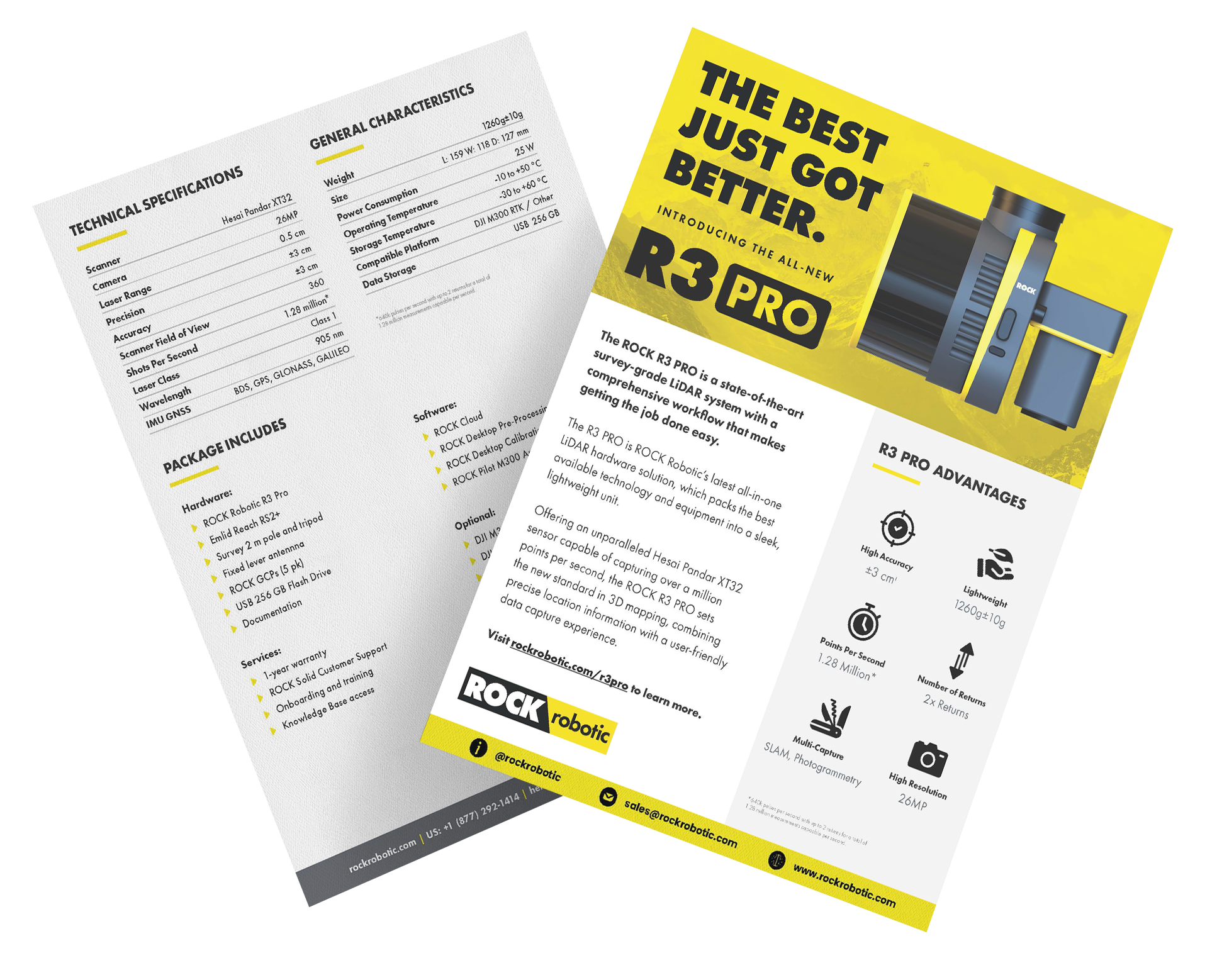
ROCK R3 Pro V2 Datenblatt
- Vollständige technische Spezifikationen
- Leistungsvergleichstabellen
- Optionen für luftgestützte metrische Kameras
- Optionale Halterungen und Zubehör
PDF-Format • 2 Seiten • Keine E-Mail erforderlich
Warum R3 Pro statt R3 Standard?
Doppelte Laserkanäle
- • 32 vs. 16 Kanäle: 2× vertikale Auflösung
- • Bessere Vegetationsdurchdringung: Mehr Returns pro Fläche
- • Sauberere Kanten: Überlegene Feature‑Definition
- • Schnellere Abdeckung: Größere Schwadbreite bei gleicher Dichte
Vorteile für Profis
- • 1,28 Mio. Pkt./s: Doppelte Datendichte
- • Für Mobile optimiert: Überlegen bei Fahrzeuggeschwindigkeiten
- • SLAM‑Exzellenz: Bessere Indoor‑Details
- • Zukunftssicher: Bewältigt anspruchsvolle Projekte
R3 Pro V2 Leistungskennzahlen
2x
Mehr Punkte pro Flug
50%
Bessere Kronendurchdringung
30%
Schnellerer Projektabschluss
Professionelle Anwendungen
Der R3 Pro V2 glänzt bei anspruchsvollen Projekten, die maximale Detailtiefe erfordern.
Autobahnkorridore
Mobile Mapping in DOT‑Qualität mit vollständigem Anlageninventar bei 70+ mph (113+ km/h).
Dichte Vegetation
Überlegene Kronendurchdringung für Forst‑ und Umweltstudien.
Komplexe Anlagen
Vollständige As‑Builts mit nahtlosen Indoor‑/Outdoor‑Übergängen.
Häufig gestellte Fragen
Lohnt sich das Upgrade vom R3 auf den R3 Pro V2?
Wenn Sie höhere Punktdichte, bessere Vegetationsdurchdringung benötigen oder regelmäßig Mobile/SLAM scannen, lohnt sich der Pro. Die verdoppelten Laserkanäle (32 vs. 16) machen einen deutlichen Unterschied bei Datenqualität und Projekteffizienz. Für einfaches Luft‑Mapping kann der R3 Standard ausreichen.
Wie vergleicht sich der R3 Pro V2 mit dem ROCK Ultra?
Der Ultra ist auf Langstrecken‑Luftkartierung spezialisiert (1000 m Reichweite, 1550 nm Laser) mit außergewöhnlicher Vegetationsdurchdringung. Der R3 Pro V2 ist das vielseitige Arbeitstier – 3‑in‑1‑Fähigkeit, hervorragend für die meisten Projekte im mittleren Bereich. Wählen Sie Ultra für riesige Luftareale; R3 Pro für Vielseitigkeit und Preis‑Leistung.
Was ist im Pro‑Paket enthalten?
Der R3 Pro V2 umfasst den 32‑Kanal‑LiDAR‑Sensor, eine 26‑MP‑Kamera, professionelles Montageset, ROCK Cloud Business Pro‑Abo, ROCK Desktop Pro‑Lizenz, priorisierten Support, Fortgeschrittenen‑Training und 2‑Jahres‑Garantie. Optional: SLAM DOCK V2 für Indoor‑Scanning empfohlen.
Kann ich später vom R3 auf den R3 Pro upgraden?
R3 und R3 Pro sind unterschiedliche Hardware‑Einheiten (16 vs. 32 Laserkanäle) – der Sensor selbst ist nicht upgradefähig. R3‑Besitzer können jedoch den R3 Pro zu einem vergünstigten Upgrade‑Preis erwerben und ihren R3 oft in Zahlung geben. Kontaktieren Sie den Vertrieb für Upgrade‑Optionen.
Wie hoch ist die Lernkurve für die 3‑in‑1‑Fähigkeit?
Sehr gering. Alle drei Modi verwenden denselben ROCK Desktop/Cloud‑Workflow. Der Wechsel zwischen Luft, Mobile und Handheld ist nur eine Frage der Montage. Unsere Schulung deckt alle drei Modi ab – die meisten Nutzer sind innerhalb einer Woche fit.
Was Pro‑Anwender sagen
Erfahrungsberichte von Profis, die für anspruchsvolle Projekte auf den R3 Pro V2 umgestiegen sind.
"Das Upgrade vom R3 auf den R3 Pro war ein Game‑Changer. Die verdoppelte Punktdichte bedeutet, dass wir höher fliegen und trotzdem unglaubliche Details erfassen können. Mobile Mapping bei Autobahngeschwindigkeit ist jetzt für unsere DOT‑Aufträge realistisch."
"Wir nutzen den R3 Pro V2 für alles – Drohnenvermessung, Fahrzeug‑Korridormapping und Indoor‑SLAM‑Scans. Ein System, das in allen drei Bereichen überzeugt, hat unsere Abläufe und Schulungen enorm vereinfacht."
Meistern Sie Ihr ROCK R3 Pro V2
Holen Sie das Beste aus Ihrer Investition heraus – mit umfassenden Schulungsoptionen für praxisnahes Lernen und den Aufbau von Expertise.
Praxisnahes Training
Denver, Colorado
Lernen Sie direkt von ROCK‑Ingenieuren mit praktischer Erfahrung an echter Ausrüstung. Beinhaltet Flugoperationen, Datenverarbeitung und fortgeschrittene Techniken.
Schulungsdetails ansehenROCK Academy
Online‑Lernplattform
Umfassender Online‑Lehrplan, der den vollständigen LiDAR‑Workflow von der Erfassung bis zu den Ergebnissen abdeckt. Lernen Sie in Ihrem eigenen Tempo mit fachkundiger Anleitung.
ROCK Academy entdeckenNicht sicher, welche Schulungsoption die richtige für Sie ist?
Sprechen Sie mit unseren SchulungsexpertenBereit für Performance in Profi‑Qualität?
Steigen Sie auf den ROCK R3 Pro V2 um und erleben Sie den Unterschied, den 32 Kanäle und 1,28 Mio. Punkte/s machen.