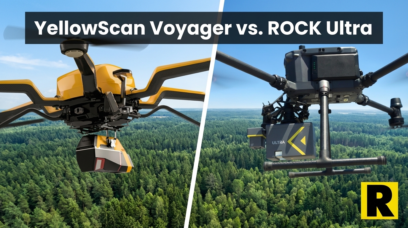
YellowScan Voyager vs. ROCK Ultra: When Raw Specs Meet Real-World Workflow
Apr 01, 2026
If you're evaluating long-range drone LiDAR systems and you haven't looked at the YellowScan Voyager, you haven't done your homework. It's a beautifully engineered sensor with genuinely extraordinary specs: 1,250 m range, 2.4 million shots per second, up to 32 returns. For heavily vegetated terrain, dense canopy penetration, or corridor work at altitude, those numbers matter.
So let's be honest upfront: the Voyager is an impressive piece of hardware.
Here's also the truth: it weighs 3.5 kg. It costs somewhere north of $80,000. And when you're done flying, you're doing most of the work yourself.
For survey businesses evaluating which long-range system to build their workflow around, those details change the math considerably.
What YellowScan Got Right
YellowScan has been building precision LiDAR systems since 2012. They know what they're doing.
The Voyager's headline stats:
- 1,250 m range at 80% reflectivity — best-in-class for a UAV-specific platform
- 2.4 million shots per second — exceptional pulse rate for dense point clouds
- Up to 32 returns — unmatched for penetrating dense forest canopy
- 1550 nm wavelength — true long-range, eye-safe, better performance in challenging conditions
- Applanix APX-15 IMU — a respected, battle-tested inertial navigation system used across the professional survey industry
- CloudStation — solid mission planning and post-processing software
For researchers mapping old-growth forest, for consultants flying dense tropical vegetation, or for organizations that need the absolute maximum in pulse return data — the Voyager is a serious tool.
So why are ROCK Ultra customers not anxious about it? Four reasons.
1. The Weight Problem Is Real
The Voyager weighs 3.5 kg. The ROCK Ultra weighs 1.4 kg.
That 2.1 kg difference might sound academic until you realize what it means in practice:
At 3.5 kg, the Voyager requires a heavy-lift drone. You're looking at a Freefly Alta X, a DJI Agras-class platform, or a similar aircraft — not the M300/M350 that most survey teams already own and operate. Heavy-lift drones cost more, fly shorter missions, require more complex maintenance, and carry higher operational risk.
The ROCK Ultra flies on your DJI M350 RTK. The same drone you use for photogrammetry. The same platform your team already knows, maintains, and has insured. No additional drone purchase. No new training curve. No additional operational complexity.
Here's the business math: the Voyager sensor plus a heavy-lift drone capable of carrying it typically runs $150,000+ for a complete deployable system. ROCK Ultra plus a DJI M350 comes in at a fraction of that.
For a regional survey firm, a DOT contractor, or a drone services provider building out their first long-range LiDAR capability — that difference is the entire business case.
2. Price vs. Business ROI
YellowScan doesn't publish Voyager pricing, but industry estimates consistently place it in the $80,000–$120,000 range for the sensor alone.
The ROCK Ultra delivers 1,000 m range, 1 million points per second, and a 90° focused FOV at a significantly lower price point — with full ROCK Cloud and Pro Services integration included.
Let's talk about what that actually means for ROI:
Florida Design Consultants used the ROCK Ultra to survey 500+ acres in a single 70-minute flight, replacing 2-3 days of conventional fieldwork. That's the productivity gain that pays for your hardware investment.
GPI completed a 360-acre urban redevelopment survey in 45 minutes — a timeline no ground crew could match.
The question isn't "which sensor has better specs." The question is "which investment generates the fastest return for my survey business." At half the price of a Voyager system, the Ultra's ROI math is hard to argue with.
3. The Ecosystem Gap
Here's where the comparison gets interesting.
When you finish a Voyager flight, you have a spectacular raw point cloud. What happens next is largely on you. CloudStation handles post-processing, and it's a solid software suite. But YellowScan has no equivalent to what ROCK Cloud delivers:
- One-click strip alignment — automated without manual tie points
- AI-assisted ground classification — separates ground, vegetation, and structures automatically
- Automated contour extraction — survey-ready contours from classified data
- ROCK Pro Services — send your raw LiDAR, get back CAD-ready planimetrics with licensed surveyors reviewing the output, typically within 3-5 business days
No other manufacturer at this tier offers an equivalent to ROCK Pro Services. When a survey firm doesn't have the staff or software to go from raw LiDAR to a deliverable — or when they're at capacity and need to outsource processing — ROCK Cloud is the answer. YellowScan provides no equivalent path.
For a one-person drone survey operation, or a small firm scaling up, the ability to get a human-reviewed, CAD-ready deliverable without hiring a CAD tech is often worth more than an extra 250 m of sensor range.
4. NDAA Compliance
Both the ROCK Ultra (on Freefly Astro or Inspired Flight IF800) and YellowScan systems can achieve NDAA compliance through US-manufactured platforms. This is a genuine advantage for both versus DJI.
Where ROCK has an edge: the ROCK Cloud ecosystem and support structure are US-based. YellowScan is a French manufacturer with European-focused support operations. For US government contractors, DOT projects, and infrastructure clients with stringent supply chain requirements, that distinction matters.
Head-to-Head: ROCK Ultra vs. YellowScan Voyager
| ROCK Ultra | YellowScan Voyager | |
|---|---|---|
| Wavelength | 1550 nm | 1550 nm |
| Max Range | 1,000 m (80% reflectivity) | 1,250 m (80%) |
| Point Rate | 1M pts/s | 2.4M shots/s |
| Returns | 7 | 32 |
| Weight | 1.4 kg | 3.5 kg |
| Required Drone | M350, Astro, IF800 | Heavy-lift required |
| Estimated System Cost | ~$80K–$100K complete | $150K+ complete |
| NDAA OK? | Yes (on Astro/IF800) | Yes |
| Cloud Workflow | ROCK Cloud + Pro Services | CloudStation |
| Automated Deliverables | Yes (Pro Services) | No equivalent |
Where the Voyager wins: Range (1,250 m vs. 1,000 m), raw pulse rate, and return count (32 vs. 7) — genuine advantages for dense canopy and extreme-altitude work.
Where ROCK Ultra wins: Weight (1.4 kg vs. 3.5 kg), compatible drone platforms, total system cost, complete cloud ecosystem with automated deliverables, and US-based support.
The Real Question
For 90% of professional UAV survey projects — corridor surveys, topographic mapping, infrastructure inspection, construction site monitoring — the ROCK Ultra's 1,000 m range and 1M pts/s is more than sufficient. You're flying at 300–400 ft AGL on most projects, not pushing the limits of a 1,250 m sensor.
The Voyager earns its place for specialized applications: old-growth forest carbon monitoring, extreme-altitude alpine surveys, research programs requiring maximum return data for canopy structure analysis.
For a commercial survey business running mixed project types — topo, ALTA, corridor, construction — the ROCK Ultra at half the weight, lower cost, and with ROCK Cloud behind it is the stronger business investment.
Curious how the ROCK Ultra performs on your specific project type? Subscribe to Indiana Drones on YouTube — Harrison flies real survey projects and shows you the actual data.