Teledyne EchoONE: NDAA Compliant — But Can It Keep Up in the Field?
Apr 01, 2026
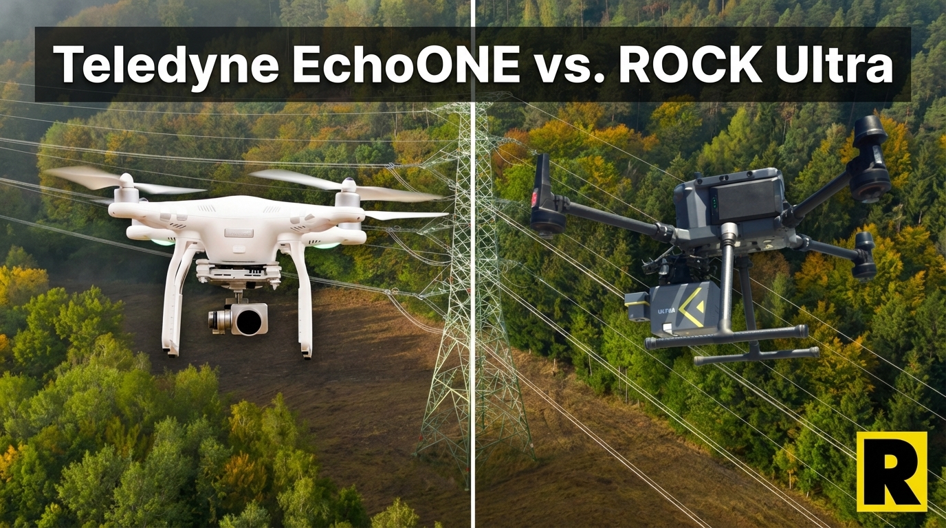
The Teledyne EchoONE made a notable entrance at INTERGEO 2025. Built through a partnership between Teledyne Geospatial and Inertial Labs, it combines a tactical-grade IMU with a compact form factor, NDAA compliance, and compatibility with multiple drone platforms — including the M350, Freefly Astro, and IF800 Tomcat.
For survey firms specifically looking for NDAA-compliant LiDAR, the EchoONE is one of a small number of legitimate options. That's genuinely important, and we're not going to minimize it.
But NDAA compliance alone doesn't close survey contracts. Performance, range, and workflow do. And on those dimensions, the EchoONE's limitations are real.
What Teledyne Got Right
The EchoONE was designed thoughtfully:
NDAA Compliance. This is the headline. Teledyne is a US company, Inertial Labs is US-based, and the resulting sensor meets NDAA requirements. For federal, DOT, utility, and infrastructure work, this is table stakes — and the EchoONE delivers it.
Tactical-Grade IMU. The KERNEL-210 IMU from Inertial Labs is genuinely tactical grade — a meaningful upgrade over consumer-grade alternatives. This contributes to the EchoONE's strong reported accuracy: 1.5 cm RMSZ to GCPs in verified testing.
Lightweight. At 1.2–1.65 kg depending on configuration, the EchoONE falls in a similar weight class to other professional UAV LiDAR systems.
Multi-Platform Compatibility. Mounts on M350, Freefly Astro, IF800 WISPR — the same platform options as ROCK Ultra. Good compatibility without platform lock-in.
Real-Time Data Preview. The EchoONE offers in-field data preview, giving operators immediate quality feedback before leaving the site.
These are real strengths. The EchoONE is a professionally engineered sensor.
Here's where the comparison diverges sharply.
1. The Range Gap Is Fundamental
The EchoONE's maximum range is 270 m at 20% reflectivity.
The ROCK Ultra's maximum range is 1,000 m at 80% reflectivity.
This isn't a marginal difference. The Ultra has nearly 4× the effective range at typical survey reflectivity conditions.
What does this mean in practice?
Flight altitude. Higher range means you can fly higher AGL while maintaining survey-grade data quality. The Ultra flies at 300–400 ft AGL with excellent results. The EchoONE's range ceiling forces lower altitude operations, which means:
- More flight lines to cover the same area
- More time in the air per acre
- Higher operational cost per project
Coverage efficiency. At 270 m maximum range and typical operating altitudes, the EchoONE's coverage width narrows considerably compared to the Ultra's 1,000 m reach. Projects that take one flight with the Ultra may require multiple flights with the EchoONE.
For small-area projects — a construction site, a single parcel survey, an industrial facility — 270 m range is adequate. For large-area topographic mapping, corridor work, or anything spanning hundreds of acres, the range limitation becomes an operational bottleneck.
2. The Camera Limitation
The EchoONE's standard integrated camera is 5 MP.
The ROCK Ultra's integrated camera is 26 MP.
For colorized point clouds — expected on virtually every modern deliverable — this gap is visible in the output. A 5 MP image colorizing a high-density point cloud produces noticeably lower quality results than a 26 MP image.
Teledyne offers an optional 61 MP camera upgrade. That adds cost and complexity. The Ultra's 26 MP camera is included in the standard system configuration.
3. No Cloud Ecosystem
After an EchoONE flight, you have a raw point cloud and post-processing on your own. Teledyne doesn't offer cloud processing services. There's no automated strip alignment, no one-click ground classification, no contour extraction service, and no professional deliverables service.
ROCK Cloud provides exactly this — and ROCK Pro Services takes it further. Send your raw LiDAR data, get back CAD-ready planimetrics from licensed surveyors within 3-5 business days.
For government contractors who need to produce deliverables on tight timelines, the absence of a professional services tier behind the EchoONE is a real gap. The hardware qualifies for government contracts. The workflow behind it doesn't support the throughput that government project volumes often require.
4. Limited Field Track Record
The EchoONE launched at INTERGEO 2025 — it's a relatively new product in a field where track record matters.
ROCK Ultra has verified case studies across:
- 500+ acre surveys in a single flight
- Airport runway mapping (R3 Pro V2)
- Highway interchange mapping
- Urban redevelopment surveys
- Post-wildfire terrain mapping
- Utility corridor vegetation management
The EchoONE has genuine promise. It lacks the documented project history that survey firms cite when building confidence in a system before committing to it on $50K+ contracts.
5. No Multi-Platform Capability
Like many sensors in this class, the EchoONE is a drone-mounted sensor. There's no vehicle mount option and no SLAM/handheld mode for GPS-denied environments.
For firms that need only aerial capability, this isn't a limitation. For firms whose clients increasingly need indoor as-builts, mobile corridor surveys, or building access — it's a ceiling.
Head-to-Head: ROCK Ultra vs. Teledyne EchoONE
| ROCK Ultra | Teledyne EchoONE | |
|---|---|---|
| Max Range | 1,000 m (80% reflectivity) | 270 m (20% reflectivity) |
| Returns | 7 | 8 |
| Accuracy | Verified field cases | 1.5 cm RMSZ (tactical IMU) |
| Camera | 26 MP | 5 MP (61 MP optional) |
| Weight | 1.4 kg | 1.2–1.65 kg |
| NDAA OK? | Yes (on Astro/IF800) | Yes |
| Platform Compatibility | M350, Astro, IF800 | M350, Astro, IF800 WISPR |
| Cloud Workflow | ROCK Cloud + Pro Services | None |
| Multi-Platform | Drone only | Drone only |
| Field Track Record | Extensive (5+ years) | New (launched 2025) |
Where EchoONE wins: NDAA compliance (matched), tactical IMU accuracy (1.5 cm verified), real-time data preview.
Where ROCK Ultra wins: Range (4× advantage), camera quality (26 MP vs. 5 MP), complete cloud ecosystem with Pro Services, proven field track record.
The NDAA Story: Both Systems Qualify
Both the EchoONE and the ROCK Ultra (on Astro/IF800) achieve NDAA compliance. If the only question is "can I use this on a government contract," both answer yes.
The question for government contractors is which system wins the work — and that depends on range capability, deliverable quality, and the professional services tier behind the hardware. On all three, ROCK Ultra leads.
The Bottom Line
The Teledyne EchoONE is a legitimate NDAA-compliant sensor with a well-designed IMU and solid accuracy numbers. For small-area government survey projects where 270 m range is sufficient, it's a viable option.
But the ROCK Ultra at 1,000 m range, 26 MP camera, and full ROCK Cloud + Pro Services integration is the more capable system for professional survey operations — at any scale, for any project type, including the government contracts the EchoONE was also designed to address.
Compliance gets you to the table. Capability wins the contract.