30 Minutes On-Site: A ROCK Ultra Drone LiDAR Case Study with Dylan Gorman
Aug 18, 2025
Surveying large, complex infrastructure like highway intersections is traditionally a time-consuming, costly, and hazardous undertaking. Closing lanes, managing traffic, and ensuring crew safety are significant logistical challenges. For Aerial Intelligence Expert Dylan Gorman of PilotByte.com, the goal was to capture a sprawling 133-acre highway interchange with maximum efficiency and safety. The solution was the ROCK Ultra, a long-range aerial LiDAR system designed to turn weeks of work into hours.
The result was game-changing. Flying at 115 meters, the entire project was captured with incredible detail and accuracy. The most impressive part?
I spent literally 30 minutes on site!”
— Dylan Gorman, PilotByte.com
The Challenge: Safely Surveying a Massive Interchange
The project focused on a multi-level highway interchange, a notoriously difficult environment for surveying. The key challenges included:
- Safety: Minimizing time near active, high-speed traffic.
- Scale: Capturing 133 acres of complex geometry, including overpasses, on-ramps, and surrounding terrain.
- Efficiency: Collecting comprehensive data in a single visit without rework.
The Solution: High-Altitude, High-Efficiency LiDAR
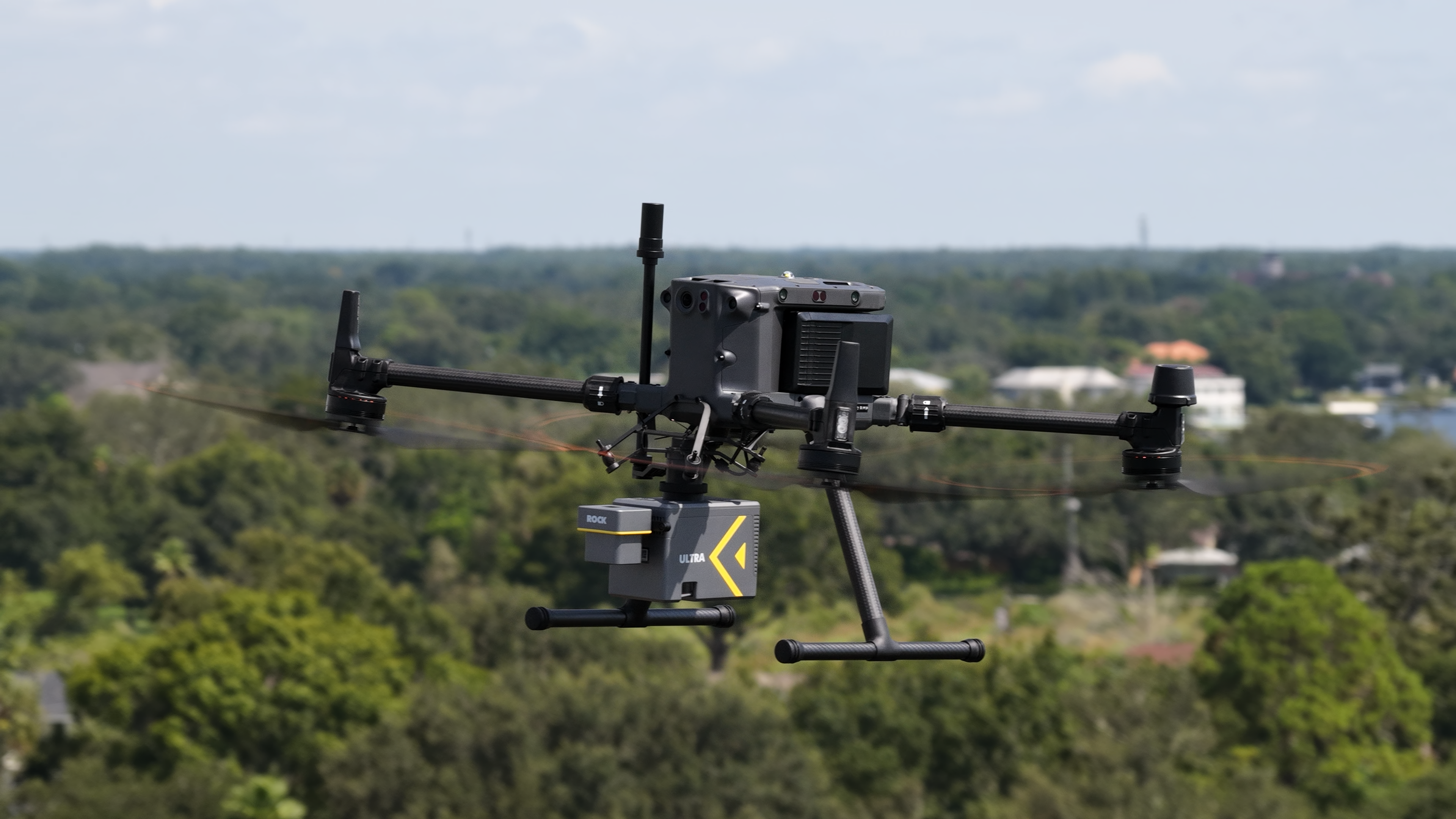
Dylan Gorman utilized the ROCK Ultra LiDAR system, flying at a height of 115 meters and a speed of 7.5 meters per second. The Ultra's 1000-meter effective range makes it the 'easy button' for professional LiDAR, allowing operators to fly at high altitudes above obstacles. This radically simplifies mission planning, reduces risk, and increases the area covered in a single flight.
The entire 133-acre site was captured in one short flight, demonstrating the system's power to handle large-scale projects with unparalleled speed.
The Data: Survey-Grade Results in Minutes
Immediately after the flight, the raw point cloud data was available for review in the ROCK Cloud platform. The density and clarity of the data, even from 115 meters, allowed for the clear identification of hard surfaces, curb lines, and terrain features across the entire interchange.
Watch the Full Case Study Video
See the full story of this impressive project, from flight to final data, in the video below.
About the ROCK Ultra LiDAR System
The ROCK Ultra is engineered for maximum efficiency and data quality on large-scale projects. It combines a long-range 1550nm laser with a tactical-grade IMU to deliver survey-grade data with 1-2 cm post-processed accuracy. Its industry-leading 7 returns per pulse and lightweight 1.4 kg design ensure superior penetration of dense vegetation while maintaining excellent flight times on drones like the DJI M350. With the ability to cover 200-300 acres in a single 30-minute flight, the Ultra dramatically reduces field time and project costs.
Join the ROCK Ultra Demo Tour
Experience the power of high-altitude LiDAR for yourself. The ROCK Ultra is traveling across America for a special "Try Before You Buy" program. Qualified professionals get a full 3-day trial to use the system on their own projects, with their own drone, backed by complete support from the ROCK Robotic team. Discover firsthand how you can reduce field time and increase safety on your most demanding jobs.