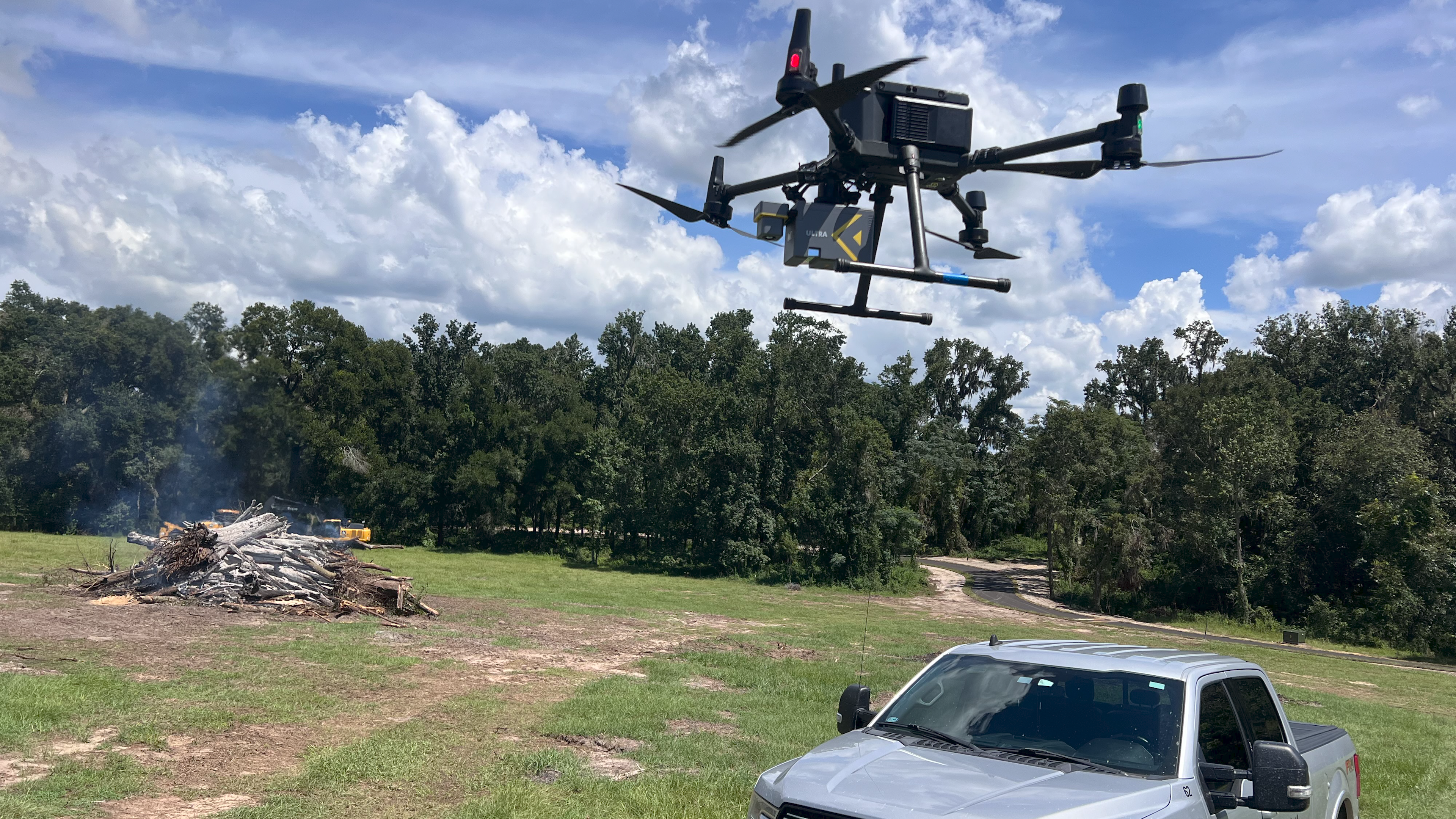
ROCK Ultra LiDAR: 188 Acres Surveyed in 17 Minutes – A Game Changer for D.C. Johnson & Associates
Aug 27, 2025

In the dynamic world of land surveying and geospatial data collection, efficiency and accuracy are paramount. For D.C. Johnson & Associates, tackling challenging terrains in Florida often meant labor-intensive, multi-day operations. That was until they integrated the ROCK Ultra Aerial Drone LiDAR system into their workflow. In a recent demo tour, Project Manager and LiDAR Specialist Davy Johnson showcased how the ROCK Ultra transformed a complex 188-acre survey into a mere 17-minute flight, revolutionizing their approach to data acquisition.
The Challenge: Dense Florida Landscapes and Demanding Deadlines
Florida's diverse landscapes present unique obstacles for surveyors. From thick, overgrown vegetation and intricate creek beds to active construction zones requiring precise monitoring, traditional methods often fall short. Davy Johnson highlighted these very challenges as the reason for choosing specific demo sites: "We looked for some of the tougher sites in Florida that we deal with on a day-to-day basis, with thick canopy, thick vegetation, winding creek beds" . The goal was to demonstrate how the ROCK Ultra could not only navigate these environments but also deliver superior results faster than ever before.
The Solution: Unmatched Speed and Penetration with ROCK Ultra LiDAR
The ROCK Ultra LiDAR system proved to be the ultimate solution. Its advanced capabilities allowed D.C. Johnson & Associates to capture high-density, survey-grade data with unprecedented speed and efficiency.
188 acres in 17 minutes—that same job would take a crew at least three days, carving through the woods with machetes.
— Davy Johnson, Project Manager, D.C. Johnson & Associates
This staggering improvement in turnaround time highlights the transformative power of the ROCK Ultra. By flying higher and faster, the system significantly reduces flight time and eliminates the need for multiple battery swaps, a common bottleneck in drone operations .
One of the most impressive features demonstrated was the vegetation penetration. The ROCK Ultra effectively cut through dense canopy, reaching critical ground features like creek beds and toe slopes that would be virtually inaccessible or extremely time-consuming with traditional methods . Davy noted how this capability allowed them to "skip the machetes," turning a multi-day manual task into minutes of aerial data capture .
Versatility: From Natural Environments to Active Construction Sites
The ROCK Ultra's versatility extends beyond dense vegetation. The demo also showcased its effectiveness in construction site monitoring. The ability to rapidly collect highly accurate data makes it an invaluable tool for tracking progress, calculating volumes, and ensuring compliance on active job sites . This provides engineers and project managers with timely, reliable information for critical decision-making.
Seamless Workflow: ROCK Desktop + ROCK Cloud
Beyond the impressive field performance, the ROCK Ultra integrates seamlessly with the ROCK Desktop and ROCK Cloud post-processing ecosystem. This ensures a smooth field-to-finish workflow, from initial data collection to the delivery of clean, accurate, and actionable deliverables . Users can perform quality control and assurance (QC/QA) with ease, confident that the final outputs are consistently high-quality and reliable.
Precision and Accuracy You Can Trust
Accuracy remains a cornerstone of any surveying operation. The ROCK Ultra doesn't compromise on this, consistently delivering precise results, even on challenging features. Whether it's capturing "soft shots" across vast areas or maintaining tight tolerances on complex curves and road crowns, the Ultra performs reliably. As Davy Johnson concluded, the system is simply “Fast and Accurate.”
For a detailed breakdown of the accuracy achieved on the Stillwell Construction Site, you can download the full Accuracy Report.
Explore the Power of ROCK Ultra
See the ROCK Ultra LiDAR in action and hear directly from Davy Johnson in the video below:
Experience the Data Firsthand
Want to see the quality of data captured by the ROCK Ultra? Explore these real-world datasets:
Image Gallery: Capturing the Details
Conclusion: Focus on Insights, Not Obstacles
With the ROCK Ultra LiDAR, every flight delivers confidence, clarity, and data you can trust. Surveying professionals like Davy Johnson can now shift their focus from overcoming environmental obstacles to deriving valuable insights from rich, accurate data. This represents a significant leap forward in aerial LiDAR technology, offering unmatched efficiency and precision for a wide range of applications.
Ready to transform your surveying workflow?