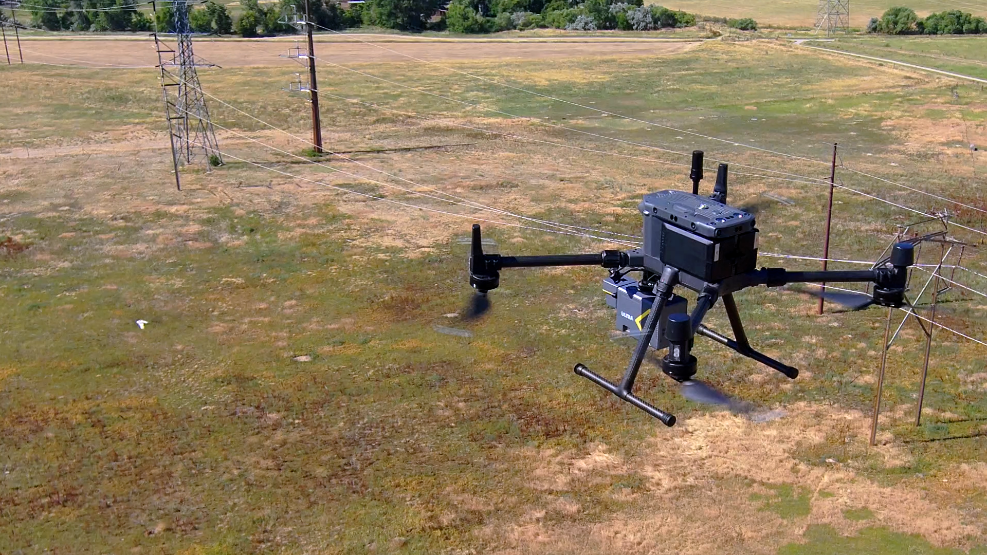
Seamless Aerial LiDAR Workflow for Utility Corridor Powerline Management with the ROCK Ultra
Oct 10, 2025
In rugged Mountain West terrain, utility corridor mapping demands altitude, coverage, and precision. For this case study, Big Sky Aerial Solutions—led by Austin Seback—put the ROCK Ultra drone LiDAR to work on a powerline vegetation-management and reconductoring project.
Flying 60 m AGL at 10 m/s in a single pass, the team captured a wide swath for hazard-tree identification, vegetation encroachment checks, and clean conductor detail across varied coniferous/deciduous cover.
About the Project
This utility corridor survey was part of a vegetation management and wildfire prevention initiative in the Mountain West. The goal: to analyze conductor-to-canopy distances, identify hazard trees, and create actionable data to support grid-hardening and encroachment mitigation.
Working with surveyors, engineers, and utility providers, Big Sky Aerial Solutions used the ROCK Ultra to deliver a single-pass data capture that reduced time in the field while maintaining centimeter-level accuracy.
Field experience & workflow
The mission ran on a DJI M300 with familiar calibration—no SOP rewrites for crews already using ROCK systems.
It was really straightforward and easy… same calibration as our R360, no changes to our workflow. Start to finish was seamless.
— Austin Seback, Big Sky Aerial Solutions
Key field notes:
- Altitude margin for safety: higher standoff from tall trees and terrain undulations.
- Faster coverage: one pass at 10 m/s hit the deliverables without doubling back.
- Time on site: receivers, calibration, two flights, and pack-up in under four hours—home before afternoon winds.
Why high-altitude LiDAR mattered here
- Vegetation management / encroachment: broader field of view around the corridor to flag leaning, dead, or overstrike-risk trees.
- Ground truth under canopy: reliable ground penetration for true tree-height calculations and clearance analysis.
- Utility detail that holds up at speed and altitude: clean conductors span-to-span and even guy-wires at tangent poles.
We didn’t have any fuzz around the lines. It’s very clear conductor detail from span to span, which really helps the digitization process.
— Austin Seback
Data quality & deliverables
Austin reported less noise and more precision than prior setups at similar or lower altitudes—while maintaining strong penetration through leafy ground cover (e.g., willow and alder). That clarity makes it easier for engineers and drafters to:
- Digitize conductors and guy-wires
- Classify vegetation and assess clearances
- Produce reconductoring and grid-hardening design inputs
- Validate trimming outcomes against before/after datasets
We’re flying higher now with Ultra and getting a larger field of view with the same level of detail—if not more.
— Austin Seback
Dataset visuals
Explore selected stills from the utility-corridor dataset:
Platform notes & iteration
A minor strip-alignment quirk surfaced with a non-standard flight pattern and has already been addressed in ongoing ROCK Desktop improvements—part of the Ultra Demo Tour’s rapid feedback loop supported by ROCK Pro Services.
About the ROCK Ultra LiDAR

Introducing the ROCK Ultra LiDAR: The “Easy Button” for Pro LiDAR
The ROCK Ultra LiDAR is a next-generation aerial LiDAR sensor meticulously engineered for high-efficiency mapping and exceptional vegetation penetration. As part of an end-to-end ecosystem, ROCK Ultra, ROCK Cloud, and ROCK Desktop work together so teams can fly higher and faster while maintaining superior data quality.
Services and Capabilities:
- Industry-Leading 7 Returns Per Pulse: With seven echo returns, the Ultra’s 1550 nm laser penetrates dense canopy to capture true ground data where other systems fail—yielding cleaner bare-earth models and fewer re-flights.
- Extended Range and Altitude: Up to 1000 m effective range; max 450 m AGL capability (operate within local regs). Confidently fly 400 ft / 120 m AGL for safer standoff and simpler mission planning.
- Enhanced Safety and Data Quality: 1550 nm is ~40× safer than 905 nm systems, enabling higher power output, stronger signal-to-noise in bright sunlight, and a smaller spot size for higher ground resolution at 100 m. Class 1 eye-safe.
- End-to-End Ecosystem Integration: Pre-process in the field with ROCK Desktop, then upload to ROCK Cloud for storage, analysis, and one-click professional deliverables (DTMs, contours, planimetrics).
- Lightweight Design: 1.21 kg (sensor) or 1.40 kg with 26 MP camera—about 60% lighter than comparable long-range systems for excellent flight performance.
The ROCK Ultra is ready to fly out of the box and includes the LiDAR unit, Pelican case, calibrated 26 MP or 45 MP camera, 256 GB high-speed USB drive, Gremsy universal mount for DJI M300/M350, a ROCK Cloud subscription, ROCK Desktop software, training & certification, and U.S.-based technical support.
Technical summary
- Collected by: Big Sky Aerial Solutions + ROCK Robotic
- Location: Mountain West utility corridor (mixed coniferous/deciduous cover)
- Drone: DJI M300
- Flight profile: 60 m AGL, 10 m/s, single pass
- Use case: Vegetation management, encroachment checks, reconductoring support, grid hardening
- Outputs: Raw point cloud, classification, conductor & guy-wire extraction, surface models, clearance analytics
Start your next utility survey with ROCK Ultra
Whether you’re mapping long corridors, validating vegetation clearances, or modernizing grid inspections, ROCK Ultra combines power, precision, and reliability—built for professionals who demand dependable results.