Mapping Mudslides: ROCK Ultra LiDAR Supports Fire Recovery at Utah’s Buckley Draw
Oct 02, 2025
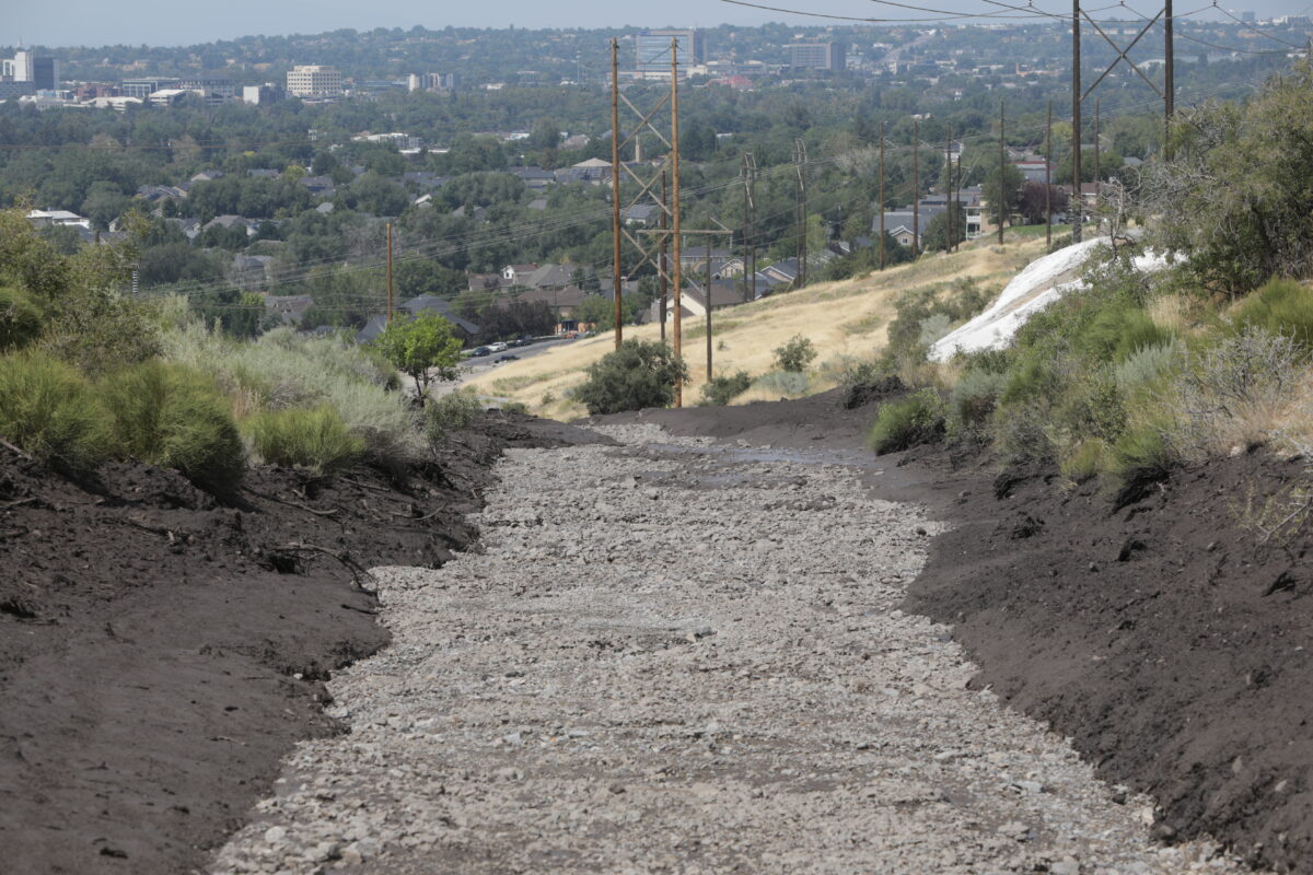
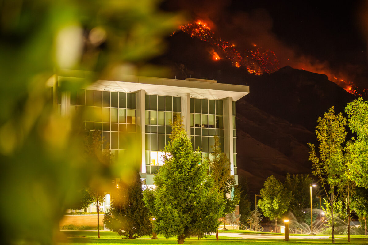
In the summer following a devastating wildfire in the Wasatch Mountains above Provo, Utah, a sudden storm unleashed a destructive mudslide through Buckley Draw. The debris flow carried tons of material downslope, filling roads, structures, and even pushing four feet of mud inside a local church.
City leaders turned to Sunrise Engineering, who deployed the ROCK Ultra drone LiDAR to map nearly 900 acres of steep terrain. The mission’s goal: capture survey-grade aerial data that could be compared with historic LiDAR, helping geotechnical engineers analyze the slide and plan mitigation.
Why drone LiDAR was critical
The steep Wasatch slopes posed unique challenges:
- Extreme elevation gain from takeoff to peak
- Rapidly changing ground conditions after fire and rain
- Dense vegetation in adjacent areas
- Emergency turnaround requirements
By flying higher, Sunrise could safely survey dangerous slopes without sacrificing accuracy.
At 400 AGL, the power lines are still solid. There’s no gaps in the data, no missing data. The dataset was clean, without the fuzziness we’ve seen elsewhere.
— Kevin Dawson, Sunrise Engineering
Field experience
The ROCK Ultra allowed Sunrise to map 878 acres of rugged terrain while maintaining efficiency. Even with hot swaps on such a large site, the workflow remained smooth.
We turned it around quickly—on site the day after the call, flew the next day. It’s helping the city and their geotechnical engineers analyze ongoing risk.
— Burton Christensen, Sunrise Engineering
Data quality and insights
The resulting dataset offered clean, detailed surfaces suitable for engineering analysis:
- Drainage & flow lines where debris traveled into town
- Power line clarity even at higher altitudes
- Surface cleanliness with minimal noise
- Adjacent vegetation penetration for accurate bare-earth modeling
Jamie Lackner from ROCK Pro Services reviewed the deliverables and highlighted the ability to see subtle ground features, trails, and drainage paths in the surface model—information critical for future slide mitigation planning.
Dataset visuals
Explore the ROCK Ultra Buckley Draw dataset below:
Technical summary
- Collected by: Sunrise Engineering + ROCK Robotic
- Location: Buckley Draw, Provo, Utah
- Total area covered: ~878 acres
- Flight height: High-altitude terrain-following (up to ~400 ft AGL)
- Flight type: Wildfire + mudslide mapping for geotechnical analysis
- Outputs: Raw point cloud, classification, elevation models, contours, orthomosaic
About the partner
Sunrise Engineering has provided surveying, laser scanning, and aerial LiDAR services for nearly three decades, supporting mining, energy, infrastructure, and municipal projects across the U.S. and internationally.
Start your next survey with ROCK Ultra
Whether facing post-wildfire recovery, mudslide analysis, or high-relief topography, the ROCK Ultra delivers the accuracy and efficiency surveyors need to make critical decisions faster.