ROCK Robotic Unveils ROCK Ultra LiDAR, Enabling Surveyors to Map 2-3x More Area Per Flight
Aug 10, 2025
FOR IMMEDIATE RELEASE
ROCK Robotic Unveils ROCK Ultra LiDAR, Enabling Surveyors to Map 2-3x More Area Per Flight with New 'Easy Button' Workflow
DENVER, CO – August 19, 2025 – ROCK Robotic, a leader in LiDAR mapping technology, today announced the launch of the ROCK Ultra, a next-generation professional airborne LiDAR system engineered to transform the efficiency and simplicity of large-scale surveying projects. The Ultra combines a powerful, long-range 1550 nm laser and a tactical-grade IMU, allowing professionals to fly at maximum legal altitudes (up to 120m / 400ft AGL) and cover 2-3 times more ground per flight compared to standard systems, all without compromising survey-grade accuracy.
The ROCK Ultra introduces an "Easy Button" for mission planning. Its exceptional range makes ground obstacles like trees, power lines, and towers irrelevant, enabling pilots to execute simple, high-altitude grid patterns over vast and complex terrains. This drastically reduces the mission planning complexity and pilot skill required, making it easier for businesses to train staff and scale operations.
“The ROCK Ultra is a fundamental simplification of the entire drone LiDAR workflow,” said Harrison Knoll, CEO of ROCK Robotic. “We designed it to solve the biggest pain points for professionals mapping large areas: time and complexity. By enabling high-altitude flights, we’re not just increasing coverage; we’re making the entire process faster, safer, and more accessible, from the field check to the final deliverable.”
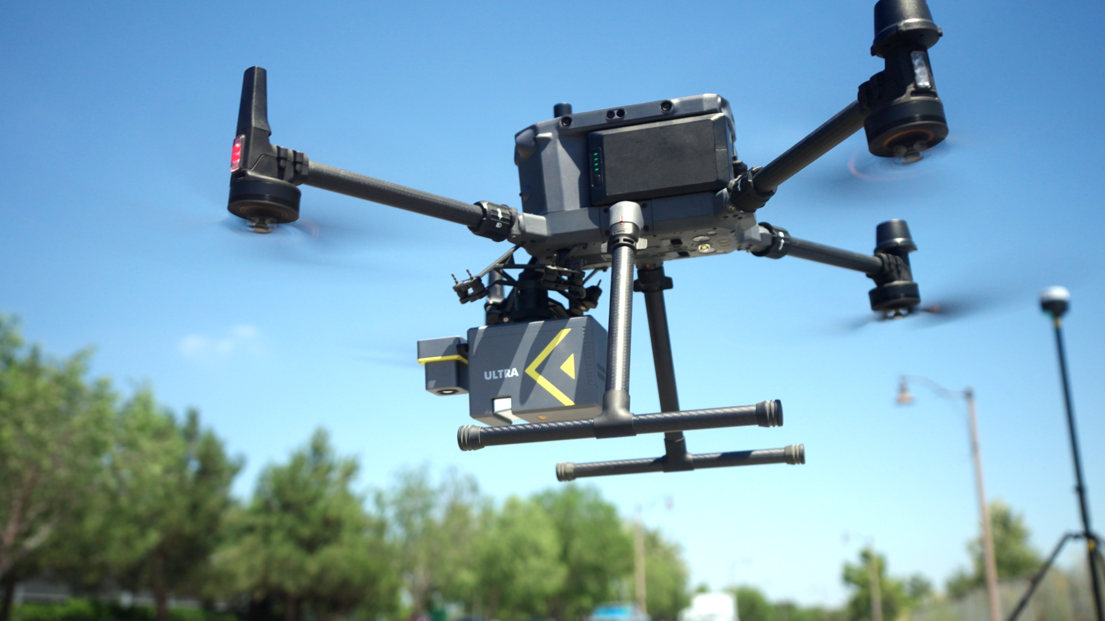
Key features and benefits of the ROCK Ultra include:
- Unmatched Range & Efficiency: A 1,000-meter measurement range allows for flights at 400ft/120m AGL, maximizing coverage and reducing field time.
- Superior Vegetation Penetration: The 1550 nm laser captures up to 7 echo returns, reliably penetrating dense vegetation to capture the true ground surface.
- Focused Data Density: A focused 90° Field of View directs all 1,000,000 points per second onto the project area, creating a denser, more effective point cloud than typical 360° systems.
- Lightweight & Versatile Design: At just 1.4 kg with its camera, the Ultra is one of the lightest long-range systems available, ensuring long flight times on standard drones like the DJI M350.
- Integrated Ecosystem: The system works seamlessly with ROCK Desktop for in-field QC, ROCK Cloud for processing and analysis, and ROCK Pro Services for one-click professional deliverables.
The system's capabilities were recently demonstrated by Florida Design Consultants, Inc., who used the ROCK Ultra to survey a complex 500+ acre residential site in Zephyrhills, Florida. The team completed the entire project in a single 70-minute flight.
We would have been out there two or three days, just cycling batteries, trying to keep up to get this entire site done [with our old system],” said Brian Drinkwater, Survey Project Manager at FDC. “We did this one in an hour and ten minutes of air time. It’s a huge benefit.”
The ROCK Ultra is available now and shipping worldwide. It is the ideal solution for land surveyors, civil engineers, forestry managers, and other professionals who need to map large areas efficiently without compromising on the quality of their data.
About ROCK Robotic
ROCK Robotic is a Denver, Colorado-based technology company that develops advanced LiDAR systems and integrated software platforms for 3D mapping and spatial data capture. Their products and services cater primarily to the land surveying, construction, utilities, and forestry sectors. ROCK Robotic offers a comprehensive ecosystem that emphasizes precision, efficiency, and ease of use, enabling professionals to capture and process high-resolution spatial data in complex environments.
Media Contact:
ROCK Robotic Marketing Team
Email: hello@rockrobotic.com
Phone: +1 (720) 706-8648
Website: www.rockrobotic.com