Meet the ROCK R3 V2: The 3-in-1 LiDAR for Aerial, SLAM & Mobile Mapping — Delivering Survey-Grade Accuracy at a Smart Price
Dec 04, 2025
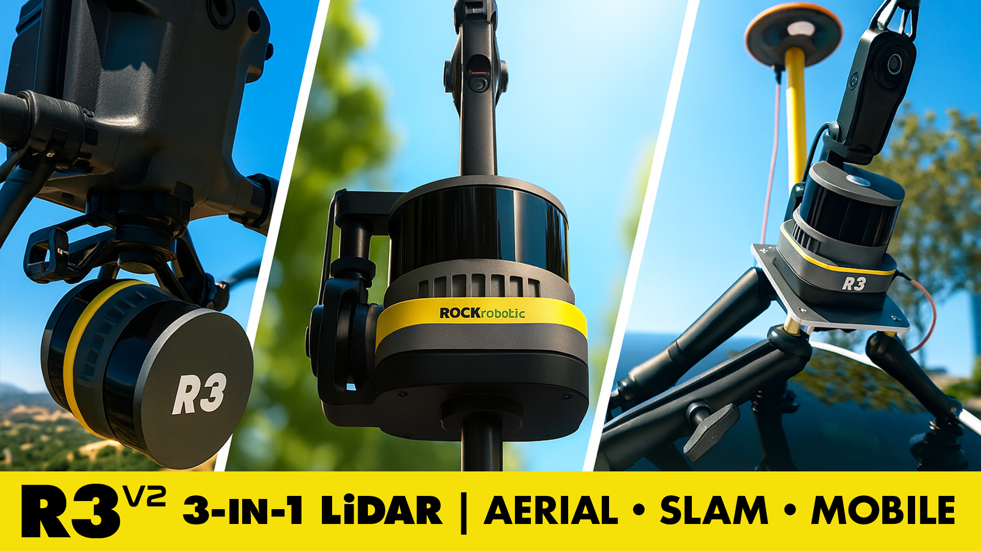
The ROCK R3 V2 is a versatile 3-in-1 LiDAR system engineered for professionals who need survey-grade precision in a compact, easy-to-use package.
Designed for aerial, handheld (SLAM), and mobile mapping, the R3 V2 captures up to 640,000 points per second with a 360° field of view, delivering dense, accurate point clouds across any environment — from residential neighborhoods to urban corridors.
Weighing just 1.26 kg, the R3 V2 is optimized for drones, vehicles, and handheld SLAM operation, giving surveyors, engineers, and geospatial professionals flexibility in every project. Backed by the ROCK Cloud, ROCK Desktop, and ROCK Pilot ecosystem, it offers a true field-to-finish LiDAR workflow, bringing professional results to more teams at a smart price.
Key Specs
- 16-channel Hesai Pandar XT16 LiDAR sensor
- 640k points/sec • 360° FOV • 5 mm range precision
- 2–3 cm system accuracy @ 40 m AGL
- 26 MP RGB camera for colorized point clouds
- Compatible with
- Optional ROCK SLAM Dock V2 for indoor or GNSS-denied environments
- Fully integrated with ROCK Cloud and ROCK Desktop
- Weight 1.26 kg • Power 25 W
Aerial LiDAR Data — South Bay Residential Dataset
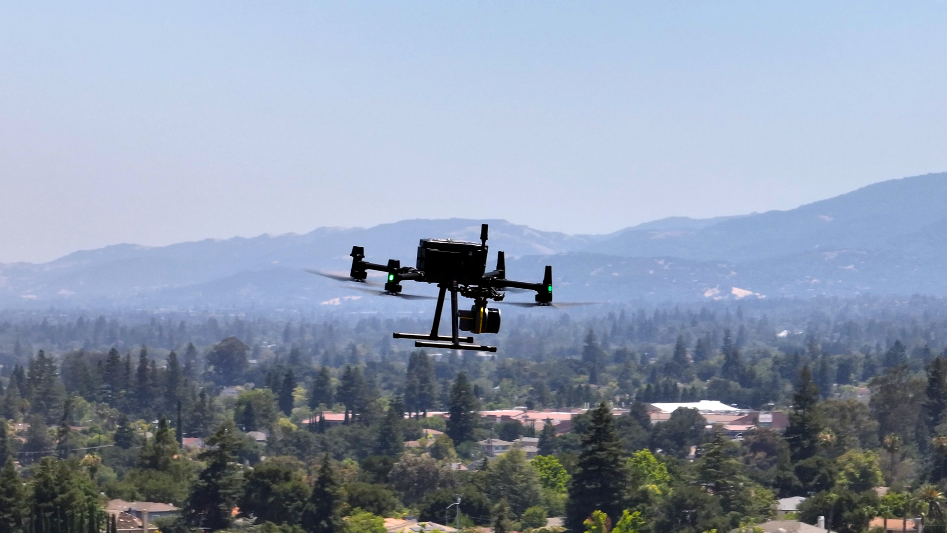
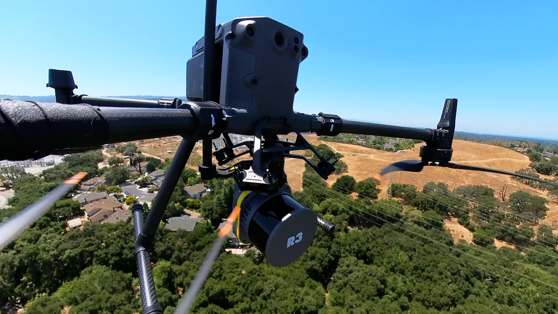
The ROCK R3 V2 excels in aerial LiDAR mapping applications — capturing high-density, survey-grade data across residential environments with ease.
Its lightweight design and wide compatibility with leading drone platforms like the DJI M300, DJI M400, Freefly Astro MAX, and IF800 Tomcat make deployment simple and reliable.
With dual return capability and 2–3 cm absolute accuracy, the R3 V2 captures rooftops, trees, and ground detail with precision. Once collected, data is processed seamlessly through ROCK Cloud, producing colorized 3D models ideal for topographic mapping and land development analysis.
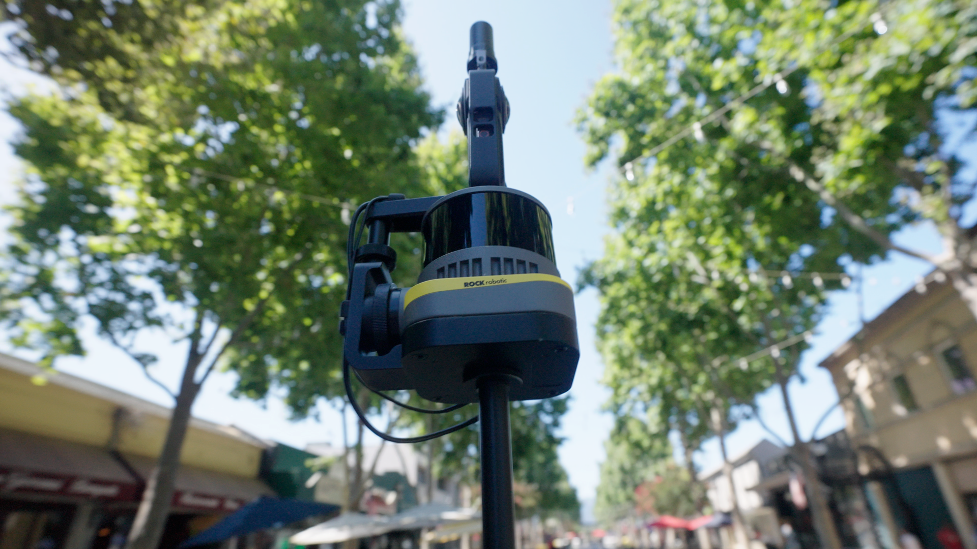
SLAM LiDAR Data — Downtown Mountain View Dataset
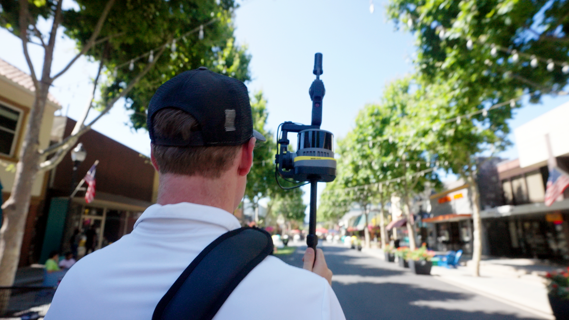
When your project moves into GNSS-denied environments, the R3 V2 converts into a handheld SLAM scanner using the ROCK SLAM Dock V2, powered by ROCK SLAM Technology.
This configuration makes mapping tight corridors, tunnels, or underpasses simple and efficient. Add the optional Insta360 camera to capture 360° photospheres using ROCK Inspect, enabling visual inspection capabilities directly within ROCK Cloud. Users can navigate inspection photospheres, click anywhere on the LiDAR data, and instantly view corresponding imagery for precise spatial context.
All data aligns and colorizes automatically in ROCK Cloud, giving users a complete indoor mapping workflow that’s fast, reliable, and easy to master.
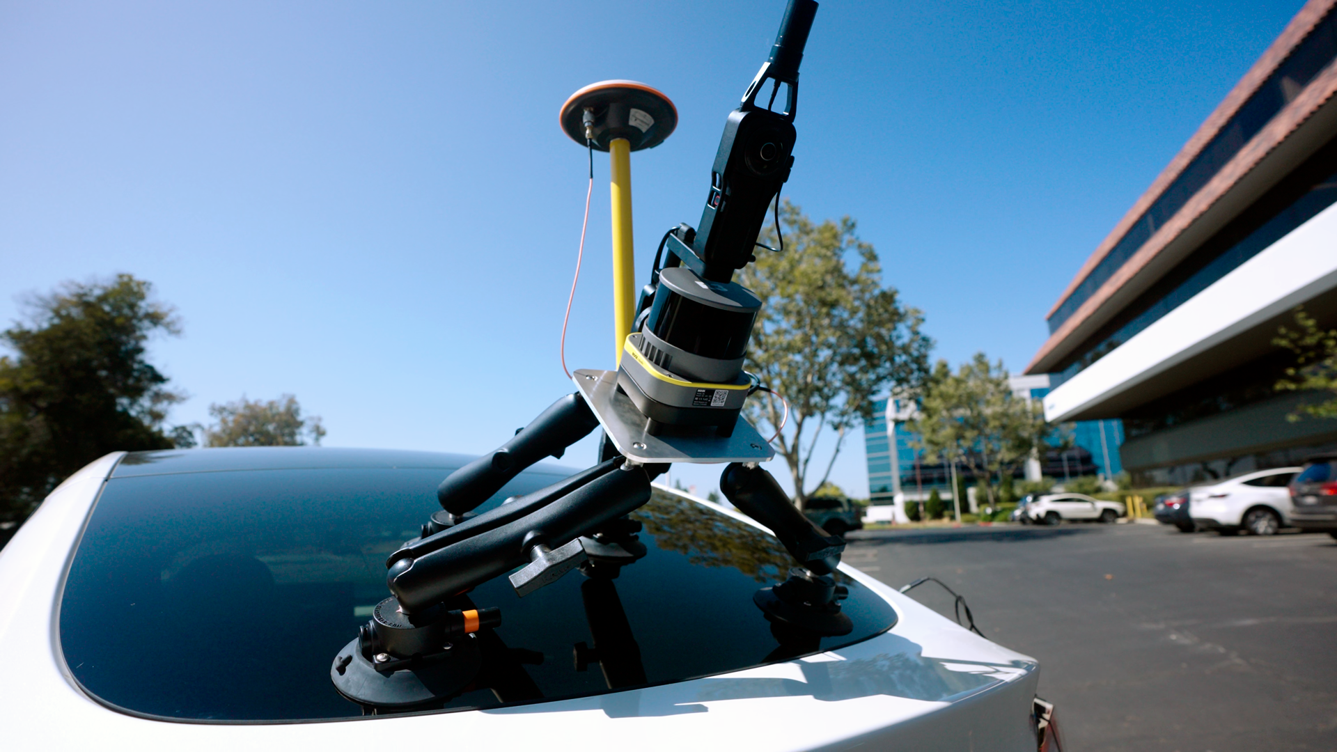
Mobile LiDAR Data — Downtown Denver Streets Dataset
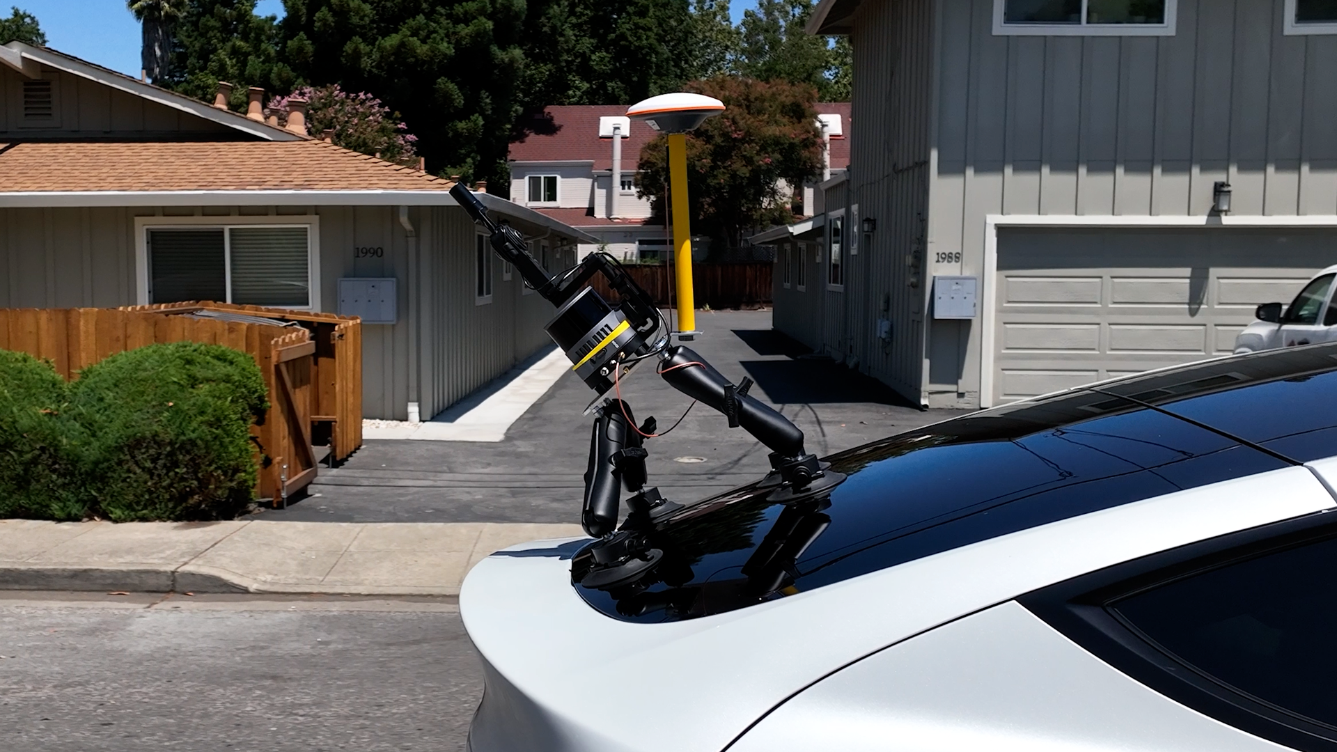
For long corridors or roadway environments, the R3 V2 supports full mobile LiDAR mapping through the ROCK Mobile Mount.
Mounted securely to a vehicle, the R3 V2 captures continuous, high-accuracy data while driving through city streets — ideal for infrastructure mapping, asset management, and large-scale urban surveys.
Data is processed through ROCK Desktop Mobile Processing, ensuring precise alignment and rapid turnaround for client-ready deliverables.
The ROCK Ecosystem — Cloud • Desktop • Pilot
ROCK’s connected ecosystem delivers a complete end-to-end mapping solution. Each component works together to streamline LiDAR capture, processing, and delivery.
- ROCK Cloud: Visualize, classify, and share LiDAR data directly in your browser.
- ROCK Desktop: Local processing software for PPK corrections, SLAM alignment, and dataset management.
- ROCK Pilot: Drone flight app for live LiDAR feedback, smart mission planning, and real-time validation.
More Than Hardware — ROCK Support That Works With You
When you purchase a ROCK LiDAR, you’re investing in more than just a device — you’re gaining a full support network committed to your success.
- ROCK Customer Success — U.S.-based representatives dedicated to helping you from setup through project completion.
- ROCK Pro Services — A professional data processing team that helps QC/QA your data, deliver mapping products, and support large or complex projects.
- ROCK Academy — Training hub designed to teach you how to fly, capture, process, and deliver LiDAR data effectively.
ROCK Robotic has seriously helped our survey business get to a new level of service and productivity. Highly recommend ROCK Pro Services and their LiDAR equipment.
— Davy J., D.C. Johnson & Associates, Inc.
With ROCK, you’re not just buying a LiDAR sensor — you’re getting a complete mapping partner that acts as an extension of your team. From field setup to deliverables, ROCK is there to help you work smarter, faster, and with confidence.
Professional LiDAR Made Accessible
The ROCK R3 V2 brings survey-grade accuracy, multi-mode flexibility, and a smart price point that opens LiDAR mapping to a broader range of professionals.
Whether you’re scanning residential neighborhoods, detailed interiors, or miles of downtown streets, the R3 V2 delivers performance that rivals top-tier systems at a fraction of the cost.
If you need even more power, explore the ROCK R3 Pro V2, featuring a 32-laser configuration for higher-density data and extreme precision.