Introducing ROCK Ultra: Survey-Grade Aerial LiDAR from 120m with No Compromises — See the Data
Jul 28, 2025
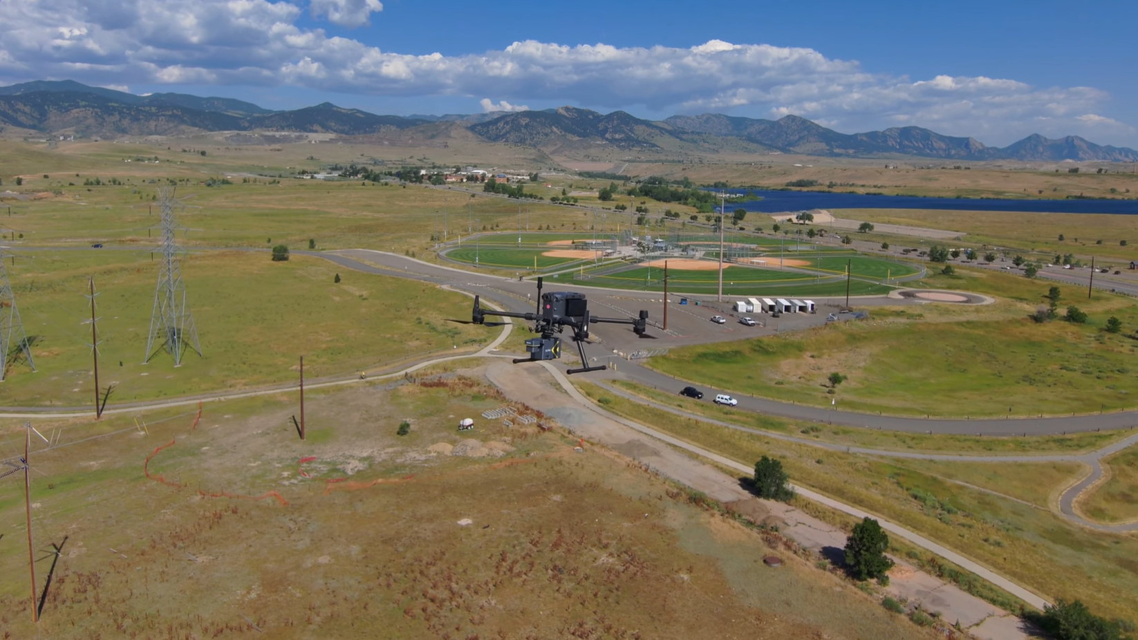
Join ROCK Robotic’s Customer Success team as they take the brand-new ROCK Ultra on its first full project demo tour — delivering unmatched precision, clarity, and efficiency at heights previously thought impossible.
For years, drone LiDAR operators have faced a balancing act: flying low for detailed resolution or flying high for safety and coverage. The ROCK Ultra changes the game — no compromises, just pure performance.
Breaking the Resolution-Altitude Barrier
With over five years of experience working alongside thousands of surveyors on the world’s most challenging projects, ROCK Robotic has developed a LiDAR system that captures survey-grade accuracy at altitudes up to **450 meters (1,400+ feet) AGL. **The result? Detailed, accurate data from heights that were once off-limits.
"It’s always been a fight between resolution and height. With the ROCK Ultra, you no longer have to choose.”
— Andrew Genco, ROCK Senior Customer Success Engineer
What Sets the ROCK Ultra Apart?
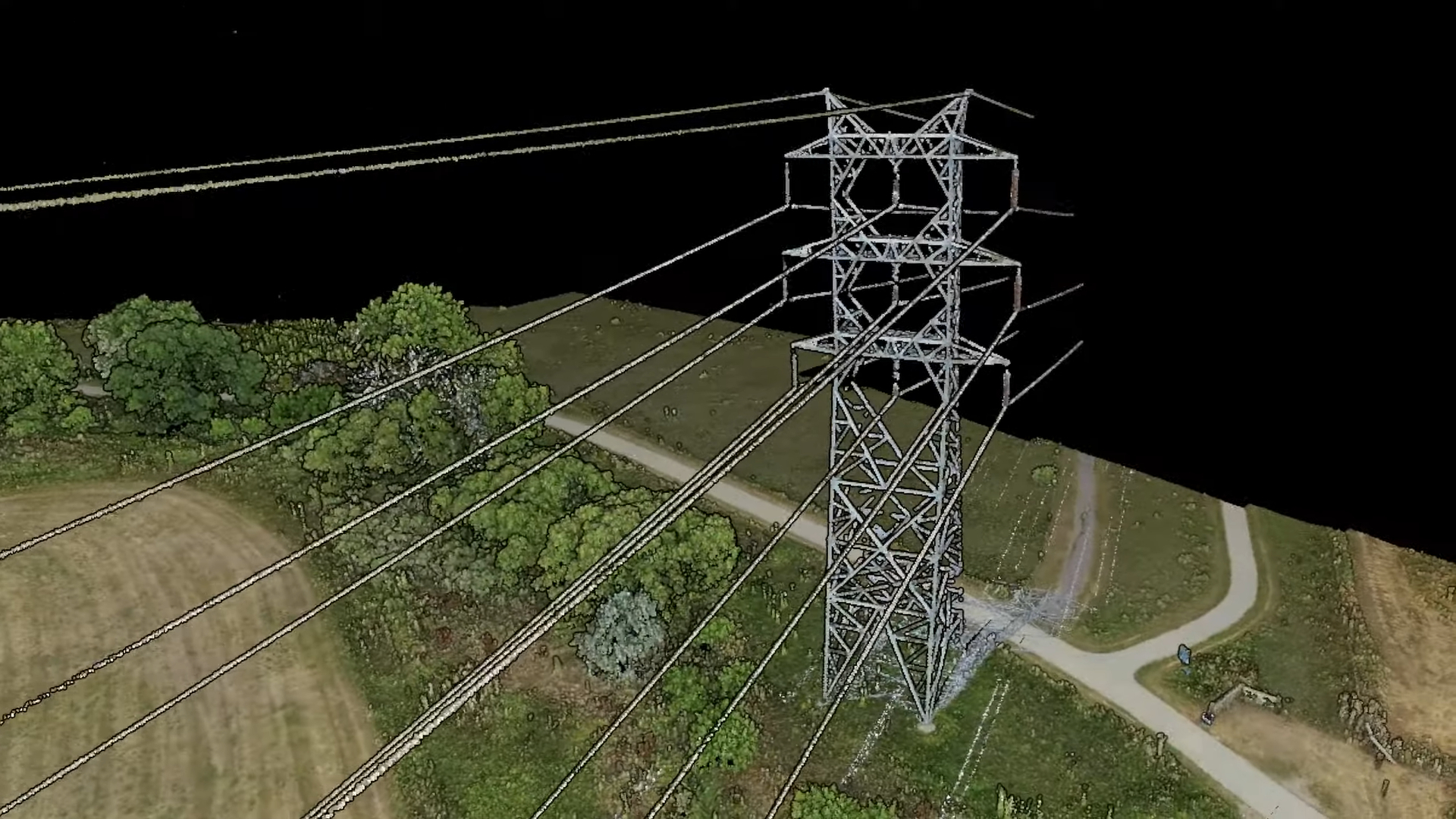
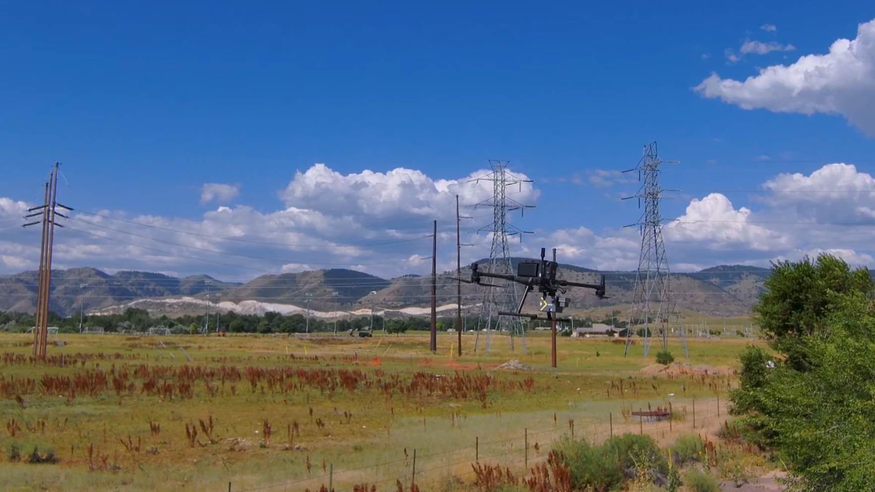
**Unrivaled Detail Through Dense Vegetation: **The advanced sensor technology captures intricate features others miss — think continuous power lines, complex wire structures, and creek beds, all sharply defined even at altitude.
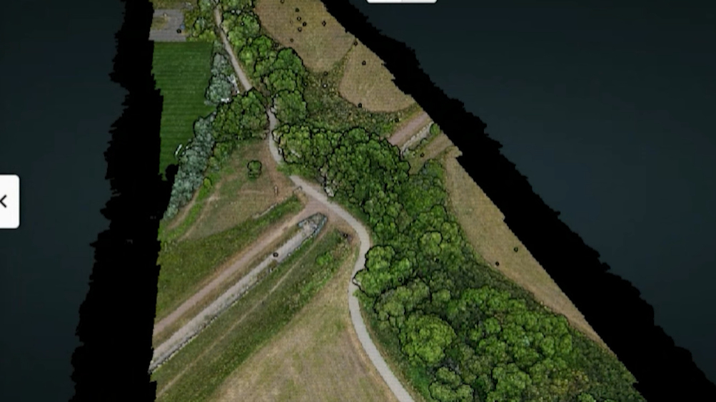
Seven Returns Per Pulse: This breakthrough enables penetration of thick vegetation and canopy, revealing ground features with astonishing clarity.
Single-Pass Efficiency: Cover hundreds of acres in minutes without multiple flight passes — saving roughly 80% of your flight time.
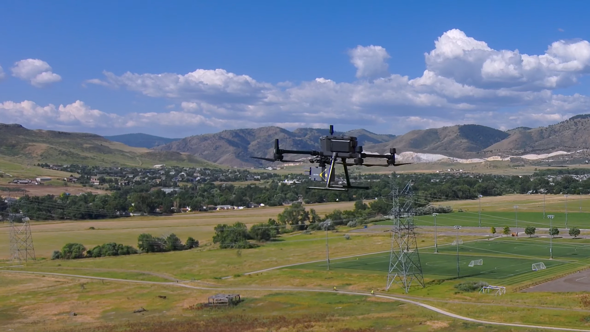
Improved Flight Safety: Fly confidently at higher altitudes, clearing tall utility lines and maintaining excellent line of sight with ease.
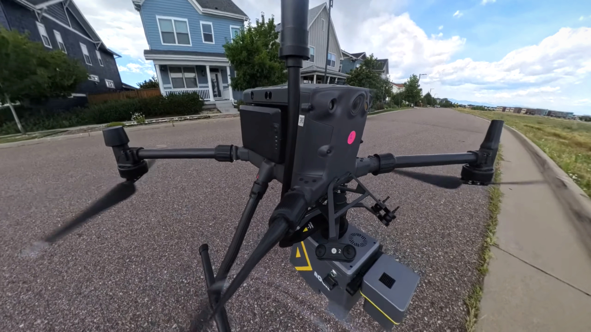
**Extended Flight Time & Battery Efficiency: **No mid-mission battery swaps required. Complete your mission on a single flight, reducing downtime and mental load.
Insights from the Field: Customer Success Team Reactions
“My jaw literally dropped the first time I saw data from the ROCK Ultra... the colorized point cloud was incredibly sharp and detailed — curves and features that usually need low and slow flights came through crystal clear even from 120 meters.”
— Jamie Lackner, ROCK Pro Services Manager
The team emphasized how the ROCK Ultra's seven returns per pulse provided exceptional depth, capturing everything from power lines to creek beds with precision.
Safety is also a game-changer according to Andrew: “Flying higher not only boosts safety but makes maintaining line of sight easier, especially over varied terrain.”
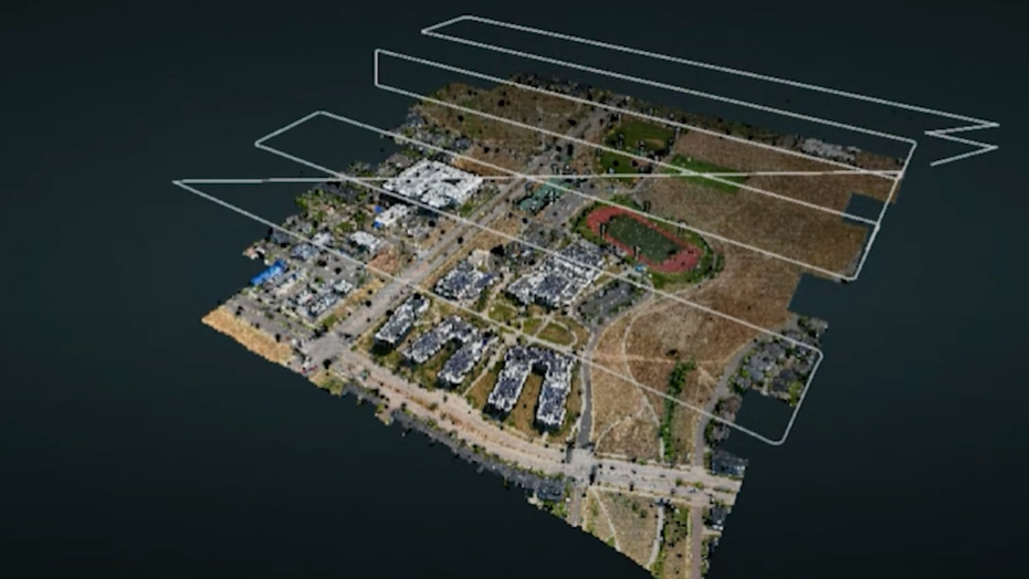
ROCK Pro Services Deliverables from ROCK Ultra flight at 120m (400 feet) AGL
Cover More Ground in Less Time
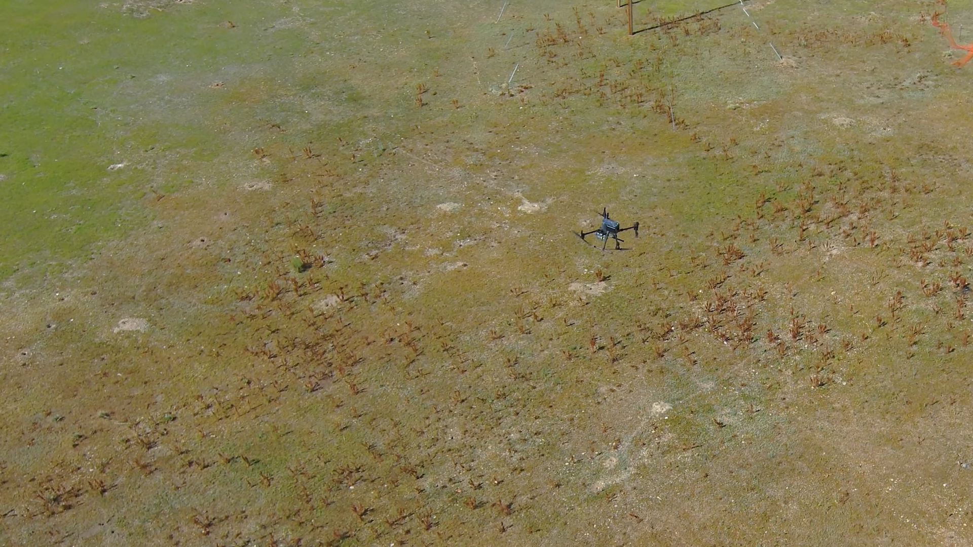
Imagine mapping 100 acres in under four minutes, capturing every essential detail without compromise. That’s the speed and accuracy ROCK Ultra delivers.
Faster project completion means more jobs, bigger scopes, and satisfied clients — all with survey-grade confidence.
Why ROCK Ultra Beats the Competition
While others force you to trade safety for detail or speed for accuracy, ROCK Ultra offers:
- High-altitude flights with no loss in data quality
- Survey-grade accuracy at unprecedented speeds
- Robust data capture through challenging vegetation
- Simplified field operations with longer flight times
- Full backing of the industry’s trusted leaders in drone LiDAR
ROCK Ultra gets the job done
Ready to Elevate Your Surveying Workflow?
Whether it’s utility corridor mapping, dense vegetation penetration, or large-scale topographic projects, the ROCK Ultra is designed to push your capabilities forward.
ROCK Robotic is committed to real solutions for real problems. With ROCK Ultra, the future of drone LiDAR surveying is clearer, safer, and faster than ever before.
Contact the ROCK Team to learn how ROCK Ultra can transform your next project!
Sales: +1 (720) 706-8648 | Email: hello@rockrobotic.com | Visit rockrobotic.com/ultra