Knowledge hub
Insights, Guides, and Case Studies
Learn how surveyors and utilities teams turn raw LiDAR into professional deliverables with ROCK. Explore best practices, product walkthroughs, and real-world success stories powered by ROCK Cloud and ROCK hardware.
Apr 01, 2026
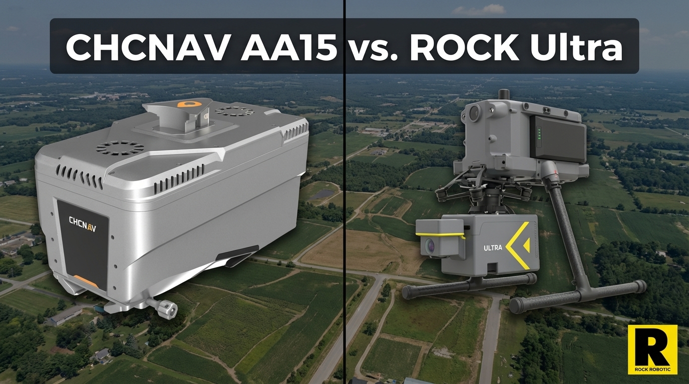
CHCNAV AA15: Monster Specs, But Can You Actually Deploy It?
The CHCNAV AlphaAir 15 has the longest range in the UAV LiDAR market — 1,800 m and 2M pts/sec on paper. Here's the practical reality of depl...
Apr 01, 2026
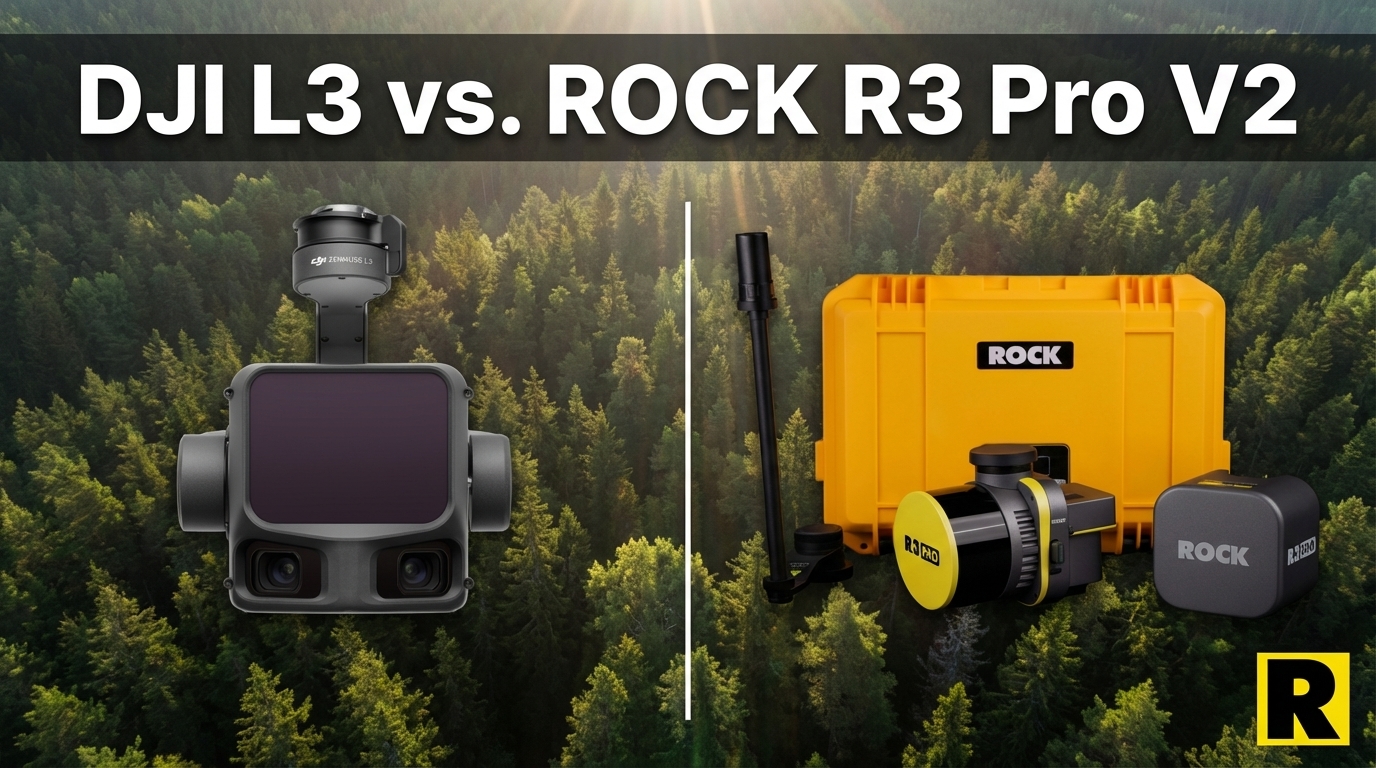
DJI L3 vs. ROCK R3 Pro V2: Different Tools for Different Businesses
The DJI Zenmuse L3 wins on aerial specs. But if your goal is to build a versatile, government-capable survey business, the R3 Pro V2 is a fu...
Apr 01, 2026
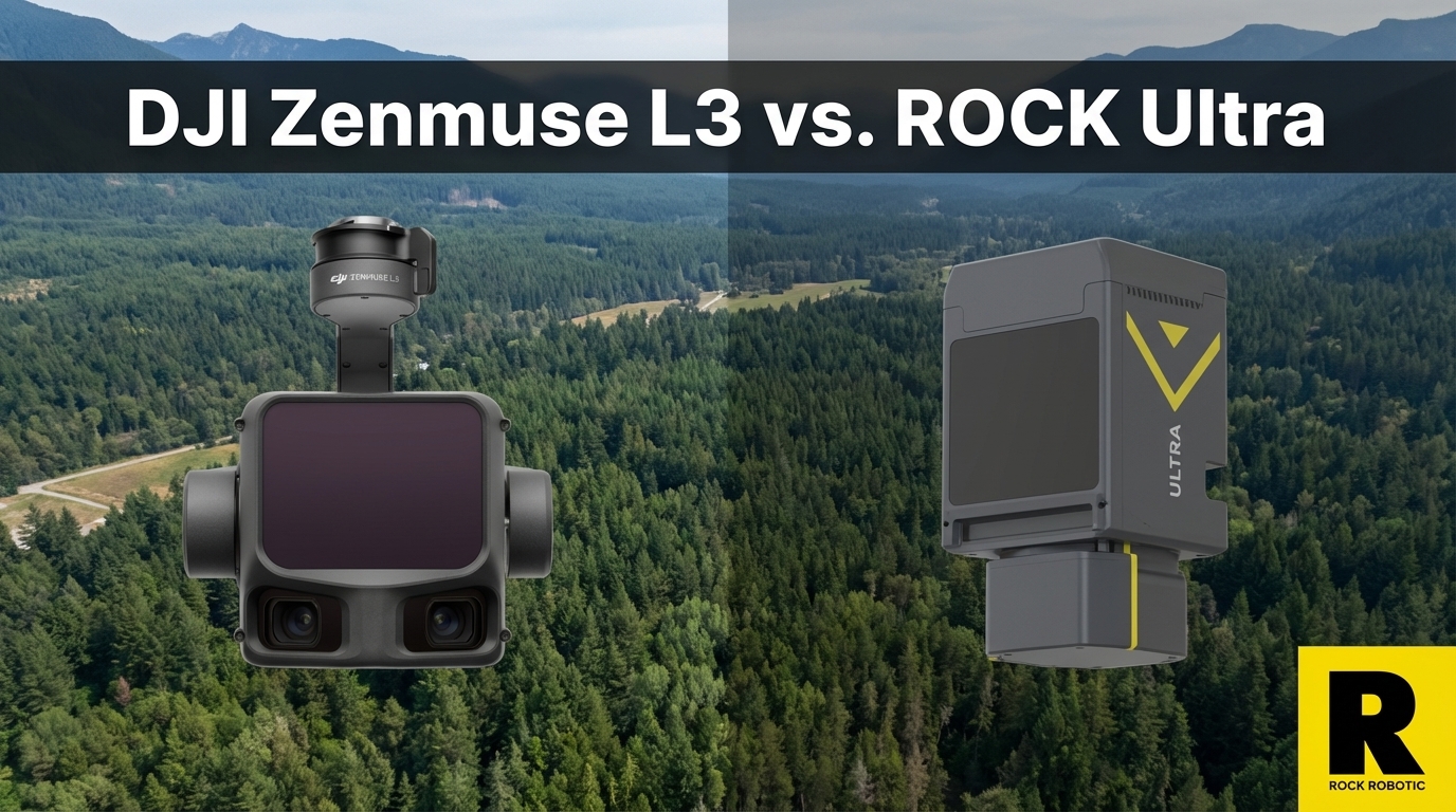
The DJI L3 Is Incredible. Here's Why We're Not Worried.
The DJI Zenmuse L3 is a genuinely impressive sensor at a disruptive price. Here's why ROCK Ultra customers aren't losing sleep — and what DJ...
Apr 01, 2026
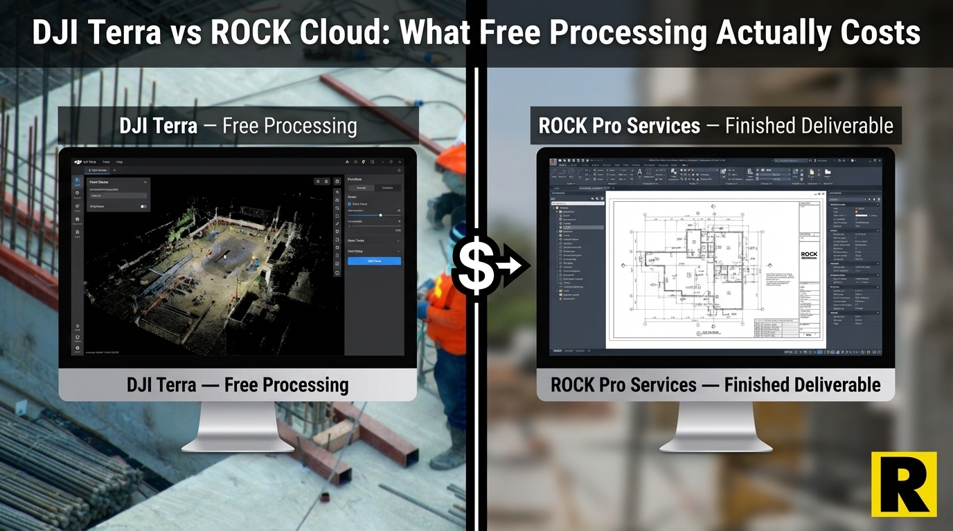
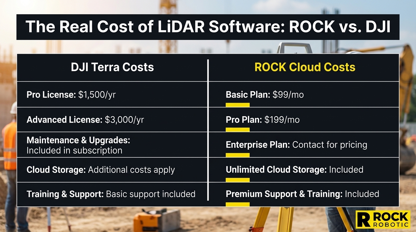
ROCK Cloud vs. DJI Terra: What "Free Processing" Actually Costs You
The DJI L3 comes with free point cloud processing in DJI Terra. But Terra gives you a raw point cloud — then what? Here is the real cost of ...
Apr 01, 2026
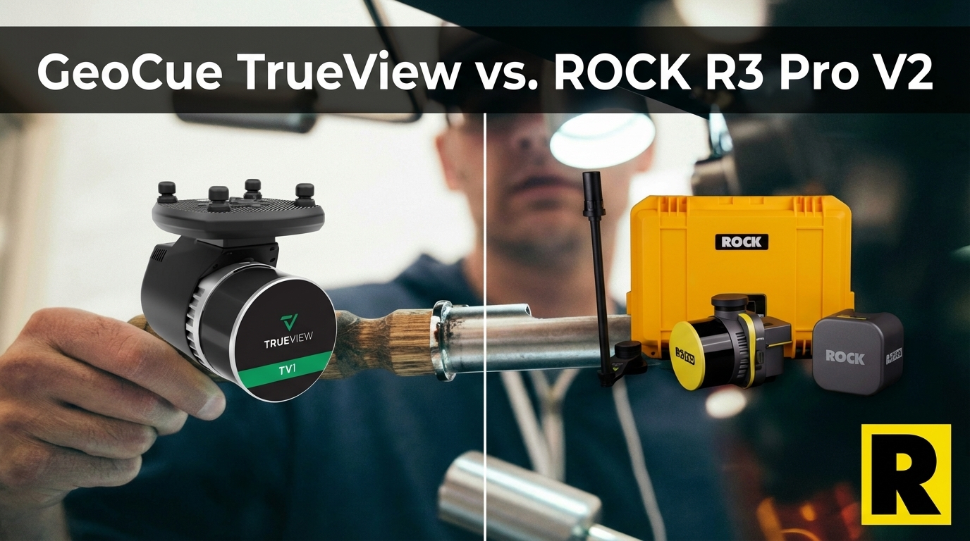
GeoCue TrueView vs. ROCK R3 Pro V2: Same Sensor, Different Ecosystem
GeoCue TrueView and ROCK R3 Pro V2 both run the Hesai XT32. The hardware is comparable. The difference is what happens after the flight — an...
Apr 01, 2026
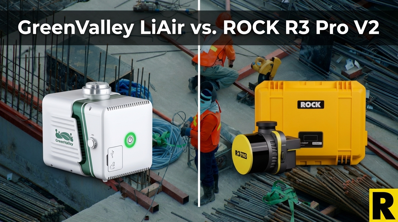
GreenValley LiAir X3C-H vs. ROCK R3 Pro V2: The Specs Match — The Ecosystem Doesn't
GreenValley's LiAir X3C-H uses the same Hesai XT32 as the ROCK R3 Pro V2. Same raw scan performance, similar weight. The difference is every...

Apr 01, 2026
The $4,000 Computer You Need to Run "Free" LiDAR Software
DJI Terra is free for L3 users. LP360 is $3,000/year. But neither of them mentions the $4,000-$8,000 workstation you need to actually run th...
Apr 01, 2026
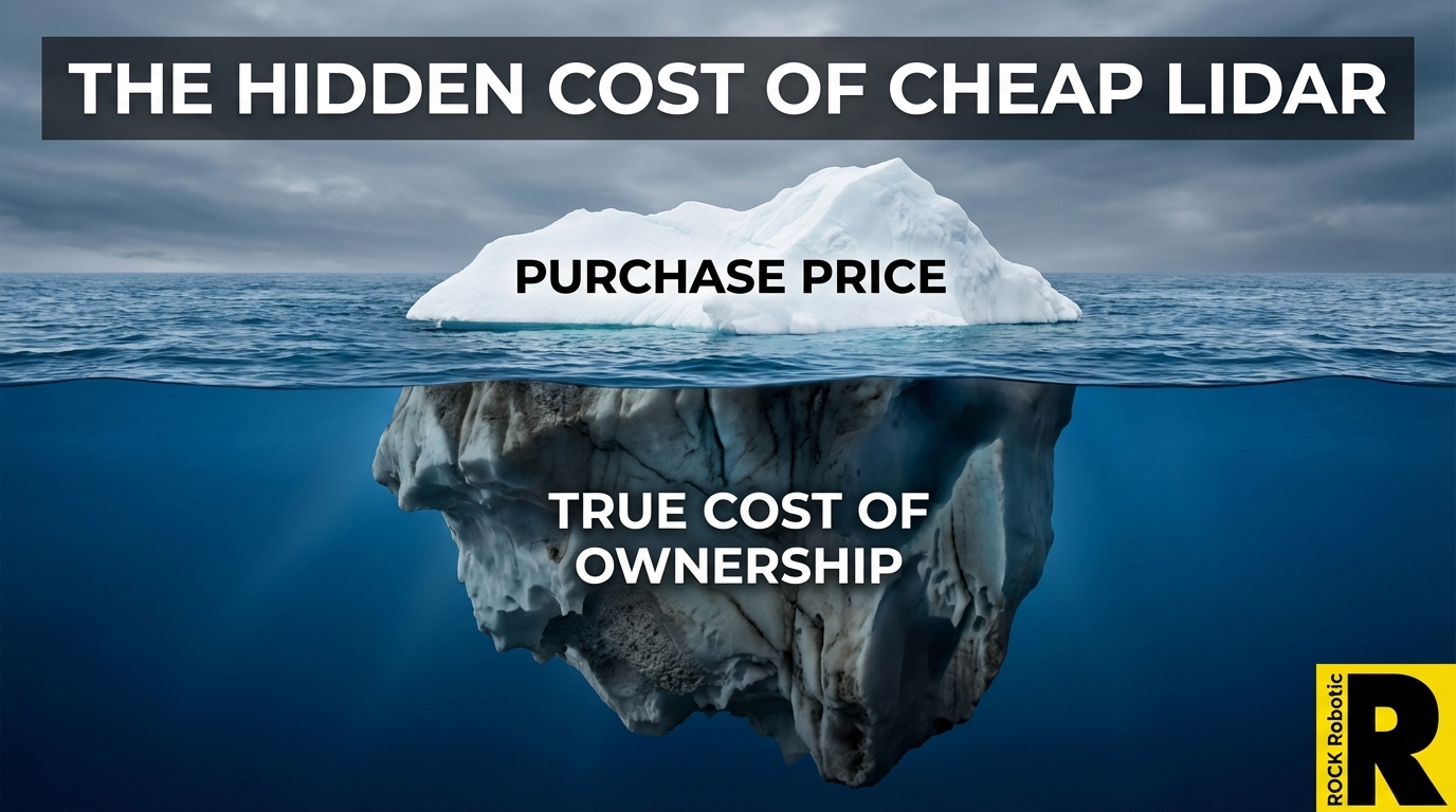
The Hidden Cost of Cheap LiDAR: What Spec Sheets Won't Tell You
The DJI L3 at $17,400 has made everyone focus on sensor price. That's the wrong metric. Total cost of ownership — hardware, software, proces...
Apr 01, 2026
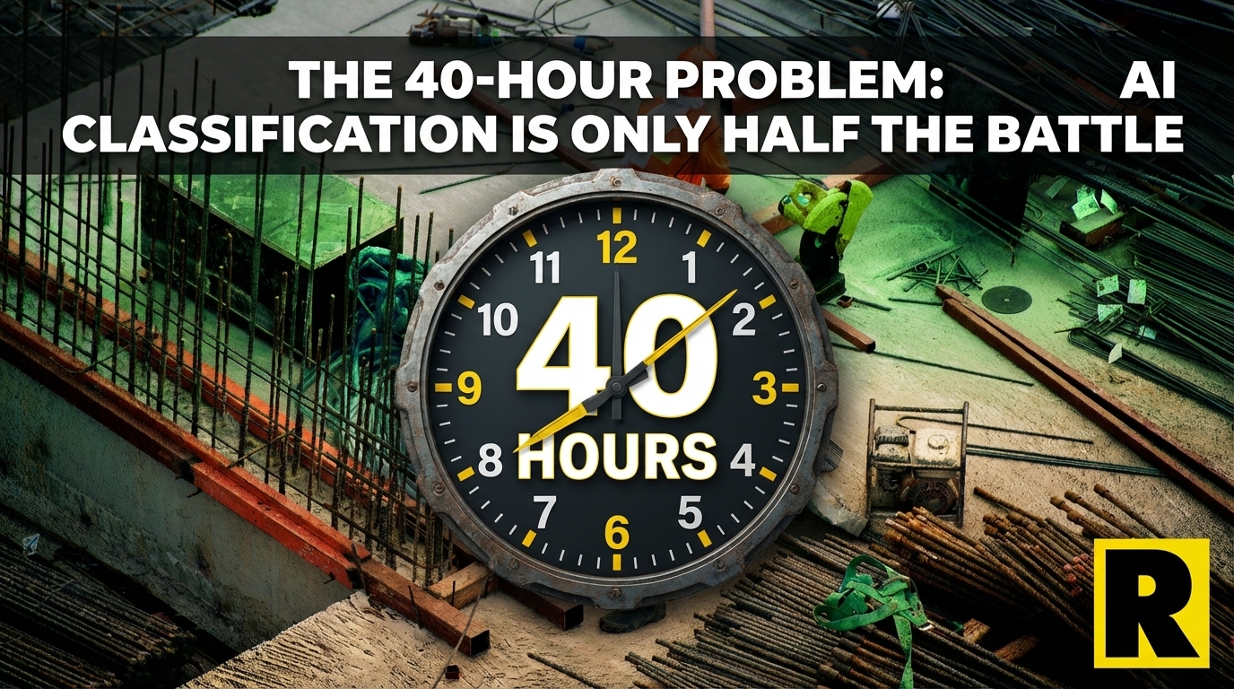
The 40-Hour Problem: Why AI Classification Is Only Half the Battle
Every LiDAR software company advertises automated AI ground classification. What they do not show you is the 30-50 hours of manual cleanup t...
Apr 01, 2026
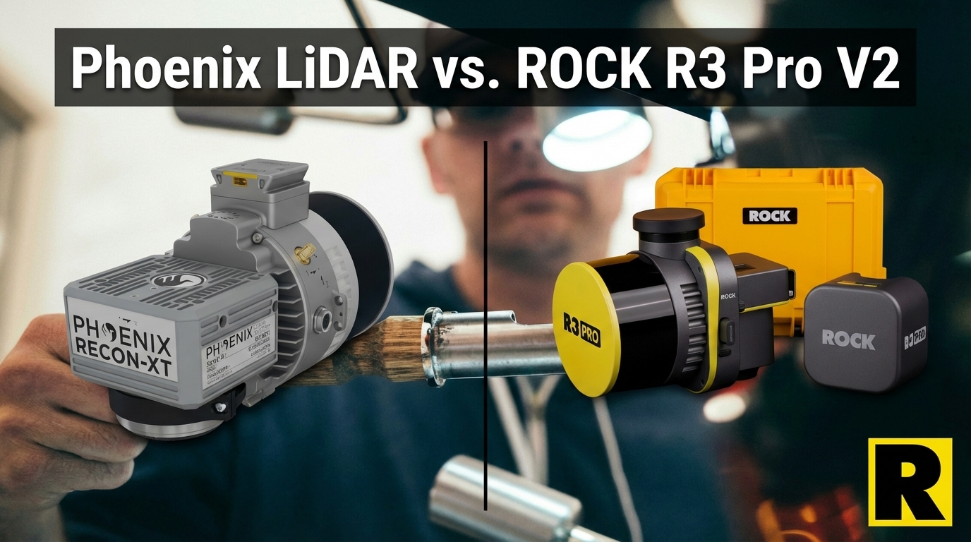
Phoenix LiDAR vs. ROCK R3 Pro V2: Legacy Prestige Meets Modern Workflow
Phoenix LiDAR (now Revolution Geosystems) has deep multi-platform DNA and Riegl-powered accuracy. But their systems are heavier, more expens...
Apr 01, 2026
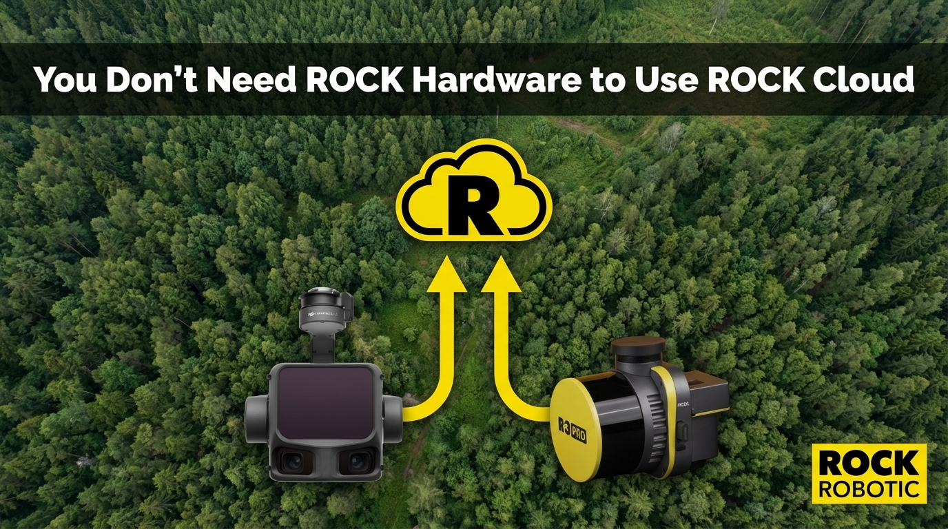
You Don't Need ROCK Hardware to Use ROCK Cloud
ROCK Cloud accepts LAS/LAZ files from any LiDAR sensor — DJI, GeoCue, YellowScan, Phoenix, or any brand. If you are processing data in Terra...
Apr 01, 2026
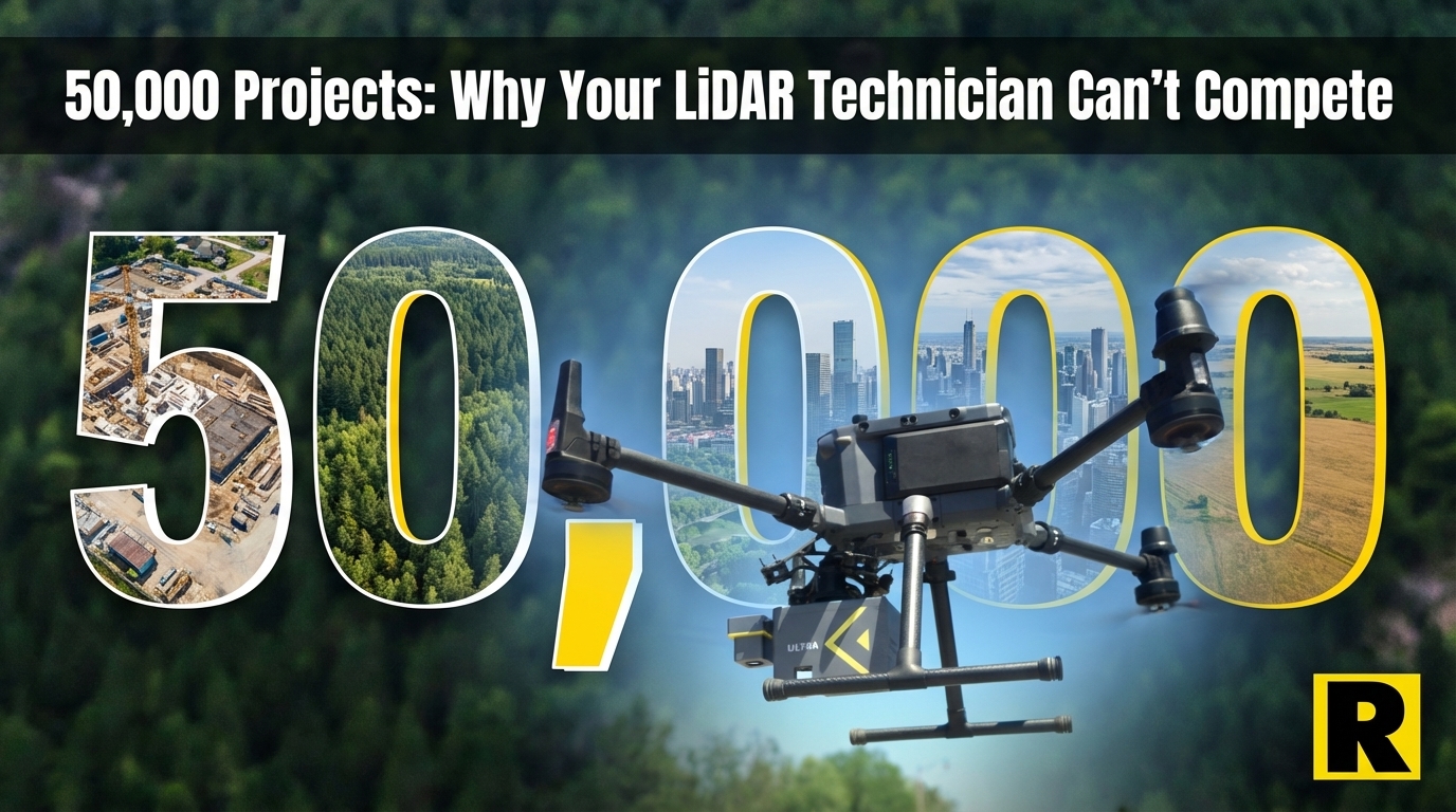
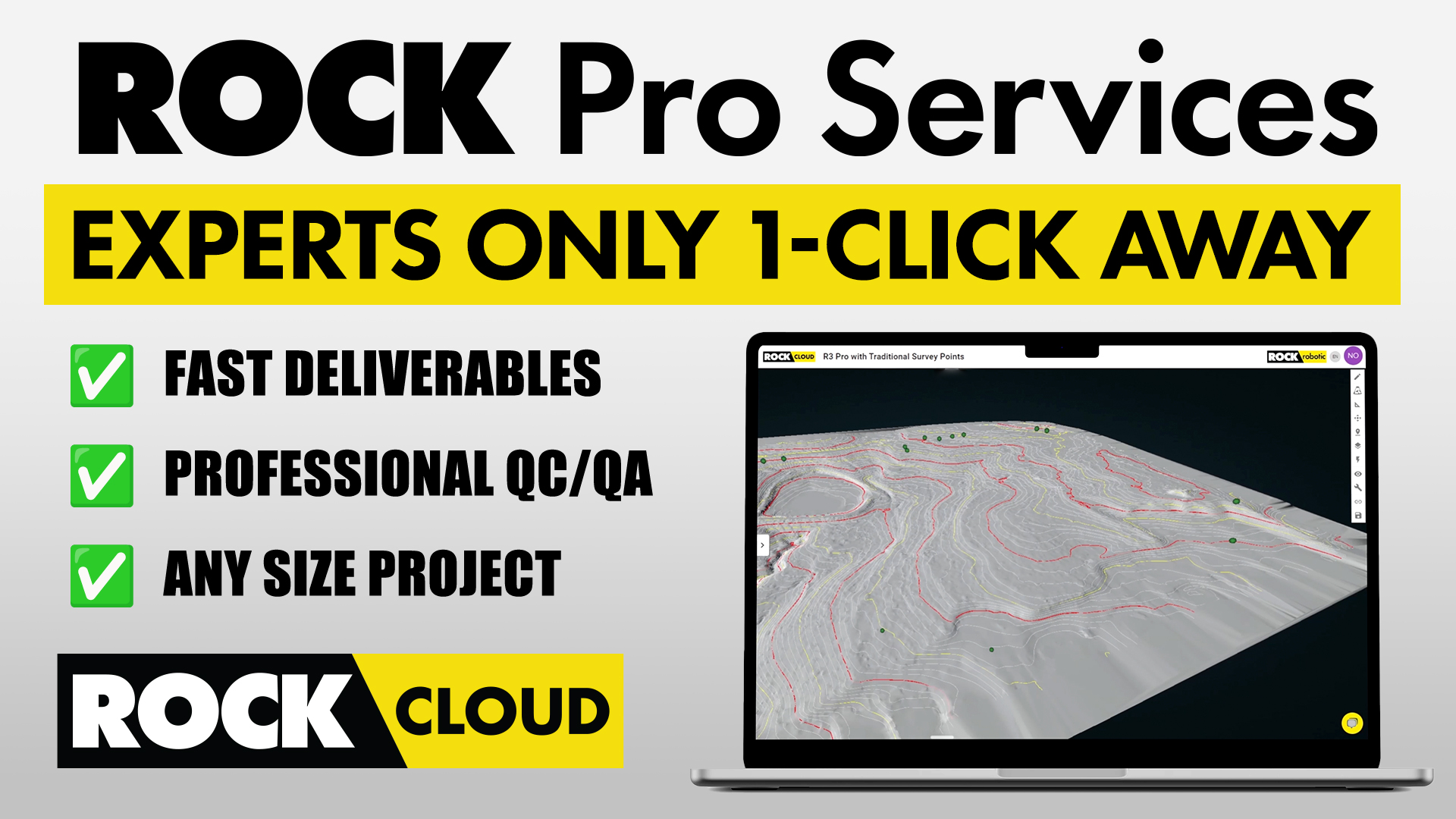
50,000 Projects: Why Your LiDAR Technician Can't Match What ROCK Pro Services Knows
ROCK Pro Services has processed over 50,000 survey projects across every terrain type imaginable. That institutional knowledge — every edge ...
Apr 01, 2026
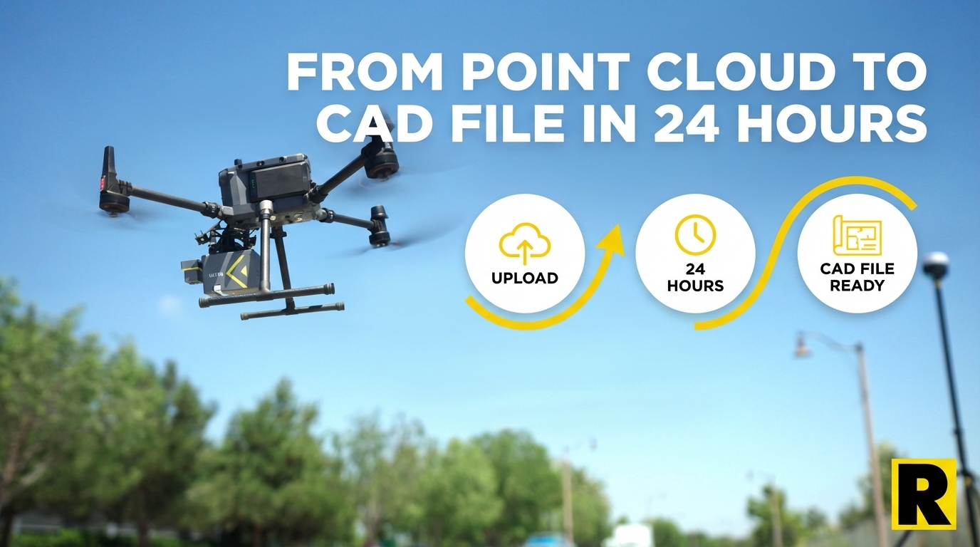
From Point Cloud to CAD File in 24 Hours: How ROCK Pro Services Works
ROCK Pro Services combines patented AI with US-based CAD professionals to turn your LiDAR point cloud into a finished, client-ready delivera...
Apr 01, 2026
The Truth About ROCK's Software Costs (And What DJI Won't Tell You About Theirs)
Competitors love to say ROCK has expensive annual fees. Let's put real numbers on the table — ROCK's three independent pillars versus DJI Te...
Apr 01, 2026
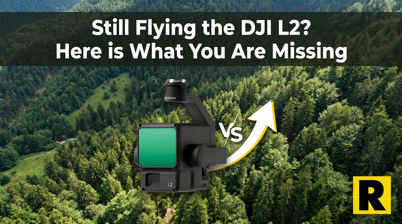
Still Flying a DJI L2? Here's What You're Missing.
The DJI L2 was a great entry point into drone LiDAR. But if you're ready to grow a serious survey business, the ROCK R3 Pro V2 opens doors t...
Apr 01, 2026
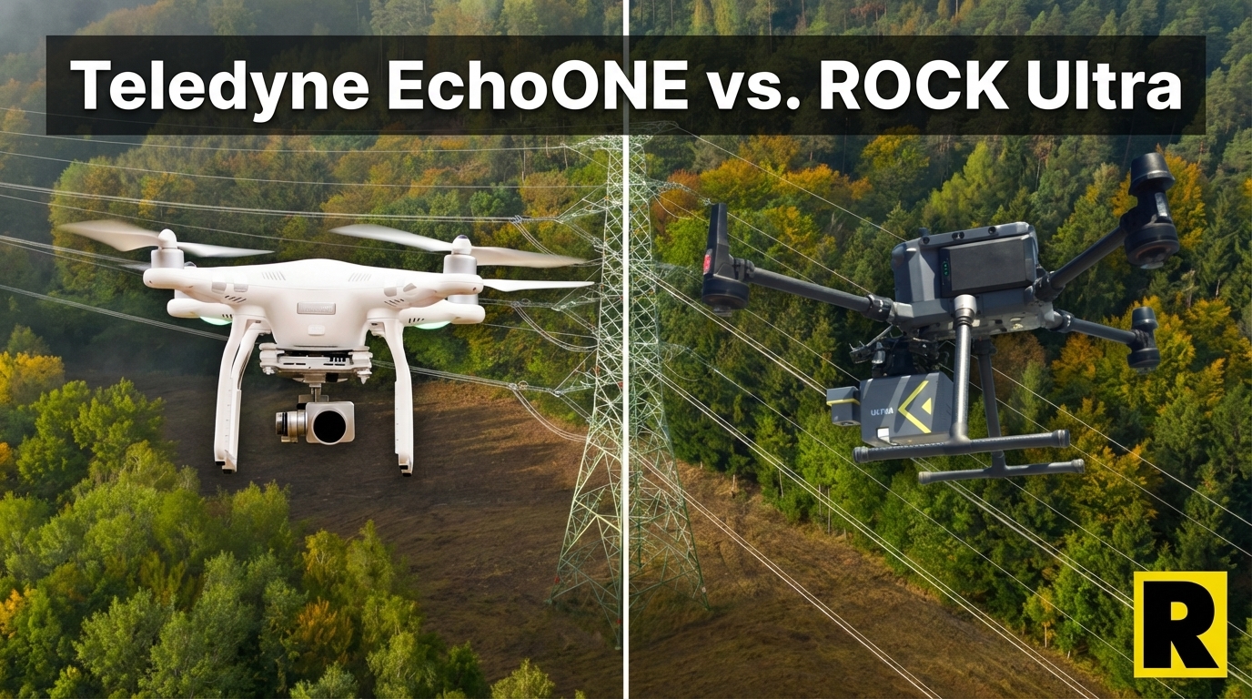
Teledyne EchoONE: NDAA Compliant — But Can It Keep Up in the Field?
The Teledyne EchoONE is one of the few NDAA-compliant drone LiDAR options on the market. Lightweight and accurate. But its 270 m range and l...
Apr 01, 2026
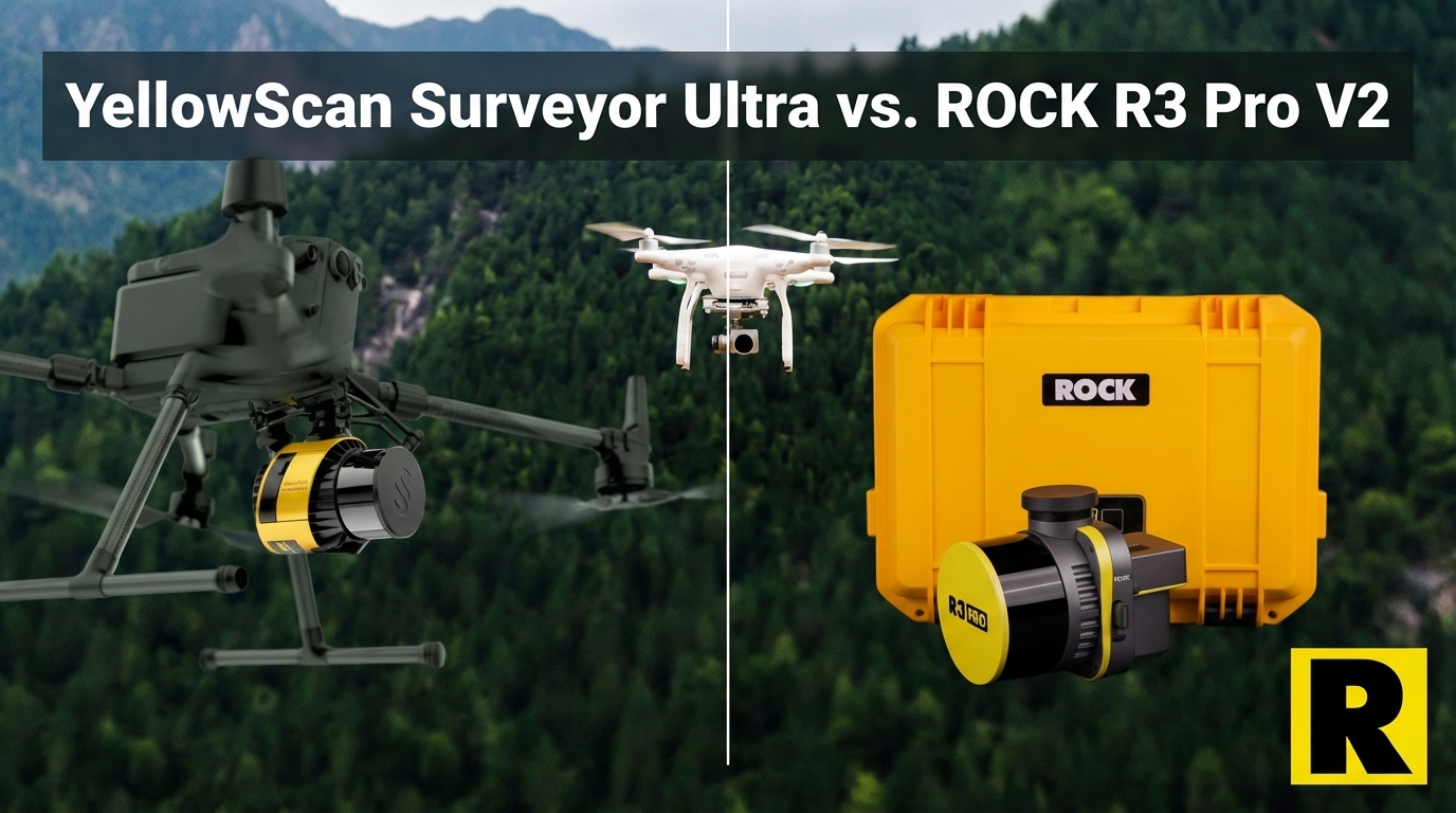
YellowScan Surveyor Ultra vs. ROCK R3 Pro V2: Premium Price, Partial Capability
The YellowScan Surveyor Ultra is impressively light at 0.98 kg. It's also priced at $40K-60K for a drone-only sensor with an 8 MP camera and...
Apr 01, 2026
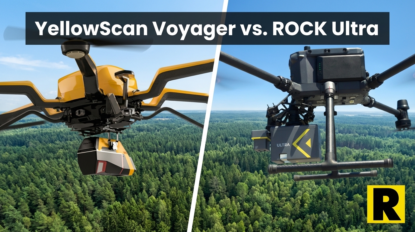
YellowScan Voyager vs. ROCK Ultra: When Raw Specs Meet Real-World Workflow
The YellowScan Voyager has monster specs — 1,250 m range, 2.4 million shots per second, 32 returns. Here's why ROCK Ultra delivers better bu...
Jan 26, 2026
ROCK Robotic Launches Splat Labs: The Professional Gaussian Splat Cloud Platform
Introducing Splat Labs—a cloud platform for hosting, sharing, and collaborating on Gaussian Splat models, plus the new PortalCam spatial cam...
Dec 17, 2025
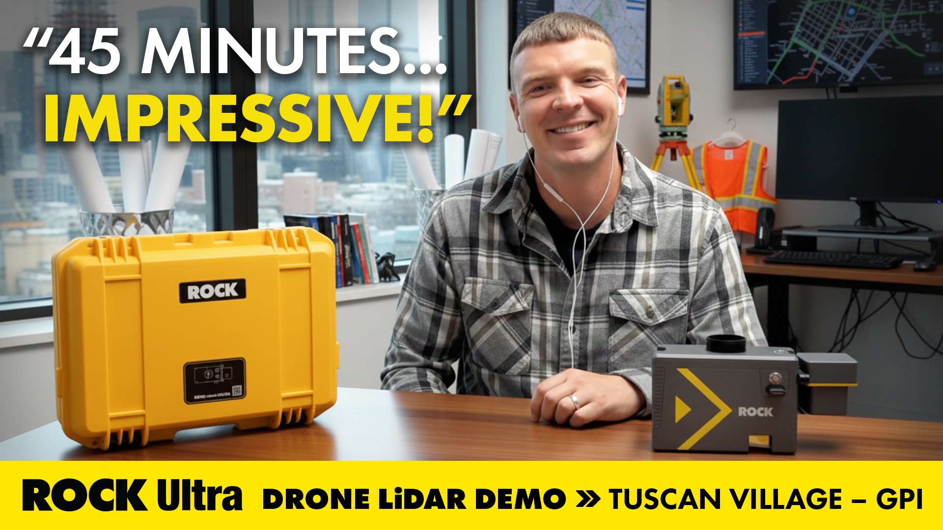
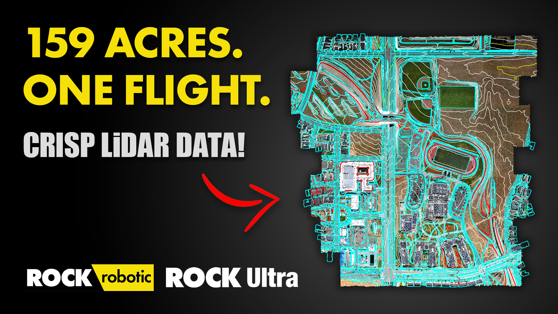
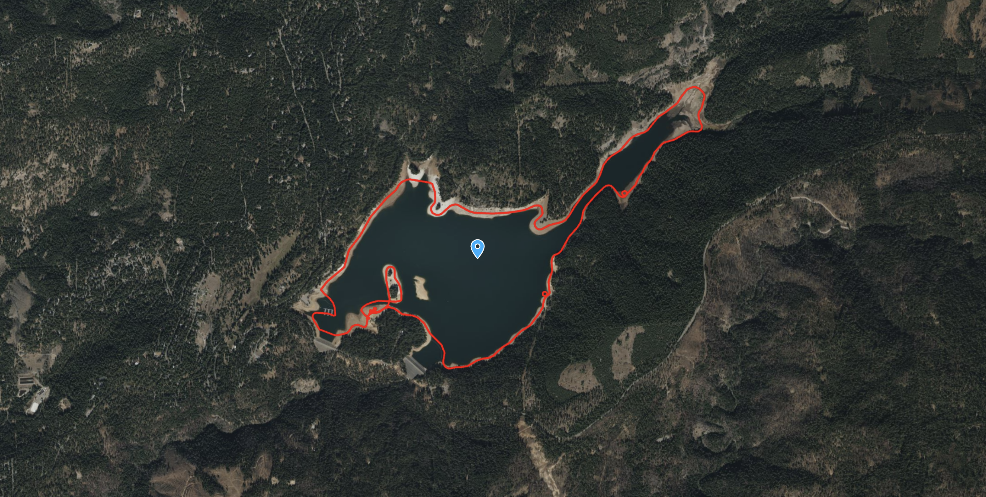
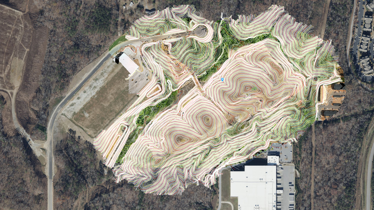
Mapping 360 Acres of Complex Urban Breaklines in 45 Minutes: Inside the ROCK Ultra Tuscan Village Demo
How GPI used the ROCK Ultra LiDAR to scan a 360-acre urban redevelopment in just 45 minutes—and how ROCK Pro Services delivered engineering-...
Dec 04, 2025
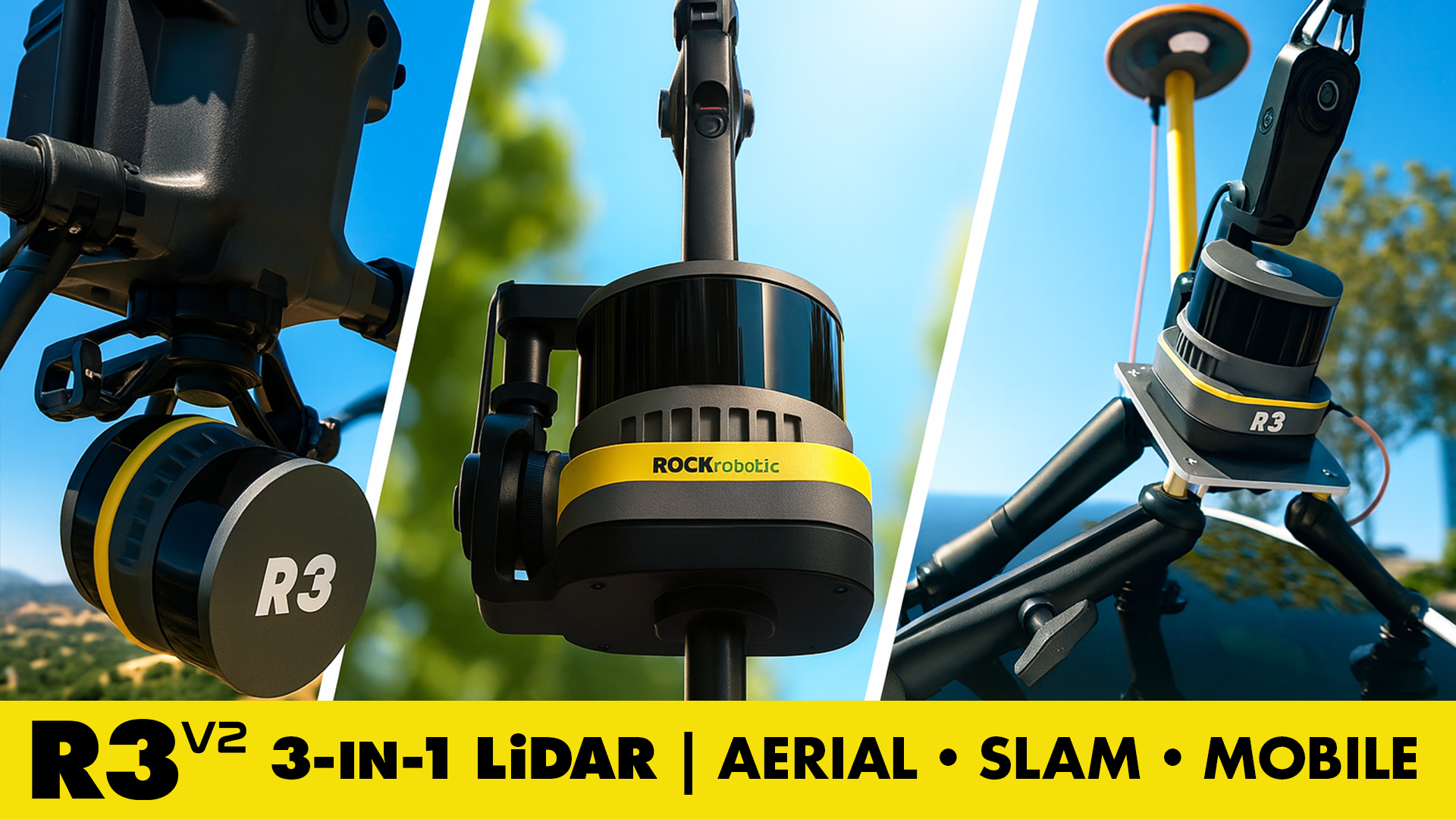
Meet the ROCK R3 V2: The 3-in-1 LiDAR for Aerial, SLAM & Mobile Mapping — Delivering Survey-Grade Accuracy at a Smart Price
Professional-grade 3-in-1 LiDAR for aerial, SLAM, and mobile mapping. Survey-grade accuracy. Smart price. ROCK R3 V2.

Nov 19, 2025
Save Money on LiDAR in 2025: How Section 179 Cuts Your Costs
Land surveyors and geospatial professionals can leverage Section 179 to write off qualifying LiDAR equipment in 2025—making this the ideal t...
Nov 13, 2025
Mapping an Open-Pit Copper Mine in British Columbia with the ROCK Ultra Drone LiDAR System
Discover how the ROCK Ultra Drone LiDAR safely mapped a large open-pit copper mine in British Columbia from 400 ft AGL—capturing survey-grad...
Nov 11, 2025
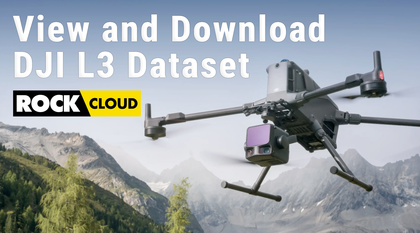
Explore the DJI Zenmuse L3 Rolling Hills Dataset: Premium LiDAR Data on ROCK Cloud
Discover the power of DJI Zenmuse L3 LiDAR with our Rolling Hills farmland dataset. View, analyze, and download high-resolution point cloud ...
Oct 31, 2025
Flying Solo: How a Single Surveyor Used ROCK Ultra Drone LiDAR to Map a Mountain Ski Resort
A single surveyor from British Columbia proves the power of the ROCK Ultra Drone LiDAR system — flying solo at 400 feet to map a Canadian mo...
Oct 10, 2025
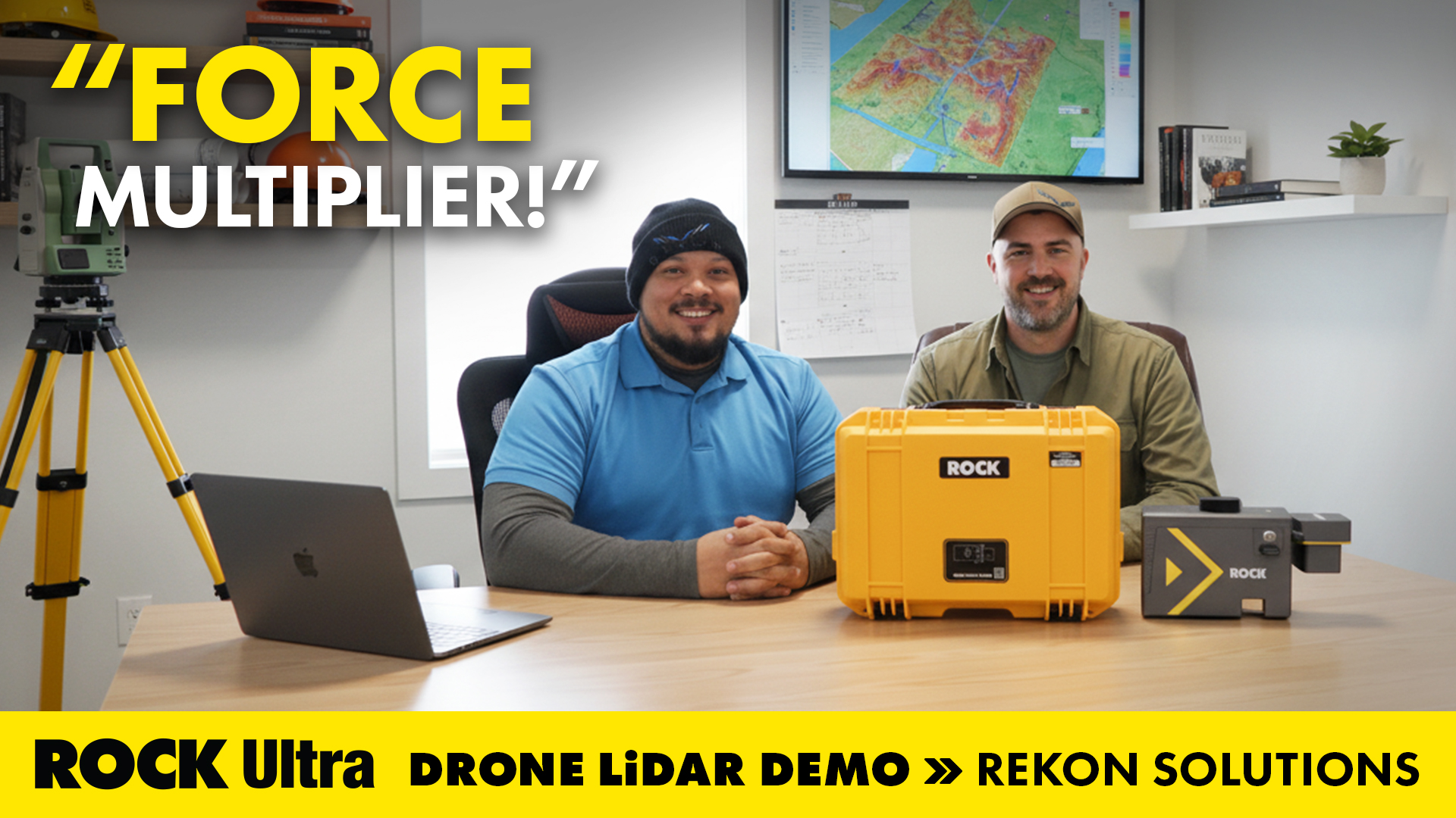
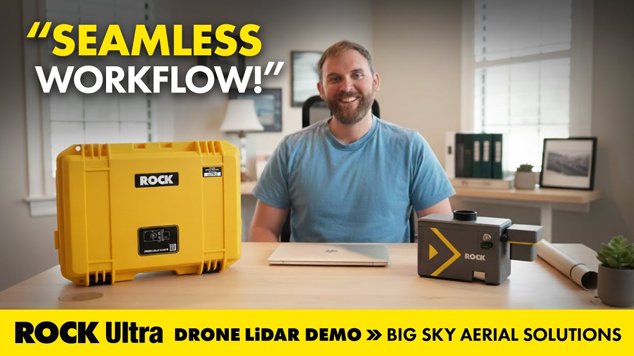
Seamless Aerial LiDAR Workflow for Utility Corridor Powerline Management with the ROCK Ultra
How Big Sky Aerial Solutions used ROCK Ultra drone LiDAR to map utility corridors for vegetation management and reconductoring—flying higher...
Oct 02, 2025
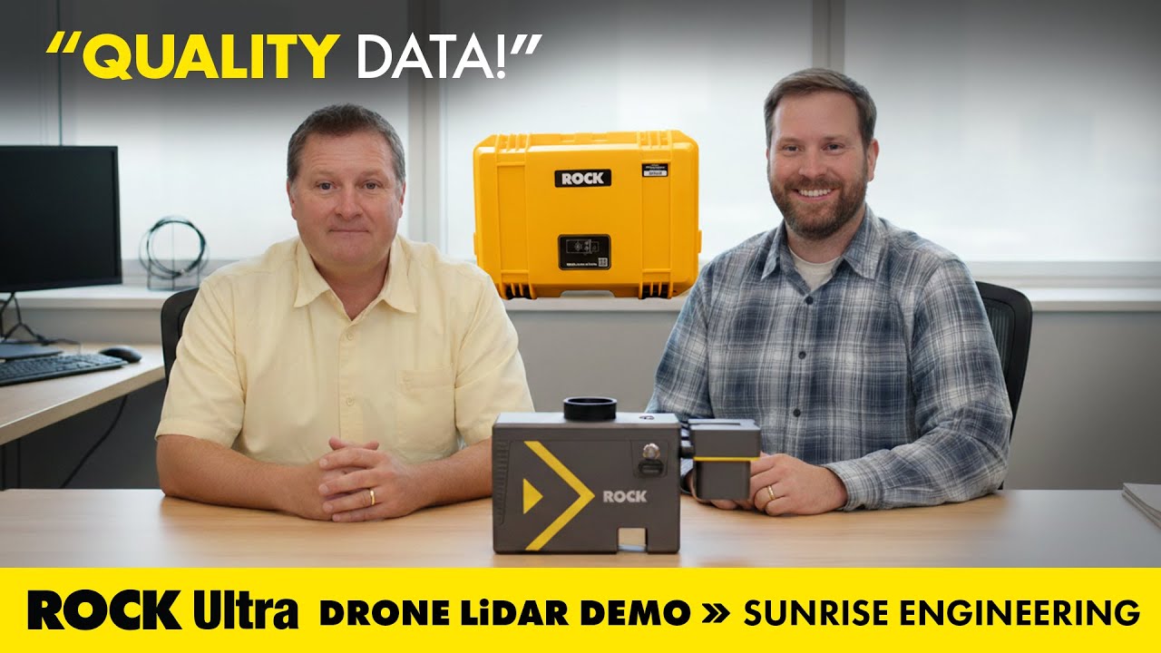
Mapping Mudslides: ROCK Ultra LiDAR Supports Fire Recovery at Utah’s Buckley Draw
How Sunrise Engineering used ROCK Ultra drone LiDAR to capture critical survey data in Provo’s Buckley Draw after wildfire and mudslide deva...
Sep 25, 2025
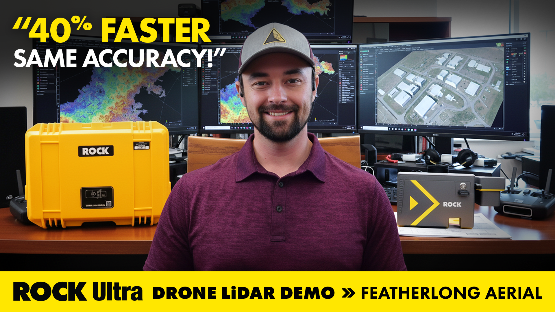
Drone LiDAR in Action: Mapping Avalanche Paths with ROCK Ultra in Colorado
How ROCK Ultra drone LiDAR supported land surveying and aerial 3D mapping during the Demo Tour with Featherlong Aerial — including a full vi...
Sep 22, 2025
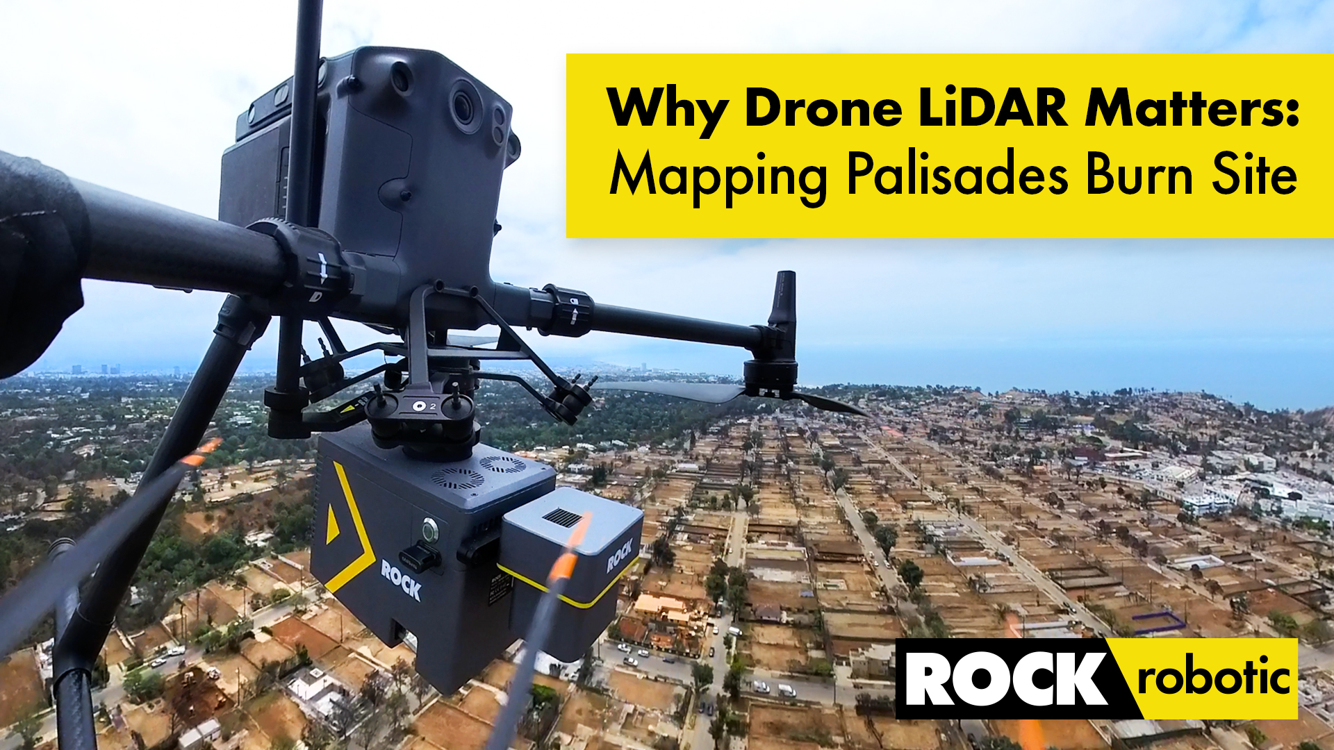
Case Study: Drone LiDAR and Wildfire Recovery – The Palisades Fire
How ROCK Ultra LiDAR helped capture critical data of the Palisades Fire burn area, providing a foundation for rebuilding and wildfire recove...
Sep 17, 2025
Elevate Your Job Site: Why Drone LiDAR from ROCK Robotic is the Best Solution for Construction Project Management
Discover how drone LiDAR from ROCK Robotic is revolutionizing construction project management, offering unparalleled precision, safety, and ...
Sep 10, 2025
Surveying Hawaii’s Dense Jungle with Aerial LiDAR Mapping: A ROCK Ultra Case Study
Discover how the ROCK Ultra LiDAR system achieved unmatched data quality and efficiency in Hawaii’s challenging terrain, even through dense ...
Sep 08, 2025
Unveiling Hidden Worlds: ROCK Ultra Aerial LiDAR Through Dense Jungle Canopy – ROCK Pro Services Data Walkthrough
Discover how ROCK Ultra LiDAR and ROCK Pro Services cut through dense vegetation to deliver unparalleled survey-grade data, revealing hidden...
Sep 03, 2025
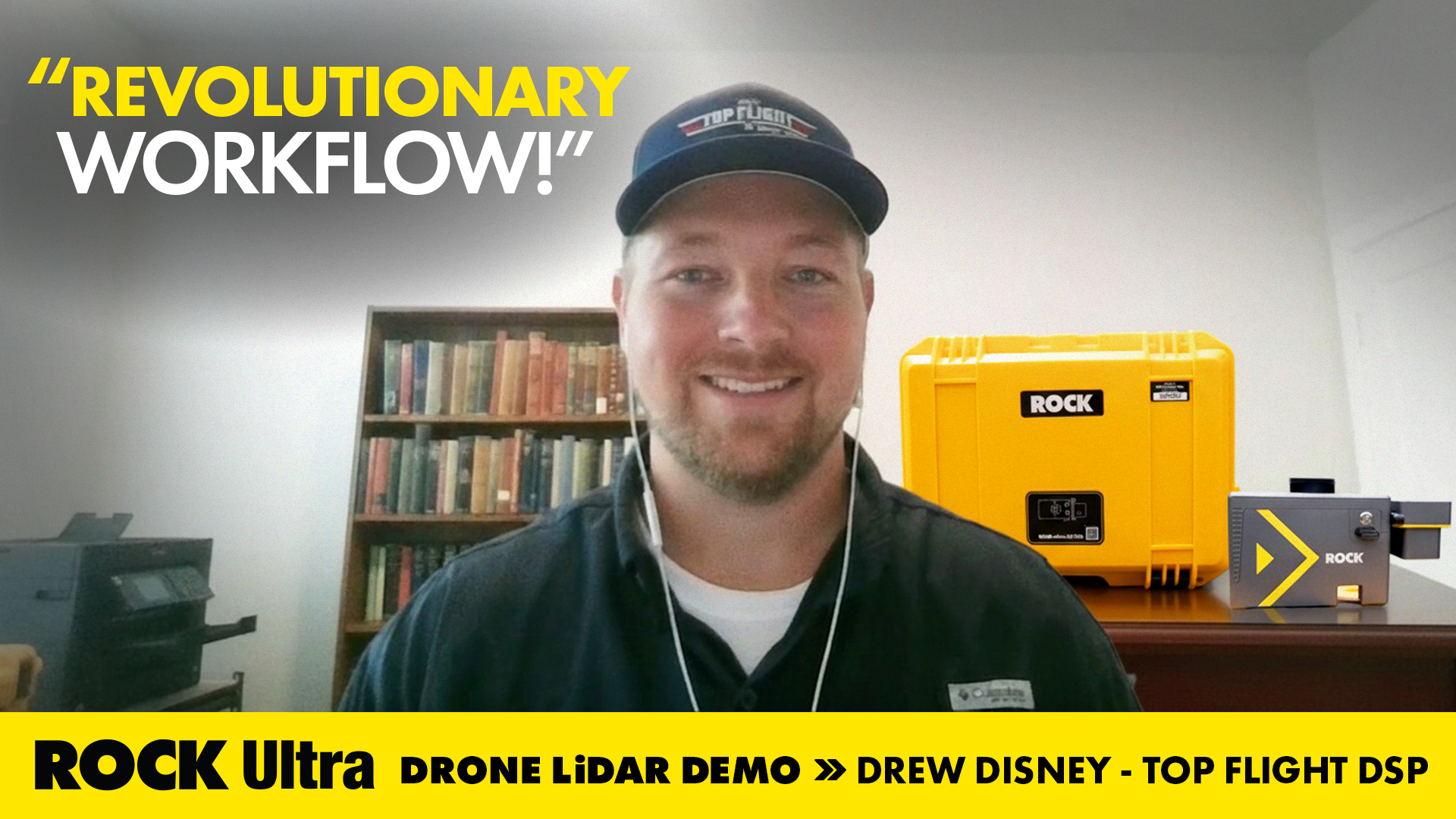
Drone Service Provider Achieves Unprecedented Efficiency with ROCK Ultra LiDAR on 300-Acre Rail Depot Project
Top Flight DSP's Drew Disney utilized the ROCK Ultra LiDAR system to quickly and accurately map a vast rail depot in Beaumont, TX, demonstra...

Aug 29, 2025
The Advantages of Drone Surveying vs. Traditional Methods
A detailed breakdown of how modern drone LiDAR workflows generate massive ROI by drastically cutting field time, reducing operational costs,...
Aug 27, 2025
ROCK Ultra LiDAR: 188 Acres Surveyed in 17 Minutes – A Game Changer for D.C. Johnson & Associates
Discover how D.C. Johnson & Associates leveraged the ROCK Ultra LiDAR drone system to survey 188 acres in just 17 minutes, replacing days of...
Aug 26, 2025
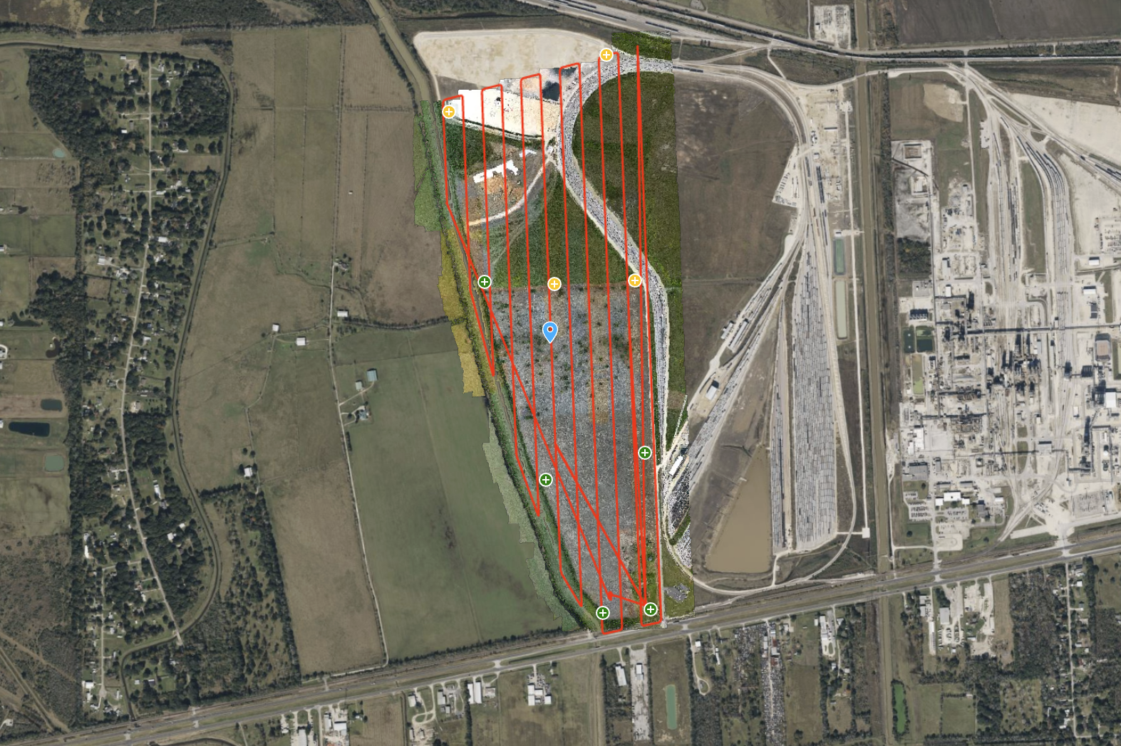
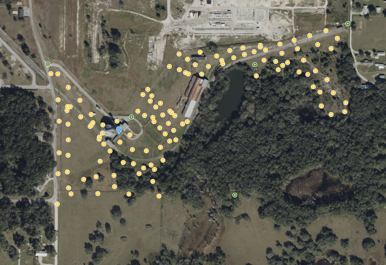
ROCK Ultra – Texas Farmland for Rail Depot Expansion
Explore a 300-acre Texas farmland site, captured for a rail depot expansion project. The ROCK Ultra LiDAR, flying at 120 meters and 5 m/s, d...
Aug 20, 2025
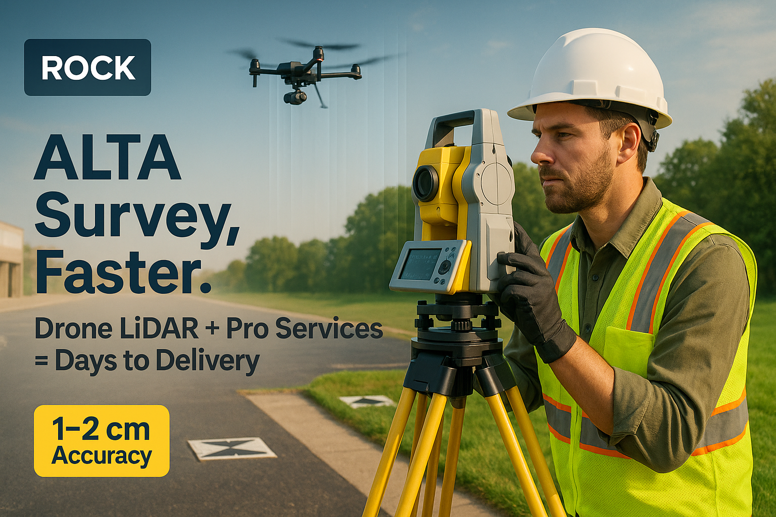
The Complete ALTA Survey Playbook: Traditional vs. ROCK Ultra + Pro Services
Comprehensive guide comparing traditional ALTA/NSPS survey methods with ROCK Ultra drone LiDAR workflows. See real cost breakdowns showing 3...
Aug 20, 2025
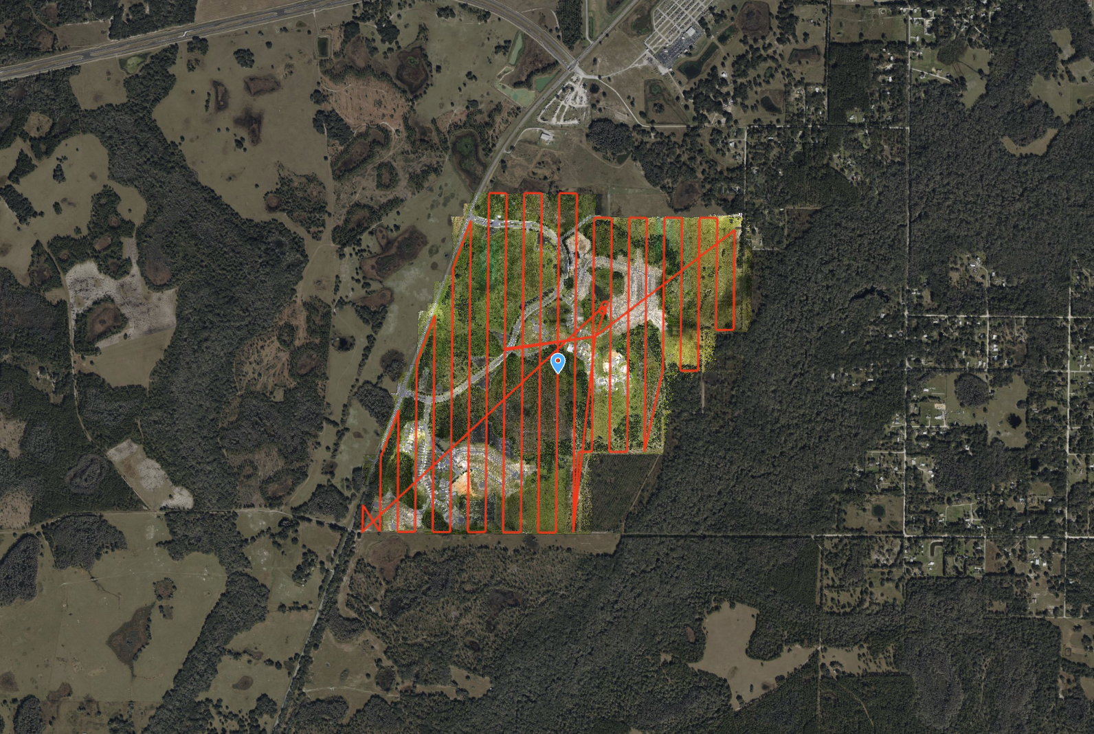
Fly Higher, Finish Faster: How Florida Design Consultants Mapped 500+ Acres in One Flight with ROCK Ultra
Discover how Florida Design Consultants, Inc. used the ROCK Ultra to survey a complex 500+ acre residential site in a single 70-minute fligh...
Aug 18, 2025
30 Minutes On-Site: A ROCK Ultra Drone LiDAR Case Study with Dylan Gorman
Aerial Intelligence Expert Dylan Gorman from PilotByte.com demonstrates how the ROCK Ultra LiDAR system captured a complex 133-acre highway ...
Aug 18, 2025
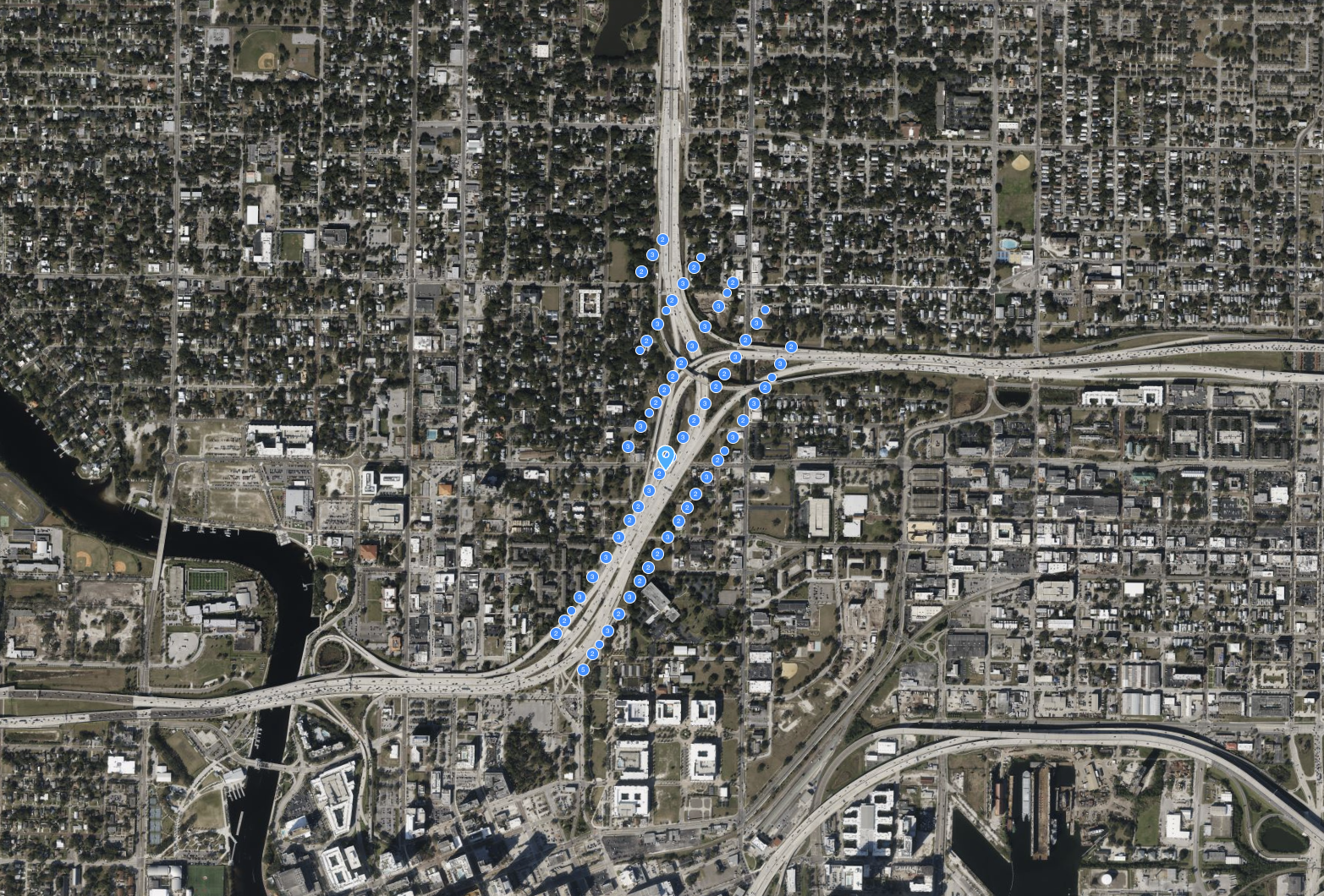
ROCK Ultra – Intersection Flyover
Experience the ROCK Ultra mapping a 133-acre highway interchange from 115 m at 7.5 m/s, capturing every detail of the busy I-275 & I-4 merge...
Aug 13, 2025
ROCK Ultra – Bower Road Survey
This 188-acre dataset, captured in just 17 minutes, showcases the ROCK Ultra's unparalleled ability to penetrate dense Florida vegetation an...
Aug 12, 2025
ROCK Ultra – Stillwell Construction Site
Experience the ROCK Ultra's power in capturing a 77-acre construction site with tall industrial structures from over 120m. This dataset high...
Aug 10, 2025
ROCK Robotic Unveils ROCK Ultra LiDAR, Enabling Surveyors to Map 2-3x More Area Per Flight
The new ROCK Ultra LiDAR system revolutionizes large-scale aerial surveying with a powerful long-range sensor and an "Easy Button" workflow,...

Aug 09, 2025
Leveraging the Rock RTK Network: A Business Case for Surveying, Drones, and GIS
The Rock RTK Network offers surveyors, drone operators, and GIS professionals access to over 16,000 global base stations for just $40/month....
Aug 09, 2025
What’s the Best UAV Flight Planning Software for LiDAR Mapping Missions?
Planning LiDAR drone missions requires specialized software to ensure consistent altitude, precise IMU calibration, and accurate data collec...
Aug 07, 2025
How the ROCK R3 Pro Helped “Mystery at Blind Frog Ranch” See Beneath the Surface
The ROCK R3 Pro LiDAR made its Discovery Channel debut on "Mystery at Blind Frog Ranch," helping geologists scan hidden fault lines and terr...
Aug 05, 2025
Above the Wires: How the ROCK Ultra’s High-Altitude LiDAR Makes Hazardous Surveys Safe
This case study explores a 178-acre canyon survey where high-voltage power lines posed a critical threat. See how the ROCK Ultra's ability t...
Aug 05, 2025
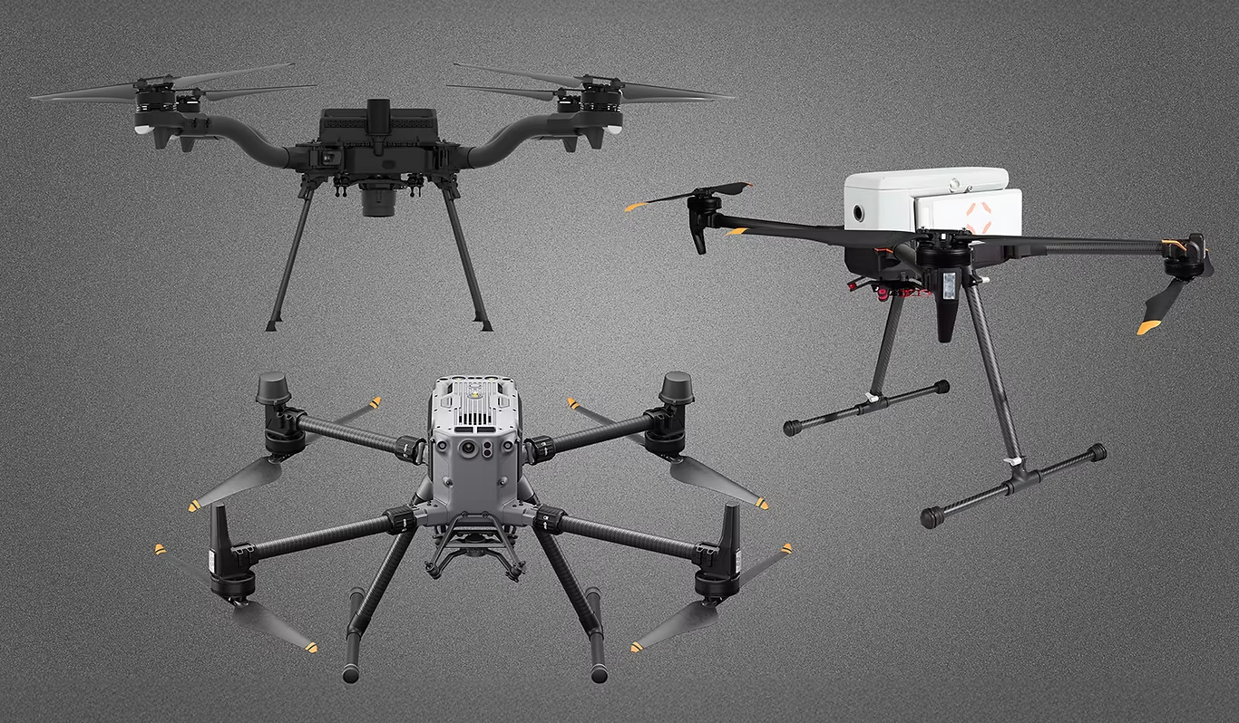
Choosing the Best Drone for LiDAR Mapping in 2025
Looking for the best drone for LiDAR mapping in 2025? This guide compares top platforms—DJI M350 RTK, Inspired Flight IF800 Tomcat, and Free...
Aug 05, 2025
Rock Robotic Photogrammetry Orthophoto Generation
Rock Robotic’s R3 Pro V2 and ROCK Ultra systems fuse high-accuracy LiDAR and RGB imagery to create seamless, distortion-free orthophotos in ...
Aug 04, 2025
Drone LiDAR Case Study: Flawless Urban Breaklines in Denver with the ROCK Ultra
In a high-efficiency urban mapping mission over Denver, the ROCK Ultra LiDAR system captured 160 acres of complex terrain in a single batter...
Jul 31, 2025
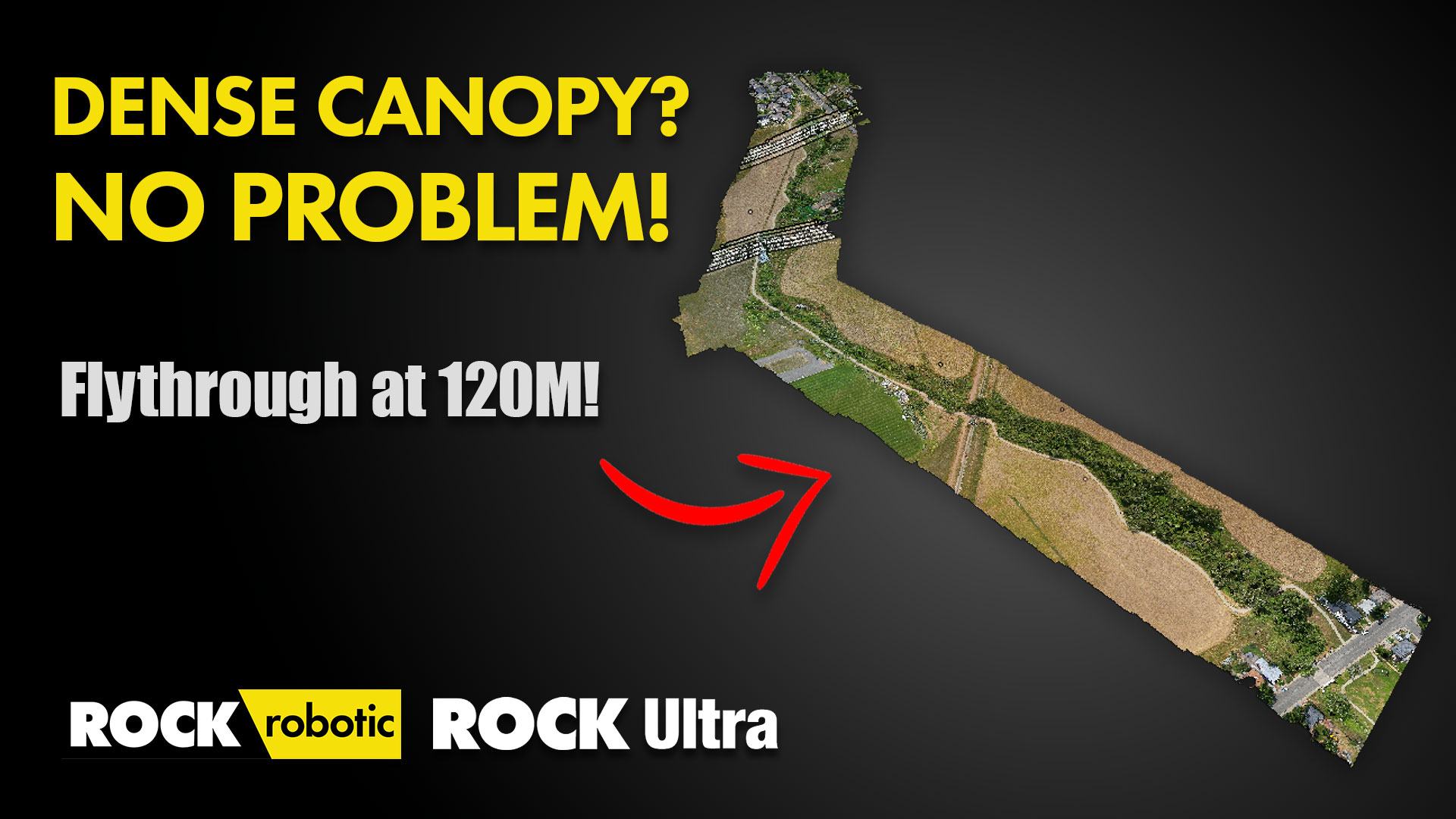
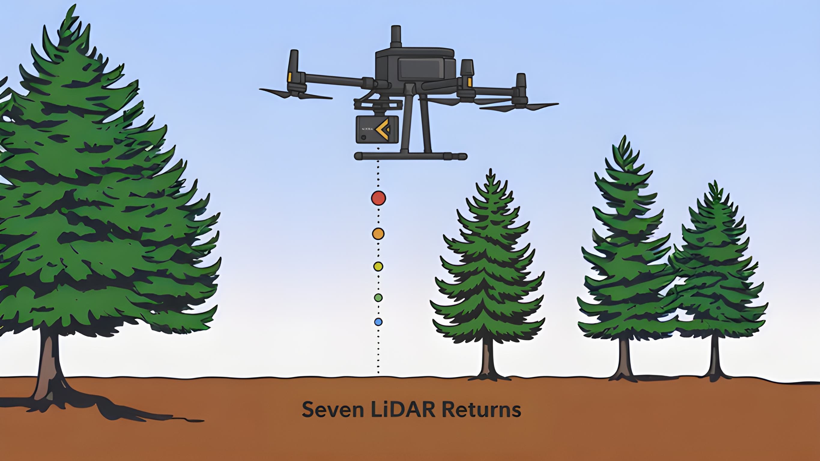
ROCK Ultra Project: Van Bibber Creek — High-Detail LiDAR Mapping at 120m Altitude
The ROCK Ultra LiDAR mapped Van Bibber Creek at 120m altitude, capturing detailed terrain through dense vegetation. Its seven-return capabil...

Jul 31, 2025
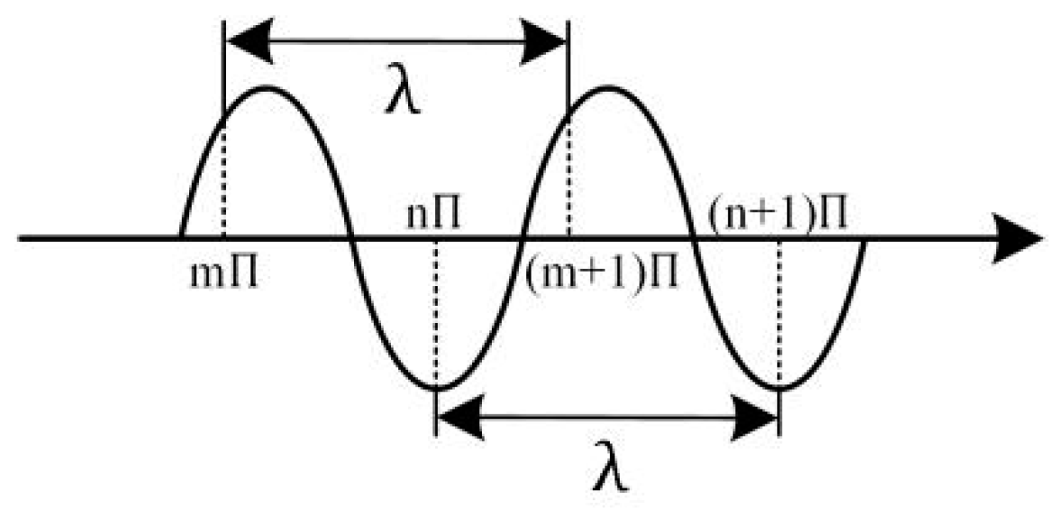
UAV‑Based LiDAR and the Importance of Flight Trajectory
Introduction Unmanned‑aircraft (UAV) laser‑scanning systems combine a lidar sensor with a global navigation satellite system (GNSS)...
Jul 29, 2025
1550‑nm LiDAR for Aerial/UAV Mapping and the ROCK Ultra System: A White Paper
Discover why 1550 nm LiDAR is revolutionizing aerial mapping. With superior eye safety, high-altitude performance, and unmatched vegetation ...
Jul 29, 2025
Enhancing Aerial LiDAR with Multiple Returns: A White Paper
Discover how capturing multiple returns in UAV LiDAR improves ground detection under dense foliage, yielding better DEMs and classification....
Jul 28, 2025
ROCK Ultra – Zephyrhills Residential Development
Flying at 120 m and 8 m/s, the ROCK Ultra mapped a massive 546-acre multi-phase development in Zephyrhills, FL, capturing wetlands, dense ve...
Jul 28, 2025
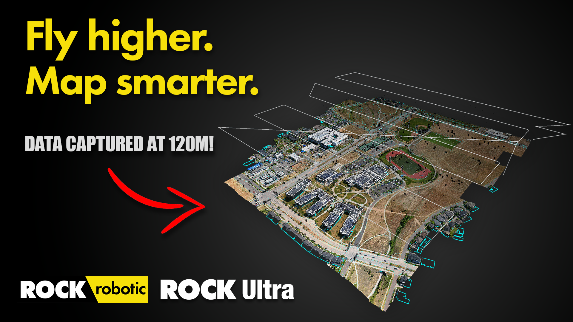
Introducing ROCK Ultra: Survey-Grade Aerial LiDAR from 120m with No Compromises — See the Data
Discover how the ROCK Ultra LiDAR system captures high-resolution, survey-grade data from 150 meters AGL. This in-depth walkthrough explores...
Jul 21, 2025
High-Altitude LiDAR: Mapping at 150m AGL with the ROCK Ultra (Data Walkthrough)
Discover how the ROCK Ultra LiDAR system captures high-resolution, survey-grade data from 150 meters AGL. This in-depth walkthrough explores...
Jul 18, 2025
ROCK Ultra – Van Bibber Creek (120m, 5 m/s)
Testing the ROCK Ultra’s canopy penetration and ground detail capture at Van Bibber Creek.
Jul 10, 2025
ROCK Ultra – Big Denver Aerial Survey
Watch the ROCK Ultra soar—mapping 159 acres from 120 m at 10 m/s with accuracy and speed.
Mar 15, 2025
Mark Rober Uses ROCK LiDAR to Reveal Space Mountain's Secrets
In a viral video comparing autonomous vehicle sensors, YouTube creator Mark Rober used a ROCK R3 Pro LiDAR scanner to create the first-ever ...

Jan 26, 2025
Unlock Precision with ROCK RTK Network for Just $40 a Month.
The ROCK RTK Network transcends borders, offering global coverage with its vast array of GNSS base stations. This network is...
.png)
Jan 25, 2025
Enhancing LiDAR Projects with ROCK Pro Services’ Comprehensive Data Review
In the world of LiDAR, precision and clarity are paramount. Yet, the path from data collection to actionable insights can be riddled with ch

Dec 26, 2024
R3 V2 Van Bibber Creek
Showing off the R3 Vegetation Penetration.
Dec 15, 2024
ROCK R3 Pro V2 & SLAM Dock – 10-Acre Handheld Neighborhood Scan
Experience a 10-acre ground-level digital twin captured with the ROCK R3 Pro V2 and SLAM Dock. This dataset showcases a handheld walking sca...
Oct 02, 2024
56th Street Underpass – SLAM and Aerial Combined
Combining aerial LiDAR and SLAM for a seamless dataset of the 56th Street Underpass in Denver, CO.
Aug 09, 2024
ROCK R3 Pro – High-Density Transmission Corridor Survey for PLS-CADD
See the ROCK R3 Pro capture a 111-acre transmission corridor at an incredible density, delivering 4.3 cm RMS accuracy for demanding PLS-CADD...
Aug 08, 2024
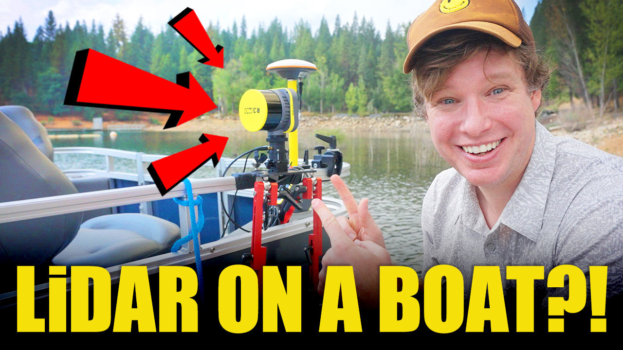
ROCK R3 Pro – Mobile Marine LiDAR Survey of Lake Coastline
Witness a unique application of the ROCK R3 Pro, mounted on a pontoon boat to capture 199 acres of the Jenkinson Lake coastline with mobile ...
Apr 25, 2024
ROCK Mobile Mount: Mobile Colorized Mapping (116 acres)
Mobile LiDAR scanning with the ROCK Mobile Mount capturing 116 acres in WGS 84/UTM zone 10N.
Mar 21, 2024
ROCK R3 Pro V2 – Mobile Mapping of an Urban Corridor
This ROCK R3 Pro V2 dataset showcases a 125-acre mobile mapping mission of an urban corridor, captured from a vehicle traveling at 19 mph.

Dec 19, 2023
Mastering Drone LiDAR Scanning with ROCK R3 Pro & DJI M300
Explore the process of flying the R3 Pro LiDAR scanner to map buildings using the DJI M300 drone.
Dec 12, 2023
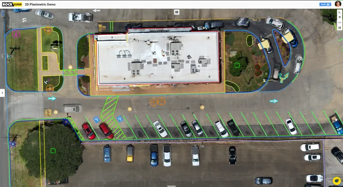
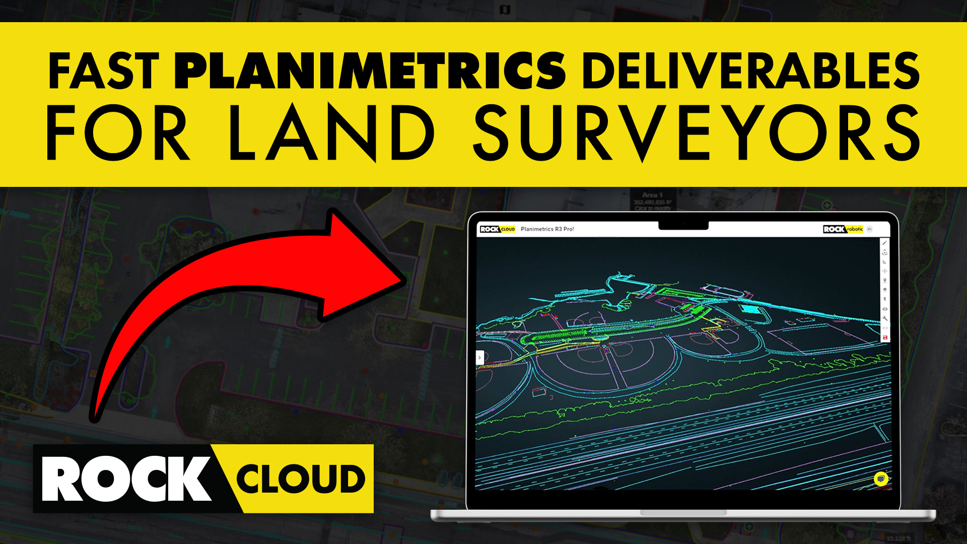
Planimetric Linework Surveying Deliverables with ROCK Pro Services
With the ROCK 50 Plan as your foundation, you can harness the power of ROCK Pro Services to order detailed planimetric deliverables.
Dec 05, 2023
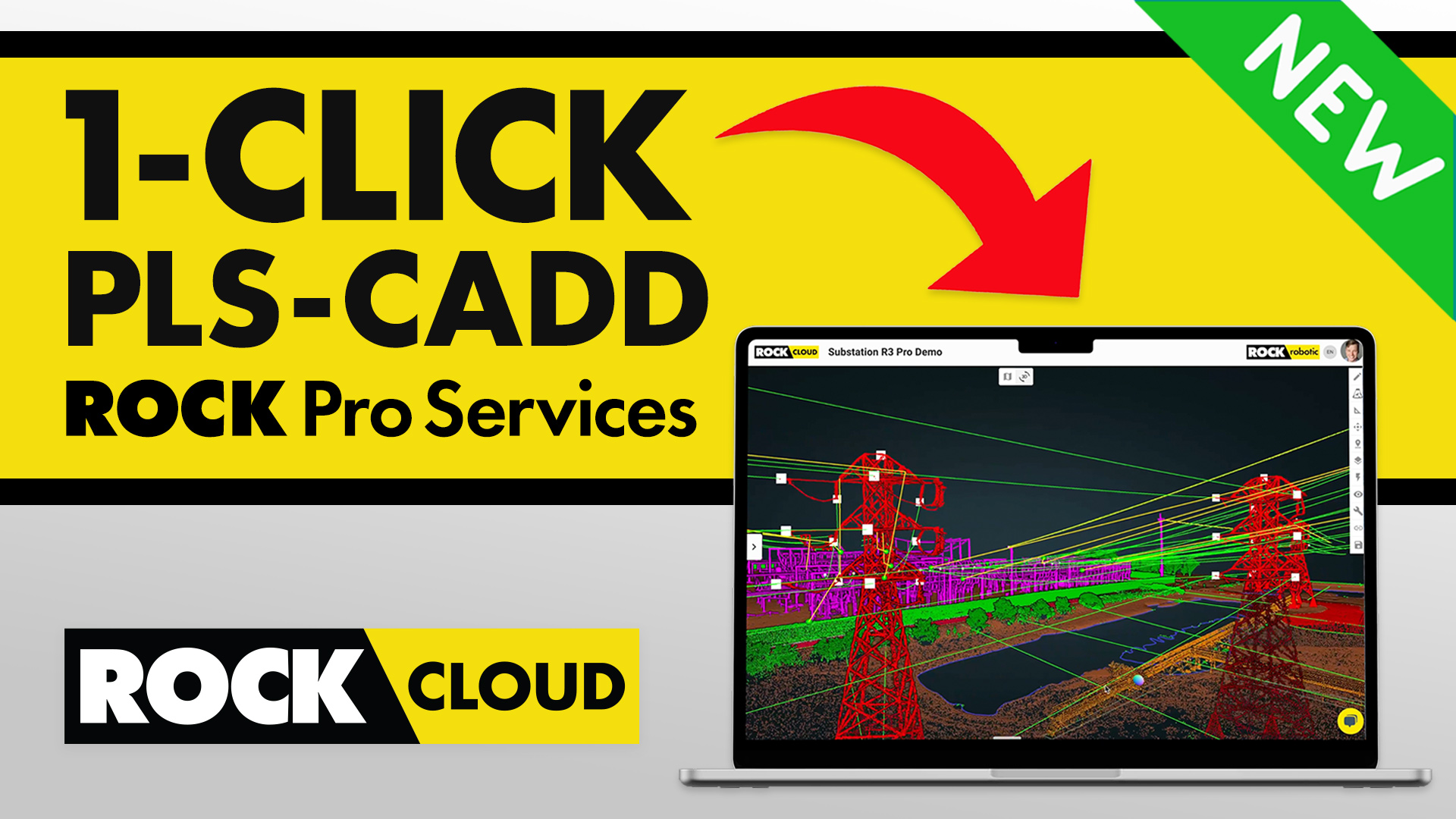
Power Line Surveying & Management Made Effortless with ROCK Pro Services for PLS-CADD
Power Line Surveying and Management Made Effortless with ROCK Processing Services for PLS-CADD.
Nov 27, 2023
ROCK Pro Services: Get Professional & Accurate Surveying Deliverables
ROCK Processing Services empowers your team to deliver complex project deliverables with expert precision and at competive prices.
Oct 24, 2023
Navigating Waters & 3D Data: Mobile Mapping on a Boat with the ROCK R3 Pro LiDAR
LiDAR Mobile Mapping on a Boat with the ROCK R3 Pro
Oct 09, 2023
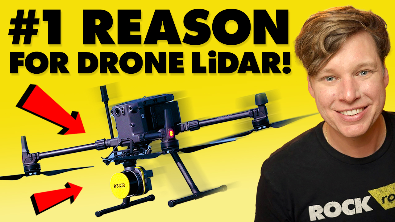
Vegetation Penetration: The #1 Reason for Drone LiDAR
Explore how the ROCK R3 Pro LiDAR system overcomes the challenge of dense vegetation in land surveying.
Sep 20, 2023
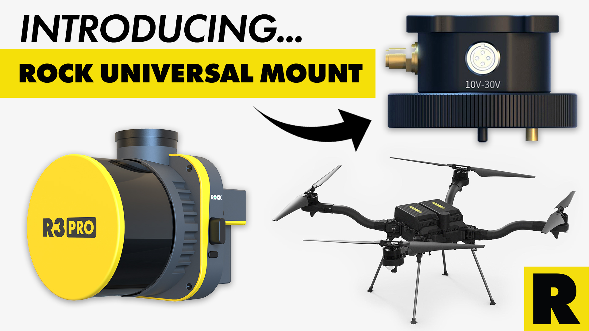
Unlocking Drone Compatibility: ROCK Robotic's Universal Mount for the R3 Pro LiDAR
The ROCK R3 Pro LiDAR is now compatible with any drone!

Sep 14, 2023
ROCK SLAM LiDAR with the R3 Pro: A Comprehensive Guide
In this article, we'll delve into how to operate the R3 Pro with SLAM mode and share some valuable tips on capturing high-quality data.
Aug 26, 2023
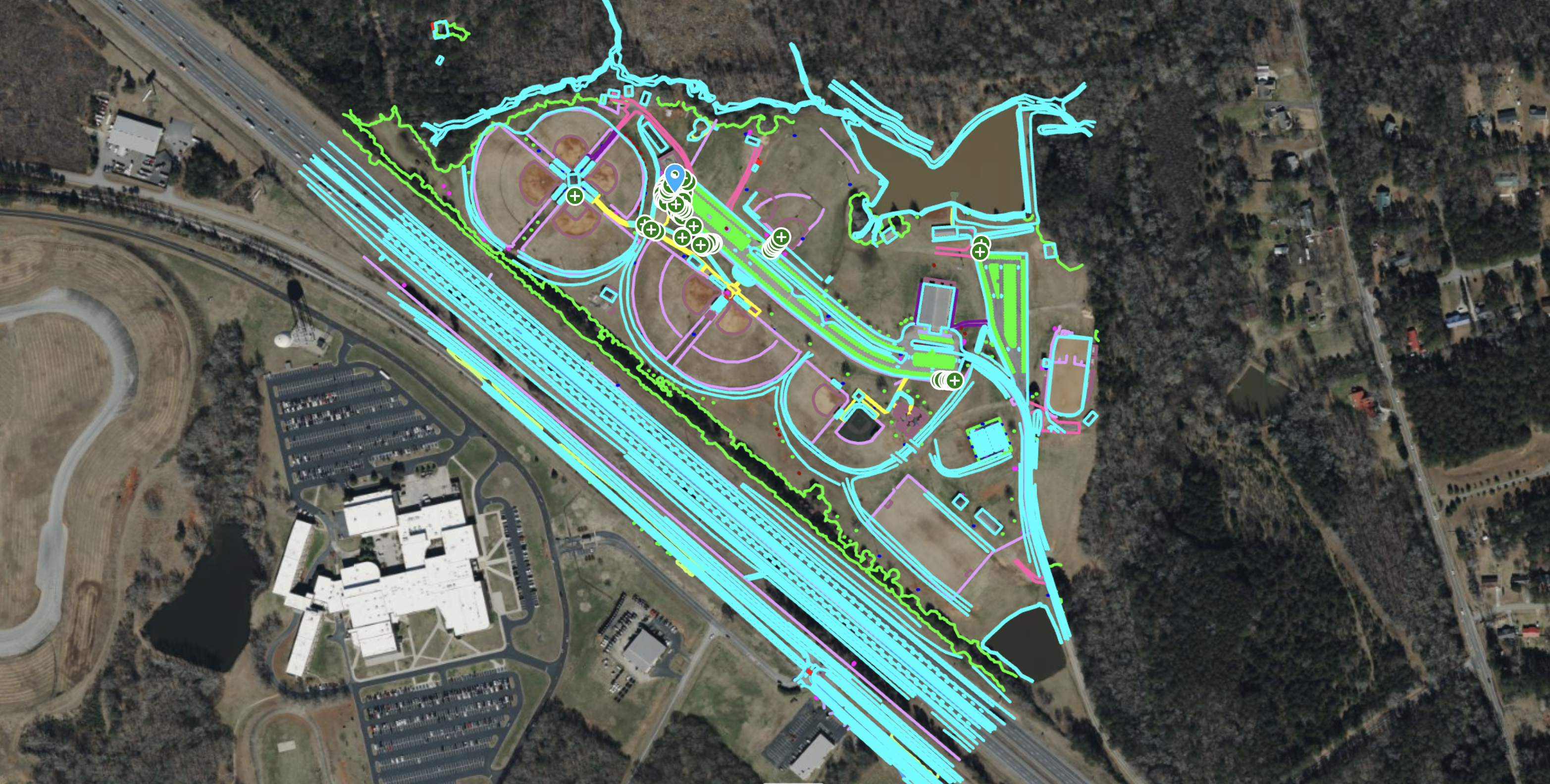
ROCK R3 Pro – 117-Acre Sports Complex & Highway Survey
See how the ROCK R3 Pro LiDAR captured a 117-acre site, including a sports complex and a major highway, delivering 0.078 ft RMS vertical acc...
Aug 15, 2023
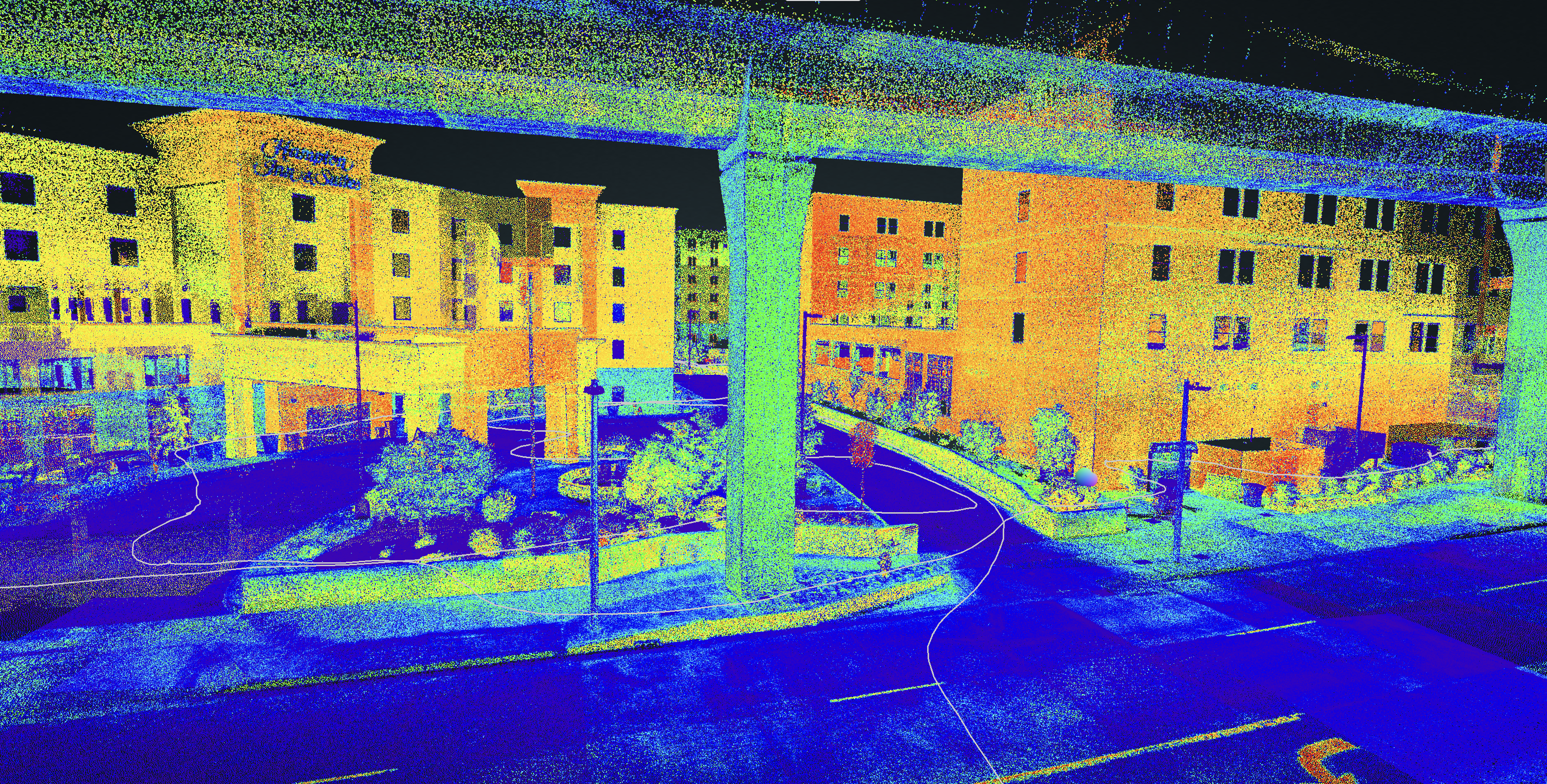
ROCK R3 Pro & ROCK SLAM – Hampton Inn As-Built Survey
Explore a complete as-built survey of a Hampton Inn hotel, captured with the ROCK R3 Pro in ROCK SLAM mode, showcasing detailed data from bo...
Aug 13, 2023
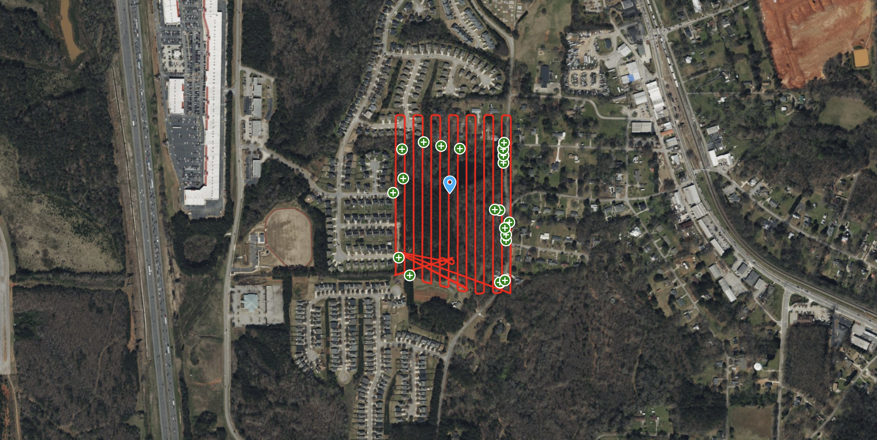
ROCK R3 Pro V2 – High-Accuracy LiDAR Survey in Dense Georgia Vegetation
Discover how the ROCK R3 Pro V2 achieved survey-grade accuracy of 0.089 ft RMS on a 37-acre site with dense vegetation, validated by a regis...
Aug 04, 2023
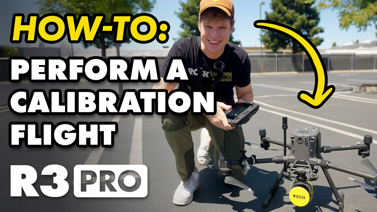
How-To Perform Calibration Flight for ROCK R3 Pro, R360, & R2A
In this informative guide, we'll walk you through the step-by-step process to ensure precise and accurate data collection every time.
Jun 15, 2023
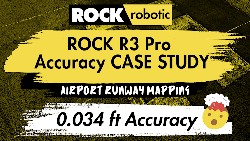
ROCK R3 Pro Accuracy Case Study: Airport Runway Mapping
Discover the unrivaled accuracy of the ROCK R3 Pro LiDAR system as it stands up to RTK GPS in a detailed case study conducted on an airport

Jun 09, 2023
How-To Price a Drone LiDAR Job: A Guide to Value-Based Pricing for your Surveying Business
Discover the power of value-based pricing for your drone LiDAR business. Learn how to determine the true worth of your services and set prof
Jun 09, 2023
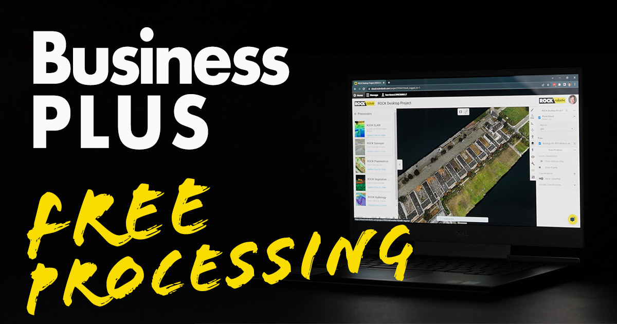
Introducing ROCK Cloud Business PLUS: Unleashing the Power of LiDAR Processing
Unveiling ROCK Cloud Business PLUS: an upgrade enhancing LiDAR processing, offering QC/QA, dedicated support, featured for the ROCK R3 PRO
May 20, 2023
The Rise of Drone-Based LiDAR: Pioneering Change with ROCK R3 Pro
The realm of spatial data collection and processing has been undergoing a transformation in the past few years, steered by the...
May 04, 2023
ROCK R3 Pro – Powerline Corridor & Vegetation Management
See how the ROCK R3 Pro and ROCK Vegetation Management service identified 712 vegetation encroachments along a 23-acre powerline corridor, p...
Apr 24, 2023
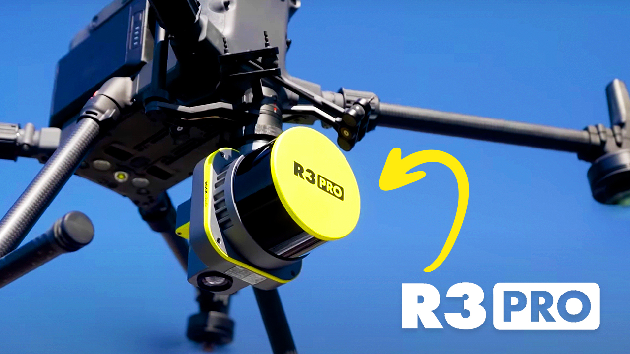
Insanely Accurate LiDAR: The New ROCK R3 PRO
Get ready to experience the next level of accuracy and workflow with the new ROCK R3 Pro survey-grade LiDAR system!
Mar 14, 2023
5 Ways LiDAR Can Measure Vegetation Health in the Forestry Industry
In the world of forestry, LiDAR is an efficient way to get a quick read on the health of an area's vegetation.
Mar 10, 2023
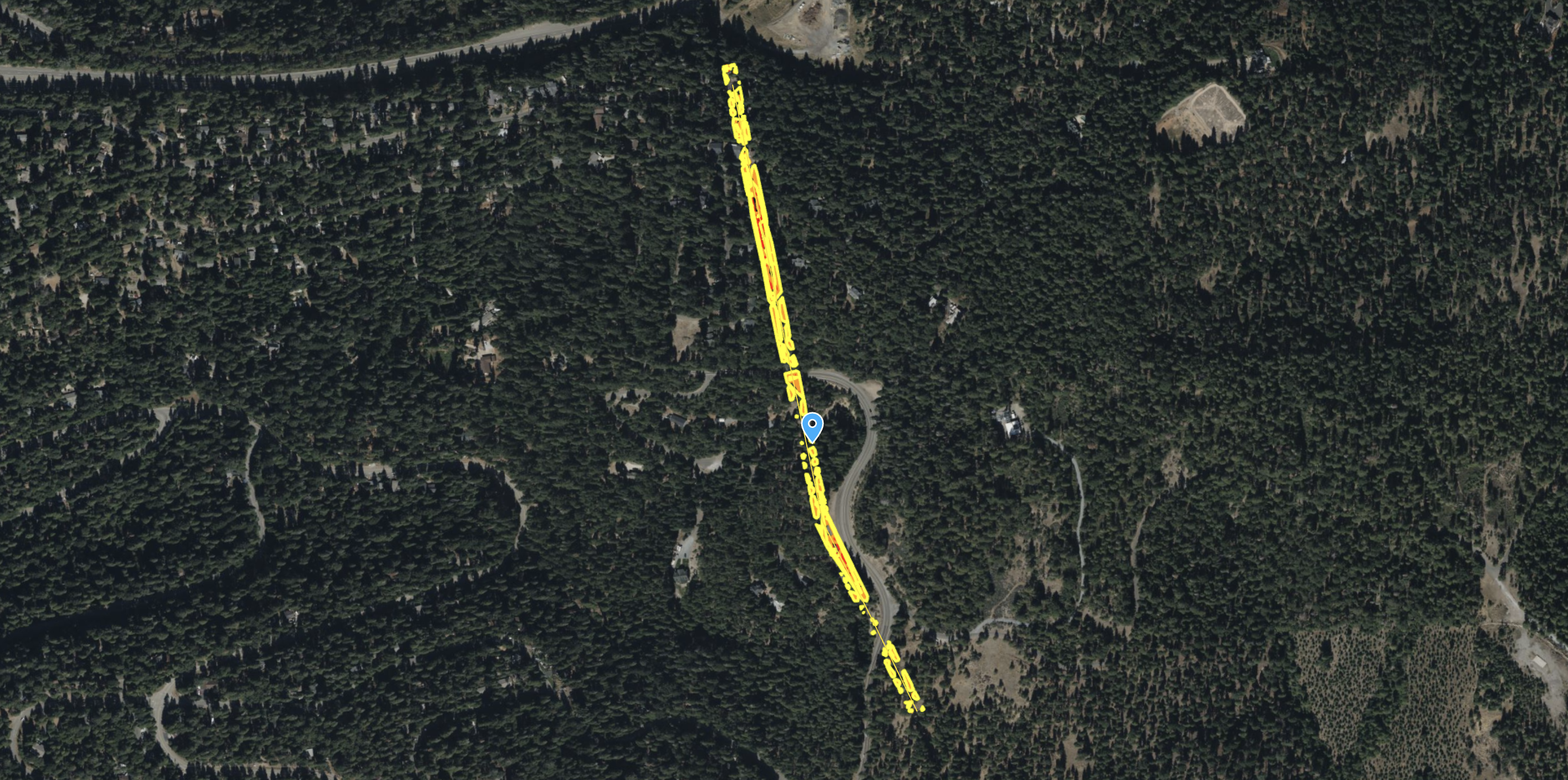
Surveying Tricky Terrain? Drone LiDAR for the Win!
As advances in drone LiDAR technology continue to accelerate, we expect to see an increase in its use for land surveys in hazardous terrain.
Mar 03, 2023
ROCK Planimetrics from High-Resolution Orthophoto
This project showcases the power of ROCK Planimetrics using only a high-resolution orthophoto captured by a DJI M3E drone—no LiDAR required.
Mar 01, 2023
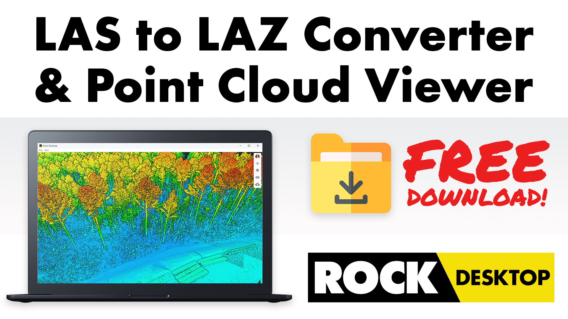
Easily convert LAS to LAZ and view your point cloud in the field with ROCK Desktop (Free Download!)
We’re excited to launch ROCK Desktop, a free point cloud converter and visualizer. It converts your LAS files to LAZ files...
Feb 28, 2023
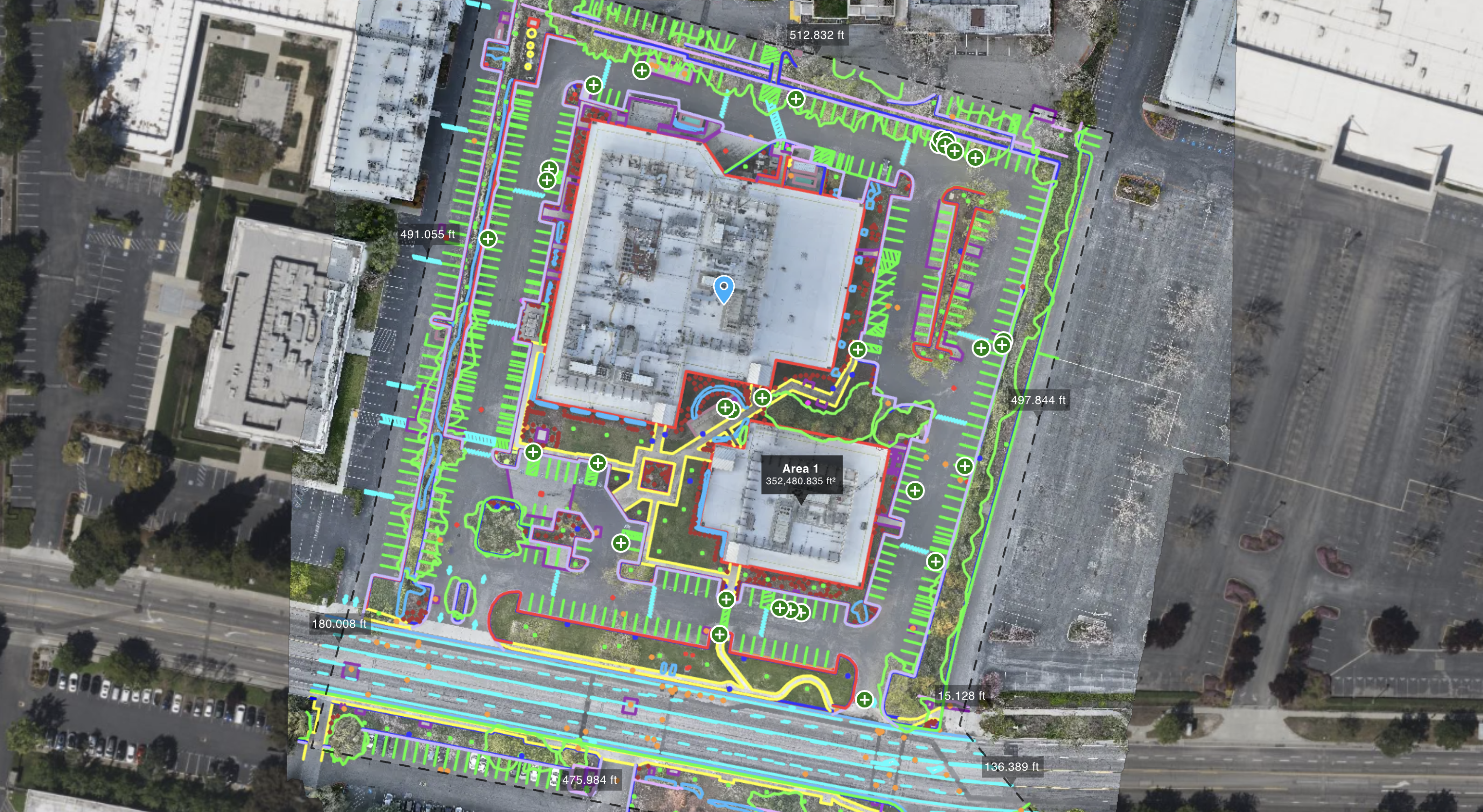
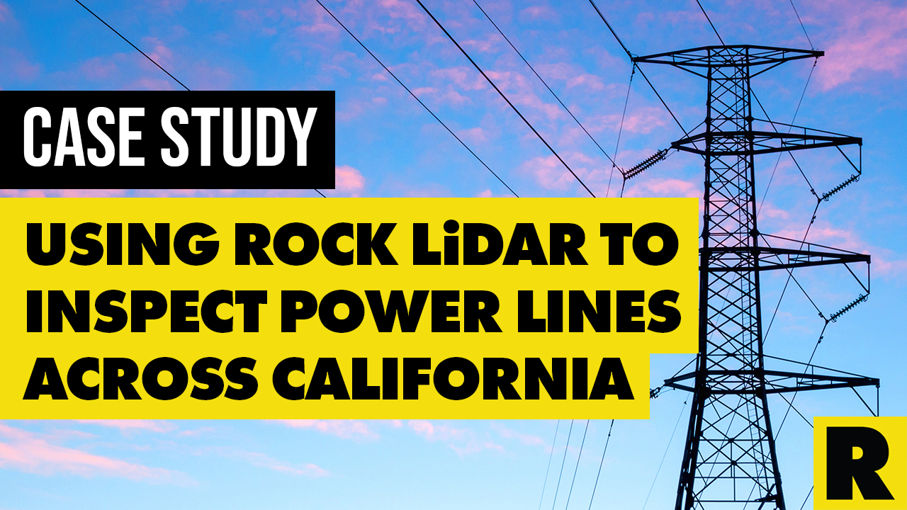
Case Study: Using ROCK LiDAR to Inspect Power Lines Across California
How did Surefire approach this extensive power line inspection project? One drone LiDAR flight at a time.

Feb 23, 2023
How to Use Drone LiDAR for Construction Site Development
Construction site development is a complex process that requires precise planning and execution. Every detail must be accounted for...
Feb 21, 2023
7 Ways to Boost Your Drone's Battery Life
To harness a drone's full potential, it's crucial to know how to stretch its battery life. This article offers seven useful tips to help inc

Feb 13, 2023
Major Benefits of Using LiDAR Surveying for Transportation Departments
Transportation departments have a big job on their hands — they're in charge of keeping our roads, bridges, and other infrastructure in...

Feb 08, 2023
3 Surveyors and Another Guy: An Incomplete History of Famous U.S. Surveyors
Mount Rushmore is known for its giant presidential faces carved into the Black Hills, but did you know that three of the four presidents...

Feb 06, 2023
Drones Are Going to Take Our Jobs: Dispelling Myths About UAVs in the Surveying Industry
Many traditional surveyors are hesitant to adopt drone LiDAR for their projects. We want to dispel some myths surveyors have about LiDAR.
Feb 02, 2023
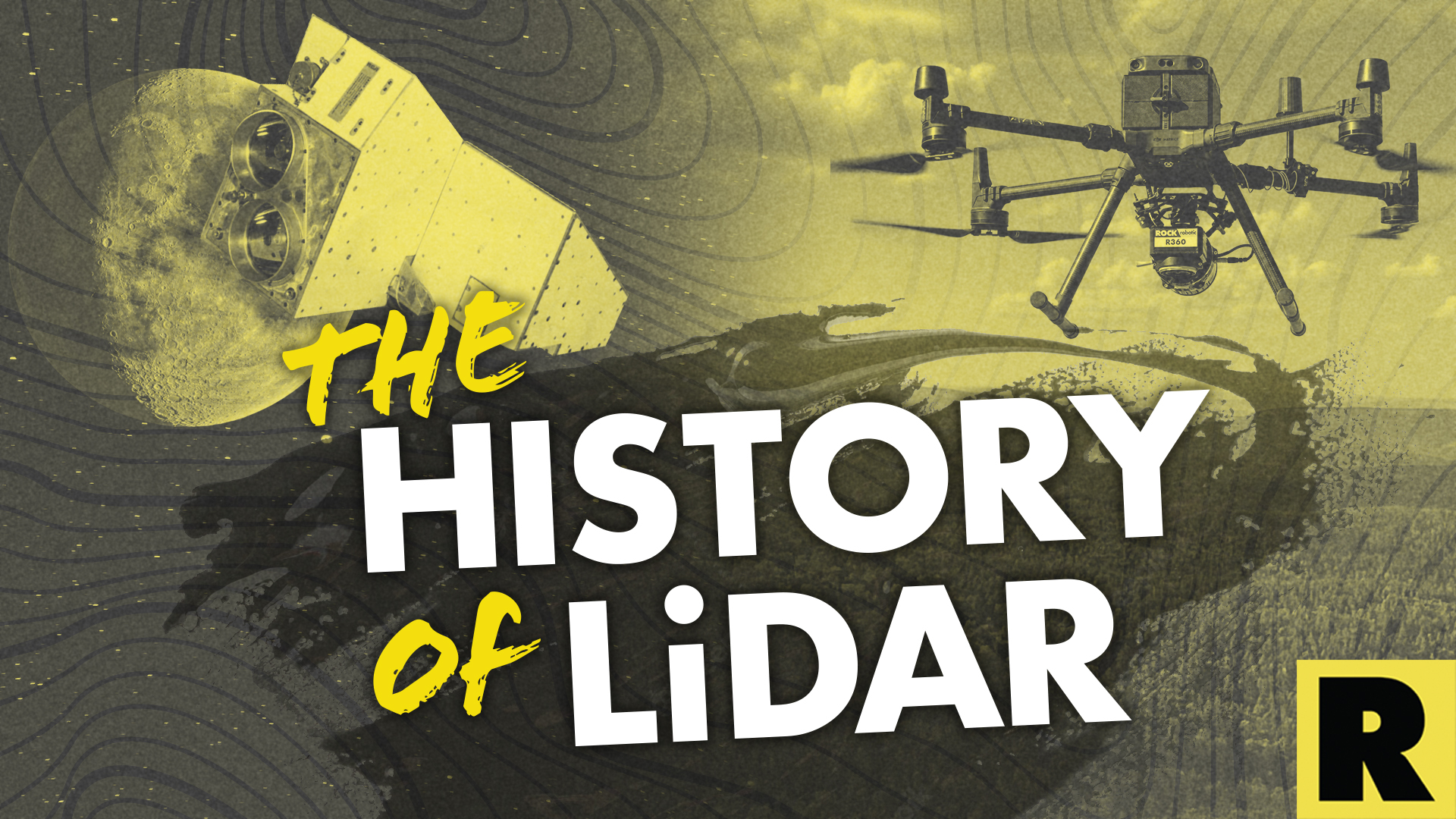
From Space Lasers to Autonomous Vehicles: The History of LiDAR
LiDAR makes it seem like we're living in the future. Today's technology allows us to receive over one million laser pulses per second...
Jan 31, 2023
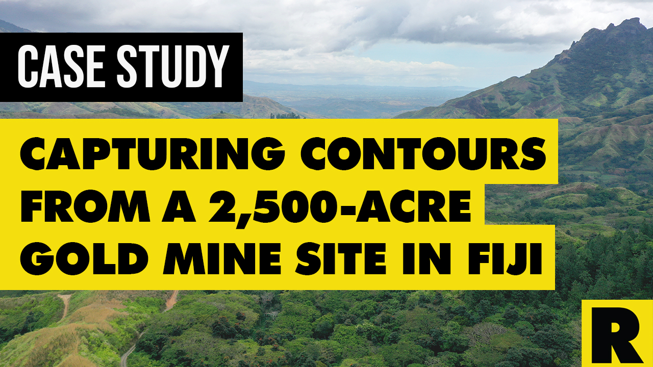
Case Study: Drone Services Provider Navigates a 2,500-Acre Gold Mine Site in Fiji with ROCK LiDAR
Kahuto Pacific was hired by a Canadian mining company to provide topographic, aerial LiDAR for a 2,500-acre (1,000-hectare) property.
Jan 27, 2023
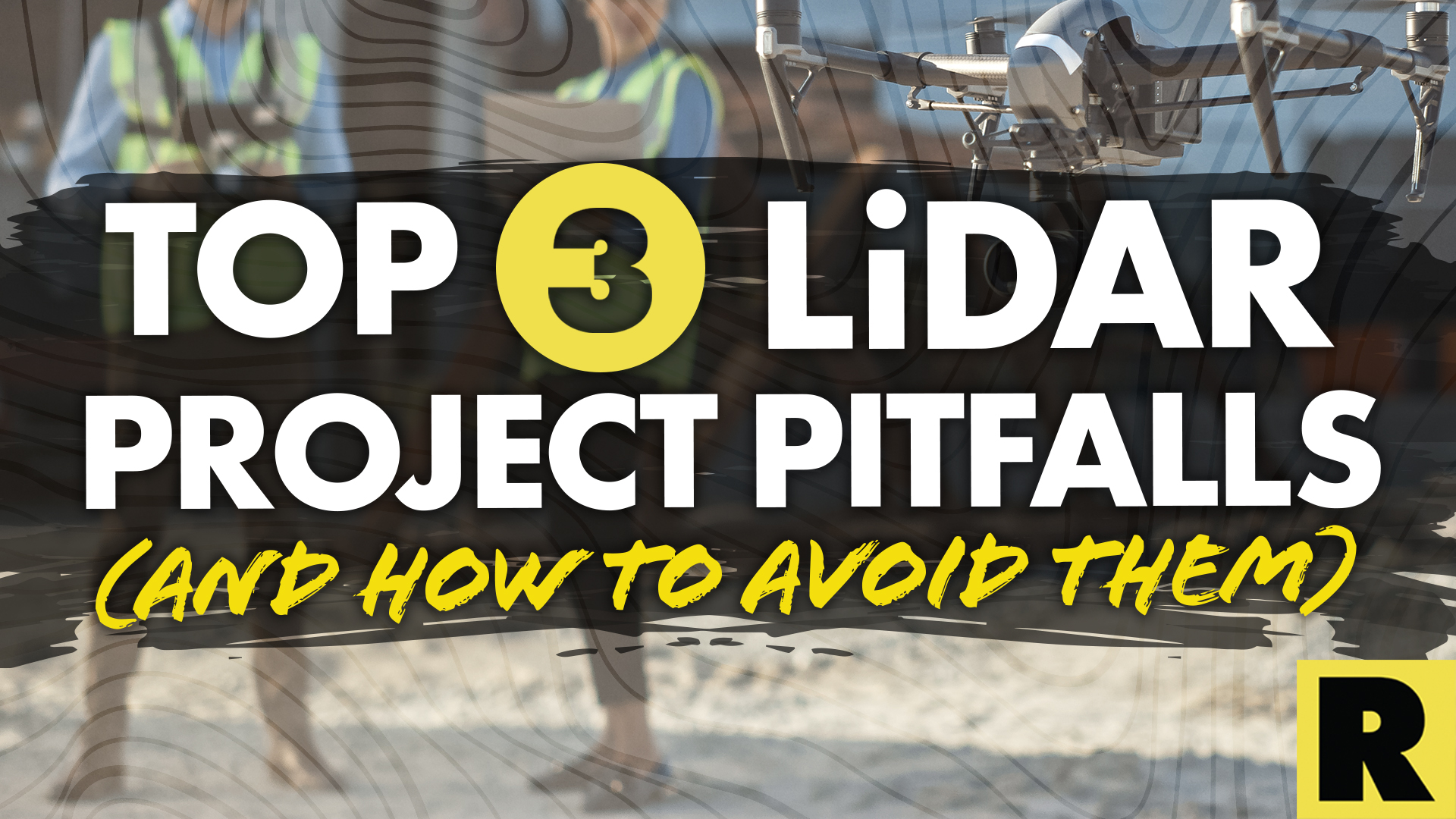
Top 3 Drone LiDAR Project Pitfalls (and How to Avoid Them)
Over the course of consulting with drone LiDAR clients, we've noticed three major project pitfalls DSPs make.
Jan 23, 2023
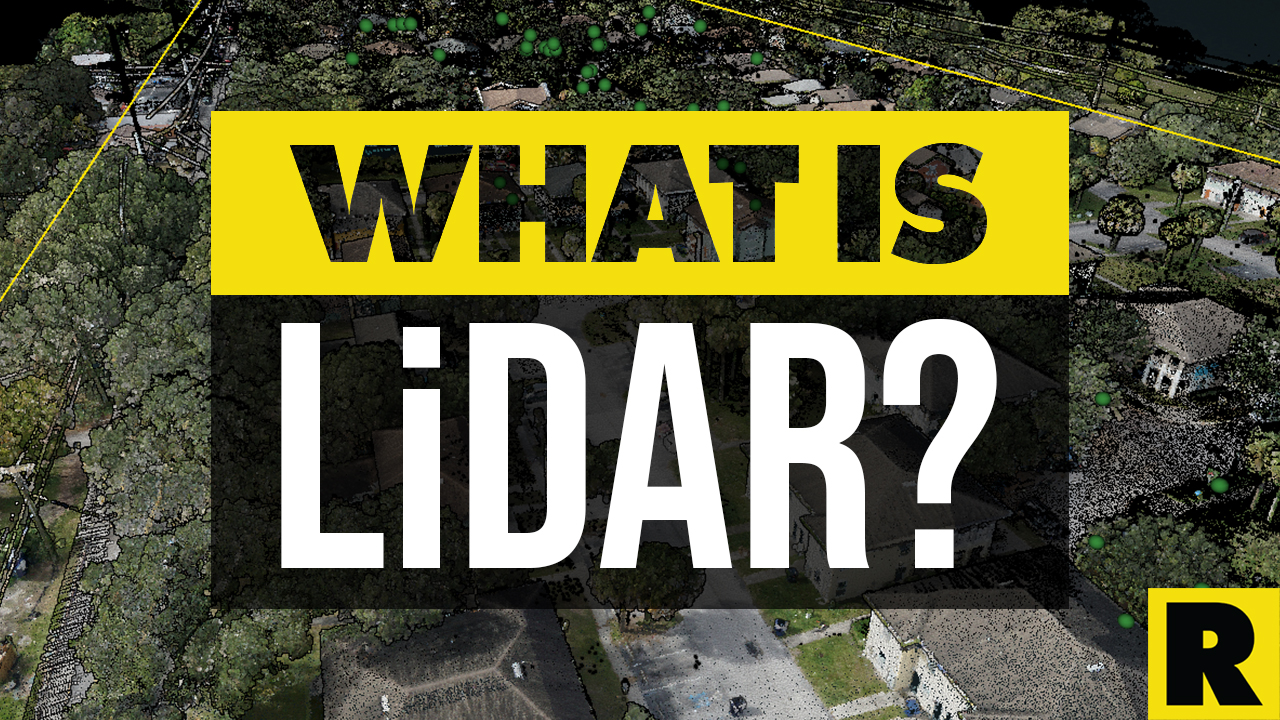
What is LiDAR?
LiDAR, or Light Detection and Ranging, is a technology that uses laser pulses to measure distance and create high-resolution 3D models...

Jan 18, 2023
GCP Best Practices for Aerial Surveying Projects
Ground Control Points (GCPs) are a crucial part of aerial surveying. They help make sure the data collected is as precise as possible.
Jan 10, 2023
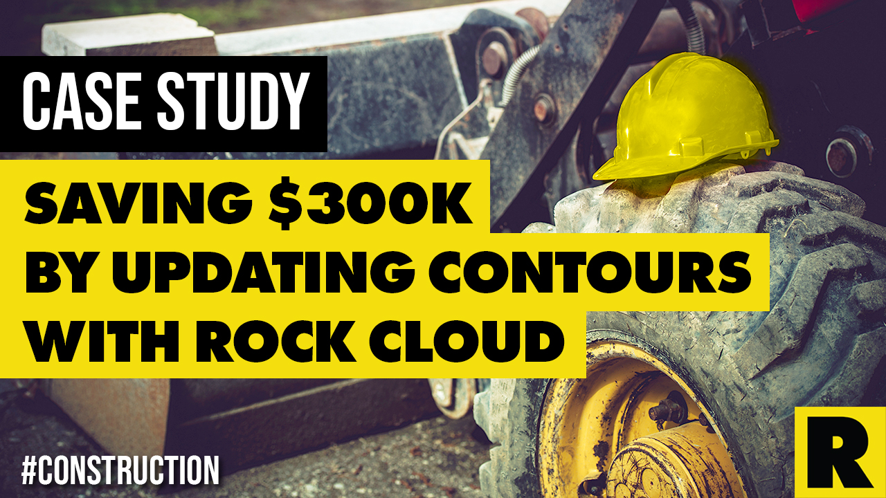
Case Study: Construction Company Saves $300k by Updating Contours with ROCK Cloud
Here's the top-level takeaway: Companies and contractors can save a significant amount of money in Construction and Earthworks projects.

Jan 09, 2023
Understanding FAA Regulations for Beyond Visual Line of Sight (BVLOS) Drone Operations
In order to operate a drone beyond line of visual sight, the FAA requires operators to obtain a Part 107 BVLOS Waiver.
Jan 03, 2023
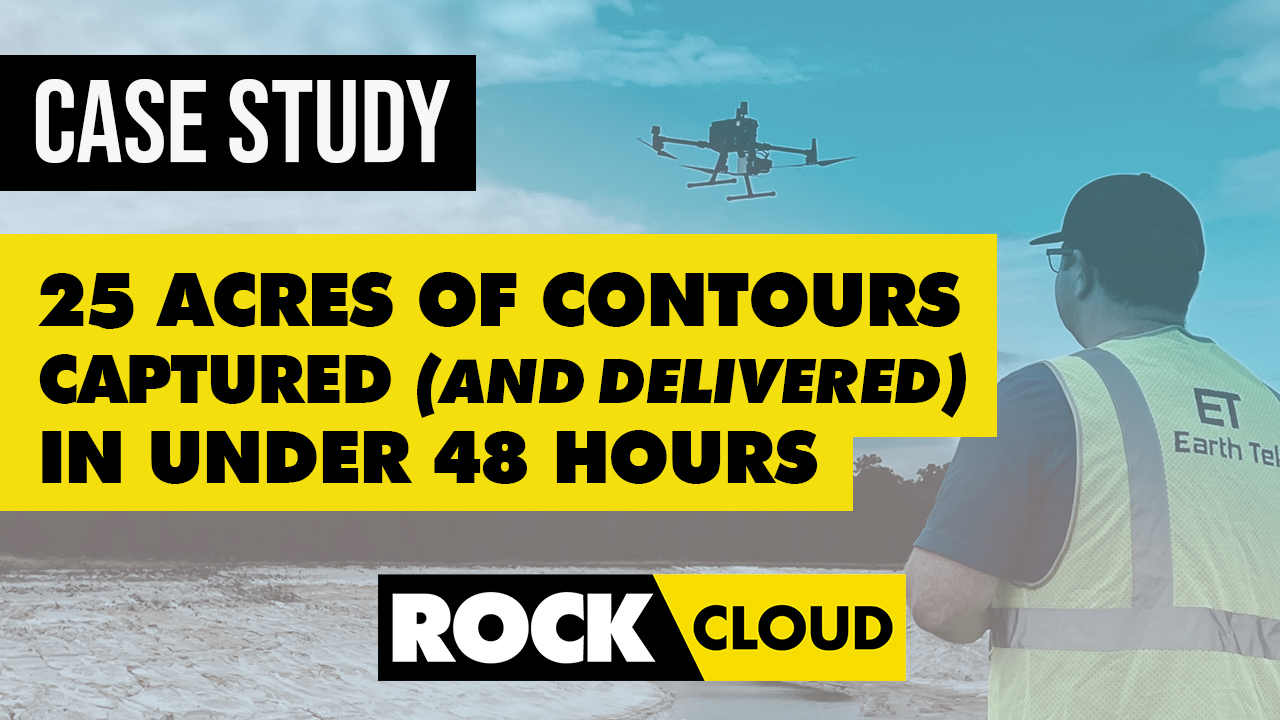
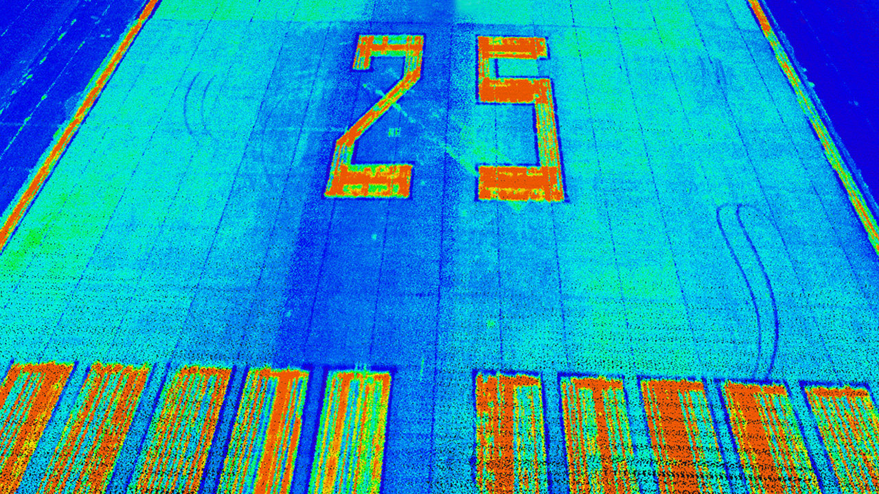
Case Study: 25 Acres of LiDAR Data Captured (and Delivered) in Under 48 Hours
Do you ever find yourself in a time crunch? When it comes to last-second client projects, it's easy for panic to begin to settle in. But,...
Dec 22, 2022
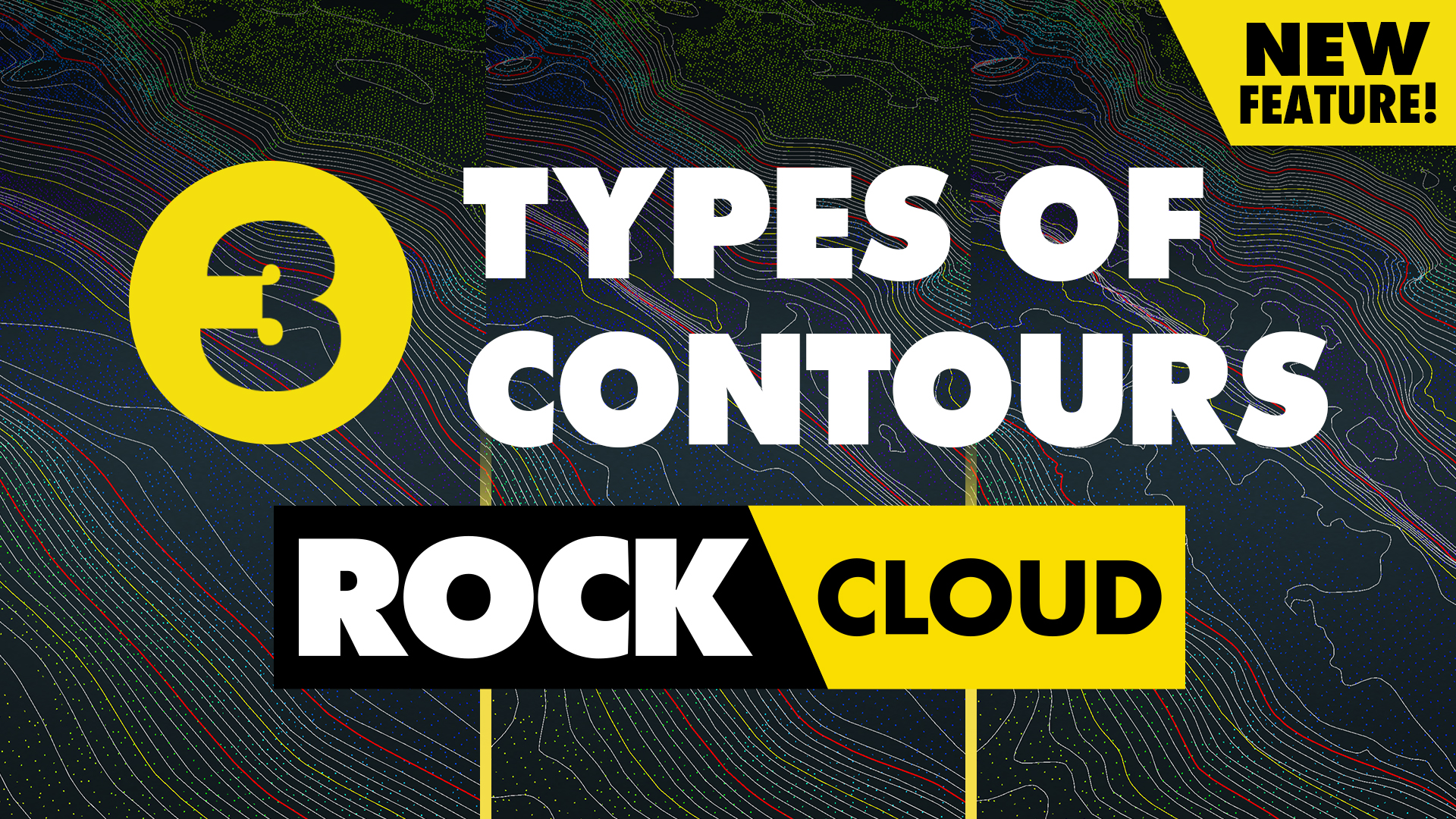
3 Types of Contours — Which Option is Best for your Surveying Project?
Nearly every land surveying project needs updated, accurate contours. Whether you’re moving dirt, pouring concrete or measuring terrain.

Dec 19, 2022
7 Drone Surveying & 3D Mapping Industry Predictions & Trends for 2023
As the use of drones continues to increase in the fields of surveying and mapping, there are a few key trends that we expect to see in 2023.
Nov 29, 2022
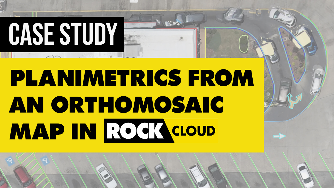
Case Study: Creating Planimetrics from an Orthomosaic Map Using ROCK Cloud
ROCK Cloud enables users of both LiDAR and Photogrammetry drones to reduce the burden of collecting data in the field efficiently.
Nov 16, 2022
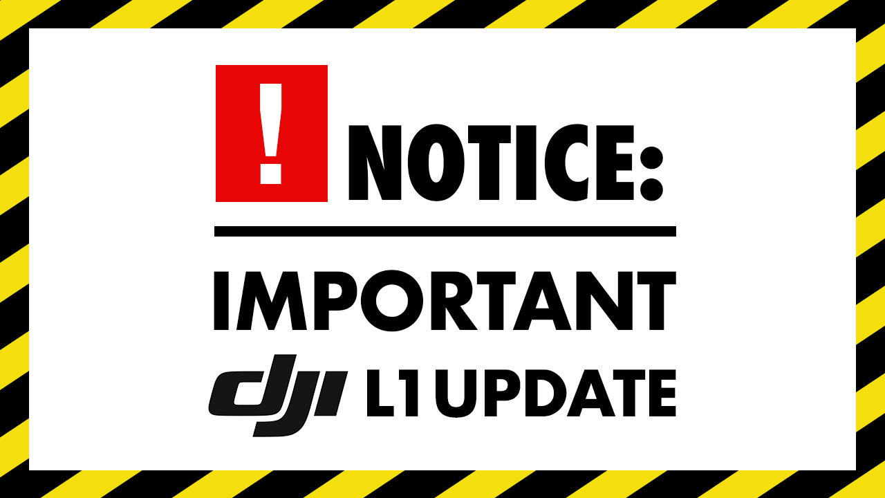
Here's a Better Alternative for Processing DJI Zenmuse L1 LiDAR Data
As of January 1, 2023, Terrasolid software will no longer be free. Terrasolid will cost surveying professionals at least $1,500/year.

Nov 07, 2022
Top 10 LiDAR Support Questions: Answered by the ROCK Support Team
Ever wonder what questions the ROCK Support Team answers most often? Take a look at our most asked questions.

Nov 03, 2022
Breaking Down 20 Common LiDAR and Surveying Terms
Here's a glossary of 20 of the most helpful LiDAR and surveying terms you need to know if you're starting to create 3D models and maps.
Oct 31, 2022
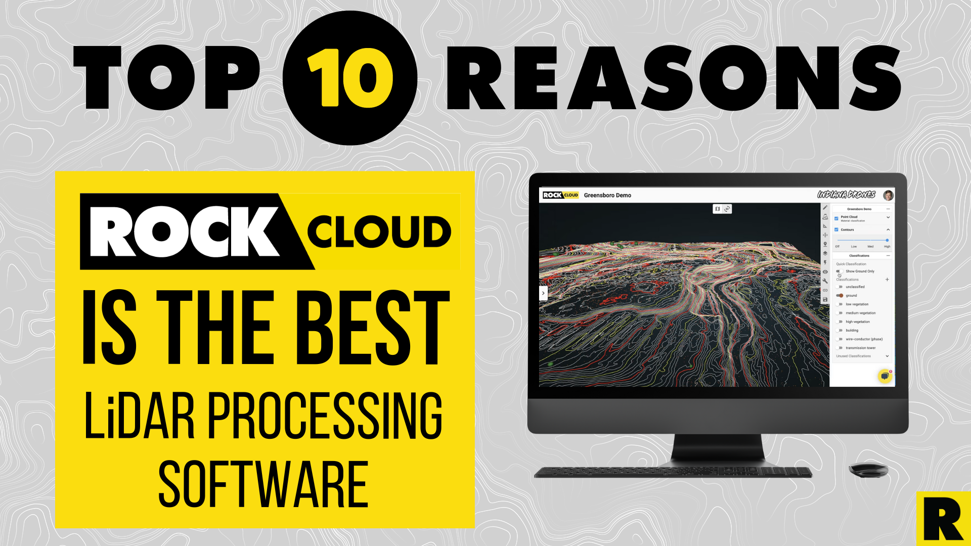
10 Reasons Why ROCK Cloud is the Best LiDAR Data Processing Software
We're living in very exciting times! LiDAR data is growing in popularity with the advent of handheld SLAM systems. Notably, the Leica...
Oct 27, 2022
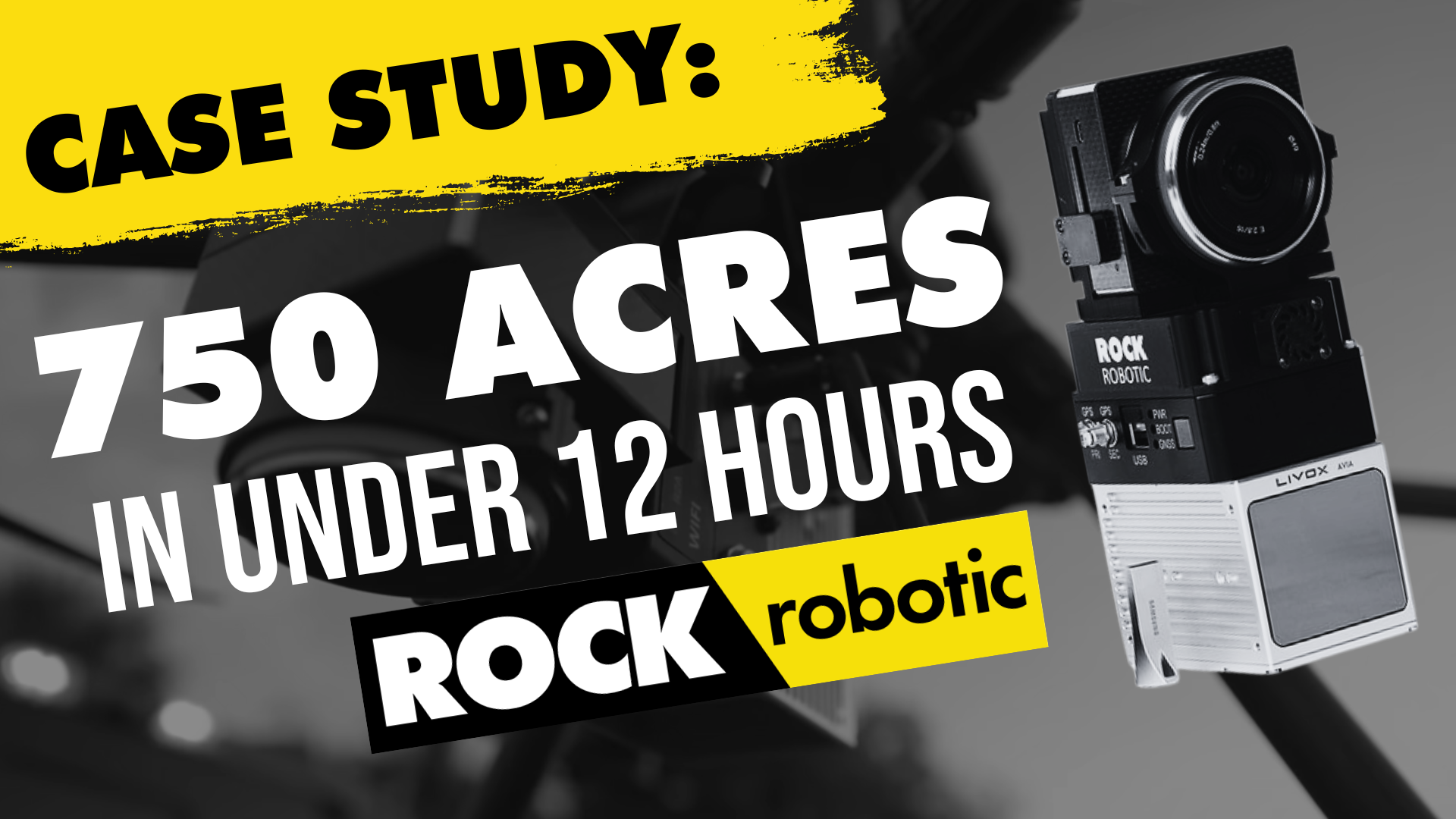
Featured Use Case: Surveying 750 Acres in Under 12 Hours with ROCK R2A LiDAR
At ROCK Robotic, we've been doing our best to spread the word that LiDAR is the game-changer in land surveying. Experienced drone pilot...

Oct 25, 2022
IRS Section 179 Changes Coming: Why You Should Invest in LiDAR Equipment by the End of 2022
The Section 179 deduction allows US taxpayers to expense qualifying purchases and to deduct the full purchase price of their equipment.
Jul 28, 2022
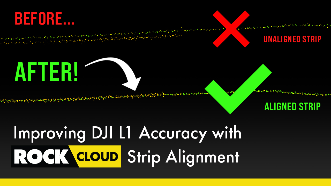
How-To Improve DJI Zenmuse L1 Accuracy w/ Strip Alignment in ROCK Cloud LiDAR Processing Software
Introducing ROCK Strip Alignment — offered exclusively through the ROCK Cloud to help improve the accuracy of your DJI L1 LiDAR data.
May 26, 2022
Get 1.65 cm Accuracy Results with the ROCK R2A Drone LiDAR & ROCK Cloud 3D Data Processing Software
ROCK Robotic's R2A LiDAR with the ROCK Cloud processing software can produce 1.65 cm accuracy! Bold statement, I know. So, let me break...
May 12, 2022
Capturing Aerial Drone LiDAR & Photogrammetry in a Single Flight (Earthworks Demo)
This article will discuss the results from the R2A LiDAR + Photogrammetry solution, alongside the output deliverables from the ROCK Cloud.
May 11, 2022
Improving Accuracy of DJI Zenmuse L1 with ROCK Cloud 3D LiDAR Data Processing Software
Aerial Drone LiDAR has never been more accessible. The new wave of LiDAR hardware spans a large price and quality range. In order to address
Apr 11, 2022
Turn your LiDAR data into stunning animations using the ROCK Cloud.
It just keeps getting better! We absolutely love this new Drone LiDAR 3D Mapped dataset. Now you can easily export videos of your LiDAR...
Mar 24, 2022
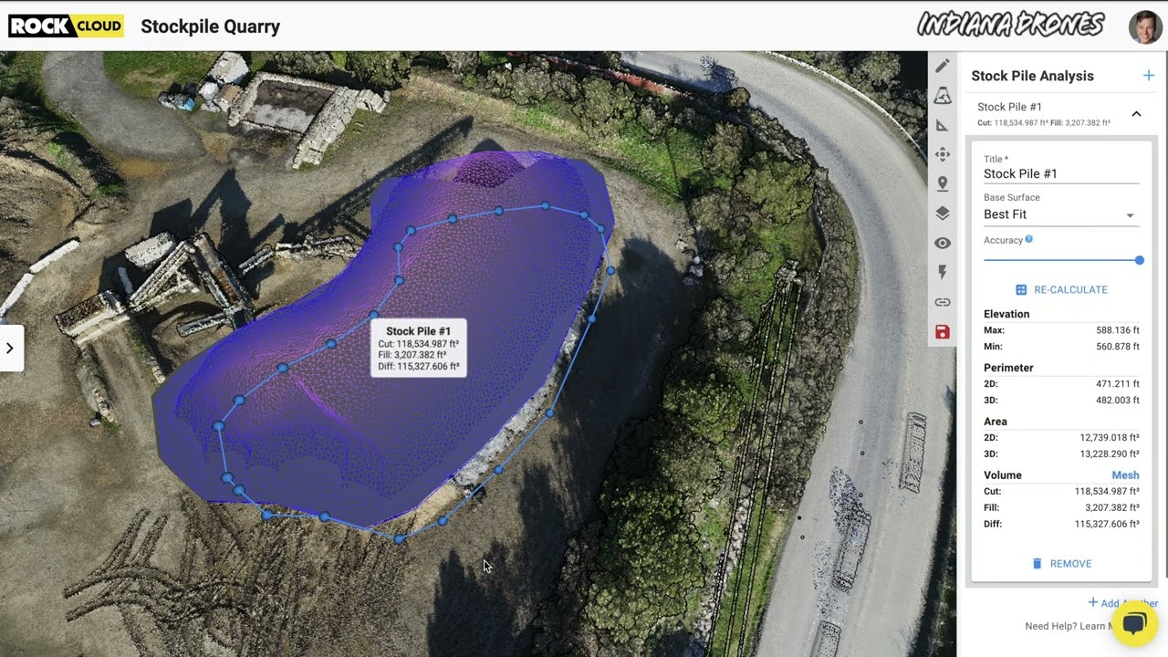
Easily calculate Volumetrics with the ROCK Cloud Stockpile Tool.
Good news... we have added a new feature to the ROCK Cloud! Now, you can quickly draw a polygon around an object to calculate the "Cut &...
Feb 18, 2022
Four Crews? Four Weeks? Forget that! ROCK can help get the job done in one day.
We received amazing feedback from one of our ROCK Cloud users. He had nothing but great things to say about our LiDAR processing software.