How-To Improve DJI Zenmuse L1 Accuracy w/ Strip Alignment in ROCK Cloud LiDAR Processing Software
Jul 28, 2022
Let's face it ... despite its known issues regarding accuracy, the DJI Zenmuse L1 LiDAR is here to stay. If you are a L1 user struggling with these issues, then ROCK is here for you!
Introducing ROCK Strip Alignment — offered exclusively through the ROCK Cloud to help improve the accuracy of your L1 LiDAR data.
What is Strip Alignment and why should I care?
Strip Alignment corrects errors in the trajectory used to produce a 3D point cloud from an airborne LiDAR mapping system. These errors are a fundamental characteristic of the 6-DOF (degrees of freedom) measurement system. That is, the position (lat, long, height) and attitude (pitch, yaw, roll) that are measured by the IMU and GNSS and then integrated together to form a trajectory through space via a PPK workflow (DJI Terra). The IMU accuracy is the largest source of error in the accuracy of the trajectory and largely affects the yaw, pitch and roll. Known issues in the height measurements can be a source of error as well. Each of these characteristics play a role in your final deliverable accuracy.
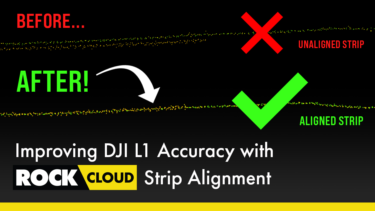
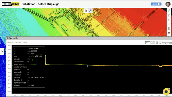
You’ll often find these visible errors when you do multiple passes with the airborne LiDAR scanner and overlap from one flight line to the next. You will see that the two point clouds will not match up perfectly. In Figure 1 you can see that the green and orange point clouds do not overlap, instead forming two layers, one atop the other. We use ROCK Strip Alignment to improve this undesirable presentation by aligning your dataset in the ROCK Cloud.
What is ROCK Strip Alignment?
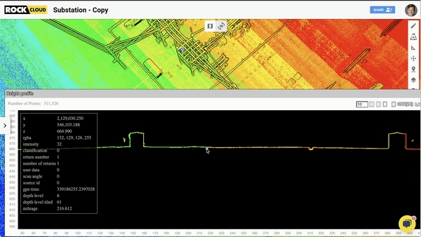
ROCK Strip Alignment takes your uploaded .LAS file, along with the trajectory (produced by DJI Terra) and analyzes the point cloud to produce a new optimized (Strip Aligned) point cloud. The process is 100% automated and results in a more accurate and visibly appealing point cloud. Results can vary among point clouds due to the nature of the error source we are correcting. The error from the IMU is not constant and has both low frequency temporal errors alongside high frequency temporal errors. Below is the same area that is shown above (Fig. 1) after ROCK Strip Alignment has been applied — it's clear to see the proof of improvement.
How do I use ROCK Strip Alignment?
It's super easy! The ROCK Strip Alignment is built into the ROCK Surveyor deliverable and is automatically used for all DJI L1 LiDAR datasets. Just upload the trajectory SBET output produced by DJI Terra and then let ROCK Cloud handle the rest.
*Read this ROCK Academy article *for more information and examples of our DJI Zenmuse L1 LiDAR Strip Alignment.
ROCK Strip Alignment is not the only tool that is deployed to improve your DJI Zenmuse L1 LiDAR dataset when you order ROCK Surveyor.
Learn more about other ways we improve your DJI Zenmuse L1 LiDAR data when you order the ROCK Surveyor in the ROCK Cloud in this **ROCK Blog Post.
Conclusion
At ROCK Robotic we are committed to improving all LiDAR data and providing our own high accuracy LiDAR remote sensing hardware. We take a strong stance in working with the LiDAR Community and general public to provide information that helps people be successful with this technology. As always, reach out to us anytime — we look forward to helping you!
Visit www.rockrobotic.com to learn more
about our products and services.